
Where Flight Simulation Enthusiasts Gather from Around the World!
AVSIM Library - Search Results

| Category: Flight Simulator 2004 - Scenery | |
| Middle East SRTM Mesh - Lebanon, Israel and Egypt Part2 |

|
File Description:
Middle East SRTM Mesh - Lebanon, Israel and most of Egypt LOD9 Terrain Mesh in 3 parts, created from SRTM 3arc sec spatial data - this is Part 2. Mesh covers area from N25 - N34 and E29 - E36. It gives You possibility to fly above continuous terrain of Lebanon, Israel and Egypt. Holes were cleared using SRTM/DTED0 merger by Martin Domig, MICRODEM and SRTMFill.
| Filename: | Middle_East_SRTM_Mesh__Lebanon_Israel_and_Egypt_Pa.zip |
| License: | Freeware, limited distribution |
| Added: | 23rd April 2004, 12:55:58 |
| Downloads: | 6,640 |
| Author: | Ryszard Winawer |
| Size: | 21.07 MB |
| Category: Flight Simulator 2004 - Scenery | |
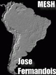
| MESH 2010 SurAmerica - Peru |
|
Images related to this file:
File Description:

MESH FERMANDOIS 2010 V1.0 / Peru (index PE1,PE2,PE3) / A highly detailed 30m SRTM mesh for South America
| Filename: | MESH_2010_SurAmerica__Peru.zip |
| License: | Freeware |
| Added: | 7th December 2009, 10:12:19 |
| Downloads: | 2,665 |
| Author: | Jose Fermandois |
| Size: | 93.24 MB |
| Category: Flight Simulator 2004 - Scenery | |
| MESH 2010 SurAmerica - Brasil 10 |
|
Images related to this file:
File Description:
MESH FERMANDOIS 2010 V1.0 / Brasil / index(BR19) / A highly detailed 30m SRTM mesh for South America (FS2004 and FSX)
| Filename: | MESH_2010_SurAmerica__Brasil_10.zip |
| License: | Freeware |
| Added: | 2nd December 2009, 14:59:17 |
| Downloads: | 1,780 |
| Author: | Jose Fermandois |
| Size: | 38.47 MB |
| Category: Flight Simulator 2004 - Scenery | |
| Baluchistan SRTM Mesh |
|
File Description:
This mesh includes both Pakistani and Iranian "Baluchistan" south of 28.5°N. The Baluchistan area would approximately fit in a square defined by Zahedan - Quetta - Karachi - Chah Bahar cities. The northernmost part of Baluchistan is already covered by my "Southern Afghanistan SRTM mesh" (afghanistan_south_srtm.zip).
Based on SRTM Data (3 arcsec, 90m) and sampled to LOD9 resolution (76m) using Matthew Styles's program "SRTM To BGL v1.04".
Big SRTM "holes" (void data) were patched with SRTM 30-arcsec dataset thanks to John Child's beautiful and powerful "Blackart" utility.
| Filename: | Baluchistan_SRTM_Mesh.zip |
| License: | Freeware, limited distribution |
| Added: | 15th August 2005, 03:13:38 |
| Downloads: | 2,588 |
| Author: | Yohann Baptiste |
| Size: | 28.81 MB |
| Category: Flight Simulator 2004 - Scenery | |
| Java SRTM Mesh |
|
File Description:
This terrain mesh scenery covers Java, Madura and Bali islands, Indonesia. Some Minor neighboring islands have been included too.
Based on SRTM Data (3 arcsec, 90m), generated with Matthew Styles's program "SRTM To BGL v1.04", sampled to LOD9 resolution (76m). While only tested with Fs2004, this mesh should also run with FS2002.
| Filename: | Java_SRTM_Mesh.zip |
| License: | Freeware |
| Added: | 14th November 2003, 03:58:44 |
| Downloads: | 6,705 |
| Author: | Yohann Baptiste |
| Size: | 20.88 MB |
| Category: Flight Simulator 2004 - Scenery | |
| Jamaica SRTM Mesh |
|
File Description:
This is a terrain mesh scenery for Jamaica.
Based on SRTM Data (3 arc/sec), generated with Matthew Styles's program "SRTM To BGL v1.04", sampled to LOD9 resolution (76m) with 4 interpolation passes. While tested under Fs2004, this mesh should also run in FS2002.
| Filename: | Jamaica_SRTM_Mesh.zip |
| License: | Freeware |
| Added: | 26th September 2003, 23:29:31 |
| Downloads: | 5,691 |
| Author: | Yohann Baptiste |
| Size: | 2.34 MB |
| Category: Flight Simulator 2004 - Scenery | |
| Lebanon SRTM Mesh |
|
File Description:
Thanks to NASA's SRTM Project and to Matthew Styles' superb SRTM to BGL converter you can enjoy the realistic sensation of soaring over Mount Lebanon and Anti-Lebanon ridges and exploring their ravines.
| Filename: | Lebanon_SRTM_Mesh.zip |
| License: | Freeware, limited distribution |
| Added: | 14th April 2004, 22:39:13 |
| Downloads: | 4,098 |
| Author: | Jad Abizeid |
| Size: | 3 MB |
| Category: Flight Simulator 2004 - Scenery | |
| France SRTM Mesh |
|
File Description:
Based on SRTM 3 arc.sec data.
Unfortunately SRTM DATA have many holes and data loss, so I made a resampling and an oversampling with other data with lower resolution, but with better coverege (like data from swiss topographic federal istitute or from italian IGM, and finally with DTED Level 0.) with geo cad software like Grass and GlobalMapper for projection convertion.
Compression and conversion to bgl with MS Flight simulator SDK at LOD 9
This scenery cover the part of France territories not included in my Italian and Spanish sceneries;thus these sceneries are required to cover entire France country. Parts of Belgium and Netherlands are included too (Till E005)
| Filename: | France_SRTM_Mesh.zip |
| License: | Freeware |
| Added: | 23rd November 2003, 11:48:22 |
| Downloads: | 25,750 |
| Author: | Pietro Mauri |
| Size: | 46.44 MB |
| Category: Flight Simulator 2004 - Scenery | |
| MESH 2010 SurAmerica - Argentina 1 |
|
Images related to this file:
File Description:

MESH FERMANDOIS 2010 V1.0 / Argentina Norte (index AR01,AR02,AR03a,AR04) / A highly detailed 30m SRTM mesh for South America
| Filename: | MESH_2010_SurAmerica__Argentina_1.zip |
| License: | Freeware |
| Added: | 2nd December 2009, 01:04:14 |
| Downloads: | 3,262 |
| Author: | Jose Fermandois |
| Size: | 89.69 MB |
| Category: Flight Simulator 2004 - Scenery | |
| MESH 2010 SurAmerica - Colombia 2 |
|
Images related to this file:
File Description:

MESH FERMANDOIS 2010 V1.0 / Colombia Sur / index(CO3,CO4)
A highly detailed 30m SRTM mesh for South America / FS2004 & FSX
| Filename: | MESH_2010_SurAmerica__Colombia_2.zip |
| License: | Freeware |
| Added: | 2nd December 2009, 15:01:25 |
| Downloads: | 3,026 |
| Author: | Jose Fermandois |
| Size: | 68.27 MB |
© 2001-2026 AVSIM Online
All Rights Reserved
Privacy Policy |