
Where Flight Simulation Enthusiasts Gather from Around the World!
AVSIM Library - Search Results

| Category: Flight Simulator 2004 - Scenery | |
| Hellas Scenery Project (HSP) - All in One scenery package 2 of 2 |

|
Images related to this file:
File Description:
Second of the two files needed. The package includes all freeware scenery created by the HSP team for Greece in FS9 up to June 2009. The package bundles all HSP released scenery in one pack which was necessary following the loss of several files after avsim's file library crash.
By using this scenery you do not need to download anything else from HSP.
Included are detailed airport sceneries of LGAL Alexandroupolis, LGAV Athens Venizelos, LGIR Iraklion, LGKO Kos, LGMK Mikonos, LGSA Chania, LGSO Syros, LGSR Santorini as well as HSP base scenery with essential improvements to other airports and finally the detailed mesh terrain for all Hellenic territory.
| Filename: | Hellas_Scenery_Project_HSP__All_in_One_scenery_pac.zip |
| License: | Freeware, limited distribution |
| Added: | 20th May 2010, 13:14:10 |
| Downloads: | 155,871 |
| Author: | Hellas Scenery Team (HST) |
| Size: | 47.54 MB |
| Category: Flight Simulator 2004 - Scenery | |
| Hellas Scenery Project (HSP) - All in One scenery package 1 of 2 |
|
Images related to this file:
File Description:
First of the two files needed. The package includes all freeware scenery created by the HSP team for Greece in FS9 up to June 2009. The package bundles all HSP released scenery in one pack which was necessary following the loss of several files after avsim's file library crash.
By using this scenery you do not need to download anything else from HSP. Included are detailed airport sceneries of LGAL Alexandroupolis, LGAV Athens Venizelos, LGIR Iraklion, LGKO Kos, LGMK Mikonos, LGSA Chania, LGSO Syros, LGSR Santorini as well as HSP base scenery with essential improvements to other airports and finally the detailed mesh terrain for all Hellenic territory.
| Filename: | Hellas_Scenery_Project_HSP__All_in_One_scenery_pac.zip |
| License: | Freeware, limited distribution |
| Added: | 20th May 2010, 13:12:04 |
| Downloads: | 165,069 |
| Author: | Hellas Scenery Team (HST) |
| Size: | 59.32 MB |
| Category: Flight Simulator 2004 - Scenery | |
| CYVC La Ronge Saskatchewan |
|
Images related to this file:
File Description:

La Ronge (Barber Field) is situated approximately six and a half kilometers north of the town of La Ronge, Saskatchewan, Canada. The present La Ronge airport was constructed beginning in 1976, notably as the central base of operations for the Province of Saskatchewan's water bomber fleet. The airport is home to maintenance facilities and a tanker base of operation for a fleet of CL-215, CL-215T, Convair 580 and deHavilland (Grumman) Tracker water bombers. The airport is also a major base of operation for Transwest airlines, West Wind Aviation, Osprey Airways and other bush operators.
CYVC was constructed using GMAX and represents the airport as it was in the Summer of 2009. It includes custom models of all the buildings at the airport, runway signs, taxiway and runway lighting, hangars, terminal building, custom vehicles and the seasonal tanker operations base. CYVC includes custom tarmac and textures to replicate the retardant and oil stained tanker ramp.
| Filename: | CYVC_La_Ronge_Saskatchewan.zip |
| License: | Freeware |
| Added: | 7th May 2010, 12:57:55 |
| Downloads: | 1,950 |
| Author: | Gregory Putz |
| Size: | 11.13 MB |
| Category: Flight Simulator 2004 - Scenery | |
| Branson Airport KBBG--New Airport, Scenery, and Flight Plans |
|
Images related to this file:
File Description:

This project adds a new Branson Airport KBBG (Missouri) to FS 2004, which opened in May 2009, and is a privately developed commercial airport. The construction of the airport, which involved the flattening of several Ozark Mountains, is claimed to be the largest earthmoving project in Missouri history. As a result, the airport actually sits on a manmade plateau, surrounded by rolling hills. The airport uses the ICAO identifier BBG, however, the airlines use the IATA code BKG. The airport is served by AirTran, Frontier, and ExpressJet (Branson AirExpress), and is located in hilly terrain. Aircraft equipped with a terrain avoidance warning system may experience system activation on final approach. AFCAD created using Airport Design Editor 9 v1.47.07, and the hilltops were cleared and flattened and roads were added using SBuilder 2.05 revision 06. The terminal and hangar were added and modified from within Airport Design Editor 9. This airport is based on my more detailed FSX version, Branson_Airport_Project.zip.
| Filename: | Branson_Airport_KBBGNew_Airport_Scenery_and_Flight.zip |
| License: | Freeware |
| Added: | 16th August 2010, 20:50:16 |
| Downloads: | 1,733 |
| Author: | Carlyle Sharpe |
| Size: | 3.23 MB |
| Category: Flight Simulator 2004 - Scenery | |
| Grande Cache CEQ5 in Alberta, Canada |
|
Images related to this file:
File Description:
Grande Cache is at 4,117 feet above sea level, just under 90 miles south of Grande Prairie and 220 miles west of Edmonton. It is among the eastern foothills of the Rockies. The town was established to accommodate employees of a coal mine and their families in the early 1970's. There was a financial roller coaster ride for the coalmine during the next few years and despite the opening of a wood chip plant and a federal prison the town was eventually downgraded to a hamlet by a vote in 2018, as it was essentially bankrupt and had a population of less than 4,500. The airport, some 10 miles east of the town, had two aprons, one for GA and scheduled flights and another, the eastern one, for fire fighting planes. I say "had" as it was closed in January 2017. However, the fire fighting area appears to have been maintained (tanks repainted, for instance) and is presumably able to support operations if required. The date for this scenery is 2009.
| Filename: | Grande_Cache_CEQ5_in_Alberta_Canada.zip |
| License: | Freeware, limited distribution |
| Added: | 29th September 2021, 03:59:20 |
| Downloads: | 89 |
| Author: | Roger Wensley |
| Size: | 7.49 MB |
| Category: Flight Simulator 2004 - Scenery | |
| Milano Malpensa Area (ISD) 2013 |
|
Images related to this file:
File Description:
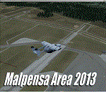
Dear Friends simmer, as always taking advantage of the beautiful objects bgl Gianluca Giovannini, I tried to improve with a symmetric pairing of autogen trees / towns / industrial buildings, the urban area near the international airport of Milano Malpensa, in the best ever scenery by the ISD project.
With the current integration I have created the village of Casenuove, Cardano al Campo, Cascina Costa, Femo, part of the small towns near the attached industrial buildings and new parking in 3D for both terminals. I paid particular attention to the impact of the approach in view of the Ticino Park with a significant density of trees near the runway. Inside you will also find the file on the grass in 3D previously published by me, so if you have already installed, you can deactivate maintaining this.
Warning Very Important: the scenery "is not complete" and to get the best result, you must install ISD LIMC 2009 (limc2009v1.1.zip) - available HERE.
| Filename: | Milano_Malpensa_Area_ISD_2013.zip |
| License: | Freeware |
| Added: | 22nd February 2013, 17:15:22 |
| Downloads: | 4,756 |
| Author: | Fabio Ferrari "fafo air" |
| Size: | 4.51 MB |
| Category: Flight Simulator 2004 - Scenery | |
| Howick Airfield (FAHC), South Africa |
|
Images related to this file:
File Description:
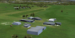
This package will add a custom (Gmax) made Howick Airfield (FAHC), KwaZulu Natal, South Africa with photoreal textures and seasonal ground textures.
Howick is a small town in the KwaZulu Natal Midlands just off the N3 freeway which connects Johannesburg and Durban and home to the famous Howick waterfall. The Umgeni river falls 95m (311 ft) over the cliffs on the way to the Indian Ocean. The town is also home to the Midmar dam. This dam is very well known as being the location of the annual Midmar Mile swimming event which, in 2009, was recognized by the Guinness Book of World Records as the world's largest open water swimming event with 13 755 competitors taking part.
The sloped grass runway is aligned 16/34 and 825m long and sits at an elevation of 3 615ft. Both runways have obstacles on the approach, with powerlines 730m from the threshold of runway 16, while runway 34's approach have hills around 900m before the threshold. The sloped runway has been created in FS2004 within the limits of the simulator itself.
| Filename: | Howick_Airfield_FAHC_South_Africa.zip |
| License: | Freeware, limited distribution |
| Added: | 15th January 2021, 20:25:51 |
| Downloads: | 203 |
| Author: | Kobus van Wyk |
| Size: | 7.67 MB |
| Category: Flight Simulator 2004 - Scenery | |
| Carp CYRP in Ontario Canada (updated October 2011) |
|
Images related to this file:
File Description:
This version further updates the post of 2006 and the 2009 update with more bespoke buildings for the west GA apron plus the revised fuelling area, and corrected surroundings with large forested areas and a modified airfield grass shape. This is a stand-alone version and does not require you to have downloaded and installed the previous posts; this REPLACES those versions. Carp airfield is fifteen miles west of Ottawa and two miles south of the town of Carp. There are two runways, 10/28 which is asphalt and almost 4,000 feet long and 100 feet wide, and 04/22 which is gravel and 2,000 feet long. The airfield has a fairly large population of general aviation residents and is slowly expanding under new ownership. This version models the large hangar beside the terminal, the "Touch'n Go" aviation warehouse that has opened more recently, and the ramshackle collection of hangars and sheds that make up Westair, the maintenance facility. The nearby pagoda-roof flight school building has in fact now been demolished, but I like it too much to do that, at least until something else has been built on that space.
| Filename: | Carp_CYRP_in_Ontario_Canada__updated_October_2011.zip |
| License: | Freeware, limited distribution |
| Added: | 25th November 2011, 09:25:34 |
| Downloads: | 587 |
| Author: | Roger Wensley |
| Size: | 7.59 MB |
| Category: Flight Simulator 2004 - Scenery | |
| Boundary Bay CZBB in British Columbia, Canada |
|
Images related to this file:
File Description:
Boundary Bay is south of Vancouver in British Columbia, close to the US/Canada border. It is the 5th busiest airfield in Canada measured in terms of take offs and landings as there are several training companies based there. The airfield was purchased by Alpha Aviation in 2009 and and modernised for the 2010 Winter Olympics, the main addition being a new terminal. This is an ex-military training base which was built in 1941, and one of the original hangars still survives. The two runways in use now (07/25 5,600' and 12/30 2,750', both of them 100' wide) are reduced asphalted areas of the original runways; the third runway is now an apron for GA parking and has had hangars built along it. There is JetA and 100LL available. The large building at the east end of the north apron is a HQ and maintenance facility for a helicopter company, Heli-one. All of the north apron buildings on the field have been modelled specifically for this scenery, plus the nearby huge greenhouse farm structures which are visible from further away than the airfield is. AI for Boundary Bay will be posted later this week.
| Filename: | Boundary_Bay_CZBB_in_British_Columbia_Canada.zip |
| License: | Freeware, limited distribution |
| Added: | 12th May 2011, 13:30:18 |
| Downloads: | 855 |
| Author: | Roger Wensley |
| Size: | 4.4 MB |
| Category: Flight Simulator 2004 - Scenery | |
| Forggensee, v2 Update |
|
Images related to this file:
File Description:

This UPDATE enhances the existing Forggensee Water-Airport(EDAF).
Klaus Jone did a magnificent job in creating this scenery for us flightsimmers, and my enhancements do NOT alter any Scenery Objects by Klaus Jone. The buildings are the same. And the number of AI planes and ships are unchanged.
My enhancements modify the BEHAVIOR of the Ships.
But the floatplane traffic is so superbly programmed that no further modifications are necessary.
Mr. Klaus Jone passed away in May 2009, and it is my intention to preserve Forggensee pretty much as HE designed it. Except for modifying the BEHAVIOR of the AI traffic, to spread it out to cover the entire area of Lake Forggensee. As the screenshots I've included illustrate.
Naturally, these updated files require that Forggensee Part 1 and Part 2 are ALREADY installed in your FS2004. My part here was to perform a few tweaks to make the AI traffic spread out all over Lake Forggensee, and ensure that ALL wake/spray effects are visible. As Klaus Jone stated: "There is some amazing traffic on the lake, have a look and have fun!"
| Filename: | Forggensee_v2_Update.zip |
| License: | Freeware |
| Added: | 18th April 2011, 19:13:38 |
| Downloads: | 727 |
| Author: | Klaus Jone, Ronald Falzon |
| Size: | 1.41 MB |


© 2001-2026 AVSIM Online
All Rights Reserved
Privacy Policy |