
Where Flight Simulation Enthusiasts Gather from Around the World!
AVSIM Library - Search Results

| Category: Flight Simulator 2004 - Scenery | |
| KGIF Winter Haven and KVDF Tampa Executive Airports |

|
Images related to this file:
File Description:
This Zip package contains two FS9 airports created using ADE9X. The two airports are Winter Haven's Gilbert and Tampa Executive. I used photo data from Google Maps to make the files. To install simply unzip the files into the FS9 Addon Scenery Scenery folder.
Here is a list of the scenery objects used in these files. If you don't have any of these on your system, they will not appear. They are all freeware and available at at AVSIM and Flightsim.com:
ga hangars ss v.3
ga hangars ss vol 2 v1
DB Parkinglots
ez-terminals ss
large hangars ss V2
loney's hangars and buildings
Loney's Hangars and Buildings2
loney's buildings
ez-extra-objects-1
warehouse airport vehicles
| Filename: | KGIF_Winter_Haven_and_KVDF_Tampa_Executive_Airport.zip |
| License: | Freeware |
| Added: | 31st July 2013, 19:08:11 |
| Downloads: | 253 |
| Author: | Michael Verlin |
| Size: | 112.6 KB |
| Category: Flight Simulator 2004 - Scenery | |
| Complement T. Agramont's Madeira v1.0 |
|
Images related to this file:
File Description:
Addon for the scene of Madeira of Toni Agramont (madeira_271158.zip) To download in this same Web! Realised to
give a little him more realism, with AFCAD of LPMA near the reality and adapted to its scene,
can be used with the Mesh of Raimondo Taburet (file: srtm3mad.zip http://www.hangartaborno.com).
In Funchal one has gotten up the arches and houses on foot of head 05, slab that holds with columns of head 23,
illumination in the retaining wall of the arches and in the highway and some Rwy12 objects that heighten a little
plus the landscape. Without Rwy12 it will also work but we strongly encourage libraries installed base.
In Porto Santo there are including his military zone, the name of the airport in the ground and Also
Rwy12 objects.
Readme.txt for the correct installation.
| Filename: | Complement_T_Agramonts_Madeira_v10.zip |
| License: | Freeware |
| Added: | 15th March 2011, 00:00:53 |
| Downloads: | 4,685 |
| Author: | Jordi Reco |
| Size: | 1.98 MB |
| Category: Flight Simulator 2004 - Scenery | |
| Altitude adjustment for Dawson City CYDA |
|
Images related to this file:
File Description:
I discovered that the Northern Canada Terrain Mesh that I installed a while back was dumping part of my Dawson City Airport CYDA into a deep hole. I tried making a flatten to reduce the height of the terrain mesh land but that did not look at all realistic. So, the solution is to raise CYDA to 1,457 feet above sea level instead of the correct (correct according to the Nav Canada Supplement) level of 1,215 feet so that it melts into the surrounding terrain. There are still some rocky faces but at least they are not in the airfield. Do you need it? Not if your version looks ok. If it doesn't look ok then try this, but save your current version so you can go back to it if you need to.
| Filename: | Altitude_adjustment_for_Dawson_City_CYDA.zip |
| License: | Freeware, limited distribution |
| Added: | 23rd July 2019, 17:24:26 |
| Downloads: | 105 |
| Author: | Roger Wensley |
| Size: | 855.58 KB |
| Category: Flight Simulator 2004 - Scenery | |
| Grande Prairie CYQU in Alberta, Canada, Updated |
|
Images related to this file:
File Description:
This is a new version of the original post from March 2014, made in 2018. It was made mainly to provide some missing textures, but has been modified to also add parked trucks and floodlights to the de-icing area (the floodlights are inoperative as they will not be on when there is no de-icing in progress) and also street and car parking lighting, a few more parked planes, and some further objects on the terminal apron area. The runway approach lighting was also corrected; moving the airport so that the ILS on 29 did not coincide with the roads would have been nice, but meant too many complications at this stage. The scenery is complete in itself and can be installed as-is if you do not have the original post. Grande Prairie is at 2,195 feet asl, 65 miles southeast of Dawsons Creek, 90 miles southwest of Peace River and around 60 miles east of the Rockies. The town has a population of around 55,000 and growing. The name comes from the wide expanse of prairies all around the town, and there is also a large forested area to the southwest leading up to the Rockies which supplies raw material for industries in the town. The airport is just to the west of the town. It was originally a military base, built during WW2. The two runways are 07-25 and 11-29 and 6,200 and 6,500 feet respectively, both 200 feet wide; runway headings had changed by 2010 in real life but take this as it was in 2008. When one is the active runway then the other is used as a taxiway. Taxiway A is very wide with in real life a repaired central section marked out for use.
| Filename: | Grande_Prairie_CYQU_in_Alberta_Canada_Updated.zip |
| License: | Freeware, limited distribution |
| Added: | 13th December 2018, 04:12:11 |
| Downloads: | 210 |
| Author: | Roger Wensley |
| Size: | 34.97 MB |
| Category: Flight Simulator 2004 - Scenery | |
| Dervio scenery - Como lake Italy |
|
Images related to this file:
File Description:
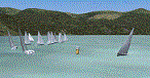
Scenery homage to a beautifull little town in north of Como lake of Italy; builded-up mainly with some existing objects and some buildings sintax made. It DOES NOT INCLUDE any airport, but represents only some pictures of Dervio town, reachable from Como Idroscalo floating airport or Samolaco or Sondrio Caiolo airports (closest ones); this is one of the moorings of Navigazione del Lago di Como. Informations: Dervio is one of the beautiful towns on north east area of Como lake, on a handland created by Varrone river. North and closed to the town, you can find Corenno Plinio old castle and in the opposite side of the lake the S. Bernardo church; you can also have some fireworks, obviously suggested with the night. Contents:
Mooring pier at snack bar, with awning and tables; Ferryboat in the lake with some sailbots in race between two buoys; Walk alongside the shore of the lake, with benches and some fisher piers; Main church with related church house and footbal soil; Several buildings, parking area, factories, bar and restaurant with tables chairs and gazebos, gas station and cars; Rail station with a small train and road gates; Sailbots on ground inside Centro Vela Dervio area and slipway with dinghy; Little marina with boats; Public park with entering gate, covered stand and tables; Residence La Boldona bloks with buildings, swimmin pool and tennis facilities, fenced; Campsite with campers, roulottes and tents; Corenno Plinio castle with tower and S. Bernardo little church; Spread of trees in all the scenery; (night scenery)two floating platforms wiht fireworks; six wood bonfires on shore of lake and on the mountains; One big ship with some other sailboats and speedboats
| Filename: | Dervio_scenery__Como_lake_Italy.zip |
| License: | Freeware |
| Added: | 22nd February 2011, 22:59:46 |
| Downloads: | 952 |
| Author: | Aldo Della Vedova |
| Size: | 12.71 MB |
| Category: Flight Simulator 2004 - Scenery | |
| Reworked Altenstadt Army airfield, ETHA (Bavaria, South-Germany) including AI-Package |
|
File Description:
This airfield, located near Schongau in the Allgaeu (Bavaria, South-Germany),
is the main training center for parachuters of the German Army and used for cargo-drop missions of various users. The airport has been reworked to improve
the overall appearance. Version 2 replaces V1 completely.
The included AI-Package contains: Bell UH-1D SAR, Nord-Aviation Noratlas ND2501,
North-American T-6D and an aircraft.cfg for an AI-Transall C160.
Two Transall and a single T-6D from Landsberg and two Noratlas from Kaufbeuren
are comming over for touch and goes at Altenstadt as scheduled per attached
flightplan. A Dornier Do-28 does local touch and goes and a Bell UH-1D SAR-helicopter hurries to Landsberg. Welcome to a little Xmas party.
Lago's FSE is required in order to see most of the major buildings / objects.
| Filename: | Reworked_Altenstadt_Army_airfield_ETHA_Bavaria_Sou.zip |
| License: | Freeware, limited distribution |
| Added: | 24th December 2005, 17:48:42 |
| Downloads: | 2,427 |
| Author: | Klaus Jone |
| Size: | 3.97 MB |
| Category: Flight Simulator 2004 - Scenery | |
| Georgetown Q61 California Scenery |
|
File Description:
This is a scenery upgrade for Georgetown Airport, California (Q61). This is part Six of a series of small airstrip and minor airfield scenery enhancements which are based on real world data from Google Earth.
Changes to the default include surrounding landclass changed to mixed forest to match better the realworld, new airfield polygon to match shape and earth colours. The hangers I added had a mix of open door and closed door models, but for some odd reason they are all showing as closed, maybe it's just my system or some glitch, let me know if you get open doors!
I also added the usual extras which are of course artistic license!
Note that there are two exclude files, that is because I forgot to save data with one and new excludes needed another file making, sorry for the clutter!
| Filename: | Georgetown_Q61_California_Scenery.zip |
| License: | Freeware |
| Added: | 26th March 2006, 17:40:05 |
| Downloads: | 576 |
| Author: | Kim Gowney |
| Size: | 349.98 KB |
| Category: Flight Simulator 2004 - Scenery | |
| Malta archipelago |
|
Images related to this file:
File Description:
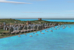
While I carried out a virtual flight from Africa toward Sicily I observes two totally naked islands. The biggest are Malta with its great airport LMML in the center. In Google earth I see that was the archipelago of Malta. Some islands that possess but churches that you hoist. I have just understood like in a piece of esth of 28x12 kilometers the biggest and 7x5 kilometers the island Gozo have been able to build so beautiful monuments. I have build some how many as some well strengths because Malta already takes many centuries defending of invasions of other towns and pirates. This archipelagos that I finish that it lacked to build in the Mediterranean. Now the "piccolissimas"
rot to alternate among my scenerys together with Baleares, Corcega, Cerdenia, Sicily, Cyprus, Crete and the group of islands of the Hreek territory.
| Filename: | Malta_archipelago.zip |
| License: | Freeware |
| Added: | 7th November 2009, 20:59:41 |
| Downloads: | 2,328 |
| Author: | Toni Agramont |
| Size: | 34.79 MB |
| Category: Flight Simulator 2004 - Scenery | |
| The Oregon Coast Scenic Railroad (OCSR) |
|
Images related to this file:
File Description:
The Oregon Coast Scenic Railroad. All aboard! This is a re-creation of the OCSR, which runs from Garibaldi, Oregon along the seashore to Rockaway Beach. It is designed to compliment the Tillamook, Oregon Airport scenery by John McKeon and David "Opa" Marshall (tills47.zip and tillup.zip - available here).
The project utilizes objects from selected EZ and RWY12 libraries as well as the new Railroad Object library by John McKeon (ezrrobjm.zip - also available here). If you have the LAGO FSE program you will be able to hear the Steam Train whistle and the nearby seagulls as files for these sounds are included. This scenery was designed to display properly in the default FS2004 environment. Please unzip to a temporary folder and follow the simple installation instructions. Compiled for your flying enjoyment by David "Opa" Marshall.
| Filename: | The_Oregon_Coast_Scenic_Railroad_OCSR.zip |
| License: | Freeware |
| Added: | 1st February 2010, 11:20:40 |
| Downloads: | 1,324 |
| Author: | David "Opa" Marshall |
| Size: | 3.45 MB |
| Category: Flight Simulator 2004 - Scenery | |
| Comb Ridge, Rock Point (49AZ), Utah/Arizona, Photo-Scenery |
|
Images related to this file:
File Description:
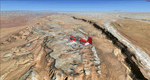
Comb Ridge, Rock Point (49AZ), Utah/Arizona, Photo-Scenery (FS9 & FSX)
This scenery extends my Monument Valley scenery to the east. It covers the area between the San Juan River in the north down to Rock Point, AZ (49AZ). Most of the scenery lies on the Navajo Nation Reservation. It completes the southeastern corner of Utah and paves our way into Colorado.
High resolution versions of this scenery for FS9 and FSX (much sharper, but larger and multiple downloads) are available at www.blueskyscenery.com/CNY_South3West6.html . The screenies are taken from the high-res versions, so expect this version to be slightly more blurry. Thanks to Joop Mak for providing custom AFCADs that correct airport layouts so that they align with the photo-textures! They are available at www.blueskyscenery.com/AFCADs.html . YourDonation@Work: Dedicated to Olivier, Kevin and Ruben.
| Filename: | Comb_Ridge_Rock_Point_49AZ_UtahArizona_PhotoScener.zip |
| License: | Freeware, limited distribution |
| Added: | 9th April 2010, 21:57:41 |
| Downloads: | 1,360 |
| Author: | Gottfried Razek, blueskyscenery.com |
| Size: | 90.99 MB |


© 2001-2026 AVSIM Online
All Rights Reserved
Privacy Policy |