
Where Flight Simulation Enthusiasts Gather from Around the World!
AVSIM Library - Search Results

| Category: Flight Simulator 2004 - Scenery | |
| Isd Lirf 2005 scenery update |

|
File Description:
New ILS is installed on RWy25 in Fiumicino Airport (LIRF)
With this update you can have the new ILS into the ISD 2005 LIrf Scenery.
Up to the 22 december 2008, NOTMAS report that the new ILS is still on Test. Be aware of further update
New frequency is the main change: now fixed in 110.15 mhz.
| Filename: | Isd_Lirf_2005_scenery_update.zip |
| License: | Freeware |
| Added: | 22nd December 2008, 22:51:27 |
| Downloads: | 10,226 |
| Author: | Giovanni Harris |
| Size: | 12.27 KB |
| Category: Flight Simulator 2004 - Scenery | |
| St Clair Regional K39 |
|
Images related to this file:
File Description:
FS2004 Scenery - St Clair Regional Airport (K39) serves St Clair and Franklin County and is owned by the City Of St Clair, Missouri, USA. The paved runway extends for 3200 feet. The facility is at an elevation of 654 feet at a distance of about 2 miles from St Clair. Created with Instant Scenery by John B. Loney, Jr.
| Filename: | St_Clair_Regional_K39.zip |
| License: | Freeware, limited distribution |
| Added: | 2nd November 2009, 19:56:50 |
| Downloads: | 187 |
| Author: | John B. Loney, Jr. |
| Size: | 9.51 MB |
| Category: Flight Simulator 2004 - Scenery | |
| Carroll County-Tolson KTSO |
|
Images related to this file:
File Description:
FS2004 Scenery - Carroll County-Tolson Airport (KTSO) serves Carrollton and Carroll County, OH USA and is owned by Carroll County Arpt Auth. The paved runway extends for 4300 feet. The facility is at an elevation of 1163 feet at a distance of about one mile from Carrollton. Created with Instant Scenery by John B. Loney, Jr.
| Filename: | Carroll_CountyTolson_KTSO.zip |
| License: | Freeware, limited distribution |
| Added: | 2nd November 2009, 19:59:13 |
| Downloads: | 200 |
| Author: | John B. Loney, Jr. |
| Size: | 409.91 KB |
| Category: Flight Simulator 2004 - Scenery | |
| Emergency Services Mission 2010-004 |
|
Images related to this file:
File Description:
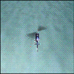
This is a series of missions called Emergency Services. All mission are flown using the Bell 206B JetRanger Helicopter. You may be flying for Fire Rescue, Medical Rescue or for the Police. In this mission you will be flying for Fire Rescue out of Half Moon Bay Airport in Half Moon Bay, CA. Your incident number is 2010-004
| Filename: | Emergency_Services_Mission_2010004.zip |
| License: | Freeware |
| Added: | 13th May 2010, 03:13:52 |
| Downloads: | 252 |
| Author: | David J Crandall |
| Size: | 3.78 MB |
| Category: Flight Simulator 2004 - Scenery | |
| Italy, Marche 3, Ancona, Photo Real |
|
Images related to this file:
File Description:
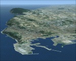
Marche, Italy, Photoreal Scenery Part 3 (Ancona). The photoreal scenery covers a great area of Marche around the city of Ancona. The airport of Ancona (ICAO code LIBP) is found near the scenery (see map). For the best results, use it in association with other parts of Marche photoreal: Marche 1 Ascoli Piceno, Marche 2 Macerata.
| Filename: | Italy_Marche_3_Ancona_Photo_Real.zip |
| License: | Freeware |
| Added: | 31st May 2010, 10:27:48 |
| Downloads: | 5,274 |
| Author: | Fulvio Mazzokan |
| Size: | 92.97 MB |
| Category: Flight Simulator 2004 - Scenery | |
| Italy, Marche 1, Ascoli Piceno, Photo Real |
|
Images related to this file:
File Description:
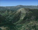
Marche, Italy, Photoreal Scenery Part 1 (Ascoli Piceno). The photoreal scenery covers a great area of Marche around the city of Ascoli Piceno. The airport of Ancona (ICAO code LIBP) is found near the scenery (see map). For the best results, use it in association with other parts of Marche photoreal: Marche 2 Macerata, Marche 3 Ancona.
| Filename: | Italy_Marche_1_Ascoli_Piceno_Photo_Real.zip |
| License: | Freeware |
| Added: | 31st May 2010, 10:29:40 |
| Downloads: | 5,004 |
| Author: | Fulvio Mazzokan |
| Size: | 86.72 MB |
| Category: Flight Simulator 2004 - Scenery | |
| Firefighting in the French Alps |
|
File Description:
A forestfire near Aix-Les-Bains, in the middle of a mountain region in France. Starting at Chambery airport (LFLB),you'll see the fire climbing up the hills, about 10 miles north. Several lakes around permitting comfortable tankfilling. In addition, I've made some propeller smoke files, as well as an improved spray effect file, which makes waterlandings more spectacular.
| Filename: | Firefighting_in_the_French_Alps.zip |
| License: | Freeware |
| Added: | 5th April 2011, 23:51:16 |
| Downloads: | 466 |
| Author: | Luc Vermaut |
| Size: | 1.76 MB |
| Category: Flight Simulator 2004 - Scenery | |
| SKRH Riohacha, Colombia |
|
File Description:
This is for everyone who likes to fly in Colombia. Since the default airport is misplaced I made this scenery based on google earth.
Este escenario es para toda la gente a qui le gusta volar en Colombia. He creado este escenario correspondiente Google Earth, porque la ubicacion del aeropuerto en el escenario default parece incorrecta.
| Filename: | SKRH_Riohacha_Colombia.zip |
| License: | Freeware |
| Added: | 4th November 2011, 00:40:06 |
| Downloads: | 611 |
| Author: | Detlev J. Rohmer |
| Size: | 8.11 MB |
| Category: Flight Simulator 2004 - Scenery | |
| HEBA - Borg El Arab - Alexandria, Egypt V0.5 |
|
File Description:
BORG EL ARAB - HEBA - V 0.5
for Flight Simulator 2004
This is my first scenery Create for FS2004. I use Google Sketchup and AFX .
I will updates this airport in the future .
I want to thank all my friends in the forum (http://www.flyingway.com/vb).
This scenery is FREE to use. Please email me first at address in readme.txt
| Filename: | HEBA__Borg_El_Arab__Alexandria_Egypt__V05.zip |
| License: | Freeware |
| Added: | 9th May 2013, 08:12:14 |
| Downloads: | 1,760 |
| Author: | IBRAHIM SAAD |
| Size: | 1.52 MB |
| Category: Flight Simulator 2004 - Scenery | |
| EGAE - Eglinton |
|
Images related to this file:
File Description:

Basic Scenery for EGAE - Eglinton Airport in Northern Ireland. This scenery has been designed from information and pictures on Google, Bing, Aerodrome Charts & Pictures. It is not 100% accurate, but an improvement and update to the default scenery. Contains Main Terminal Building and new stands. All files required are included and this has NOT been tested on FSX.
| Filename: | EGAE__Eglinton.zip |
| License: | Freeware |
| Added: | 13th May 2013, 18:35:01 |
| Downloads: | 919 |
| Author: | Matt Adams |
| Size: | 3.9 MB |


© 2001-2026 AVSIM Online
All Rights Reserved
Privacy Policy |