
Where Flight Simulation Enthusiasts Gather from Around the World!
AVSIM Library - Search Results

| Category: Flight Simulator 2004 - Scenery | |
| Hutchinson Municipal KHUT |

|
Images related to this file:
File Description:
FS2004 Scenery-Hutchinson Municipal Airport (KHUT), Ks serves Hutchinson and Reno County and is owned by the City Of Hutchinson. The airport has more than one runway. The longest is a paved runway extending 7001 feet. The facility is at an elevation of 1542 feet at a distance of about 3 miles from Hutchinson. Scenery Created with FSDS3, Lago's FSE, EZ Scenery and Rwy12. FSDS3 textures included. Must download EZ Scenery and Rwy12 libraries. AFCAD2 and Traffic Tools flight plans included.
| Filename: | Hutchinson_Municipal_KHUT.zip |
| License: | Freeware |
| Added: | 24th April 2006, 02:54:20 |
| Downloads: | 666 |
| Author: | John B. Loney, Jr. |
| Size: | 909.15 KB |
| Category: Flight Simulator 2004 - Scenery | |
| Polikhnitos |
|
File Description:
The default Polikhnitos airport isn't placed correctly and causes "plateaus" problems with high resolution mesh. A plateaus problems is when you have a default airport badly placed and mesh installed that has a higher resolution than the default mesh you will have airports at the bottom of a crater or on a "Ayers rock". This scenery fixes the problem and allows you to use meshes up to 38m. Not tested with higher resolution, I don't think meshes of 19m exist for that region.
| Filename: | Polikhnitos.zip |
| License: | Freeware |
| Added: | 14th July 2007, 10:20:16 |
| Downloads: | 620 |
| Author: | Jean-paul Marchetti |
| Size: | 896.7 KB |
| Category: Flight Simulator 2004 - Scenery | |
| Unlaska (Dutch Harbor) |
|
File Description:
FS2004 Scenery - Unalaska Airport (IATA: DUT, ICAO: PADU, FAA LID: DUT)[2] is a public airport in the City of Unalaska, on Amaknak Island in the Aleutian Islands, off the coast of the U.S. state of Alaska. It is located 50 miles from the Great Circle route to the Orient on the Bering Sea coast of Unalaska Island, 800 air miles southwest of Anchorage and 1,950 miles from Seattle. The usual EZ Scenery Libraries required. By John B. Loney, Jr.
| Filename: | Unlaska_Dutch_Harbor.zip |
| License: | Freeware, limited distribution |
| Added: | 29th November 2007, 10:17:39 |
| Downloads: | 2,335 |
| Author: | John B. Loney, Jr. |
| Size: | 155.83 KB |
| Category: Flight Simulator 2004 - Scenery | |
| Princeton 2005 |
|
Images related to this file:
File Description:
FS2004 Scenery-A completely reworked Princeton Airport with FSDS2, Rwy12 and Lago's FSE. Princeton Airport(39N) serves Princeton/Rocky Hill and Somerset County NJ and is owned by Princeton Aero Corp. The paved runway extends for 3099 feet. The facility is at an elevation of 125 feet at a distance of about 3 miles from Princeton/Rocky Hill/. Requires AFCAD2, Traffic Tools v2.0, and Nova and Nova Gold textures. Rwy12 and FSE recommended for full effect. By John B. Loney, Jr
| Filename: | Princeton_2005.zip |
| License: | Freeware, limited distribution |
| Added: | 17th May 2010, 22:04:49 |
| Downloads: | 903 |
| Author: | John B. Loney, Jr. |
| Size: | 1.38 MB |
| Category: Flight Simulator 2004 - Scenery | |
| FS2004 Scenery - Waukegan Regional KUGN |
|
Images related to this file:
File Description:
Re-upload. FS2004 Scenery-Waukegan Regional Airport (KUGN) serves Chicago/Waukegan and Lake County and is owned by Waukegan Port District. The airport has more than one runway. The longest is a paved runway extending 6000 feet. The facility is at an elevation of 727 feet at a distance of about 35 miles from Chicago. Textures included. Requires Traffic Tools and AFCAD2 along with Rwy12 objects/textures and FSE. Created with FSDS2, Rwy12 and FSE. By John B. Loney, Jr.
| Filename: | FS2004_Scenery__Waukegan_Regional_KUGN.zip |
| License: | Freeware, limited distribution |
| Added: | 7th June 2010, 08:25:49 |
| Downloads: | 1,405 |
| Author: | John B. Loney, Jr. |
| Size: | 1.91 MB |
| Category: Flight Simulator 2004 - Scenery | |
| Cremona Migliaro LILR - Italy VFR scenery |
|
File Description:
LILR - Migliaro is a little airport located near Cremona (Italy)
The Air Club of Cremona proposes like reference for all those who interested for the disciplines aeronautics.
Beyond to the maintenance of the Airport structure of Cremona, it directly manages the schools of flight to motor, flight to sail and parachuting.
2.1 nm at nnw of Cremona. Coordinate: N 45.09.90 - E 10.00.10
Special thanks to Genesio 'Gene' Tatta, pictures and on-site support.
This product is released as Freeware. Copyright Claudio Grassi.
| Filename: | Cremona_Migliaro_LILR__Italy_VFR_scenery.zip |
| License: | Freeware, limited distribution |
| Added: | 31st May 2004, 13:20:34 |
| Downloads: | 6,495 |
| Author: | Claudio Grassi |
| Size: | 2.8 MB |
| Category: Flight Simulator 2004 - Scenery | |
| Chiang Kai Shek Intl |
|
File Description:
This file is a version for the default airport with 75 gates/parking/cargo parking, airport views are from the roof of the control tower (only when you are in TOWER view) for those that have Lee swordy's wonderful afcad_204 found here at Avsim.com can lower the tower height by 45ft you will then be inside the control tower but may find the tinted glass to dark to see clearly especially at night time, and all taxiways now have lighting
| Filename: | Chiang_Kai_Shek_Intl.zip |
| License: | Freeware |
| Added: | 15th November 2003, 12:14:55 |
| Downloads: | 1,784 |
| Author: | Ray Smith |
| Size: | 12.72 KB |
| Category: Flight Simulator 2004 - Scenery | |
| PHJH Kapalua-West Maui |
|
Images related to this file:
File Description:

Kapalua airport (ICAO: PHJH—IATA: JHM—FAA:JHM) is located on the west side of the Hawaiian island of Maui. It serves Lahaina, and the resort communities of Kaanapali, Napili-Honokowai and Kapalua. This scenery includes a detailed model of Kapalua airport, the rooftop Hyatt Regency Resort helipad, approximately 170 square kilometers of West Maui terrain including extensive autogen buildings and trees, as well as numerous models of real-world resorts and hotels on a 12 km strip along the coast of West Maui.
| Filename: | PHJH_KapaluaWest_Maui.zip |
| License: | Freeware, limited distribution |
| Added: | 30th August 2017, 17:21:57 |
| Downloads: | 1,579 |
| Author: | Gregory Putz |
| Size: | 54.76 MB |
| Category: Flight Simulator 2004 - Scenery | |
| EGGP Liverpool - Local Landmarks - Runcorn/Widnes Bridges Ver 1.0 |
|
File Description:
This is the second in a series of individual landmark sceneries for use while VFR flying in the area of Liverpool John Lennon Airport (EGGP).
This scenery has been designed to compliment the Liverpool John Lennon Airport Scenery also by DerboSoft and was previously part of that scenery distribution.
The scenery is aligned to the Visual Flight / Getmapping VFR Scenery published by Just Flight. However this release also includes files to align the bridges to both the FS2002 and FS2004 default sceneries.
| Filename: | EGGP_Liverpool__Local_Landmarks__RuncornWidnes_Bri.zip |
| License: | Freeware |
| Added: | 16th January 2004, 01:09:22 |
| Downloads: | 7,733 |
| Author: | Paul Derbyshire |
| Size: | 69.07 KB |
| Category: Flight Simulator 2004 - Scenery | |
| Gallatin Field - Bozeman, MT |
|
Images related to this file:
File Description:
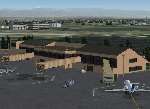
Scenery for Gallatin Field in Bozeman, Montana. Scenery was created for FS9, but should work in FSX. It was created completely in Gmax and separately compiled, so no other libraries are needed. Also included is a landclass file to create the town of Belgrade immediately southwest of the airport, which didn't even exist in the default scenery. Landclass was also updated to change the areas north of the airport to it's actual agricultural use rather than the small forests depicted in the default.
| Filename: | Gallatin_Field__Bozeman_MT.zip |
| License: | Freeware, limited distribution |
| Added: | 28th December 2009, 11:35:54 |
| Downloads: | 2,934 |
| Author: | Gary Widup |
| Size: | 1.28 MB |


© 2001-2026 AVSIM Online
All Rights Reserved
Privacy Policy |