
Where Flight Simulation Enthusiasts Gather from Around the World!
AVSIM Library - Search Results

| Category: Flight Simulator 2004 - Scenery | |
| FS2004 Scenery - Elizabeth Field 0B8 |

|
File Description:
FS2004 Scenery - Elizabeth Field Airport (0B8) serves Fishers Island and Suffolk County Long Island, N.Y. and is owned by Town Of Southold. The airport has more than one runway. The longest is a paved runway extending 2328 feet. The facility is at an elevation of 9 feet. The scenery objects were placed using Instant Scenery using the EZ Scenery libraries. Instructions for Ultimate Terrain users included. Created in collaboration with Ray Lunning by John B. Loney, Jr.
| Filename: | FS2004_Scenery__Elizabeth_Field_0B8.zip |
| License: | Freeware, limited distribution |
| Added: | 21st December 2007, 04:36:10 |
| Downloads: | 816 |
| Author: | John B. Loney, Jr. |
| Size: | 219.35 KB |
| Category: Flight Simulator 2004 - Scenery | |
| DTTR El Borma, Tunisia |
|
File Description:
Googly scenery for El Borma (ICAO: DTTR, IATA: EBM), a small airport with a
long runway deep in the Tunisian desert near the Algerian border. El Borma,
also known as Al Borma or Al Burmah is one of Tunisia's top onshore oil and
natural gas sources and it is this that probably justifies the twice-weekly
flights operated by ATR turboprops of Sevenair.
Microsoft have only provided runways at this airport in Flight Simulator
2004 and this scenery seeks to redress the situation so that you and your
"AI" traffic can use the airport realistically.
The scenery does not purport to be ultra-accurate. Based on high quality
satellite imagery from Google Earth, the layout is proportionally correct but the
added airport features, such as buildings, are built from default Microsoft objects
and add-on libraries so will not look exactly like the real thing.
You are not obliged to download and install any additional scenery libraries,
but to enjoy this scenery in its entirety, you may wish to. It will work fine,
with or without.
| Filename: | DTTR_El_Borma_Tunisia.zip |
| License: | Freeware |
| Added: | 17th December 2008, 16:49:15 |
| Downloads: | 1,028 |
| Author: | John Hinson |
| Size: | 58.32 KB |
| Category: Flight Simulator 2004 - Scenery | |
| Eagle County (KEGE), Glenwood Springs (KGWS), Colorado, Photo-Scenery (FS9 & FSX) |
|
Images related to this file:
File Description:
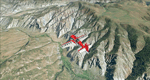
To explore this region depart from Eagle County Regional Airport (KEGE) which is a popular regional airport used in winter to transport skiers to nearby Vail. Northwest of the airport you can see the pit gypsum mine of American Gypsum which produces a variety of wallboard products. When you fly to the west and along the Eagle River, you soon pass its confluence with the Colorado River. Further west you can fly along Glennwood Canyon and finally reach Glennwood Springs where the Colorado meets the Roaring Fork River. Here you can turn south and fly direct Glenwood Springs Airport (KGWS) which lies south of the city. This scenery brings you another 3.500 sq km of beautiful Colorado in 4.7m/pix quality.
High resolution versions of this scenery for FS9 and FSX (much sharper, but larger and multiple downloads) are available at www.blueskyscenery.com/GNB_SouthWest2.html . The screenies are taken from the high-res versions, so expect this version to be slightly more blurry. YourDonation@Work: Dedicated to Alain and James.
| Filename: | Eagle_County_KEGE_Glenwood_Springs_KGWS_Colorado_P.zip |
| License: | Freeware, limited distribution |
| Added: | 30th January 2010, 17:01:49 |
| Downloads: | 2,710 |
| Author: | Gottfried Razek - blueskyscenery.com |
| Size: | 93.8 MB |
| Category: Flight Simulator 2004 - Scenery | |
| SPHZ Anta/Comandante German Arias Grazz, Peru |
|
Images related to this file:
File Description:
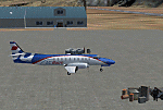
Googly scenery for SPHZ Anta/Comandante German Arias Grazz, Peru - a small
domestic airport for which nothing more than a runway is provided in Flight
Simulator 2004. These scenery files add the apron, taxiways, buildings and
other airport features so that you and your "AI" traffic can land, taxi, park
and take off in a realistic manner.
The airport is served daily by domestic operator L C Busre and perhaps also
others using small aircraft, but little information has been found on activity
in this area.
The scenery does not purport to be ultra-accurate. Based on high-detail satellite
imagery from Google Earth, the layout is proportionally correct but the added
airport features, such as buildings, are built from default Microsoft objects
and add-on libraries so will not look like the real thing.
You are not obliged to download and install any additional scenery libraries,
but to enjoy this scenery in its entirety, you may wish to. It will work fine,
with or without.
[File re-uploaded at request of AVSIM]
| Filename: | SPHZ_AntaComandante_German_Arias_Grazz_Peru.zip |
| License: | Freeware |
| Added: | 23rd May 2010, 01:24:24 |
| Downloads: | 1,224 |
| Author: | John Hinson |
| Size: | 65.15 KB |
| Category: Flight Simulator 2004 - Scenery | |
| MRAO Turtuguero, Costa Rica |
|
Images related to this file:
File Description:
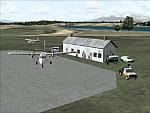
Googly scenery for MRAO Turtuguero, Costa Rica - another one that Microsoft
forgot in FS2004. It is a small domestic airport located on a long spit of
land that almost seems like an island. Turtuguero is just a village but the
airport also serves the lush Tortuguero National Park (rain falls all the
year round here) which draws thousands of visitors each year. The airport
is served daily by DHC-6 Twin Otters of Nature Air.
These scenery files create the airport and add taxiways, aprons, buildings and other airport features, so that you and your "AI" traffic can land, taxi, park and take
off in a realistic manner.The scenery does not purport to be ultra-accurate. Based on less-than-perfect satellite imagery from Google Earth, the layout is as good as I can get it, but some imagination has been used as I cannot tell what buildings exist. The
buildings and other features I have provided are built from default Microsoft
objects and add-on libraries so will not look exactly like the real thing.
You are not obliged to download and install any additional scenery libraries,
but to enjoy this scenery in its entirety, you may wish to. It will work fine,
with or without. [File re-uploaded at request of AVSIM]
| Filename: | MRAO_Turtuguero_Costa_Rica.zip |
| License: | Freeware |
| Added: | 28th May 2010, 20:40:00 |
| Downloads: | 1,174 |
| Author: | John Hinson |
| Size: | 65.12 KB |
| Category: Flight Simulator 2004 - Scenery | |
| Ogdensburg International KOGS New York state close to the St. Lawrence River |
|
File Description:
Ogdensburg is called "International" but there is in fact very little activity, in spite of Big Sky Airways now operating flights between Ogdensburg and Boston. The airfield and the town of the same name are close to the St. Lawrence and the border with Ontario in Canada, and would be very convenient for a cross border hop except for the stepped up security that now applies to cross-border flights. So it is now even emptier than before, in spite of the excellent condition of the 5,200' runway.
| Filename: | Ogdensburg_International__KOGS_New_York_state_clos.zip |
| License: | Freeware |
| Added: | 2nd August 2007, 03:16:36 |
| Downloads: | 844 |
| Author: | Roger Wensley and Jim Turner |
| Size: | 1.13 MB |
| Category: Flight Simulator 2004 - Scenery | |
| Burlington Airpark, Burlington, Ontario, Canada (CZBA) |
|
File Description:
FS2004 Scenery- Burlington Airpark, Burlington Ontario Canada. A small airport with a pave rwy + a grass rwy. Southwest of Toronto North of Hamilton Ont. By Ed DesRoches & tested by Brent Robillard.
| Filename: | Burlington_Airpark_Burlington_Ontario_Canada_CZBA.zip |
| License: | Freeware |
| Added: | 20th September 2008, 23:47:33 |
| Downloads: | 994 |
| Author: | Ed DesRoches |
| Size: | 5.01 MB |
| Category: Flight Simulator 2004 - Scenery | |
| Tinker Air Force Base and Air Logistics Center, Oklahoma USA |
|
File Description:
FS2004 for Tinker Air Force Base and Air Logistics Center. Custom GMAX scenery with new landclass and airport background. May require other files for full activation - please read the readme file.
| Filename: | Tinker_Air_Force_Base_and_Air_Logistics_Center_Okl.zip |
| License: | Freeware, limited distribution |
| Added: | 7th October 2008, 06:15:03 |
| Downloads: | 2,839 |
| Author: | John Stinstrom |
| Size: | 3.52 MB |
| Category: Flight Simulator 2004 - Scenery | |
| EDOV-04 |
|
Images related to this file:
File Description:
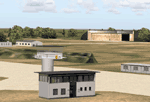
FS2004 scenery--Borstel airport EDOV near
Stendal in Sachsen Anhalt Germany.
Originally a WWII paratroops base, later
base of soviet jetfighters and helicopters,
but now in civilian use. By Thomas Erthner.
| Filename: | EDOV04.zip |
| License: | Check within download |
| Added: | 13th February 2010, 01:04:00 |
| Downloads: | 1,071 |
| Author: | Thomas Erthner |
| Size: | 2.25 MB |
| Category: Flight Simulator 2004 - Scenery | |
| Berclair, Texas - Goliad Naval Outlaying Field - KNGT |
|
File Description:
Berclair, TX airport was formerly code 7T3 now changed to KNGT. The original FS2004 was incorrect runways was an X across runways. I corrected two runways separated and more improved details.
| Filename: | Berclair_Texas__Goliad_Naval_Outlaying_Field__KNGT.zip |
| License: | Freeware |
| Added: | 7th August 2020, 19:21:08 |
| Downloads: | 144 |
| Author: | Stuart John Gilbert II |
| Size: | 1.51 MB |


© 2001-2026 AVSIM Online
All Rights Reserved
Privacy Policy |