
Where Flight Simulation Enthusiasts Gather from Around the World!
AVSIM Library - Search Results

| Category: Flight Simulator 2004 - Scenery | |
| Complement T. Agramont's Madeira v1.0 |

|
Images related to this file:
File Description:
Addon for the scene of Madeira of Toni Agramont (madeira_271158.zip) To download in this same Web! Realised to
give a little him more realism, with AFCAD of LPMA near the reality and adapted to its scene,
can be used with the Mesh of Raimondo Taburet (file: srtm3mad.zip http://www.hangartaborno.com).
In Funchal one has gotten up the arches and houses on foot of head 05, slab that holds with columns of head 23,
illumination in the retaining wall of the arches and in the highway and some Rwy12 objects that heighten a little
plus the landscape. Without Rwy12 it will also work but we strongly encourage libraries installed base.
In Porto Santo there are including his military zone, the name of the airport in the ground and Also
Rwy12 objects.
Readme.txt for the correct installation.
| Filename: | Complement_T_Agramonts_Madeira_v10.zip |
| License: | Freeware |
| Added: | 15th March 2011, 00:00:53 |
| Downloads: | 4,683 |
| Author: | Jordi Reco |
| Size: | 1.98 MB |
| Category: Flight Simulator 2004 - Scenery | |
| Brevoort CWOB and BAF-3 radar plus Cartwright LAB-6 radar Canada |
|
Images related to this file:
File Description:
Brevoort airstrip and the BAF-3 radar it serves is on Brevoort Island, off one of the southeastern tips of Baffin Island and 140 miles east of Iqaluit. This scenery includes the BAF-3 buildings on the hilltop and those on the airstrip below, plus the roads connecting them and down to the beach landing area on the rocky coast. This scenery is made for the FSGenesis 76m terrain mesh for northern Canada, and there will be a repost of all my northern Canada airfields to suit this; I cannot think now why I never installed this mesh before. The AI reflects the use of civil airlines for resupply and transportation of personnel. Given the terrain the wind should be from the north so that ai lands using the 02 runway. Landing from the north will involve a terrain clash while take off towards the north will not as the climb out clears the hilltop. The video shows the 600 foot cliff at the runway threshold and an Air Tindi plane on the apron. Cartwright CYCA is on the Labrador coast and has been posted by Flight Ontario as part of their Goose Bay and Labrador Regional Airports sceneries. The nearby LAB-6 radar site is included here, connected to CYCA by an extended road. The site uses the same buildings as Brevoort and Saglek (posted recently) and although I have included them here as separate sceneries the contents can be placed in the same folders as Saglek with a saving in duplicated textures. The textures here are more accurate than Saglek so say yes to over-write; a downloader with personal experience of Brevoort noted that in reality they are lighter.
| Filename: | Brevoort_CWOB_and_BAF3_radar_plus_Cartwright_LAB6_.zip |
| License: | Freeware, limited distribution |
| Added: | 20th August 2017, 15:46:36 |
| Downloads: | 176 |
| Author: | Roger Wensley |
| Size: | 4.37 MB |
| Category: Flight Simulator 2004 - Scenery | |
| Glacier Bay - Alaska/Canada, Version 2, Part 1 of 2 |
|
Images related to this file:
File Description:
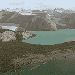
Glacier Bay v2 is a complete replacement of the default FS2004 landscape and scenery of more than 90,000 square kilometers (36,000 sq miles) of Southeast Alaska and adjacent areas of Yukon and British Columbia. File 1 of 2 (also requires glbayv2b.zip)
Landscape enhancements include high-resolution terrain mesh, detailed shorelines, rivers, lakes, and glaciers, and accurate land cover data with custom seasonal ground textures. Inland water bodies can be made to "freeze over" via an on/off switch. Other landmarks include the settlements of Juneau, Haines, Skagway, Yakutat, Atlin, and Carcross as well as road and railroad networks, cabins, lodges, and lighthouses. We modeled or enhanced 16 main airfields (plus one fictitious airstrip), 20 unlisted airstrips, 16 seaplane bases, and seven heliports. We've also included AI ship traffic in various locations as well as optional flightplans for GA and floatplane AI traffic.
Glacier Bay v2 is fully compatible with other third-party add-ons, including terrain mesh (FSGlobal, FS Genesis, etc.), ground textures (Ground Environment, BEV, FScene, etc.), and landscape enhancements (Ultimate Terrain Canada/Alaska, Misty Fjords, Tongass Fjords, Freight Dogs). A configurator panel (requires .Net Framework!) allows users to set compatibility options and to choose levels of scenery detail. We provide an autoinstaller and detailed documentation with a sectional map of the coverage area and a list of weblinks to real-world information.
For feedback and questions, please visit the Glacier Bay v2 support forum at http://forums.fsaddon.eu/viewforum.php?f=10. This project is a collaboration of nine FS developers from Germany, Austria, USA, and Canada, logging more than 1000 hours of work over the past 14 months. We acknowledge the kind support of FSAddon.com. However, this project is independent of any commercial company or product. Enjoy!
| Filename: | Glacier_Bay__AlaskaCanada_Version_2_Part_1_of_2.zip |
| License: | Freeware, limited distribution |
| Added: | 28th May 2010, 19:34:54 |
| Downloads: | 41,284 |
| Author: | Holger Sandmann, Rainer Duda, Michael Eder, Scot Fraser, Manfred Herz, Jay Langham, Jon Patch, Larry Silsbee, and Jim Vile |
| Size: | 56.46 MB |
| Category: Flight Simulator 2004 - Scenery | |
| Glacier Bay - Alaska/Canada, Version 2, Part 2 of 2 |
|
Images related to this file:
File Description:

Glacier Bay v2 is a complete replacement of the default FS2004 landscape and scenery of more than 90,000 square kilometers (36,000 sq miles) of Southeast Alaska and adjacent areas of Yukon and British Columbia. File 2 of 2 (also requires glbayv2a.zip)
Landscape enhancements include high-resolution terrain mesh, detailed shorelines, rivers, lakes, and glaciers, and accurate land cover data with custom seasonal ground textures. Inland water bodies can be made to "freeze over" via an on/off switch. Other landmarks include the settlements of Juneau, Haines, Skagway, Yakutat, Atlin, and Carcross as well as road and railroad networks, cabins, lodges, and lighthouses. We modeled or enhanced 16 main airfields (plus one fictitious airstrip), 20 unlisted airstrips, 16 seaplane bases, and seven heliports. We've also included AI ship traffic in various locations as well as optional flightplans for GA and floatplane AI traffic.
Glacier Bay v2 is fully compatible with other third-party add-ons, including terrain mesh (FSGlobal, FS Genesis, etc.), ground textures (Ground Environment, BEV, FScene, etc.), and landscape enhancements (Ultimate Terrain Canada/Alaska, Misty Fjords, Tongass Fjords, Freight Dogs). A configurator panel (requires .Net Framework!) allows users to set compatibility options and to choose levels of scenery detail. We provide an autoinstaller and detailed documentation with a sectional map of the coverage area and a list of weblinks to real-world information.
For feedback and questions, please visit the Glacier Bay v2 support forum at http://forums.fsaddon.eu/viewforum.php?f=10. This project is a collaboration of nine FS developers from Germany, Austria, USA, and Canada, logging more than 1000 hours of work over the past 14 months. We acknowledge the kind support of FSAddon.com. However, this project is independent of any commercial company or product. Enjoy!
| Filename: | Glacier_Bay__AlaskaCanada_Version_2_Part_2_of_2.zip |
| License: | Freeware, limited distribution |
| Added: | 28th May 2010, 19:36:31 |
| Downloads: | 40,558 |
| Author: | Holger Sandmann, Rainer Duda, Michael Eder, Scot Fraser, Manfred Herz, Jay Langham, Jon Patch, Larry Silsbee, and Jim Vile |
| Size: | 85.99 MB |
| Category: Flight Simulator 2004 - Scenery | |
| EPGD 2008 - Gdansk Lech Walesa Airport, Poland |
|
Images related to this file:
File Description:

Gdansk Lech Walesa Airport (EPGD) is an international airport located in Gdansk, Poland, not far from the city centers of the Tricity metropolitan area: Gdansk (6.25 miles/10 km), Sopot (6.25 miles/10 km) and Gdynia (14.4 miles/23 km). The airport is named after Lech Walesa, the former Polish president. On the outside wall of the terminal building one can see the logo of the airport, which is Lech Walesa's actual signature, a stylized "W".
EPGD 2008 is the first Polish scenery in this quality. Main features of the scenery are:
-Airport ground high resolution textures - (five seasons + night textures);
-Highly detailed 3D objects, all photo textured;
-Animation vehicles ground services;
-Detailed autogen and photorealistic trees;
-Detail mesh.
For more details please look at the README file attached to the scenery file.
| Filename: | EPGD_2008__Gdansk_Lech_Walesa_Airport_Poland.zip |
| License: | Freeware |
| Added: | 18th May 2010, 10:37:46 |
| Downloads: | 25,749 |
| Author: | Kuba Paczek |
| Size: | 24.06 MB |
| Category: Flight Simulator 2004 - Scenery | |
| Modified SRTM relief 76 m for Slovakia |
|
File Description:
This Slovak terrain mesh 76 m (LOD9) is made from the 3arc-sec SRTM. The voids in the source data were filled by the interpolation. Both the primary processing of the 3arc-sec data and the rendering of the terrain in the FS cause flattening and simplifying of the real shape of the terrain. This phenomenon was partially compensated by the sharpening of the source data.
Made by the programs Surfer (Golden Software) and MS Terrain SDK 2000 and 2002. The relief covers the area N49.9219 E016.1719 to N47.4609 E022.9687 in the boundaries of the LOD9 quadrants. This scenery contains only the elevation data. The other elements of the basic terrain as the landclass, locally used airborne photos, vector roads, rivers and lakes are available in different sceneries by other authors and they are continuously developed.
| Filename: | Modified_SRTM_relief_76_m_for_Slovakia.zip |
| License: | Freeware, limited distribution |
| Added: | 28th May 2010, 19:40:13 |
| Downloads: | 4,606 |
| Author: | Vladimir Stoje |
| Size: | 19.36 MB |
| Category: Flight Simulator 2004 - Scenery | |
| KCRW - Charleston-Yeager 2014 |
|
Images related to this file:
File Description:
Yeager Airport KCRW in Charleston, West Virginia, is a mid-size airport surrounded by beautiful terrain (see the section on Optional Mesh). The terminal can easily accommodate 737 class airliners as well as commuter turboprops, and there are GA and West Virginia National Guard ramps. This scenery reflects the current single runway configuration, the former second runway having been converted into taxiway C. It is a complete rebuild with all custom buildings and some photo ground textures. I have also redone the instrument approaches to match the current real ones, and they will automatically be listed and displayed on your GPS. Instrument Approach Plates are included.
This work is entirely my own, but I would like to thank Brandon DePalo for his very well done earlier version of KCRW. Without that, I would not have known about this airport.
| Filename: | KCRW__CharlestonYeager_2014.zip |
| License: | Freeware |
| Added: | 26th April 2014, 07:05:30 |
| Downloads: | 646 |
| Author: | Sidney Schwartz |
| Size: | 7.29 MB |
| Category: Flight Simulator 2004 - Scenery | |
| Modified SRTM Relief 76 m for Czech Republic |
|
File Description:
This Czech Republic terrain mesh 76 m (LOD9) is made from the 3arc-sec SRTM. Small voids in the source data were filled by the interpolation. Both the primary processing of the 3arc-sec data and the rendering of the terrain in the FS cause flattening and simplifying of the real shape of the terrain. This phenomenon was partially compensated by the sharpening of the source data. Made by the programs Surfer (Golden Software) and MS Terrain SDK 2000 and 2002. The relief covers the area N51.1523 E011.9531 to N48.5156 E018.9844 in the boundaries of the LOD9 quadrants. This scenery contains only the elevation data. The other elements of the basic terrain as the landclass, locally used airborne photos, vector roads, rivers and lakes are available in different sceneries by other authors and they are continuously developed.
| Filename: | Modified_SRTM_Relief_76_m_for_Czech_Republic.zip |
| License: | Freeware |
| Added: | 22nd December 2003, 21:25:07 |
| Downloads: | 6,722 |
| Author: | Vladimir Stoje |
| Size: | 20.81 MB |
| Category: Flight Simulator 2004 - Scenery | |
| High Canyon Camp |
|
File Description:
This little camp in the Ketchikan, Alaska area is part of a group of fictional sceneries covering Southeast AK. Should work fine with or without Eddy Denny's terrain mesh. I hope you enjoy them as much as I have.
Menu entries on the Add-on Scenery menu will get you to the starting points. Requires trees_v3 from Garrish Gray. Includes a short dirt strip, STOL planes only need apply. It makes for a nice hop from Ketchikan, AK, and due its proximity to Moudi Farm (Najis Bush Scenery), is a good weekend camping spot for farm residents and visitors. The old cabin is boarded up and has fallen into disuse, but the landing strip is in pretty good shape, and you will usually (okay always) find campers there. Fly on in, I'm sure you'll be welcome.
| Filename: | High_Canyon_Camp.zip |
| License: | Freeware |
| Added: | 16th January 2004, 21:11:31 |
| Downloads: | 1,629 |
| Author: | Todd Hudgel |
| Size: | 980.46 KB |
| Category: Flight Simulator 2004 - Scenery | |
| Tokyo Bay 2005 |
|
Images related to this file:
File Description:
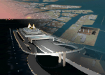
FS2004 Scenery Tokyo Bay Scenery 2005 Ver. 5.0
This add-on scenery improves specific scenerys (Tokyo Bay, Japan) of FS2004.
There are a lot of reclaimed land in Tokyo Bay.
They form an artificial peculiar coastline. This scenery reproduces these coastlines precisely.
And, this scenery reproduces the Keihin industrial area and the Keiyo industrial area in Tokyo Bay located west and east. In this scenery design, the coastline was reproduced as exactly as possible, following the specification of FS2004.
Moreover, 90m mesh geographical data is reproduced by using SRTM 3arc/sec.
The range of detailed coastline and 90m digital elevation data is as follows:
** [detailed coastline] N33:45 E138:45 to N36:55 E141:05 (included Izu Islands)
** [90m digital elevation data] N33:00 E138:00 to N37:00 E141:00 --
The Tokyo Wan AquaLine is arranged in the exact location. By Kazuo Kawamura
| Filename: | Tokyo_Bay_2005.zip |
| License: | Freeware, limited distribution |
| Added: | 3rd December 2011, 23:51:31 |
| Downloads: | 11,790 |
| Author: | Kazuo Kawamura |
| Size: | 9.74 MB |


© 2001-2026 AVSIM Online
All Rights Reserved
Privacy Policy |