
Where Flight Simulation Enthusiasts Gather from Around the World!
AVSIM Library - Search Results

| Category: Flight Simulator 2004 - Scenery | |
| Landing Areas for Western Australia V1 |

|
File Description:
A collection of 35 dirt station strips (ranch strips)and country airstrips for Western Australia made from a blend of AFCAD, Airport, Runway 12, E.O.D. and Google Earth and using my country api's. Some textures are mine and the rest are an accumulation of 6 years FS. An addition to the many other fine contributions for WA. Simply unzip in addon scenery and register the folder in your FS.
| Filename: | Landing_Areas_for_Western_Australia_V1.zip |
| License: | Freeware |
| Added: | 13th August 2006, 20:39:56 |
| Downloads: | 1,162 |
| Author: | Alan Blencowe |
| Size: | 5.03 MB |
| Category: Flight Simulator 2004 - Scenery | |
| Australian Lighthouses - Part 5 - Western Australia |
|
File Description:
Around Australia's coastline there are over 350 lighthouses. I received a suggestion a month ago asking if I would do the locations of the lighthouses down the coast of New South Wales and when I did a bit of research I thought, why not do the whole 36,735 kilometres around Australia? Here is Part 6 - the lighthouses located on the coastline of Western Asutralia - the first landfall for the early European explorers and many decades before Captain James Cook encountered the Great South Land. Some installations no longer exist but I have included several (not all of them) for those of us who like historical and period flying. If it was there in 1935, it's there in this package! There is a Read Me included. No third-party content is required.
| Filename: | Australian_Lighthouses__Part_5__Western_Australia.zip |
| License: | Freeware |
| Added: | 11th February 2006, 00:54:54 |
| Downloads: | 2,268 |
| Author: | Bruce Kennewell |
| Size: | 137.27 KB |
| Category: Flight Simulator 2004 - Scenery | |
| Australian Lighthouses - Part 5 - South Australia |
|
File Description:
Around Australia's coastline there are over 350 lighthouses.
I received a suggestion a month ago asking if I would do the locations of the lighthouses down the coast of New South Wales and when I did a bit of research I thought, why not do the whole 36,735 kilometres around Australia?
Here is Part 5 - the lighthouses located on the coastline of State of South Asutralia.
Some installations no longer exist but I included them for those of us who like historical and period flying. If it was there in 1935, it's there in this package!
A Read Me file is included. No third-party content is required.
| Filename: | Australian_Lighthouses__Part_5__South_Australia.zip |
| License: | Freeware |
| Added: | 9th February 2006, 15:18:18 |
| Downloads: | 2,485 |
| Author: | Bruce Kennewell |
| Size: | 127.72 KB |
| Category: Flight Simulator 2004 - Scenery | |
| Ballina, New South Wales, Australia (YBNA) |
|
File Description:
A very attractive small airport approximately 120 nautical miles from Coffs Harbour and a slightly shorter distance to Grafton and Lismore. This makes a good stopover for hopping down the east coast of Australia. The airport handles around 11 flight a day from Sydney and is also a busy GA aiport. Airlines REX and Qantas link fly into Ballina. The size of the airport has allowed me to put in that extra detail which makes to terminal and surrounds very much "as in real life". Photographic textures are used throughout for the buildings and even the trees and shrubs are hand made macros from photographs at the airport. Thanks to the cooperation of Northern Airline Services - Mr Bruce Beesley the MD and Graeme from Ballina Council the relative position of all of the buildings are exactly to scale as shown on scale drawings of the airport. AFCAD and Traffic Tools files are included to add extra AI traffic. For that reason and because of limited apron space no static planes have been used. In addition a landclass is included to make the airport ground texture resemble the real thing and also to widen the river behind runway 24. The scenery concentrates on adding a realistic terminal to the airport and hangars which are as close as possible to the real thing. Many other details have been added all authentically Ballina. The default runway detail remain unchanged with the exception of VASI placement. Other than that the airport merges into the default scenery without the usual "green oasis" effect. Full night lighting is included plus a rather dubious attempt to model the inside of the terminal (strictly not to be taken too seriously)
| Filename: | Ballina_New_South_Wales_Australia_YBNA.zip |
| License: | Freeware |
| Added: | 25th January 2004, 19:16:25 |
| Downloads: | 5,909 |
| Author: | John Ross |
| Size: | 6.8 MB |
| Category: Flight Simulator 2004 - Scenery | |
| Jandakot Airport (YPJT) - Perth, Western Australia |
|
File Description:
Jandakot Airport for FS2004 only (FS2002 version also available). One of Australia's busiest general aviation airports. Package includes highly detailed photoreal scenery, accurate airport layout, immediate roads, lakes, tracks and other navigation points. Several reference points around Perth also included. All objects custom built for the scenery, all textures are photoreal. Pilot Activated Lighting functional (daytime), LOD models used throughout to assist performance. AFCAD and AI flight plans included. Please read user guide before installing. Designed by Westsim Design Group. http://www.westsim.com.au/
| Filename: | Jandakot_Airport_YPJT__Perth_Western_Australia.zip |
| License: | Freeware, limited distribution |
| Added: | 12th December 2003, 16:54:29 |
| Downloads: | 5,243 |
| Author: | Westsim Design Group - Jarrad Marshall, Derek Kippo and Leon Markich |
| Size: | 4.63 MB |
| Category: Flight Simulator 2004 - Scenery | |
| NZ Rural Airstrips, v3 |
|
Images related to this file:
File Description:
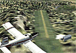
Replaces my previous versions. 9 more strips included. Gisborne area. Requires Christian Stock's payware NZ mesh in the form of "Mountains of New Zealand" and topo in the form of "Lakes and Rivers of New Zealand".
| Filename: | NZ_Rural_Airstrips_v3.zip |
| License: | Freeware |
| Added: | 17th April 2010, 16:18:18 |
| Downloads: | 147 |
| Author: | Godfrey Tier |
| Size: | 2.37 MB |
| Category: Flight Simulator 2004 - Scenery | |
| La Tortuga Island - SyDesigns |
|
File Description:
La Tortuga Island Scenery for Flight Simulator 2004: It is an accurate depiction of this paradise located near Margarita Island in Venezuela. It includes two airfields, new coastlines, mesh, landclass, visual details for VFR flying, and animated scenery.
| Filename: | La_Tortuga_Island__SyDesigns.zip |
| License: | Freeware, limited distribution |
| Added: | 3rd August 2006, 03:52:22 |
| Downloads: | 4,324 |
| Author: | Sabino Yacobone & Arnoldo Perdomo |
| Size: | 6.72 MB |
| Category: Flight Simulator 2004 - Scenery | |
| FYKT, J. G. H. Van Der Wath airport, Keetmanshoop, Namibia for FS9 |
|
File Description:
Based on googleEarth picture. Ez-scenery and rwy12 objects included. Compatible with Holger Sandmann's Namibia LOD9 Terrain mesh (namibia_ne.zip, namibia_nw.zip, namibia_se.zip, namibia_sw.zip, namibia_cp.zip) as well as his namibia_scenery_updates.zip, all found at avsim.com. (re-upload, originally uploaded 23rd November 2008)
| Filename: | FYKT_J_G_H_Van_Der_Wath_airport_Keetmanshoop_Namib.zip |
| License: | Freeware |
| Added: | 16th May 2010, 23:59:11 |
| Downloads: | 1,080 |
| Author: | Detlev J. Rohmer |
| Size: | 5.88 MB |
| Category: Flight Simulator 2004 - Scenery | |
| RANGITAIKI - NZRK |
|
Images related to this file:
File Description:
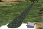
Simple rendition of this aerodrome, 16nm south-east of Taupo, (NAZP), New Zealand. Made for Christian Stock's NZ mesh in the form of "Mountains of New Zealand"
and topo in the form of "Lakes and Rivers of New Zealand".
| Filename: | RANGITAIKI__NZRK.zip |
| License: | Freeware |
| Added: | 6th February 2011, 03:46:28 |
| Downloads: | 206 |
| Author: | Godfrey Tier |
| Size: | 183.53 KB |
| Category: Flight Simulator 2004 - Scenery | |
| Europe SRTM mesh Part 13: Western Spain & Portugal |
|
File Description:
Europe SRTM LOD9 mesh part 13 of 13: Covers Spain west of 4.5°W and Portugal.
This Europe SRTM project was optimized for the lowest HDD space use: Each part macthing exactly the boundaries of its neighbors, you'll have a complete corevage of Europe without gap or overlapping scenery. Based on SRTM Data v1 and v2 (3 arcsec, 90m) and sampled to LOD9 resolution (76m). Each SRTM tile was carefully checked and repaired with Blackart v4.02: water areas are now flattened (lighter mesh), and SRTM voids were treated taking advantage of Blackart's sophisticated interpolation algorithm. When required, biggest voids were patched with oversampled SRTM 30 arcsec data and/or manual input.
| Filename: | Europe_SRTM_mesh_Part_13_Western_Spain__Portugal.zip |
| License: | Freeware, limited distribution |
| Added: | 20th October 2005, 11:22:13 |
| Downloads: | 15,504 |
| Author: | Yohann Baptiste |
| Size: | 34.22 MB |
© 2001-2026 AVSIM Online
All Rights Reserved
Privacy Policy |