
Where Flight Simulation Enthusiasts Gather from Around the World!
AVSIM Library - Search Results

| Category: Flight Simulator 2004 - Scenery | |
| Northern Venezuela SRTM Mesh part 2 |

|
File Description:
This terrain mesh scenery covers north of Venezuela (southern boundary is 8°48'N) and Dutch caribeans: Aruba, Curacao & Bonaire islands.
Based on SRTM Data (3 arcsec, 90m), generated with Matthew Styles's program "SRTM To BGL v1.04", sampled to LOD9 resolution (76m) with 5 interpolation passes.
This part contains Venezuela-NW.bgl. See venezuela_n_mesh_pt2-1.jpg for the .BGL files coverage.
| Filename: | Northern_Venezuela_SRTM_Mesh_part_2.zip |
| License: | Freeware |
| Added: | 7th October 2003, 18:19:24 |
| Downloads: | 8,628 |
| Author: | Yohann Baptiste |
| Size: | 14.31 MB |
| Category: Flight Simulator 2004 - Scenery | |
| Canary Islands 76m SRTM Terrain Mesh |
|
File Description:
USGS SRTM 3 arc-second, resampled to LOD9 (76 meters).
This is a terrain mesh scenery of the Canary Islands west of Morocco, Africa.
It includes the following islands: Hierro, La Palma, La Gomera, Tenerife, Gran Canaria, Fuerteventura, Lanzarote
| Filename: | Canary_Islands_76m_SRTM_Terrain_Mesh.zip |
| License: | Freeware, limited distribution |
| Added: | 4th April 2004, 06:56:49 |
| Downloads: | 18,598 |
| Author: | Andreas Trawny |
| Size: | 2.99 MB |
| Category: Flight Simulator 2004 - Scenery | |
| Turkey Mesh SRTM V2, Part II |
|
Images related to this file:
File Description:
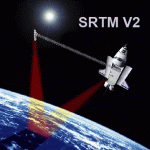
SRTM Version 2 is the result of a substantial editing effort by the National Geospatial Intelligence Agency and exhibits well-defined water bodies and coastlines and the absence of spikes and wells.
| Filename: | Turkey_Mesh_SRTM_V2_Part_II.zip |
| License: | Freeware |
| Added: | 25th January 2011, 14:32:45 |
| Downloads: | 2,882 |
| Author: | Tuncer Celik |
| Size: | 79.06 MB |
| Category: Flight Simulator 2004 - Scenery | |
| Turkey Mesh SRTM V2, Part I |
|
Images related to this file:
File Description:

SRTM Version 2 is the result of a substantial editing effort by the National Geospatial Intelligence Agency and exhibits well-defined water bodies and coastlines and the absence of spikes and wells.
| Filename: | Turkey_Mesh_SRTM_V2_Part_I.zip |
| License: | Freeware |
| Added: | 25th January 2011, 14:32:24 |
| Downloads: | 3,444 |
| Author: | Tuncer Celik |
| Size: | 88.4 MB |
| Category: Flight Simulator 2004 - Scenery | |
| Northern Venezuela SRTM Mesh Part 1 |
|
File Description:
This terrain mesh scenery covers north of Venezuela (southern boundary is 8°48'N) and Dutch caribeans: Aruba, Curacao & Bonaire islands.
Based on SRTM Data (3 arcsec, 90m), generated with Matthew Styles's program "SRTM To BGL v1.04", sampled to LOD9 resolution (76m) with 5 interpolation passes.
This part contains Venezuela-NE.bgl, Venezuela-N.bgl plus all islands. See venezuela_n_mesh_pt1-1.jpg for the .BGL files coverage.
| Filename: | Northern_Venezuela_SRTM_Mesh_Part_1.zip |
| License: | Freeware |
| Added: | 7th October 2003, 18:15:30 |
| Downloads: | 8,986 |
| Author: | Yohann Baptiste |
| Size: | 13.93 MB |
| Category: Flight Simulator 2004 - Scenery | |
| Southern Ontario Canada LOD 9 Mesh |
|
File Description:
Please note that I forgot to cut the one side of the screenshots so the right side of the image is what was present on my second monitor which in the first two pictures was my background.
The default mesh for Southern Ontario Canada was pretty flat and did not show the small rolling hills that are present throughout the province. This is LOD9 (90 meter) mesh that covers ALL of Southern Ontario from Elliot Lake, Sudbury and North Bay in the North, to near Montreal in the east, to Windsor in the southwest and all points in between. This mesh covers the entire area of Ontario shown in the Toronto VNC.
| Filename: | Southern_Ontario_Canada_LOD_9_Mesh.zip |
| License: | Freeware, limited distribution |
| Added: | 16th January 2004, 02:01:29 |
| Downloads: | 6,542 |
| Author: | David Voogd |
| Size: | 41.32 MB |
| Category: Flight Simulator 2004 - Scenery | |
| Israel SRTM 90m Mesh Ver. 1.0 |
|
File Description:
Finally, VFR/CVFR pilots are able to enjoy the tall peaks of the Hermon mountain, the Golan heights and the ravines of the Western slopes of the Carmel mountains, the road to Jerusalem and the sub-sea level features of the Sea of Galilee and the famous Dead Sea.
The Negev Desert can finally show off its fascinating topography which includes, among others, the Small Crater and Ramon Crater whose features are clearly visible from space. There are many canyons, ravines, dry streams and other dramatic ground landscapes which can make a Negev Dessert VFR Expedition quite exciting. The trip could end at Eilat. Now you can see this well known touristic resort, bordered on the West and East by the tall and rugged mountains which have been among its more typical features.
| Filename: | Israel_SRTM_90m_Mesh_Ver_10.zip |
| License: | Freeware, limited distribution |
| Added: | 23rd April 2004, 12:54:03 |
| Downloads: | 12,086 |
| Author: | Alexander Lawrence |
| Size: | 7.26 MB |
| Category: Flight Simulator 2004 - Scenery | |
| New Zealand SRTM Elevation Mesh LOD9 |
|
File Description:
New Zealand elevation mesh scenery based on SRTM data, LOD9. Includes terrain only and combines with any default or add-on scenery, no *additional* landcover information, coastline definitions or airports. This single ZIP-file includes North and South island and nearby smaller islands (e.g. Chatham Is.).
| Filename: | New_Zealand_SRTM_Elevation_Mesh_LOD9.zip |
| License: | Freeware, limited distribution |
| Added: | 11th July 2004, 04:40:56 |
| Downloads: | 9,229 |
| Author: | Matthias Weidemann |
| Size: | 40.03 MB |
| Category: Flight Simulator 2004 - Scenery | |
| Iberia LOD 10 Mesh, Part 1 |
|
File Description:
Iberia LOD10 Mesh for FS2004, covering Kingdom of Spain, Republic of Portugal, South of French Republic and North of Magreb. To be used with iberia_part2.zip
| Filename: | Iberia_LOD_10_Mesh_Part_1.zip |
| License: | Freeware |
| Added: | 16th December 2010, 12:50:16 |
| Downloads: | 2,781 |
| Author: | Miguel Regalado Querol |
| Size: | 205.54 MB |
| Category: Flight Simulator 2004 - Scenery | |
| Devils Tower Terrain Mesh (ver 2) |
|
File Description:
This terrain mesh covers most of Crook County, Wyoming which contains Devils Tower National Monument. This terrain mesh was obtained from NED 1 arc second data and resampled to LOD10 resolution (38.2m). The area near the Devils Tower was obtained from NED 1/3 arc second data and resampled to LOD11 resolution (19.1m). The exact coverage is everything between W105* 7' 30" to W104* 0' 0" by N45* 0' 0" to N44* 15' 0". Devils Tower can be found by starting at Ipy Ranch (WY14) and traveling on a track of 194 degrees for 3 nautical miles. This version corrects a major positional error that was present in the first release and includes higher resolution data near the Devils Tower.
| Filename: | Devils_Tower_Terrain_Mesh_ver_2.zip |
| License: | Freeware |
| Added: | 26th November 2003, 00:25:13 |
| Downloads: | 3,556 |
| Author: | Joshua Robertson, 3D Softworks Design Studios |
| Size: | 4.54 MB |
© 2001-2026 AVSIM Online
All Rights Reserved
Privacy Policy |