
Where Flight Simulation Enthusiasts Gather from Around the World!
AVSIM Library - Search Results

| Category: Flight Simulator 2004 - Scenery | |
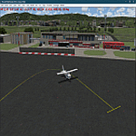
| Santa Ana John Wayne Airport (KSNA) |

|
File Description:
Detailed scenery for John Wayne Orange County Airport, Santa Ana, California. This scenery has been designed and developed in GMAX, and captures the real airport 'feel' as much as possible.
| Filename: | Santa_Ana_John_Wayne_Airport_KSNA.zip |
| License: | Freeware, limited distribution |
| Added: | 4th July 2004, 17:20:42 |
| Downloads: | 18,060 |
| Author: | Shehryar Ansari |
| Size: | 12.67 MB |
| Category: Flight Simulator 2004 - Scenery | |
| Dalnegorsk, Russia - Dalnegorsk airport - UHWD *UPDATE* |
|
File Description:
The airport was uploaded last April 20, 2020 in avsim filename is "eastern_russia_arpts.zip". I sent the airport code was DHG. Someone emailed me that advised me the airport code should be UHWD. I tried to find it but no luck. Someone knows Russian. The airport code is UHWD now I updated and changed it. Please remove DHG files if you installed them before. Replacement of a new file UHWD. Make sure you change flight plans if you have them.
| Filename: | Dalnegorsk_Russia__Dalnegorsk_airport__UHWD__UPDAT.zip |
| License: | Freeware |
| Added: | 25th May 2021, 22:46:24 |
| Downloads: | 82 |
| Author: | Stuart John Gilbert II |
| Size: | 6.9 KB |
| Category: Flight Simulator 2004 - Scenery | |
| W29 - Bay Bridge Airport - Stevensville, Maryland - USA |
|
Images related to this file:
File Description:
FS2004 Scenery - Bay Bridge Airport (FAA LID: W29) is a county-owned public-use airport located in Stevensville, Maryland.The airport is named for the nearby Chesapeake Bay Bridge and is mostly used for general aviation. Bay Bridge Airport covers an area of 72 acres (29 ha) and contains one asphalt runway (11/29) measuring 2,903 x 60 ft (885 x 18 m). Non-default AI repaints/traffic available by John Burford. Scenery created by John B. Loney, Jr.
| Filename: | W29__Bay_Bridge_Airport__Stevensville_Maryland__USA.zip |
| License: | Freeware, limited distribution |
| Added: | 18th November 2014, 14:58:27 |
| Downloads: | 294 |
| Author: | John B. Loney, Jr. |
| Size: | 8.02 MB |
| Category: Flight Simulator 2004 - Scenery | |
| PHOG - Kahului Airport, Hawaii |
|
Images related to this file:
File Description:

FS2004 Scenery for Kahului Airport Hawaii (PHOG). Kahului Airport is the primary airport on the island of Maui and receives both overseas and inter island flights. On Maui you'll find beautiful beaches, exciting water sports, Haleakala Crater, the old whaling town of Lahaina, blue skies, great dining and the Aloha spirit. We look forward to welcoming you to the Valley Island. Scenery contains photoground cover for the airport, custom FSDS scenery objects, and custom AI aircraft.
| Filename: | PHOG__Kahului_Airport_Hawaii.zip |
| License: | Freeware, limited distribution |
| Added: | 5th April 2015, 23:58:16 |
| Downloads: | 1,771 |
| Author: | John Stinstrom |
| Size: | 5.91 MB |
| Category: Flight Simulator 2004 - Scenery | |
| Rabah Bitat Airport (DAAB) Algeria - Scenery |
|
File Description:
Formerly known as Les Salines Airport, and popularly as El Mellah Airport is an international airport located 9 km south of Annaba, a city in Algeria. It is named after Rabah Bitat a president of Algeria (1978-1979). During World
War II the airport was known as Bone Airfield, and was used by the German Luftwaffe. Later captured by the United States Army, the USAAF Twelfth Air Force in the Western Desert Campaign in 1942-1943.
| Filename: | Rabah_Bitat_Airport_DAAB_Algeria__Scenery.zip |
| License: | Freeware |
| Added: | 7th July 2010, 14:55:28 |
| Downloads: | 1,966 |
| Author: | Emad Qtiefan |
| Size: | 5.58 MB |
| Category: Flight Simulator 2004 - Scenery | |
| Lima/Allen County (OH) Regional Airport (KAOH) |
|
File Description:
Built in 1963, it replaced KLIA which was located Northwest of Lima near the village of Elida. It features ILS approach capability, a full-service repair facility, and two runways. 10/28 is 6,000' x 150' asphalt, while 14/32 is a combination asphalt & sod (I couldn't duplicate this with ADE9X, so it's paved as well). I was able to include a rotating beacon in this package (and might offer as an upgrade to previous sceneries). The buildings aren't a true match, but far better than the default mess. Also, rwy 10/28 has been brought up to date; I've lengthened it to 6,000 ft and re-numbered it from the "09/27" found in Fs9.
| Filename: | LimaAllen_County_OH_Regional_Airport_KAOH.zip |
| License: | Freeware |
| Added: | 20th February 2011, 20:45:44 |
| Downloads: | 203 |
| Author: | Stephen Plumb |
| Size: | 947.41 KB |
| Category: Flight Simulator 2004 - Scenery | |
| KRCA - Ellsworth Air Force base |
|
Images related to this file:
File Description:

Beginning with it's inception as a B-17 training field, Ellsworth has changed and upgraded itself through it's history as host to B-29's, B-36's, B-52s, and finally the B-1 Lancer. One of only two dedicated bases world-wide for the Lancer this base sports a combination of new and old with proud traditions. This package features custom FSDS scenery with seasonal ground cover. Although designed primarily for use with MAIWs B-1B Lancer package (maiw_ellsworth_afb_221720.zip) it will of course work with all aircraft. This version is an upgrade which corrects the file name, some errors in documentation and adds the missing taxi-signs. Thanks to folks for reporting the errors.
| Filename: | KRCA__Ellsworth_Air_Force_base.zip |
| License: | Freeware, limited distribution |
| Added: | 24th February 2014, 23:55:41 |
| Downloads: | 1,272 |
| Author: | John Stinstrom |
| Size: | 6.11 MB |
| Category: Flight Simulator 2004 - Scenery | |
| LOD10 (38-m) Glacier Bay National Park, Alaska |
|
File Description:
This LOD10 (38-m) add-on mesh of Glacier Bay National Park and the adjacent Lynn Canal area between Juneau and Skagway (N58-60 W134-138) is an optional (!) upgrade of gl_bay_1.zip (by Holger Sandmann and Jim Keir). It adds more detail to the mountainous areas and allows to locally override other installed Alaska add-on meshes without having to deactivate them. The USGS NED seamless digital elevation data used for this mesh have a 2-arcsec (~60-m) resolution. Thus, the compilation as LOD10 (38-m) will reveal all terrain details contained in the source data. Please read the gl_bay_1.zip read-me file for further information about the special features of the Glacier Bay Project.
| Filename: | LOD10_38m_Glacier_Bay_National_Park_Alaska.zip |
| License: | Freeware, limited distribution |
| Added: | 16th February 2004, 03:40:57 |
| Downloads: | 8,593 |
| Author: | Holger Sandmann |
| Size: | 24.98 MB |
| Category: Flight Simulator 2004 - Scenery | |
| FMCZ - Dzaoudzi Pamandzi International Airport - Dzaoudzi, Mayotte |
|
File Description:
Dzaoudzi Pamandzi International Airport (IATA: DZA, ICAO: FMCZ) in an airport located in Dzaoudzi, Mayotte on the southern tip of the island of Petite-Terre (or Pamanzi), located east of Grande-Terre, the main island of Mayotte. It is the only airport in Mayotte with scheduled services, mainly to destinations within Africa and to France.
| Filename: | FMCZ__Dzaoudzi_Pamandzi_International_Airport__Dza.zip |
| License: | Freeware |
| Added: | 1st January 2014, 09:21:04 |
| Downloads: | 797 |
| Author: | Billy Guo |
| Size: | 516.75 KB |
| Category: Flight Simulator 2004 - Scenery | |
| Bangui M'Poko International Airport (FEFF) V1 |
|
Images related to this file:
File Description:
Thanks for downloading Bangui M'Poko International Airport V1. This is Main International Airport of Central African Republic. The Airport scenery was built from Sketchup, Instant Scenery, SBUILDER and ADE. Needs RWY12 Object library for objects. RWY12 object library is available on avsim. Uses tropical trees macros by Gerrish Gray.
See Readme for install instructions. Cheers!
| Filename: | Bangui_MPoko_International_Airport_FEFF_V1.zip |
| License: | Freeware |
| Added: | 8th August 2021, 07:31:38 |
| Downloads: | 336 |
| Author: | Emmanuel Mwandosya |
| Size: | 11.99 MB |
© 2001-2026 AVSIM Online
All Rights Reserved
Privacy Policy |