
Where Flight Simulation Enthusiasts Gather from Around the World!
AVSIM Library - Search Results

| Category: Flight Simulator 2004 - Scenery | |
| Panama City - Bay Cty 2 |

|
File Description:
FS2004 Scenery-Panama City-Bay Co Intl Airport (KPFN) serves Panama City and Bay County and is owned by Panama City-Bay Co Arpt Dist. The airport has more than one runway. The longest is a paved runway extending 6304 feet. The facility is at an elevation of 21 feet at a distance of about 3 miles from Panama City. Version 2 includes dynamic scenery, Totally redone static scenery taken from Google Earth Satellite Images. All Runways in use. Created with FSDS2.10, Rwy12, EZ Scenery, with a new AFCAD2 file and Traffic Tools. FSDS2 scenery textures included. (Previous version had 1186 downloads)
| Filename: | Panama_City__Bay_Cty_2.zip |
| License: | Freeware |
| Added: | 27th February 2006, 00:48:28 |
| Downloads: | 3,314 |
| Author: | John B. Loney, Jr. |
| Size: | 1000.19 KB |
| Category: Flight Simulator 2004 - Scenery | |
| Pawnee, Oklahoma H97 |
|
File Description:
FS2004 scenery - Pawnee, Oklahoma H97
NOT COMPATABLE WITH FS2002
In reality this is a two turf landing strip airport - however, since I have had some family there
(maybe still do) I have taken the liberty of improving the airport by lengthing the R32 to 5,500'
ashphalt, high intensity lighting, fuel service, improved paved parking, and ILS for the "flight
school" and for your ease of flying. NDB has also been added. Plus: progressive taxi & tower.
You will also note sailboats and other craft in the two lakes surrounding Pawnee all of which are autogen FS2004 addons made possible by Robert Furlan.
| Filename: | Pawnee_Oklahoma_H97.zip |
| License: | Freeware |
| Added: | 29th March 2004, 14:09:21 |
| Downloads: | 703 |
| Author: | jimmy R martin |
| Size: | 1.06 MB |
| Category: Flight Simulator 2004 - Scenery | |
| Madrid Barajas from 2005 onwards |
|
Images related to this file:
File Description:
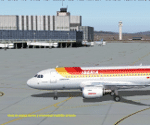
Madrid Barajas FS9 standalone airport, to substitute/update the original FS9 version with the actual 4 RWY operation and two new terminals. Resubmitted at libarian's request. You MUST have a good mesh for spanish terrain, otherwise this scenery won't look good. May I suggest a visit to AirHispania L.A.V. web site, www.airhispania.com, for a free download of their mesh from the scenery section, under "Publicaciones" (publications). Based on LEMDGB from the Zafra brothers original work to complement/update Simwings original Madrid airport, and published with their permission, this version does not require any payware. Taxiway signs now obsolete. Enjoy . Fernando de la Portilla
| Filename: | Madrid_Barajas_from_2005_onwards.zip |
| License: | Freeware |
| Added: | 21st February 2010, 01:45:52 |
| Downloads: | 8,226 |
| Author: | Fernando de la Portilla |
| Size: | 804.05 KB |
| Category: Flight Simulator 2004 - Scenery | |
| Dallas, Texas Love Field (KDAL) - AI Greyhound Bus Shuttle amd Scenery |
|
File Description:
Dallas, Texas - Love Field (KDAL) Shuttle Bus Service. This package adds a fictional Shuttle Bus service (using an AI Greyhound Bus) from the GA side of the airport to the Main terminal. It is designed to compliment the Sikorsky S-76C Helijet Shuttle service - dallashj.zip and s76_dhj.zip - available from this site. At the Bus Shuttle starting location, and along the bus route, there are a few scenery enhancements created with the EZ Scenery Object Placer program. All necessary files - other than the AI Greyhound Bus - are included. This scenery is presented not only as an interesting addition to the KDAL airport, but also as a “case study” to help you add the same type of service in other suitable locations. By studying the Afcad I have created, you will quickly see how it is possible to include AI Bus service in your sceneries using the "invisible” airport technique. Please unzip this package (using folders option) to a temporary folder and carefully follow the simple installation instructions.
| Filename: | Dallas_Texas_Love_Field_KDAL___AI_Greyhound__Bus_S.zip |
| License: | Freeware |
| Added: | 24th July 2006, 20:54:37 |
| Downloads: | 1,572 |
| Author: | David "Opa" Marshall |
| Size: | 2.64 MB |
| Category: Flight Simulator 2004 - Scenery | |
| SWUY Coari/Urucu, Brazil |
|
File Description:
Googly scenery for SWUY Coari/Urucu, Brazil, a small domestic airport
located near Brazil's largest inshore gas source and serving the city
of Coari (some distance away), one of the largest cities in the Amazonas
state. The airport is served about four times daily by ATR aircraft of
Total Linhas Aereas on domestic flights, plus general aviation traffic.
Flight Simulator 2004 has made no provision for traffic with only a runway
provided and this scenery seeks to redress the situation.
The scenery does not purport to be ultra-accurate. Based on high quality
satellite imagery from Google Earth, the layout is proportionally correct but the
added airport features, such as buildings, are built from default Microsoft objects
and add-on libraries so will not look exactly like the real thing.
You are not obliged to download and install any additional scenery libraries,
but to enjoy this scenery in its entirety, you may wish to. It will work fine,
with or without.
| Filename: | SWUY_CoariUrucu_Brazil.zip |
| License: | Freeware |
| Added: | 16th April 2008, 19:26:04 |
| Downloads: | 1,208 |
| Author: | John Hinson |
| Size: | 61.58 KB |
| Category: Flight Simulator 2004 - Scenery | |
| Christchurch, UK circa 1944 |
|
File Description:
Christchurch began its existance in 1926 when a field known as Burrys field near Mudeford, Christchurch UK was used for pleasure flights.In 1935 airfield became known as Bournemouth Airport. Christchurch Airfield was therefore the original Bournemouth Airport. In the early March of 1944, the USAAF arrived as the 509th, 510th and 511th Fighter Squadrons of the 405th Fighter Group. The squadrons flew P47 aircraft on raids over occupied France. All the 405th units left for airfields in occupied France shortly after D-Day. Production of Mosquitos, Horsa Gliders and the Oxford was undertaken here during war time and post war the Airspeed Ambassador and the DH Sea Vixen. Hurn is now "Bournemouth Airport". Christchurch was closed in 1964 and after some years the site developed for housing. Regretably there is no Memorial to the airmen who flew from here or any reminder of their sacrifice. Many people I have met who live on what was the airfield have no idea that it ever existed!
| Filename: | Christchurch_UK_circa_1944.zip |
| License: | Freeware |
| Added: | 19th July 2008, 13:09:24 |
| Downloads: | 728 |
| Author: | Kit Yardley |
| Size: | 5.14 MB |
| Category: Flight Simulator 2004 - Scenery | |
| KSGU-Saint George, Utah |
|
File Description:
The 6600' long St. George airport in southwestern Utah sits high on a mesa! You grasp your armrest hoping that you will become airborne before you fall off the cliff...Or just after landing you are nervously waiting for the pilot to apply the brakes as the end of the runway rushes up to meet you before you fall into nothingness! Such is the fate that awaits the pilot or passenger that ventures to the Saint George, Utah airport.
Actually, it is a very safe and delightful airport to base your flights from. Visit Southern Utah and see the many sights that await the adventurous soul. Take a trip from KSGU to Moab-KCNY or KVEL and marvel at the diversity of the landscape. ( I upgraded those 2 airports also.)
While designed for use with Ultimate Terrain, this enhancement should work with the default FS2004 setting. Please unzip to a temporary folder and follow the simple installation instructions.
| Filename: | KSGUSaint_George_Utah.zip |
| License: | Freeware |
| Added: | 23rd August 2008, 09:49:58 |
| Downloads: | 1,412 |
| Author: | Alan C. Heiner |
| Size: | 664.81 KB |
| Category: Flight Simulator 2004 - Scenery | |
| OPGD Gwadar International, Pakistan |
|
Images related to this file:
File Description:
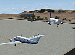
Googly scenery for OPGD Gwadar International, Pakistan. In Flight Simulator
2004 only general aviation parking is provided at this so-called international airport but in the real world it is served two or three times a day by Airbii of Airblue and ATRs of Pakistan International Airways. These scenery files improve or add
aprons, taxiways, buildings and other airport features to Flight Simulator's limited
representation and allow "AI" traffic to land, taxi, park and take off in a realistic
manner.
The scenery does not purport to be ultra-accurate. Based on high-detail satellite
imagery from Google Earth, the layout is proportionally correct but the added
airport features, such as buildings, are built from default Microsoft objects
and add-on libraries so will not look like the real thing.
You are not obliged to download and install any additional scenery libraries,
but to enjoy this scenery in its entirety, you may wish to. It will work fine,
with or without.
[File re-uploaded at request of AVSIM]
| Filename: | OPGD_Gwadar_International_Pakistan.zip |
| License: | Freeware |
| Added: | 15th May 2010, 23:51:51 |
| Downloads: | 170 |
| Author: | John Hinson |
| Size: | 58.09 KB |
| Category: Flight Simulator 2004 - Scenery | |
| VAUD Udaipur/Dabok, India |
|
Images related to this file:
File Description:
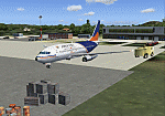
Googly scenery for VAUD Udaipur/Dabok, (also sometimes referred to as VAID) a small domestic airport in
India served by about six flights a day by jets and propeller aircraft from
airlines such as Alliance Air, Jagson Airlines and Jet Airways. These
scenery files improve/add aprons, taxiways, buildings and other airport
features to Flight Simulator's basic representation.
The scenery does not purport to be ultra-accurate. Based on high-detail satellite
imagery from Google Earth, the layout is proportionally correct but the added
[File re-uploaded at request of AVSIM]
airport features, such as buildings, are built from default Microsoft objects
and add-on libraries so will not look exactly like the real thing.
You are not obliged to download and install any additional scenery libraries,
but to enjoy this scenery in its entirety, you may wish to. It will work fine,
with or without.
[File re-uploaded at request of AVSIM]
| Filename: | VAUD__UdaipurDabok_India.zip |
| License: | Freeware |
| Added: | 23rd May 2010, 01:22:29 |
| Downloads: | 1,425 |
| Author: | John Hinson |
| Size: | 67.47 KB |
| Category: Flight Simulator 2004 - Scenery | |
| OPGD Gwadar International, Pakistan |
|
Images related to this file:
File Description:
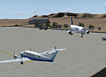
Googly scenery for OPGD Gwadar International, Pakistan. In Flight Simulator
2004 only general aviation parking is provided at this so-called international airport but in the real world it is served two or three times a day by Airbii of Airblue and ATRs of Pakistan International Airways. These scenery files improve or add
aprons, taxiways, buildings and other airport features to Flight Simulator's limited
representation and allow "AI" traffic to land, taxi, park and take off in a realistic
manner.
The scenery does not purport to be ultra-accurate. Based on high-detail satellite
imagery from Google Earth, the layout is proportionally correct but the added
airport features, such as buildings, are built from default Microsoft objects
and add-on libraries so will not look like the real thing.
You are not obliged to download and install any additional scenery libraries,
but to enjoy this scenery in its entirety, you may wish to. It will work fine,
with or without.
[File re-uploaded at request of AVSIM]
| Filename: | OPGD_Gwadar_International_Pakistan.zip |
| License: | Freeware |
| Added: | 23rd May 2010, 01:26:15 |
| Downloads: | 1,065 |
| Author: | John Hinson |
| Size: | 58.09 KB |


© 2001-2026 AVSIM Online
All Rights Reserved
Privacy Policy |