
Where Flight Simulation Enthusiasts Gather from Around the World!
AVSIM Library - Search Results

| Category: Flight Simulator 2004 - Scenery | |
| Crotone (Crotone, LIBC), Calabria, Italy, Photo Real |

|
Images related to this file:
File Description:
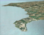
This file contains the photoreal scenery of the oriental part of Calabria (Italy). The airport of Crotone (ICAO code LIBC) is found inside the scenery. The Photo Real Scenery is wide for around 2000 squared Kms.
| Filename: | Crotone_Crotone_LIBC_Calabria_Italy_Photo_Real.zip |
| License: | Freeware |
| Added: | 3rd June 2010, 21:28:56 |
| Downloads: | 10,213 |
| Author: | Fulvio Mazzokan |
| Size: | 61.08 MB |
| Category: Flight Simulator 2004 - Scenery | |
| Lamezia (LICA), Calabria, Italy, Photo Real |
|
Images related to this file:
File Description:
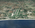
This file contains the photoreal scenery of central part of Calabria (Italy). The airport of Lamezia Terme (ICAO code LICA) is found inside the scenery. The Photo Real Scenery is wide for around 2500 squared Kms.
| Filename: | Lamezia_LICA_Calabria_Italy_Photo_Real.zip |
| License: | Freeware |
| Added: | 3rd June 2010, 22:43:24 |
| Downloads: | 16,844 |
| Author: | Fulvio Mazzokan |
| Size: | 71.47 MB |
| Category: Flight Simulator 2004 - Scenery | |
| Ellisworth International KRCA |
|
File Description:
FS 2004 scenery
Ellsworth International - KRCA
Ellsworth AFB is scheduled to close so we have now merged all our Pacific NW hubs into this airport and added an extra runway to handle all the traffic plus jumbo aircraft parking leaving just enough military spaces to the
south for full compability for your traffic program. Fully compatable with ALL 2004-5 Traffic program addons. Flight plans,
additional airport lines for TTools, AFCAD, LAGO fse included. Full ILS AFCAD and taxi. Pleae enjoy! Even room to add your own objects!
| Filename: | Ellisworth_International_KRCA.zip |
| License: | Freeware |
| Added: | 12th September 2005, 12:17:47 |
| Downloads: | 1,038 |
| Author: | Jimmy R Martin, C Grady Cates |
| Size: | 630.98 KB |
| Category: Flight Simulator 2004 - Scenery | |
| Louisville KSDF--UPS Ramp |
|
File Description:
This is a complete re-do for the UPS cargo area at Louisville-Standiford Int'l. The default FS version of UPS's main hub was way off. The scenery was built with Rwy12 and EZ-Scenery. The AFCAD was based on the Patrick Finch version of the airport which is available at AVSIM.net. I reccommend that if you don't have his scenery, that you download and install it as well. It will revamp the passenger side of the airport and complement the cargo side to make a complete package.
| Filename: | Louisville_KSDFUPS_Ramp.zip |
| License: | Freeware |
| Added: | 26th January 2006, 05:05:16 |
| Downloads: | 4,375 |
| Author: | William Morgan/FRF Studio |
| Size: | 1.14 MB |
| Category: Flight Simulator 2004 - Scenery | |
| Oakes Field (MYX6) GMAX version |
|
File Description:
This file is intended to completely replace the older versions of MYX6. This file, written in xml language and compiled using the new FS2004 SDK's, should be compatible with all near-future versions of MSFS (or at least thats what they promised). Once installed, you will see Oakes Field, along with its two paved runways, and all the airport buildings. AI aircraft traffic has also been added to the airport. Planes in company colors will be performing touch and go's and scheduled cargo runs to some of the neighboring islands several times per day.
| Filename: | Oakes_Field_MYX6_GMAX_version.zip |
| License: | Freeware, limited distribution |
| Added: | 31st March 2006, 00:17:20 |
| Downloads: | 1,009 |
| Author: | Todd Lucas |
| Size: | 5.06 MB |
| Category: Flight Simulator 2004 - Scenery | |
| Beaver Municipal, Ok |
|
File Description:
FS2004 Scenery - Beaver Municipal (K44) is a small airport located in Beaver, Ok. It has 2 runways, one asphalt and the other grass. There is no fuel, maintenence nor attendents. The airport is publicly owned by the City of Beaver. Coordinates: 36-47-56.0930N/100-31-47.5350W ( 36.79891/-100.52987) Located 1 mile SW of Beaver, Oklahoma. Surveyed Elevation is 2491 feet MSL. Beaver Municipal was formerly known as Q44. PLEASE READ THE README FILE!!! Created with EZ Scenery. One non-defaut ai aircraft included. By John B. Loney, Jr.
| Filename: | Beaver_Municipal_Ok.zip |
| License: | Freeware, limited distribution |
| Added: | 4th June 2007, 19:29:29 |
| Downloads: | 442 |
| Author: | John B. Loney, Jr. |
| Size: | 712.49 KB |
| Category: Flight Simulator 2004 - Scenery | |
| Groton-New London scenery |
|
File Description:
FS2004 Scenery - Groton-New London Airport (IATA: GON, ICAO: KGON, FAA LID: GON) is a state-owned public-use airport located three miles (5 km) southeast of the central business district of Groton, a town in New London County, Connecticut, United States. It serves the southeastern Connecticut region, including the shoreline localities of Groton, New London, and Mystic. Created with Instant Scenery using various Object Libraries, I highly recommend David "Opa" Marshall's tall ships scenery (tallpack.zip) as a companion to Groton-New London. By John B. Loney, Jr.
| Filename: | GrotonNew_London_scenery.zip |
| License: | Freeware, limited distribution |
| Added: | 8th January 2008, 03:54:10 |
| Downloads: | 1,539 |
| Author: | John B. Loney, Jr. |
| Size: | 3.07 MB |
| Category: Flight Simulator 2004 - Scenery | |
| KSNC Chester, Connecticut (formerly 3B9) |
|
Images related to this file:
File Description:
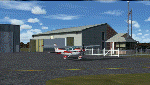
Chester is a small public-use airport in southeastern Connecticut. There is almost always a crosswind on the short, narrow runway. Sharp dropoffs at both ends of the strip make for a tricky approach, but if you can manage it, you'll be rewarded with a neat little airport surrounded by the gorgeous scenery of the Connecticut River Valley. The FBO is top-notch, fuel prices are the best around, and it's one of the last places still selling 80-octane.
Custom Gmax scenery and photo textures. AI traffic with default aircraft included.
| Filename: | KSNC_Chester_Connecticut_formerly_3B9.zip |
| License: | Freeware, limited distribution |
| Added: | 15th November 2009, 00:43:41 |
| Downloads: | 667 |
| Author: | Dave Athay |
| Size: | 1017.03 KB |
| Category: Flight Simulator 2004 - Scenery | |
| Collings and Mansfield |
|
File Description:
FS2004 Scenery - In 1979 the Collings Foundation was founded to support "living history" events involving transportation. Originally founded with the focus of automobiles, the foundation moved to aircraft as the need for quality aviation history exhibits grew. Mansfield Municipal Airport (1B9) serves Mansfield and Bristol County, MA and is owned by the Town Of Mansfield. The airport has more than one runway. The longest is a paved runway extending 3498 feet. The facility is at an elevation of 122 feet. Created using Instant Scenery by John B. Loney, Jr.
| Filename: | Collings_and_Mansfield.zip |
| License: | Freeware, limited distribution |
| Added: | 3rd February 2010, 02:07:34 |
| Downloads: | 247 |
| Author: | John B. Loney, Jr. |
| Size: | 1.78 MB |
| Category: Flight Simulator 2004 - Scenery | |
| UNNT Tolmachevo-2008, Novosibirsk (v 1.05) |
|
Images related to this file:
File Description:
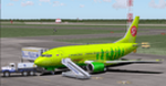
Novosibirsk Tolmachevo Airport (IATA: OVB, ICAO: UNNT) is situated in the town of Ob, 16 km from center of Novosibirsk, an industrial and scientific center in Siberia - Russia's third largest city. Novosibirsk airport is the biggest transit hub on the main routes between Europe and Asia beyond the Urals. There is a 3,600 m (11,811 ft) active runway and another 3,605 m runway under construction, along with 2 passenger terminals, 1 cargo terminal and 61 aircraft stands.
This archive contains all of the current bug fixes for the scenery.
| Filename: | UNNT_Tolmachevo2008_Novosibirsk_v_105.zip |
| License: | Freeware |
| Added: | 5th May 2010, 21:30:39 |
| Downloads: | 13,690 |
| Author: | Tolmachevo TEAM: Burakov Fedor and Usachev Pavel |
| Size: | 57.35 MB |


© 2001-2026 AVSIM Online
All Rights Reserved
Privacy Policy |