
Where Flight Simulation Enthusiasts Gather from Around the World!
AVSIM Library - Search Results

| Category: Flight Simulator 2004 - Scenery | |
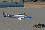
| FS2004 Scenery - Elizabeth Field 0B8 |

|
File Description:
FS2004 Scenery - Elizabeth Field Airport (0B8) serves Fishers Island and Suffolk County Long Island, N.Y. and is owned by Town Of Southold. The airport has more than one runway. The longest is a paved runway extending 2328 feet. The facility is at an elevation of 9 feet. The scenery objects were placed using Instant Scenery using the EZ Scenery libraries. Instructions for Ultimate Terrain users included. Created in collaboration with Ray Lunning by John B. Loney, Jr.
| Filename: | FS2004_Scenery__Elizabeth_Field_0B8.zip |
| License: | Freeware, limited distribution |
| Added: | 21st December 2007, 04:36:10 |
| Downloads: | 815 |
| Author: | John B. Loney, Jr. |
| Size: | 219.35 KB |
| Category: Flight Simulator 2004 - Scenery | |
| OPDB Dalbandin, Pakistan |
|
Images related to this file:
File Description:

Googly scenery for OPDB Dalbandin, Pakistan - a quiet domestic airport for
which no operational facilities are provided in Flight Simulator 2004. These
scenery files add/correct the runways, apron, taxiways, buildings and other
airport features so that you and your "AI" traffic can land, taxi, park
and take off in a realistic manner.
The airport appears to be served all of once per week by ATRs of Pakistan
International Airways so will hardly buzz with activity, but you will be
assured of a friendly welcome when you arrive.
The scenery does not purport to be ultra-accurate. Based on high-detail satellite
imagery from Google Earth, the layout is proportionally correct but the added
airport features, such as buildings, are built from default Microsoft objects
and add-on libraries so will not look like the real thing.
You are not obliged to download and install any additional scenery libraries,
but to enjoy this scenery in its entirety, you may wish to. It will work fine,
with or without.
[File re-uploaded at the request of AVSIM]
| Filename: | OPDB_Dalbandin_Pakistan.zip |
| License: | Freeware |
| Added: | 5th May 2010, 22:32:37 |
| Downloads: | 1,017 |
| Author: | John Hinson |
| Size: | 65.99 KB |
| Category: Flight Simulator 2004 - Scenery | |
| SPHZ Anta/Comandante German Arias Grazz, Peru |
|
Images related to this file:
File Description:
Googly scenery for SPHZ Anta/Comandante German Arias Grazz, Peru - a small
domestic airport for which nothing more than a runway is provided in Flight
Simulator 2004. These scenery files add the apron, taxiways, buildings and
other airport features so that you and your "AI" traffic can land, taxi, park
and take off in a realistic manner.
The airport is served daily by domestic operator L C Busre and perhaps also
others using small aircraft, but little information has been found on activity
in this area.
The scenery does not purport to be ultra-accurate. Based on high-detail satellite
imagery from Google Earth, the layout is proportionally correct but the added
airport features, such as buildings, are built from default Microsoft objects
and add-on libraries so will not look like the real thing.
You are not obliged to download and install any additional scenery libraries,
but to enjoy this scenery in its entirety, you may wish to. It will work fine,
with or without.
[File re-uploaded at request of AVSIM]
| Filename: | SPHZ_AntaComandante_German_Arias_Grazz_Peru.zip |
| License: | Freeware |
| Added: | 23rd May 2010, 01:24:24 |
| Downloads: | 1,224 |
| Author: | John Hinson |
| Size: | 65.15 KB |
| Category: Flight Simulator 2004 - Scenery | |
| Eagle County (KEGE), Glenwood Springs (KGWS), Colorado, Photo-Scenery (FS9 & FSX) |
|
Images related to this file:
File Description:
To explore this region depart from Eagle County Regional Airport (KEGE) which is a popular regional airport used in winter to transport skiers to nearby Vail. Northwest of the airport you can see the pit gypsum mine of American Gypsum which produces a variety of wallboard products. When you fly to the west and along the Eagle River, you soon pass its confluence with the Colorado River. Further west you can fly along Glennwood Canyon and finally reach Glennwood Springs where the Colorado meets the Roaring Fork River. Here you can turn south and fly direct Glenwood Springs Airport (KGWS) which lies south of the city. This scenery brings you another 3.500 sq km of beautiful Colorado in 4.7m/pix quality.
High resolution versions of this scenery for FS9 and FSX (much sharper, but larger and multiple downloads) are available at www.blueskyscenery.com/GNB_SouthWest2.html . The screenies are taken from the high-res versions, so expect this version to be slightly more blurry. YourDonation@Work: Dedicated to Alain and James.
| Filename: | Eagle_County_KEGE_Glenwood_Springs_KGWS_Colorado_P.zip |
| License: | Freeware, limited distribution |
| Added: | 30th January 2010, 17:01:49 |
| Downloads: | 2,706 |
| Author: | Gottfried Razek - blueskyscenery.com |
| Size: | 93.8 MB |
| Category: Flight Simulator 2004 - Scenery | |
| DTTR El Borma, Tunisia |
|
File Description:
Googly scenery for El Borma (ICAO: DTTR, IATA: EBM), a small airport with a
long runway deep in the Tunisian desert near the Algerian border. El Borma,
also known as Al Borma or Al Burmah is one of Tunisia's top onshore oil and
natural gas sources and it is this that probably justifies the twice-weekly
flights operated by ATR turboprops of Sevenair.
Microsoft have only provided runways at this airport in Flight Simulator
2004 and this scenery seeks to redress the situation so that you and your
"AI" traffic can use the airport realistically.
The scenery does not purport to be ultra-accurate. Based on high quality
satellite imagery from Google Earth, the layout is proportionally correct but the
added airport features, such as buildings, are built from default Microsoft objects
and add-on libraries so will not look exactly like the real thing.
You are not obliged to download and install any additional scenery libraries,
but to enjoy this scenery in its entirety, you may wish to. It will work fine,
with or without.
| Filename: | DTTR_El_Borma_Tunisia.zip |
| License: | Freeware |
| Added: | 17th December 2008, 16:49:15 |
| Downloads: | 1,027 |
| Author: | John Hinson |
| Size: | 58.32 KB |
| Category: Flight Simulator 2004 - Scenery | |
| HSSS Khartoum, Sudan |
|
File Description:
Googly scenery for HSSS Khartoum, Sudan. For Sudan's main international airport,
the Flight Simulator depiction is somewhat simplified, depicting just a few
buildings which are badly located. These scenery files attempt to reproduce
the real atmosphere of the airport - from the huge clutter of small hangars
and workshops and large quantities of inactive planes through to the aircraft
dump at the north end of the airport.
The scenery does not purport to be ultra-accurate. Based on high-detail satellite
imagery from Google Earth, the layout is proportionally correct but the added
airport features, such as buildings, are built from default Microsoft objects
and third-party object libraries so will not look like the real thing.
You are not obliged to download and install any additional scenery libraries,
but to enjoy this scenery in its entirety, you may wish to. It will work fine,
with or without. These files complement the Sudan Airways AI Fleet Pack by Billy Rutherford &
John Hinson, updating the scenery files contained therein, but the two are not
inter-dependent.
| Filename: | HSSS_Khartoum_Sudan.zip |
| License: | Freeware |
| Added: | 9th March 2007, 17:29:13 |
| Downloads: | 4,417 |
| Author: | John Hinson |
| Size: | 38.74 KB |
| Category: Flight Simulator 2004 - Scenery | |
| VAAH Ahmedabad International, India |
|
Images related to this file:
File Description:

Googly scenery for VAAH Ahmedabad International, India - an enhancement to the airport provided in Flight Simulator 2004 which is incorrect in many respects. These scenery files correct and improve the terminal location, apron, taxiways, buildings and other airport features so that you and your "AI" traffic can land, taxi, park and take off in a realistic manner.
The airport is served by aircraft as large as Jumbo Jets from a range of domestic and international Indian airline operators, together with flights from other countries' airlines such as Kuwait Airways and Singapore Airlines.
The scenery does not purport to be ultra-accurate. Based on high-detail satellite imagery from Google Earth, the layout is proportionally correct but the added airport features, such as buildings, are built from default Microsoft objects and add-on libraries so will not look like the real thing.
You are not obliged to download and install any additional scenery libraries, but to enjoy this scenery in its entirety, you may wish to. It will work fine, with or without.
[File re-uploaded at request of AVSIM]
| Filename: | VAAH_Ahmedabad_International_India.zip |
| License: | Freeware |
| Added: | 26th June 2010, 06:06:36 |
| Downloads: | 2,921 |
| Author: | John Hinson |
| Size: | 82.47 KB |
| Category: Flight Simulator 2004 - Scenery | |
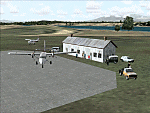
| Union Island TVSU in the Grenadines, eastern Caribbean Version 1.1 |
|
Images related to this file:
File Description:
This is a self-contained version 1.1 that modifies the terrain flattens around the airport. I found that suddenly, and for no apparent reason, the Lesser Antilles mesh and my flattens were at war and creating hills within the airport boundary. If you are not having problems then you do not need this.
Union Island is in the southern tail of the chain of islands known as St Vincent and the Grenadines, between Canouan and Carriacou. Union is another small island, 3.5 miles long and at its widest 1.5 miles wide; the resident population is around 3,000, mostly in the two towns Clifton and Ashton. The airport is at the eastern end of the island, and has been extended into the sea on landfill. The runway is now around 2,480 feet long, aligned 08 (and with the southeast trade winds it is unlikely that you will find yourself using 26) and with a displaced threshold of 530 feet due to the hill to the west. The terminal is adjacent to a rather small apron; there is parking on the grass north of the taxiway. There are connecting flights by SVG to Barbados and the other islands and these are reflected in the AI. The airport has no lighting, and flights are obliged to land and depart in daylight hours only, outside of which the airport is closed.
| Filename: | Union_Island_TVSU_in_the_Grenadines_eastern_Caribb.zip |
| License: | Freeware, limited distribution |
| Added: | 16th June 2013, 18:46:33 |
| Downloads: | 526 |
| Author: | Roger Wensley |
| Size: | 2.02 MB |
| Category: Flight Simulator 2004 - Scenery | |
| MRAO Turtuguero, Costa Rica |
|
Images related to this file:
File Description:
Googly scenery for MRAO Turtuguero, Costa Rica - another one that Microsoft
forgot in FS2004. It is a small domestic airport located on a long spit of
land that almost seems like an island. Turtuguero is just a village but the
airport also serves the lush Tortuguero National Park (rain falls all the
year round here) which draws thousands of visitors each year. The airport
is served daily by DHC-6 Twin Otters of Nature Air.
These scenery files create the airport and add taxiways, aprons, buildings and other airport features, so that you and your "AI" traffic can land, taxi, park and take
off in a realistic manner.The scenery does not purport to be ultra-accurate. Based on less-than-perfect satellite imagery from Google Earth, the layout is as good as I can get it, but some imagination has been used as I cannot tell what buildings exist. The
buildings and other features I have provided are built from default Microsoft
objects and add-on libraries so will not look exactly like the real thing.
You are not obliged to download and install any additional scenery libraries,
but to enjoy this scenery in its entirety, you may wish to. It will work fine,
with or without. [File re-uploaded at request of AVSIM]
| Filename: | MRAO_Turtuguero_Costa_Rica.zip |
| License: | Freeware |
| Added: | 28th May 2010, 20:40:00 |
| Downloads: | 1,174 |
| Author: | John Hinson |
| Size: | 65.12 KB |
| Category: Flight Simulator 2004 - Scenery | |
| Havana 1962 Scenery |
|
File Description:
This scenery includes Havana as it was in 1962 (a mysterious city of much fascination for me) including El Morro Fortress on its rocky outcropping at the entrance to Havana harbor, the largest such fortress in the Caribbean, and its adjacent lighthouse. In downtown Havana you will see the capital building and several old cathedrals. Near the Malicon sea walk by the beach, you will find 3 famous hotels and former casinos, the Flamingo, the Riviera, and the Havana Hilton. The Havana Hilton opened just days before Castro seized power and nationalized it. When he first came to power he occupied the top floor for some time. Havana Airport opened originally as Rancho Los Boyeos Airport, located just southwest from the city in the village of the same name, which was then mostly farms, small ranches, and tiny communities. The original terminal was a very pretty Spanish colonial building, which the dictator Fulgencio Batista had remodeled in a 1950's cubist-tudor style. It was at the time of this remodeling (1957) that the airport's name was changed to Jose Marti International Airport, named after the famous Cuban revolutionary and poet of the 19th century. Jose Marti Airport was in the 1950s and 1960s the primary port of entry airport for Cuba. Up until the January 1st 1959 revolution many US airlines served Havana, but due to mounting tensions, the crisis of the Bay of Pigs attack, and later on the October 1962 missile crisis, traffic and tourism was ended as the US led blockade of Cuba took hold. By the time of this scenery, April 1962, the once former bustling Jose Marti airport had become quite sedate.
| Filename: | Havana_1962_Scenery.zip |
| License: | Freeware, limited distribution |
| Added: | 4th March 2010, 23:36:41 |
| Downloads: | 3,864 |
| Author: | Mike Stevens and Tom Gibson |
| Size: | 9.72 MB |
© 2001-2026 AVSIM Online
All Rights Reserved
Privacy Policy |