
Where Flight Simulation Enthusiasts Gather from Around the World!
AVSIM Library - Search Results

| Category: Flight Simulator 2004 - Scenery | |
| Chin Mon & Matsu Island SRTM Mesh |

|
File Description:
Patch up two missing islands mesh, ChinMon & Matsu, for Stefan Braunewell's Taiwan Mesh (AVSIM, taiwanmesh.zip).
It is inculding 3 global tiles: N24E118, N26E119, and N26E120.
| Filename: | Chin_Mon__Matsu_Island_SRTM_Mesh.zip |
| License: | Freeware |
| Added: | 6th January 2004, 23:00:09 |
| Downloads: | 2,760 |
| Author: | Rudolf Liu |
| Size: | 2.35 MB |
| Category: Flight Simulator 2004 - Scenery | |
| la Réunion, île Maurice SRTM Mesh |
|
File Description:
This terrain mesh scenery covers la Réunion,Mauritius island
Based on SRTM30 Data, generated with FsTerrain 2002, sampled to LOD9 resolution (76m),3ArcSec . While tested with Fs2002, this mesh should also run in FS2004.It contains REUN.bgl.
| Filename: | la_Runion_le_Maurice_SRTM_Mesh.zip |
| License: | Freeware |
| Added: | 22nd November 2003, 08:49:22 |
| Downloads: | 7,135 |
| Author: | lalarisolo Rakouth |
| Size: | 9.17 MB |
| Category: Flight Simulator 2004 - Scenery | |
| Guatemala & Honduras SRTM Mesh Part 1 |
|
File Description:
This terrain mesh scenery was made to fit Jozef Kusters' Nicaragua mesh on its south-eastern edges. It covers Guatemala, western & northern Honduras (including Isl de la Bahia - Roatan), Belize and Salvador. Based on SRTM Data (3 arc/sec), generated with Matthew Styles's program "SRTM To BGL v1.04", sampled to LOD9 resolution (76m) with 5 interpolation passes. While tested under Fs2004, this mesh should also run in FS2002.
This part contains Guatemala-S.BGL. See guatemala_honduras_mesh_pt1.jpg for .BGL files coverage.
| Filename: | Guatemala__Honduras_SRTM_Mesh_Part_1.zip |
| License: | Freeware |
| Added: | 30th September 2003, 15:19:59 |
| Downloads: | 6,995 |
| Author: | Yohann Baptiste |
| Size: | 16.92 MB |
| Category: Flight Simulator 2004 - Scenery | |
| SRTM Mesh for Madagascar Part 2 |
|
File Description:
this is the part 2 of madagascar mesh, it cover the south of island, enjoy
| Filename: | SRTM_Mesh_for_Madagascar_Part_2.zip |
| License: | Freeware, limited distribution |
| Added: | 2nd April 2004, 15:40:35 |
| Downloads: | 10,849 |
| Author: | jean gabriel laurent |
| Size: | 24.21 MB |
| Category: Flight Simulator 2004 - Scenery | |
| Canary Islands 76m SRTM Terrain Mesh |
|
File Description:
USGS SRTM 3 arc-second, resampled to LOD9 (76 meters).
This is a terrain mesh scenery of the Canary Islands west of Morocco, Africa.
It includes the following islands: Hierro, La Palma, La Gomera, Tenerife, Gran Canaria, Fuerteventura, Lanzarote
| Filename: | Canary_Islands_76m_SRTM_Terrain_Mesh.zip |
| License: | Freeware, limited distribution |
| Added: | 4th April 2004, 06:56:49 |
| Downloads: | 18,605 |
| Author: | Andreas Trawny |
| Size: | 2.99 MB |
| Category: Flight Simulator 2004 - Scenery | |
| Turkey Mesh SRTM V2, Part I |
|
Images related to this file:
File Description:
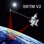
SRTM Version 2 is the result of a substantial editing effort by the National Geospatial Intelligence Agency and exhibits well-defined water bodies and coastlines and the absence of spikes and wells.
| Filename: | Turkey_Mesh_SRTM_V2_Part_I.zip |
| License: | Freeware |
| Added: | 25th January 2011, 14:32:24 |
| Downloads: | 3,451 |
| Author: | Tuncer Celik |
| Size: | 88.4 MB |
| Category: Flight Simulator 2004 - Scenery | |
| Israel SRTM 90m Mesh Ver. 1.0 |
|
File Description:
Finally, VFR/CVFR pilots are able to enjoy the tall peaks of the Hermon mountain, the Golan heights and the ravines of the Western slopes of the Carmel mountains, the road to Jerusalem and the sub-sea level features of the Sea of Galilee and the famous Dead Sea.
The Negev Desert can finally show off its fascinating topography which includes, among others, the Small Crater and Ramon Crater whose features are clearly visible from space. There are many canyons, ravines, dry streams and other dramatic ground landscapes which can make a Negev Dessert VFR Expedition quite exciting. The trip could end at Eilat. Now you can see this well known touristic resort, bordered on the West and East by the tall and rugged mountains which have been among its more typical features.
| Filename: | Israel_SRTM_90m_Mesh_Ver_10.zip |
| License: | Freeware, limited distribution |
| Added: | 23rd April 2004, 12:54:03 |
| Downloads: | 12,095 |
| Author: | Alexander Lawrence |
| Size: | 7.26 MB |
| Category: Flight Simulator 2004 - Scenery | |
| Romania Mesh |
|
File Description:
Well, the mesh covers the complete Romanian territory - made with the data of ESA/NASA and processed by the SRTM global processor and sampled at 3 arcseconds. Give it a try!
| Filename: | Romania_Mesh.zip |
| License: | Freeware, limited distribution |
| Added: | 11th November 2003, 19:34:55 |
| Downloads: | 6,513 |
| Author: | Stefan Braunewell |
| Size: | 56.06 MB |
| Category: Flight Simulator 2004 - Scenery | |
| Yemen, Asia (Part1) |
|
File Description:
This mesh includes the country of Yemen. This part covers the area from
N12 E43 to N17 E45. USGS SRTM 3 arc-second, resampled to LOD9 (76 meters).
Part 1 of 3.
| Filename: | Yemen_Asia_Part1.zip |
| License: | Freeware, limited distribution |
| Added: | 17th April 2004, 23:27:30 |
| Downloads: | 3,854 |
| Author: | Michael Speck |
| Size: | 18.87 MB |
| Category: Flight Simulator 2004 - Scenery | |
| Yemen, Asia (Part2) |
|
File Description:
This mesh includes the country of Yemen. This part covers the area from
N13 E46 to N17 E48. USGS SRTM 3 arc-second, resampled to LOD9 (76 meters).
Part 2 of 3.
| Filename: | Yemen_Asia_Part2.zip |
| License: | Freeware, limited distribution |
| Added: | 17th April 2004, 23:28:18 |
| Downloads: | 3,667 |
| Author: | Michael Speck |
| Size: | 14.85 MB |


© 2001-2026 AVSIM Online
All Rights Reserved
Privacy Policy |