
Where Flight Simulation Enthusiasts Gather from Around the World!
AVSIM Library - Search Results

| Category: Flight Simulator 2004 - Scenery | |
| UKSD 's Military Airfields in Yorkshire - UPDATE |

|
File Description:
Update for Military Airfields in Yorkshire, deals with a few compatibility issues with other scenery. See the pdf document for more details. Also add's a few more RAF type buildings to Topcliffe, Linton on Ouse and Church Fenton.
| Filename: | UKSD_s_Military_Airfields_in_Yorkshire__UPDATE.zip |
| License: | Freeware, limited distribution |
| Added: | 11th January 2006, 04:57:18 |
| Downloads: | 3,239 |
| Author: | Stephen Legg & Rob Brittain |
| Size: | 3.18 MB |
| Category: Flight Simulator 2004 - Scenery | |
| KSBA - Santa Barbara Airport - California, USA |
|
File Description:
KSBA - In Santa Barbara Airport California. The default scenery wasn't updated. The airport had been changed a lot: additional of a new terminal, apron, and taxiways. I created beautiful details airport. Sailboats, oil tanker, boats and oil rig.
| Filename: | KSBA__Santa_Barbara_Airport__California_USA.zip |
| License: | Freeware |
| Added: | 3rd March 2014, 00:03:07 |
| Downloads: | 1,011 |
| Author: | Stuart J Gilbert II |
| Size: | 2.54 MB |
| Category: Flight Simulator 2004 - Scenery | |
| Whitsundays Water & Landclass Scenery Missing Texture |
|
File Description:
It appears that I made a boo boo. Here is the missing grass texture that I forgot to add which leaves a big white block around Whitsunday Airport in my FS2004 Whitsundays Water & Landclass Scenery package . Sincere apologies.
| Filename: | Whitsundays_Water__Landclass_Scenery_Missing_Textu.zip |
| License: | Freeware |
| Added: | 11th March 2004, 04:05:22 |
| Downloads: | 1,850 |
| Author: | Darren Jackson |
| Size: | 82.04 KB |
| Category: Flight Simulator 2004 - Scenery | |
| Euroairport Basel Mulhouse Freiburg |
|
File Description:
The Euroairport Basel Mulhouse Freiburg LFSB, Pre-Release
Created 18.04.2004, Tested with Win XP on F2004.
This is a Pre-Release of the EAP LFSB because of many requests.
Still a lot of work has to be done!
| Filename: | Euroairport_Basel_Mulhouse_Freiburg.zip |
| License: | Freeware |
| Added: | 19th April 2004, 04:02:59 |
| Downloads: | 8,721 |
| Author: | Joerg Unglaub |
| Size: | 11.85 MB |
| Category: Flight Simulator 2004 - Scenery | |
| Belize, Dangriga V1.0 |
|
Images related to this file:
File Description:
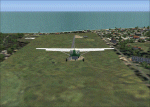
Installment # 3 of my Belize scenery update. Dangriga could be one of the better airports in Belize, were it not for some trees and a airport perimeter that tends to turn into a swamp with every major rain.
| Filename: | Belize_Dangriga_V10.zip |
| License: | Freeware, limited distribution |
| Added: | 22nd April 2010, 13:44:49 |
| Downloads: | 431 |
| Author: | Alf B. Meier |
| Size: | 294.84 KB |
| Category: Flight Simulator 2004 - Scenery | |
| E T Joshua TVSV on Saint Vincent in the eastern Caribbean |
|
Images related to this file:
File Description:
Saint Vincent island is the northernmost of the group of islands known as St Vincent and the Grenadines, just south of St Lucia. St Vincent is around 17 miles long and 10 miles wide and by far the largest in the group, and the islands have a total population of around 120,000. E T Joshua is at the southern end of the island, adjacent to the capital Kingstown. There is a new airport under construction a few miles to the east which will have a longer runway and a larger apron, and when it is ready E T Joshua will probably be closed and redeveloped.
The terminal and the other smaller buildings are all made with photographic textures; the terminal is now quite old and has seen better days. The airport is a hub for small local airlines and also has regular LIAT flights connecting to other islands. The runway is just a shade under 4,700 feet of asphalt, so there are no direct flights from Europe. The new airport to the east is depicted as under construction; obviously I have not flown there and I have not tried to depict the terminal building which is also under construction but a mystery to me.
| Filename: | E_T_Joshua_TVSV_on_Saint_Vincent_in_the_eastern_Caribbean.zip |
| License: | Freeware, limited distribution |
| Added: | 11th June 2013, 16:29:42 |
| Downloads: | 536 |
| Author: | Roger Wensley |
| Size: | 3.13 MB |
| Category: Flight Simulator 2004 - Scenery | |
| OSM World: Western Europe |
|
Images related to this file:
File Description:
Read Installation instructions carefully, this is a complex scenery package!
This package includes a "Dev Kit" should you wish to expand it to other areas! Please contact me if you wish to do so! This is community effort! If we all contribute, we will hopefully have the entire world covered one day!
Welcome to OSM World: Western Europe! This is a vector data scenery package covering the western European area. Coastlines, Rivers, lakes, roads, railways, and power lines with detail never before seen! All in an autogen-compatible density! You can see roundabouts, train terminals, harbor areas in a resolution of a point every 10 meters. At this same resolution a vectorial city class places residential (in small and big building variations, depending on surface area) and industrial areas exactly where they are supposed to be. This gives the city areas a resolution far superior to the capacity of FS-2004 default landclass bitmaps, limited to approximately 1 Km x 1 Km squares. OSM World: Western Europe will even give you small roads leading to small towns (even a few houses across)! From big highway intersections, including ramps, to the tiniest rural pathways covering the entire western area! Wherever in Western Europe you fly, there is something to see!
| Filename: | OSM_World_Western_Europe.zip |
| License: | Freeware |
| Added: | 13th October 2014, 00:18:39 |
| Downloads: | 4,129 |
| Author: | Mario Noriega |
| Size: | 274.75 MB |
| Category: Flight Simulator 2004 - Scenery | |
| Ivujivik CYIK and Quaqtaq CYHA adapted for the FSGenesis 76m North Canada Terrain Mesh |
|
Images related to this file:
File Description:
These are replacement bgl's to convert Ivujivik CYIK and Quaqtaq CYHA in Quebec Canada for use with the FSGenesis 76m terrain mesh for northern Canada. I recently discovered this terrain mesh while making a scenery that is, in real life, on the edge of a cliff and cannot understand now why I did not install it before. This is not stand-alone, and presumes that you have already downloaded and installed both previously posted sceneries. The installation consists solely of replacing the existing scenery bgl's with the new. Ivujivik has built a new terminal building since the original scenery post but I have fond "Summer" memories of the old one and stayed with it, shown here in a pic at a surprising time of the year.
| Filename: | Ivujivik_CYIK_and_Quaqtaq_CYHA_adapted_for_the_FSG.zip |
| License: | Freeware, limited distribution |
| Added: | 26th August 2017, 17:54:09 |
| Downloads: | 92 |
| Author: | Roger Wensley |
| Size: | 1.94 MB |
| Category: Flight Simulator 2004 - Scenery | |
| Placerville (KPVF) Scenery Update |
|
File Description:
An Update to the KPVF Placerville Scenery files. This update has two files, an AFCAD which has an additional GA parking spot named "W Parking 1". If you select this as your start location you will start your flight inside a green T hanger at the far end of the field where most of the additional scenery is placed. Also a new scenery file which has a lot more trees added to the northern area, which is what you see on the aerial photo. Also it corrects an error in which a stack of crates are hovering above the ground near the end of the parking ramp. You will need the original exclude file in the first KPVF Scenery so this is not a stand alone install.
| Filename: | Placerville_KPVF_Scenery_Update.zip |
| License: | Freeware |
| Added: | 21st March 2006, 23:39:23 |
| Downloads: | 351 |
| Author: | Kim Gowney |
| Size: | 5.17 KB |
| Category: Flight Simulator 2004 - Scenery | |
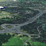
| Sturt Point CWSP in Nunavut, Canada |
|
Images related to this file:
File Description:
Sturt Point was a DEW line I Station on the south coast of Victoria Island, 50 miles east of Cambridge Bay. It was closed in 1963 but remains in place, though a 5 man I Station has such a small impact on its surroundings that it is hardly visible. The runway is 3,420 feet of gravel aligned 117T/297T, and there are no lights, signage, or windsock, but there are ruts in the gravel. A North Warning System station was built 15 miles inland and closer to Cambridge Bay, operating from 1991 onwards. This has a short (1,280'?) gravel runway aligned 138T/318T (and named CWSX here). No ruts in the gravel, but also still no lights, signage, or windsock.
| Filename: | Sturt_Point_CWSP_in_Nunavut_Canada.zip |
| License: | Freeware, limited distribution |
| Added: | 11th November 2012, 21:07:18 |
| Downloads: | 206 |
| Author: | Roger Wensley |
| Size: | 1.35 MB |
© 2001-2026 AVSIM Online
All Rights Reserved
Privacy Policy |