
Where Flight Simulation Enthusiasts Gather from Around the World!
AVSIM Library - Search Results

| Category: Flight Simulator 2004 - Scenery | |
| Exclude to remove some incorrectly placed bridges in Egypt |

|
Images related to this file:
File Description:
A Desert Flower Exclude. While flying around Egypt you may have encountered another error which shipped with FS2004 - a flower like arrangement of bridges (see screenshots) which are totally out of place. This file includes provides a VTPX exclude bgl which removes them. Please unzip to a temporary folder and follow the very simple installation instructions. Compiled for your flying enjoyment by David "Opa" Marshall.
| Filename: | Exclude_to_remove_some_incorrectly_placed_bridges_.zip |
| License: | Freeware |
| Added: | 11th November 2009, 00:27:41 |
| Downloads: | 2,056 |
| Author: | David "Opa" Marshall |
| Size: | 259.42 KB |
| Category: Flight Simulator 2004 - Scenery | |
| LTBS Dalaman Intl. Airport 2010 |
|
Images related to this file:
File Description:
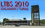
Realistic represantation of current LTBS Dalaman International Airport with the new terminal and parallel runways.A very popular touristic attraction in Turkey, a very busy airport in real life with traffic from all over Europe. A must have scenery for FS, both for offline and online flights. A place with a great approach view. Very close to other popular holiday destinations like Antalya,Bodrum,Izmir.
| Filename: | LTBS_Dalaman_Intl_Airport_2010.zip |
| License: | Freeware |
| Added: | 18th April 2010, 15:57:39 |
| Downloads: | 8,556 |
| Author: | Nuri Guven |
| Size: | 29.76 MB |
| Category: Flight Simulator 2004 - Scenery | |
| Google Earth Scenery Database for New Zealand |
|
Images related to this file:
File Description:
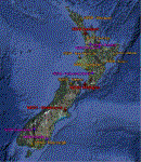
This is a .kmz file showing most of the amazing FS9 sceneries available for NZ (75 or so).
Just double-click on the file and they should show up in GE. Airports are categorised, so you can accurately filter by airport type. Download links are provided for each, as well as a link to a screenshot.
Makes planning a flight a little easier, and perhaps more interesting, as you can often zoom down to street view in GE, and see what the airport looks like!
| Filename: | Google_Earth_Scenery_Database_for_New_Zealand.zip |
| License: | Freeware |
| Added: | 30th March 2011, 01:09:13 |
| Downloads: | 374 |
| Author: | Charl du Toit |
| Size: | 17.54 KB |
| Category: Flight Simulator 2004 - Scenery | |
| Metro Field MTF in Fairbanks Alaska |
|
Images related to this file:
File Description:
Metro Field is more of a float plane "pond" than a field, close to and northeast of Fairbanks International Airport in Alaska. There is a gravel strip alongside the water, but the "strip" is actually a gravel road that functions as a runway when required. And if that sounds familiar it is also pretty much the description for nearby Chena Marina, though Metro is nowhere near as busy. This is one of four float plane bases around Fairbanks. You will definitely need Ultimate Terrain Alaska Canada.
| Filename: | Metro_Field_MTF_in_Fairbanks_Alaska.zip |
| License: | Freeware, limited distribution |
| Added: | 21st August 2010, 03:27:58 |
| Downloads: | 371 |
| Author: | Roger Wensley |
| Size: | 986.7 KB |
| Category: Flight Simulator 2004 - Scenery | |
| NZHN - Hamilton International Airport - Hamilton, New Zealand *Update* |
|
File Description:
This Update add a more realistic Terminal building to the Hamilton International Airport scenery. A previous installation of the Hamilton International Airport scenery is necessary.
| Filename: | NZHN__Hamilton_International_Airport__Hamilton_New.zip |
| License: | Freeware |
| Added: | 4th May 2015, 08:59:59 |
| Downloads: | 418 |
| Author: | David Kolas |
| Size: | 36.64 KB |
| Category: Flight Simulator 2004 - Scenery | |
| Vsar Adventures |
|
File Description:
An Search And rescue platform at AMELAND (EHAL) a burning Schip in north of Vlieland and a helidek in north of vlieland.
Adventures for Helicopters...
| Filename: | Vsar_Adventures.zip |
| License: | Freeware |
| Added: | 4th April 2004, 18:10:14 |
| Downloads: | 998 |
| Author: | Dennis Ozkohen, Youri Dorchain |
| Size: | 871.45 KB |
| Category: Flight Simulator 2004 - Scenery | |
| Ocean Stations for Multiplayer Use |
|
File Description:
I've produced this scenery to provide all of the Ocean Stations I know about in the 1950's and 1960's. There is a Coast Guard ship on station (painted in the colors of the USA), an NDB to give you a bearing to the ship, a way to contact the ship using voice (you can get your position relative to the ship this way), and a DME for distances further than the limited 30 NM FS ATC gives you (normal communications would reach about 100 NM). You can also get a weather report, and if you are a seaplane you can be cleared to land. If you are a landplane, I guess this would constitute permission to ditch...
I want to give a big thank you to Mitsuya Hamaguchi (hama) for graciously supplying the ship used in this scenery.
This version uses scenery ships, which will not disappear in multiplayer. There is only a US ship, however. For the AI ship version (with ships of several countries) download OceanStations.zip instead.
| Filename: | Ocean_Stations_for_Multiplayer_Use.zip |
| License: | Freeware, limited distribution |
| Added: | 6th May 2008, 03:51:56 |
| Downloads: | 543 |
| Author: | Tom Gibson |
| Size: | 405.16 KB |
| Category: Flight Simulator 2004 - Scenery | |
| Alaska North Slope 4: Lonely Air Force Station (AK71) |
|
Images related to this file:
File Description:
The town of Barrow is in the far north of Alaska, and these are coastal villages or radar installations to the west, south, and now east of Barrow. There will be further additions. Lonely Air Force Station AK71 is 80 miles east of Barrow and on the coast. It was, and at first sight appears still to be, a DEW station until you are close enough to see that the gravel apron is deteriorating. There is a gravel runway around 5,000 feet long, a large hangar, the DEW buildings, radar under the domes, the remains of huge line-of-sight communications reflectors, and oil tanks. Some DEW sites are not worth a visit; others are surprisingly intact and this is one of those. The AI takes place three days a week and is a C130, in which case the DEW site is still functioning or under mothball maintenance, a chartered Reeve Aleutian in which case the site is closed and they are documenting wildlife, and a Cessna with a group of the curious.
| Filename: | Alaska_North_Slope_4_Lonely_Air_Force_Station_AK71.zip |
| License: | Freeware, limited distribution |
| Added: | 20th June 2016, 08:02:18 |
| Downloads: | 306 |
| Author: | Roger Wensley |
| Size: | 2.32 MB |
| Category: Flight Simulator 2004 - Scenery | |
| Ontario Small Fields in Canada: #7 Lucan CPS4 |
|
Images related to this file:
File Description:
This is the seventh in a series of small airfields in southern Ontario Canada, Lucan CPS4; plus revised AI and parking for #6 Nixon CNX8 to include a crop spray plane (the Grumman 164) which I have just identified from a photograph; plus a note re an addition required to the different crop spray aircraft (the AT802) config file so that it parks correctly at St Thomas CYQS.
Lucan is 15 miles north of London Ontario, and 20 miles southeast of Lake Huron. The airfield is the base for a small crop spraying business and has a grass runway of 3,100 feet aligned 09/27, and with lighting. The overhead cables that previously imposed a 550 feet threshold displacement on the runway 09 approach (up to and including 2010) have now been buried. The lighting is owner-controlled and cannot be turned on from the air. Fuel and oil is available. The crop spray plane is a Grumman G164A Ag-Cat, which was manufactured in the 1970's and remains in use with a lot of owner-operators.
| Filename: | Ontario_Small_Fields_in_Canada_7_Lucan_CPS4.zip |
| License: | Freeware, limited distribution |
| Added: | 27th October 2015, 15:16:58 |
| Downloads: | 167 |
| Author: | Roger Wensley |
| Size: | 4.59 MB |
| Category: Flight Simulator 2004 - Scenery | |
| St Michael Island in Alaska-St Michael 5S8 and Stebbins WBB |
|
Images related to this file:
File Description:
St Michael Island is 50 miles southwest of Unalakleet, an island that in fact appears to be a cape and a firmly attached piece of the mainland. On the island there are two villages, St Michael on the northeast corner and Stebbins on the northwest. St Michael has a new airfield that is west of the village by around a mile or so, with a gravel runway 4,000 feet long. The old and now closed airport was known as SMK, and is now readily identifiable by the new red-roofed school building that occupies the centre of the runway. The new airfield now has an icao code of PAMK, but FS9 does not readily accept icao code changes so we are stuck with the original code it was given, 5S8. The SMK icao of the old airport will still show on your gps as if I deleted it the runway would also have to be deleted, and a substitute and unsatisfactory gravel apron made to impersonate a runway. Stebbins is 5 miles west of St Michael and next to the shore, a smaller village than St Michael with around 250 inhabitants. The airfield is at the southern end of the village and has a gravel runway that is 3,000 feet long. The icao code is WBB. There is no AI included here as it was already included in the post of Shaktoolik. There is a correction here for Shaktoolik, which I now find should have had a blue garage, not a red one; I wrongly named a photo. A note here about my scenery making. This is post number 501 and there will not be many more to follow this as I am almost at the end of the photos I took or found for scenery purposes. There is a limit to what can be located online and I have already been making use of the little there is; eg Unalakleet. So, if you are near an airfield (preferably Canadian or Alaskan) and have a camera..... Let me know.
| Filename: | St_Michael_Island_in_AlaskaSt_Michael_5S8_and_Steb.zip |
| License: | Freeware, limited distribution |
| Added: | 1st August 2019, 16:45:58 |
| Downloads: | 93 |
| Author: | Roger Wensley |
| Size: | 3.88 MB |
© 2001-2026 AVSIM Online
All Rights Reserved
Privacy Policy |