
Where Flight Simulation Enthusiasts Gather from Around the World!
AVSIM Library - Search Results

| Category: Flight Simulator 2004 - Scenery | |
| Bluff Park Farm 71AK, Wasilla Creek Airpark 05AK, Memory Lake 5AK8, 3AK2, 05AK, 5AK5, 16AK, 34AK, 59AK, and AK65, all near Anchorage in Alaska, PART 2 Flattens |

|
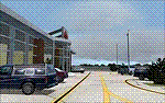
Images related to this file:
File Description:
Bluff Park Farm 71AK, plus Wasilla Creek Airpark 05AK, plus Memory Lake 5AK8, plus 3AK2, 05AK, 5AK5, 16AK, 34AK, 59AK, and AK65, all near Anchorage in Alaska, US FLATTENS PART 2
This is a PART 2 repost from 100 years ago because only one down-loader informed me very very recently that three airfields in that area needed altitude adjustment, namely 5AK8, 05AK, and 71AK. If you have this problem put the three bgl's in the FS9/Scenery/World/Scenery folder. If you don't have this problem then ignore this and finish your beer.
| Filename: | Bluff_Park_Farm_71AK_Wasilla_Creek_Airpark_05AK_Me.zip |
| License: | Freeware, limited distribution |
| Added: | 29th November 2019, 22:41:51 |
| Downloads: | 111 |
| Author: | Roger Wensley |
| Size: | 4.2 KB |
| Category: Flight Simulator 2004 - Scenery | |
| Woodward Field Airport KCDN |
|
Images related to this file:
File Description:
Woodward Field Airport is a county-owned public-use general aviation airport. It is sometimes called Kershaw County Airport, and many people also know it as the Camden Airport. It is located approx. 6.9 miles northeast of the historical city of Camden, South Carolina and currently does not serve scheduled airline flights. It is host to several vintage aircraft events and fly-in's annually. Scenery was designed with ADE9X v1.47 and Google Maps.(for placement references) Requires EZ-Scenery and RWY12 library collections for proper display of scenery objects. ez_1.zip and rwy12_1.zip
| Filename: | Woodward_Field_Airport_KCDN.zip |
| License: | Freeware |
| Added: | 20th November 2011, 00:02:58 |
| Downloads: | 482 |
| Author: | Glenn Mullis |
| Size: | 3.22 MB |
| Category: Flight Simulator 2004 - Scenery | |
| London Heathrow New ATC Tower |
|
File Description:
The new ATC tower at Heathrow stands a full 87 meters as the most promonent sight on the airfield. Now you can add it to the default FS2004 scenery using this addon. Though the tower is not yet fully completed the addon here has been created using all available data as to dimensions, location, and physical appearance. Recommended for use with Pete Davies AFCAD file available here at the avsim file library as asix9_egll_2005.zip. This AFCAD file has the correct gate locations for the position of the tower. Enjoy!!!
| Filename: | London_Heathrow_New_ATC_Tower.zip |
| License: | Freeware, limited distribution |
| Added: | 23rd July 2005, 23:04:11 |
| Downloads: | 2,872 |
| Author: | Douglas Mc Kay |
| Size: | 359.04 KB |
| Category: Flight Simulator 2004 - Scenery | |
| KSHN Sanderson, WA Emma Field Add On |
|
File Description:
KSHN, Sanderson, WA for use with Lago's FSE for 2004. This was made as a present for the guys over at the Emma Field Flying Club but can be enjoyed by all who love to fly in the state of Washington. Included are full seasonal day/night sounds as well as dynamic scenery and plenty of eye candy. This is very dense scenery but mid level machines to high level machines should see no frame loss at all. Lago's FSE for 2004 required and FSGenesis US Landclass is recommended (freeware or payware) for full enjoyment.
| Filename: | KSHN_Sanderson_WA_Emma_Field_Add_On.zip |
| License: | Check within download |
| Added: | 6th January 2004, 20:19:48 |
| Downloads: | 2,540 |
| Author: | Lauren Robison |
| Size: | 2.77 MB |
| Category: Flight Simulator 2004 - Scenery | |
| Csákvár (Abandoned Airport) |
|
File Description:
Csákvár, Hungary abandoned military airport. This is my first scenery design, so sorry for poorness. Made from real aviation maps. I'm making many airports in Hungary,so those how miss the airports will get those soon. About 55 aiports will be made. I hope I can finish them within a month or two. I upload another scenery: Békéscsaba. I will put all the aiportst in one pack. Made with FS Scenery Creator. Macros used from the internet. If you have any questions, please write me at: [email protected] Thanks!
| Filename: | Cskvr_Abandoned_Airport.zip |
| License: | Freeware |
| Added: | 17th May 2004, 22:40:46 |
| Downloads: | 761 |
| Author: | Kornél Várhelyi |
| Size: | 214.46 KB |
| Category: Flight Simulator 2004 - Scenery | |
| Project México Real LOD10 File 4 of 11 |
|
File Description:
File 4th of 11 of a Terrain Mesh that covers the entire Mexican Territory and related areas bordering the U.S., Guatemala and Belice areas. Part of the "Proyecto México Real" project, compiled at LOD10 (1.24 arcseconds in latitude and 1.65 arcseconds in longitude) resolution from INEGI data. Intended to enhance the virtual flying experience complementing the LOD8 and LOD9 versions compiled from the same data. Compatible backwards with Flight Simulator 2000, Flight Simulator 2002 and Combat Flight Simulator 2. Refer to the file contents about the cover area to this compressed file.
| Filename: | Project_Mxico_Real_LOD10_File_4_of_11.zip |
| License: | Check within download |
| Added: | 6th June 2006, 00:58:59 |
| Downloads: | 3,065 |
| Author: | Juan José Galván Bautista |
| Size: | 74.49 MB |
| Category: Flight Simulator 2004 - Scenery | |
| Project México Real LOD10 File 6 of 11 |
|
File Description:
File 6th of 11 of a Terrain Mesh that covers the entire Mexican Territory and related areas bordering the U.S., Guatemala and Belice areas. Part of the "Proyecto México Real" project, compiled at LOD10 (1.24 arcseconds in latitude and 1.65 arcseconds in longitude) resolution from INEGI data. Intended to enhance the virtual flying experience complementing the LOD8 and LOD9 versions compiled from the same data. Compatible backwards with Flight Simulator 2000, Flight Simulator 2002 and Combat Flight Simulator 2. Refer to the file contents about the cover area to this compressed file.
| Filename: | Project_Mxico_Real_LOD10_File_6_of_11.zip |
| License: | Check within download |
| Added: | 6th June 2006, 01:07:16 |
| Downloads: | 3,022 |
| Author: | Juan José Galván Bautista |
| Size: | 71.63 MB |
| Category: Flight Simulator 2004 - Scenery | |
| Project México Real LOD10 File 11 of 11 |
|
File Description:
File 11th of 11 of a Terrain Mesh that covers the entirety of Mexican Territory and related bordering U.S., Guatemala and Belice areas, part of the "Proyecto México Real" project, compiled at LOD10 (1.24 arcseconds in latitude and 1.65 arcseconds in longitude) resolution from INEGI data. Intended to enhance the virtual flying experience complementing the LOD8 and LOD9 versions compiled from the same data. Compatible backwards with Flight Simulator 2000, Flight Simulator 2002 and Combat Flight Simulator 2. Refer to the file contents about the cover area to this compressed file.
| Filename: | Project_Mxico_Real_LOD10_File_11_of_11.zip |
| License: | Check within download |
| Added: | 6th June 2006, 01:52:33 |
| Downloads: | 3,095 |
| Author: | Juan José Galván Bautista |
| Size: | 69.98 MB |
| Category: Flight Simulator 2004 - Scenery | |
| Elk City Municipal Airport, Ok |
|
File Description:
FS2004 Scenery-Elk City Municipal Airport,Ok (KELK) serves Elk City and Beckham County and is owned by the City Of Elk City. The paved runway extends for 4402 feet. The airport provides servicing of aircraft, aircraft maintenance and hanger facilities. The facility is at an elevation of 2002 feet at a distance of about one mile from Elk City. Scenery has dynamic scenery created with Lago's FSE. Modified AFCAD file. Objects placed using EZ Scenery, Rwy12 and FSDS3. Includes flightplan for AI traffic and textures for FSDS3 segments.
| Filename: | Elk_City_Municipal_Airport_Ok.zip |
| License: | Freeware |
| Added: | 11th February 2006, 23:57:10 |
| Downloads: | 514 |
| Author: | John B. Loney, Jr. |
| Size: | 741.52 KB |
| Category: Flight Simulator 2004 - Scenery | |
| Beaver Municipal, Ok |
|
File Description:
FS2004 Scenery - Beaver Municipal (K44) is a small airport located in Beaver, Ok. It has 2 runways, one asphalt and the other grass. There is no fuel, maintenence nor attendents. The airport is publicly owned by the City of Beaver. Coordinates: 36-47-56.0930N/100-31-47.5350W ( 36.79891/-100.52987) Located 1 mile SW of Beaver, Oklahoma. Surveyed Elevation is 2491 feet MSL. Beaver Municipal was formerly known as Q44. PLEASE READ THE README FILE!!! Created with EZ Scenery. One non-defaut ai aircraft included. By John B. Loney, Jr.
| Filename: | Beaver_Municipal_Ok.zip |
| License: | Freeware, limited distribution |
| Added: | 4th June 2007, 19:29:29 |
| Downloads: | 440 |
| Author: | John B. Loney, Jr. |
| Size: | 712.49 KB |
© 2001-2026 AVSIM Online
All Rights Reserved
Privacy Policy |