
Where Flight Simulation Enthusiasts Gather from Around the World!
AVSIM Library - Search Results

| Category: Flight Simulator 2004 - Scenery | |
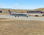
| FMEE Roland Garros and Reunion Island for FS2004 |

|
Images related to this file:
File Description:
Roland Garros Airport (ICAO: FMEE) is the principal airport of the French Overseas Region of Reunion Island. This scenery is a representation of the airport for FS2004, and integrated into a scenery for the entire Reunion island by France VFR. The combination of FMEE airport and Reunion Island is by permission of France VFR. Conditions of use of this scenery package are contained in the Release Notes. The starting point of FMEE airport scenery is the FS2002 FMEE scenery by Yannick Mille. Static aircraft in this scenery are courtesy of David Rawlins. Some GSE models used in this scenery are by permission of Harry Urben.
This is an update to the FMEE scenery previously released. Some minor revisions are included to the airport scenery in addition to the integration with Reunion Island.
| Filename: | FMEE_Roland_Garros_and_Reunion_Island_for_FS2004.zip |
| License: | Freeware, limited distribution |
| Added: | 31st July 2022, 17:21:37 |
| Downloads: | 846 |
| Author: | Gregory Putz / France VFR |
| Size: | 109.28 MB |
| Category: Flight Simulator 2004 - Scenery | |
| New York Kennedy JFK / KJFK, Version 7 |
|
Images related to this file:
File Description:

Thank you for downloading my scenery. This is an update to the default JFK airport in New York. It contains the new American Airlines terminal and roadways through the center of the airport. Also included are refinements to all the other terminals with realistic jetway positioning and more usable gates. Terminal 4 was completely rebuilt from scratch
so as to appear as it does today. All terminals have accurate parking assignments per the Port Authority website. This scenery was built using Abacus' EZ-Scenery program.
Update:
This update contains a brand new, more accurate version of terminal 4, updates to American's terminal 8, and a completely reworked Afcad file with all taxiway signs corrected and in proper position. Also, parking has been updated and made much more accurate.
| Filename: | New_York_Kennedy_JFK__KJFK__Version_7.zip |
| License: | Freeware |
| Added: | 20th May 2010, 09:07:17 |
| Downloads: | 39,026 |
| Author: | William Morgan, FRFSTUDIO.NET |
| Size: | 24.53 MB |
| Category: Flight Simulator 2004 - Scenery | |
| Airstrips of the Iberian Peninsular |
|
Images related to this file:
File Description:
Third in my ongoing "Airstrips of Western Europe" project for FS2004, herewith about fifty sceneries of small, mostly default airfields in Spain and Portugal, each enhanced with taxiways, parking spaces and aprons as appropriate, to further facilitate the generation of lightweight AI traffic in the area without overloading the more major airfields.
Again, there's no photo-realism here, just a selection of basic 'generic' buildings, more or less accurately sized and placed to reflect the airfield layout as seen on on-line satellite imagery and aerial photography. These buildings have minimal effect on frame-rates, so are ideal for this kind of job. The airfields are aligned as well as possible with the roads etc. in UT Europe and the Genesis Europe mesh, but should mostly be fine in a default installation or other configuration.
| Filename: | Airstrips_of_the_Iberian_Peninsular.zip |
| License: | Freeware |
| Added: | 8th August 2024, 12:56:49 |
| Downloads: | 90 |
| Author: | Chris Eve |
| Size: | 1.3 MB |
| Category: Flight Simulator 2004 - Scenery | |
| Complement T. Agramont's Madeira v1.0 |
|
Images related to this file:
File Description:
Addon for the scene of Madeira of Toni Agramont (madeira_271158.zip) To download in this same Web! Realised to
give a little him more realism, with AFCAD of LPMA near the reality and adapted to its scene,
can be used with the Mesh of Raimondo Taburet (file: srtm3mad.zip http://www.hangartaborno.com).
In Funchal one has gotten up the arches and houses on foot of head 05, slab that holds with columns of head 23,
illumination in the retaining wall of the arches and in the highway and some Rwy12 objects that heighten a little
plus the landscape. Without Rwy12 it will also work but we strongly encourage libraries installed base.
In Porto Santo there are including his military zone, the name of the airport in the ground and Also
Rwy12 objects.
Readme.txt for the correct installation.
| Filename: | Complement_T_Agramonts_Madeira_v10.zip |
| License: | Freeware |
| Added: | 15th March 2011, 00:00:53 |
| Downloads: | 4,676 |
| Author: | Jordi Reco |
| Size: | 1.98 MB |
| Category: Flight Simulator 2004 - Scenery | |
| Farallon Island Chain, Version 4 |
|
File Description:
Beta version 4: Combines North, Middle, and Southeast Farallon Islands into one download. Lighthouse added to Southeast Farallon Island along with the water catchment pad (also serves as helipad). These islands were mysteriously absent from the FS2004 default scenery, probably owing to their small size. When I went to look for them I found a small mountain of water instead of the islands. Most people don't seem to be aware of the Farallon Islands. Located off the coast of California, near San Francisco, they are home to thousands of birds, seals, and some of the largest Great White sharks known to man. All of this is within a very short distance of the city. Today, it is a wildlife refuge and is off limits to visitation by the general public. Those of you interested in more info might check out "The Devil's Teeth" by Susan Casey. These islands were created as scenery objects instead of traditional terrain in order to preserve detail. The terrace on the Southeast Farallon Island is landable now but the terrain is pretty rough. If you're in Timberwolf Aviation and you're doing the multiplayer session on 03/26/2006, this is the version you should get.
| Filename: | Farallon_Island_Chain_Version_4.zip |
| License: | Freeware, limited distribution |
| Added: | 26th March 2006, 21:32:24 |
| Downloads: | 1,834 |
| Author: | Glen Gordon (Prof K.) |
| Size: | 1.51 MB |
| Category: Flight Simulator 2004 - Scenery | |
| Memmingen Airbase (ETSM, South-Germany) including MilCom AI-Traffic |
|
File Description:
This airbase, located in the beautiful Allgaeu (Bavaria, South-Germany) about
55 NM in the west of Munich, was the homebase of the JaBoG34 riding the F104
1964 thru 1987 and then the Tornado PA200. After JaboG34 had been dissolved
in 2003, it was decided to use the airfield for commercial air traffic.
In memory of the JaBoG34 at the "Memminger Berg" and to keep the ATC people busy,
I created this airfield with combined military / commercial AI-Traffic.
The included AI-Package contains Lockheed F-104 GAF, Republik F-84F GAF,
Panavia-Tornado GAF, Airbus-A310 GAF, Lockheed-P3 Orion GNY, Boeing-727 with
UN paint, Boeing-737 Lauda, Bombardier CRJ-200 Lufthansa and aircraft.cfg for
MS: Beech-Baron 58, King-Air 350, and Learjet 45.
Several F104's and Tornados perform touch and goes in the local area, further an
UN-B727 leaves IFR to Decimomannu (LIED) and a GAF-A310 goes IFR to Cologne.
Some of the commercial airplanes perform touch and goes also, a CRJ-200 goes
IFR to Munich and a Lauda-737 goes IFR to Vienna per attached flightplan.
Lago's FSE is required in order to see most of the major buildings / objects.
Welcome to the party again.
| Filename: | Memmingen_Airbase_ETSM_SouthGermany_including_MilC.zip |
| License: | Freeware, limited distribution |
| Added: | 16th November 2005, 16:22:23 |
| Downloads: | 7,702 |
| Author: | Klaus Jone |
| Size: | 11.47 MB |
| Category: Flight Simulator 2004 - Scenery | |
| HCMI Berbera, Somalia |
|
Images related to this file:
File Description:
Googly scenery for HCMI Berbera, Somalia - an airport largely overlooked in
Flight Simulator 2004 with just a runway and tower provided at what is actually
the country's largest airport. At one time it had two active runways and a
strong military presence but today activity is limited to occasional
civilian flights. These scenery files add taxiways, aprons, buildings and
other airport features (and remove the non-existent tower that Microsoft
put there) so that you and your "AI" traffic can land, taxi, park and take
off in a realistic manner. This desert-surrounded airport is served three times per week by Douglas DC-9 jets of Kenyan airline African Express Airways.
The scenery does not purport to be ultra-accurate. Based on high-detail satellite
imagery from Google Earth, the layout is proportionally correct but the added
airport features, such as buildings, are built from default Microsoft objects
and add-on libraries so will not look like the real thing.
You are not obliged to download and install any additional scenery libraries,
but to enjoy this scenery in its entirety, you may wish to. It will work fine,
with or without. [File re-uploaded at request of AVSIM]
| Filename: | HCMI_Berbera_Somalia.zip |
| License: | Freeware |
| Added: | 29th May 2010, 09:26:33 |
| Downloads: | 1,317 |
| Author: | John Hinson |
| Size: | 62.07 KB |
| Category: Flight Simulator 2004 - Scenery | |
| RPLL Version 8 (Ninoy Aquino Internal Airport, Villamor Airbase, Sangley Airbase and Metro Manila) |
|
Images related to this file:
File Description:
Welcome to the latest version of the RPLL and Metro Manila scenery for FS9. This scenery is a a total rework of my previous scenery and contains a more accurate depiction of the entire metropolis. Over 4 years in the making and is the last upgrade for FS9.
This release coincides the first release sometime August of 2006. This scenery covers an area of around 1,400 sq. km. which includes major cities around Metro Manila: from Taytay in the east to Sangley in the west; from Alabang in the south to Novaliches/Caloocan-Bulacan boundaries in the north.
Sangley (RPLS) Airbase has also been redesigned (only the runway and taxiways). The entire Manila Bay coastline from Sangley to Novaliches has been recreated, adding fish-farms, correct coastal shape, breakwaters, reclaimed areas and marine ports. All major roads and river/water systems are also covered in this scenery.
The RPLL airport scenery contains 90 percent of the existing structures plus noticeable buildings around the vicinity including the new Newport City, Libingan ng mga Bayani, Fedex HQ and MIAA offices; and warehouse around rwys 06 and 24. 80 percent of the structures are individually textured. Also included in the package is Nestor d'Angelos Metro Manila buildings.
| Filename: | RPLL_Version_8_Ninoy_Aquino_Internal_Airport_Villa.zip |
| License: | Freeware, limited distribution |
| Added: | 4th August 2010, 03:48:52 |
| Downloads: | 4,609 |
| Author: | Lowil fred Espada |
| Size: | 25.37 MB |
| Category: Flight Simulator 2004 - Scenery | |
| Watson Lake CYQH and CEJ9 in the Yukon Territories, Canada |
|
Images related to this file:
File Description:
Watson Lake is at 2,200 feet asl on the east side of the Rockies, in the Yukon Territories. The town is less than five miles north of the border with BC and is built around Wye Lake, just a few miles southeast of the much larger Watson Lake. Whitehorse is some 200 miles to the west, and Fort Nelson 220 miles to the east. The airport was built during WW2 and there remains one surviving original hangar, along with later additions. Unusually, the town of Watson Lake came into being because of the airport's existence, though with the closure of one mine that the airport used to serve and the serial closure of another (closed four times?) both the airport and the town (population 500) are in a downward spiral. The airport is 5 miles to the west of the town. There were two runways, but one is now closed and the remaining one is 08-26, 5,500 feet and 150 feet wide. There are two aprons, the northern one being half-used by CL 415 fire-fighting planes (included in the AI, along with Central Mountain Air). All the buildings for CYQH are modeled specifically, but the CJE9 shed is a guess.
| Filename: | Watson_Lake_CYQH_and_CEJ9_in_the_Yukon_Territories.zip |
| License: | Freeware, limited distribution |
| Added: | 14th July 2014, 21:38:57 |
| Downloads: | 443 |
| Author: | Roger Wensley |
| Size: | 17.6 MB |
| Category: Flight Simulator 2004 - Scenery | |
| Komakuk Beach & Storm Hills DEW sites in Yukon and Northwest Territories, Canada |
|
Images related to this file:
File Description:
These are DEW line sites in northern mainland Canada, to the west of Tuktoyaktuk.
Komakuk Beach CWKB is not included in FS9 and is in the Yukon, only 20 miles from the Alaska border. It is, as the name suggests, close to the sea, and the gravel runway 3,600' by 125' has its western end almost on the beach.
There is no lighting and no signage and the airfield is officially listed as closed, but in fact is used during the annual maintenance and refuelling of the automated NWS (North Warning Station) close by and for any unscheduled servicing. This replaced the previous much older DEW station that was manned year round and had a lot more buildings.
Storm Hills CWSH is in the Northwest Territories, 43 miles south-southwest of Tuktoyaktuk, up on higher land at 810 feet ASL. The NWS (there was no previous DEW station at this site) is serviced by helicopter from Tuktoyaktuk and has a gravel landing pad on the north side of the station. It will show on a gps and it is 5 miles west of the distinctively shaped and large Parsons Lake. This too was not in FS9.
| Filename: | Komakuk_Beach__Storm_Hills_DEW_sites_in_Yukon_and_.zip |
| License: | Freeware, limited distribution |
| Added: | 16th July 2012, 18:56:09 |
| Downloads: | 304 |
| Author: | Roger Wensley |
| Size: | 1.68 MB |
© 2001-2026 AVSIM Online
All Rights Reserved
Privacy Policy |