
Where Flight Simulation Enthusiasts Gather from Around the World!
AVSIM Library - Search Results

| Category: Flight Simulator 2004 - Scenery | |
| BFU Manitoba, Canada |

|
File Description:
Scenery for the new FBO of Bush Flying Unlimited, based out of Cross Lake, (CYCR), Manitoba, Canada. Features custom objects, textures, nightlighting, and various starting points, including water, helipad, and runway starts. Included are 2 BFU related destinations, Stan’s Cabin and a BFU sponsored hunting party camp, both include NDBs incase you feel like cheating!
| Filename: | BFU_Manitoba_Canada.zip |
| License: | Freeware |
| Added: | 7th October 2003, 01:32:37 |
| Downloads: | 5,714 |
| Author: | Michael Carr - MCDesigns 2003 |
| Size: | 6.66 MB |
| Category: Flight Simulator 2004 - Scenery | |
| Belize Belmopan, v1.0 |
|
Images related to this file:
File Description:
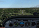
A local joke says that Belmopan airstrip has everything an airport needs... except traffic....
That has changed as of late because Tropic Air took it up in its itinerary.
This is the 9th installment of my Belize Scenery update, Belmopan and surrounding villages have been edited for an accurate layout to facilitate VFR navigation.
| Filename: | Belize_Belmopan_v10.zip |
| License: | Freeware, limited distribution |
| Added: | 26th April 2010, 19:23:03 |
| Downloads: | 501 |
| Author: | Alf B. meier |
| Size: | 198.89 KB |
| Category: Flight Simulator 2004 - Scenery | |
| Clermont-Ferrand Aulnat Auvergne (LFLC) |
|
File Description:
Airport of Clermont-Ferrand (France, in Auvergne) with realistic AFCAD, buildings and an AI prototype with Air France (Regional) aircrafts, general aviation traffic (Aéroclub d'Auvergne) and military with C-160 Transal, E-3F AWACS (furthers explications in readme.txt to find and install all these aircrafts). Enjoy ! Made with a participation of Guy Nemoz.
| Filename: | ClermontFerrand_Aulnat_Auvergne_LFLC.zip |
| License: | Freeware |
| Added: | 4th September 2005, 18:11:35 |
| Downloads: | 16,244 |
| Author: | Pierre M. |
| Size: | 3.9 MB |
| Category: Flight Simulator 2004 - Scenery | |
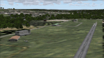
| Fort Smith CYSM in Northwest Territories, Canada Revised |
|
Images related to this file:
File Description:
This is an updated version to remove an incomplete static Beaver reported by Graeme (thanks Cobber) and to include other modifications that I made for my own version since posting the original; different taxiway lights, revised aprons, and in particular the revised AI that I mentioned in the original 2011 post. This is complete and can be installed as-is, or used to modify an existing post by changing the original folder contents. Fort Smith is just north of the border between Alberta and Northwestern Territories, midway between Lake Athabasca to the southeast and Great Slave Lake to the north west. You might stop there when flying between Yellowknife or Hay River to La Ronge or Saskatoon. It looks as if it is ex-military and these are the remains of what were once 10,000 feet of asphalt runways. The main runway is now 11/29 and 6,000 feet long, and the secondary one is 1,800 feet of mostly gravel. There is an airline based at the field, Northwestern Air, and fuel is available at a self service point. The town of Fort Smith is two miles east of the airfield, on the bank of the Slave River and where there are some rapids that require a portage to get around them. Before aviation came along the river was a major route to the north and all those furry animals, which was why the Hudson's Bay Company established an outpost there in 1872. Today it has a population of 2,400 and the main activities are government administration of much of the Northwest Territories, education, and tourism.
| Filename: | Fort_Smith_CYSM_in_Northwest_Territories_Canada_Re.zip |
| License: | Freeware, limited distribution |
| Added: | 23rd January 2019, 19:14:44 |
| Downloads: | 143 |
| Author: | Roger Wensley |
| Size: | 7.16 MB |
| Category: Flight Simulator 2004 - Scenery | |
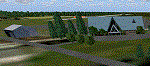
| CYRL & CKS4 - Red Lake & Fishing Lodge Outposts - Ontario, Canada |
|
Images related to this file:
File Description:
Red Lake is in Ontario, 90 miles east of the Manitoba border & 120 miles north of the US border. The town is at what was the northern end of "the road" for many years, & this has led to it becoming a centre for floatplane flights north to fishing lodges etc. It has also become THE centre of Noorduyn Norseman floatplanes in Canada & there is a Norseman on display & an annual Norseman festival. Red Lake CYRL airport is 3 miles north of the town with 5,000 feet of asphalt runway aligned 08-26 with PAPI at both ends. The apron is in two parts; the western for the fire fighting planes & the eastern for the new terminal & the hangars for North Star, Superior, and Wasaya. There is also a scruffy hangar that is used for storage & to the south of the east apron some private hangars. The town & the float base (CKS4) are at the southern end of Howey Bay. Planes taxi north before going to full power for take off, & there are two main companies based at CKS4, Chimo & Green's, both of them using Norsemans (or Norsemen?) among other planes. Chimo service their fishing lodge & outposts in the Roderick Lake area, & Green's (who have a base on the west side of Howey Bay) service their own outposts on Trout Lake & Nungesser Lake in the AI. There are other Red Lake float operations using Norsemans from further north on the lake & they service fishing lodges in the AI on Peisk Lake and Uchi Lake. The AI also includes some GA float planes, & there are numerous GA & scheduled flights into CYRL.
| Filename: | CYRL__CKS4__Red_Lake__Fishing_Lodge_Outposts__Onta.zip |
| License: | Freeware, limited distribution |
| Added: | 15th November 2015, 14:29:42 |
| Downloads: | 499 |
| Author: | Roger Wensley |
| Size: | 32.92 MB |
| Category: Flight Simulator 2004 - Scenery | |
| Beaver Creek CYXQ in Yukon Territory, Canada |
|
Images related to this file:
File Description:
Beaver Creek is located at mile 1202 of the Alaska Highway, just east of the Alaska/Yukon border. The populaton is around 100 and the main employment is with the Border Agency, the White River First Nation, or with local tourist lodges. The airfield is a mile north of the town and close to the Canadian border post, which is included in the scenery. It was built by Jack Stalberg in the 1960's, and I have no further information beyond the fact that he loved to fly. The airport serves as an "airport of entry", though it is restricted in hours of opening and in the size of aircraft that it can handle; up to a maximum of only 15 seats. The single runway is 3,745 feet long and 100 feet wide, gravel, aligned 13-31 in FS9, lit, and with vasi at both ends. Righthand circuits for runway 13. There is a 340 feet threshold displacement to runway 31, which is of course unmarked on a gravel runway. The terminal building was recently reclad; I don't like it, but they didn't consult me. The ai reflects the sort of traffic the airfield gets; ie brief paperwork stopovers for GA or small charter flights into Canada from Alaska, usually in the mornings.I have adjusted the local scenery terrain levels to remove adjacent hills that I believe do not exist in real life but are part of the Northern Canada terrain mesh that I have installed. If you do not have this mesh you may find that the scenery works fine for you without the API flatten that is included here. The airfield is at 2,129 feet ASL.
| Filename: | Beaver_Creek_CYXQ_in_Yukon_Territory_Canada.zip |
| License: | Freeware, limited distribution |
| Added: | 28th January 2019, 06:19:20 |
| Downloads: | 174 |
| Author: | Roger Wensley |
| Size: | 4.68 MB |
| Category: Flight Simulator 2004 - Scenery | |
| Airstrips of Scandinavia and the Baltic States |
|
Images related to this file:
File Description:
Effectively an extension of my "Airstrips of Western Europe" project for FS2004, around 140 sceneries of small airfields in Scandinavia and the Baltic states, each enhanced with buildings, taxiways, parking spaces and aprons as appropriate, to further facilitate the generation of lightweight AI traffic in the area, without overloading the more major airfields.
Given the available comprehensive coverage of both Norway and Finland by other authors, and much of Denmark by myself in my earlier "Airstrips of North-West Europe" upload, this selection comprises mostly small Swedish and Baltic State airfields.
Unfortunately, due to the very nature of much of the area, some of these airstrips are just that, a grass/dirt runway on a flattened/mown area in the landscape with just an associated building or two. Nevertheless, they do perform the required function of providing sources for AI traffic. The very existence of those airstrips not included in FS2004 is referred to in various on-line databases.
Again, there's no photo-realism here, just a selection of basic 'generic' buildings, more or less accurately sized and placed to reflect the airfield layout as seen on on-line satellite imagery and aerial photography. These buildings have minimal effect on frame-rates, so are ideal for this kind of job. The airfields are aligned as well as possible with the roads etc. in UT Europe (where applicable) and the Genesis Europe mesh, but should mostly be fine in a default installation or other configuration.
Please read the rest of this "blurb" in the included text file. There may be some details of note or interest.
| Filename: | Airstrips_of_Scandinavia_and_the_Baltic_States.zip |
| License: | Freeware |
| Added: | 11th November 2024, 17:25:16 |
| Downloads: | 106 |
| Author: | Chris Eve |
| Size: | 2.52 MB |
| Category: Flight Simulator 2004 - Scenery | |
| CYSA - Stratford Municipal Airport - Ontario, Canada |
|
Images related to this file:
File Description:
Stratford Airfield in Ontario Canada, a place what young singer Justin Bieber called his home town. And now you are able to land there, just as he will certainly do many times. The Airfield ICAO Code changed in September 2009 to CYSA. To prevent trouble with Flight Simulator 9 I keep it the way (old CNM4)! So don't wonder!
| Filename: | CYSA__Stratford_Municipal_Airport__Ontario_Canada.zip |
| License: | Freeware |
| Added: | 5th April 2015, 23:57:35 |
| Downloads: | 277 |
| Author: | David Kolas |
| Size: | 5.22 MB |
| Category: Flight Simulator 2004 - Scenery | |
| Bismarck Municipal Airport |
|
File Description:
Bismarck Municipal Airport (KBIS) serves central North Dakota and its capital city of Bismarck. Scenery includes a representation of the new airline terminal, opened in 2005, jetways, FBOs, and hangars created from scenery library objects. See readme for required object library files. No custom models were created for this scenery. Not tested with FSX or FS2002.
| Filename: | Bismarck_Municipal_Airport.zip |
| License: | Freeware, limited distribution |
| Added: | 30th June 2008, 08:47:20 |
| Downloads: | 1,349 |
| Author: | Eric O'Link |
| Size: | 368.36 KB |
| Category: Flight Simulator 2004 - Scenery | |
| KVLD Valdosta Regional Airport |
|
File Description:
Valdosta Regional Airport was constructed in the 1940s as a general aviation facility. The airport is situated on 760 acres of land, just south of the City of Valdosta. In 1980, commercial commuter service to/from Atlanta was inaugurated. The airport consists of 3 runways, two of which may be used by current ASA commercial aircraft.
| Filename: | KVLD_Valdosta_Regional_Airport.zip |
| License: | Freeware |
| Added: | 11th April 2010, 08:18:05 |
| Downloads: | 696 |
| Author: | Tommy Harris |
| Size: | 9.69 MB |
© 2001-2026 AVSIM Online
All Rights Reserved
Privacy Policy |