
Where Flight Simulation Enthusiasts Gather from Around the World!
AVSIM Library - Search Results

| Category: Flight Simulator 2004 - Scenery | |
| Devils Tower Terrain Mesh (ver 2) |

|
File Description:
This terrain mesh covers most of Crook County, Wyoming which contains Devils Tower National Monument. This terrain mesh was obtained from NED 1 arc second data and resampled to LOD10 resolution (38.2m). The area near the Devils Tower was obtained from NED 1/3 arc second data and resampled to LOD11 resolution (19.1m). The exact coverage is everything between W105* 7' 30" to W104* 0' 0" by N45* 0' 0" to N44* 15' 0". Devils Tower can be found by starting at Ipy Ranch (WY14) and traveling on a track of 194 degrees for 3 nautical miles. This version corrects a major positional error that was present in the first release and includes higher resolution data near the Devils Tower.
| Filename: | Devils_Tower_Terrain_Mesh_ver_2.zip |
| License: | Freeware |
| Added: | 26th November 2003, 00:25:13 |
| Downloads: | 3,556 |
| Author: | Joshua Robertson, 3D Softworks Design Studios |
| Size: | 4.54 MB |
| Category: Flight Simulator 2004 - Scenery | |
| Tokelau Islands - Complete Scenery |
|
Images related to this file:
File Description: NOTICE: There is one object library that is necessary but I forgot to mention in the pdf documentation! It is the file 'ez_housez_and_buildings.zip' here in the library by Ron Jeffers.
This project is a complete scenery rendition of the archipelago of Tokelau for FS2004.
The scenery includes all islands, with detailed coastlines, Landclass with villages represented, and Waterclass with the shallow reef banks also recreated.
Included are also 4 separate AFCAD files which generate 4 fictional airfields, one on each atoll.
Many objects were also added to give the scenery a less desolate and more alive look.
This is my first complete scenery project, my previous scenery uploads consisted only of AFCAD files or LC files.
Enjoy exploring these gems in the South Pacific!
| Filename: | Tokelau_Islands__Complete_Scenery.zip |
| License: | Freeware, limited distribution |
| Added: | 8th March 2018, 00:37:09 |
| Downloads: | 535 |
| Author: | Leonardo Santos |
| Size: | 11.91 MB |
| Category: Flight Simulator 2004 - Scenery | |
| PASD - Sand Point - Aleutians Alaska USA |
|
Images related to this file:
File Description:
Sand Point is in the eastern third of the Aleutian chain of islands in Alaska, around 85 miles east of Cold Bay on Popof Island. The town has a population of around 1,000 and it's economy is solidly based on fishing. There is, in the town, a fish processing plant owned by Trident (their largest plant is in Akutan, east of Dutch Harbor) and the area close to the airport is used for crab pot storage etc. The single runway is aligned 13-31 (with right hand circuits on 13) and 6,000 feet long. There are scheduled flights by Grant Aviation to neighbouring local airfields and flights to and from Anchorage by Peninsula Air (included in the AI posted with Adak). The Coastguard also make occasional visits.
| Filename: | PASD__Sand_Point__Aleutians_Alaska_USA.zip |
| License: | Freeware, limited distribution |
| Added: | 22nd January 2015, 23:59:35 |
| Downloads: | 365 |
| Author: | Roger Wensley |
| Size: | 6.38 MB |
| Category: Flight Simulator 2004 - Scenery | |
| Europe SRTM mesh Part 02: UK & Ireland |
|
File Description:
Europe SRTM LOD9 mesh part 2 of 13: Covers all of UK & Ireland except the Shetlands, and a tiny part of France (from Calais to Abbeville).
This Europe SRTM project was optimized for the lowest HDD space use: Each part macthing exactly the boundaries of its neighbors, you'll have a complete corevage of Europe without gap or overlapping scenery. Based on SRTM Data v1 and v2 (3 arcsec, 90m) and sampled to LOD9 resolution (90m). Each SRTM tile was carefully checked and repaired with Blackart v4.02: water areas are now flattened (lighter mesh), and SRTM voids were treated taking advantage of Blackart's sophisticated interpolation algorithm. When required, biggest voids were patched with oversampled SRTM 30 arcsec data and/or manual input.
| Filename: | Europe_SRTM_mesh_Part_02_UK__Ireland.zip |
| License: | Freeware, limited distribution |
| Added: | 19th October 2005, 16:11:56 |
| Downloads: | 17,957 |
| Author: | Yohann Baptiste |
| Size: | 36.17 MB |
| Category: Flight Simulator 2004 - Scenery | |
| UK Hospitals (Vol 1) |
|
File Description:
This scenery collection contains airfield data for 54 Helipad landing sites in Wales, Lancashire, Merseyside, Cheshire and Cumbria based on the information provided by the Confederation of Helicopter Ambulance Services. Information here http://www.chasuk.co.uk/Documentation/HospitalLandingSites/tabid/69/Default.aspx.
The scenery is intended to be used in FS2004 Century of Flight with Just Flight's VFR photographic VFR scenery installed. The height data from CHASUK has been ignored in favour of that obtained from the Just Flight default mesh.
I have started to add autogen trees etc. around some of the landing sites - but this takes a lot longer and so I'm issuing vol 1 first with autogen only added to a few of the sites in the Chester/Merseyside area.
| Filename: | UK_Hospitals_Vol_1.zip |
| License: | Freeware |
| Added: | 2nd April 2009, 16:44:10 |
| Downloads: | 1,100 |
| Author: | Russ McGinn |
| Size: | 231.54 KB |
| Category: Flight Simulator 2004 - Scenery | |
| CJS4 Moose Jaw Municipal Airport, Saskatchewan, Canada, Version 2 |
|
Images related to this file:
File Description:

Moose Jaw Muni is located 13 km northeast of the city of Moose Jaw, Saskatchewan, Canada. The airfield is a small general aviation airport and hub in the summer for agricultural aircraft. CJS4 Moose Jaw Muni was constructed using GMAX and includes all the airport buidings,signage, fencing, custom ground and runway textures, and lighting. The scenery replicates the pilot activated ARCAL lighting of the airfield approach lights, edge lights, runway and taxiway lights.
This is an update to the July 2007 version of the scenery, which was lost in the AVSIM hack. This is a complete revision of the airport includng new hangars so if you have the orginal file please delete and replace with this version 2 of CJS4 Moose Jaw Municipal airport.
| Filename: | CJS4_Moose_Jaw_Municipal_Airport_Saskatchewan_Cana.zip |
| License: | Freeware |
| Added: | 5th January 2011, 14:55:31 |
| Downloads: | 1,162 |
| Author: | Gregory Putz |
| Size: | 20.36 MB |
| Category: Flight Simulator 2004 - Scenery | |
| USA Landclass AddOn - Vegetation Part I update 1.2 |
|
Images related to this file:
File Description:
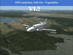
FS2004 USA Landclass AddOn - Vegetation Part I update 1.2
is a update of the Kootenay Range from KFCA to CYXC and CYGE.
It refers to
http://library.avsim.net/download.php?DLID=188823
Also changed the surrounding base LC40. Simply overwrite the Folders.
In the folder are the *.inf and *.raw file, if you like to change :)
| Filename: | USA_Landclass_AddOn__Vegetation__Part_I_update_12.zip |
| License: | Freeware |
| Added: | 18th February 2015, 23:25:22 |
| Downloads: | 261 |
| Author: | Markus Balz |
| Size: | 628.03 KB |
| Category: Flight Simulator 2004 - Scenery | |
| 4NC9 - Lake Norman - North Carolina, USA |
|
Images related to this file:
File Description:

This float plane scene is based on the terra server. Lake Norman is in close proximity to the city of Charlotte, NC. The dam has dynamic spray and adjoining industry. A map of the state camp ground is included for your adding to my custom made scenery. I pulled this from my personal archives...
| Filename: | 4NC9__Lake_Norman__North_Carolina_USA.zip |
| License: | Freeware |
| Added: | 11th July 2015, 11:20:14 |
| Downloads: | 235 |
| Author: | Rick Connolly |
| Size: | 3.02 MB |
| Category: Flight Simulator 2004 - Scenery | |
| East Vancouver Island |
|
File Description:
These files are a revision of the default Vancouver Island shorelines and landclass textures from Sooke to Campbell River, British Columbia. Included are the islands from the Southern Gulf Islands to Texada Island and inland to Cowichan Lake. Most of the smaller lakes within 20 km of the shoreline have been redrawn as well.
| Filename: | East_Vancouver_Island.zip |
| License: | Freeware, limited distribution |
| Added: | 19th November 2003, 14:01:50 |
| Downloads: | 8,200 |
| Author: | Harvey Janszen |
| Size: | 256.63 KB |
| Category: Flight Simulator 2004 - Scenery | |
| Pfaffnau Heliport 2004 |
|
File Description:
A small very accurate heliport in the Swiss country side of Heli Gotthard with elevated helipad, surrounding buildings
all made with digital photographs. All textures are with full night lightning.
Static cars, trucks and roads are included. It's our second heliport of the SWISS HELICOPTER DESIGN GROUP. It works now
with FS2004 (tree textures).
| Filename: | Pfaffnau_Heliport_2004.zip |
| License: | Freeware, limited distribution |
| Added: | 13th September 2003, 17:27:22 |
| Downloads: | 3,989 |
| Author: | Andreas Hegi and Simon Baumann |
| Size: | 2.53 MB |
© 2001-2026 AVSIM Online
All Rights Reserved
Privacy Policy |