
Where Flight Simulation Enthusiasts Gather from Around the World!
AVSIM Library - Search Results

| Category: Flight Simulator 2004 - Scenery | |
| Homer PaHO in Alaska US |

|
Images related to this file:
File Description:
Homer is a mainly GA airfield with rows of open air parking, but it also has scheduled flights, a terminal building, a long (for GA) runway of just under 6,700 feet that is 150 feet wide and aligned 03-21 with VASI on both ends and ILS on 03. So I think we can refer to it as an airport. Plus, at the time of this scenery (around 2010) there were three newly completed hangars on the north apron that I was told were for three companies, Bald Mountain Air service, Maritime Helicopters, and Pathfinder Aviation. I do not know which was for whom, but all three companies are in the helicopter and/or plane charter business. The south apron has a number of hangars and other buildings along it's length, starting at the western end with Smokey Bay Air that has an old control tower on the roof, then the Fire Station, and then Homer Air. I am not aware of who owns what after those first three, except that at the far eastern end there are several garages etc for the airport maintenance equipment. Next to the airport at that end there are a number of boat maintenance companies with boats pulled out of the water; this could not be well replicated due to the airport elevation above the sea level and a misplaced road. The nearby Beluga Lake 5BL float base is also included here, with some AI. The lake height above sea level has been adjusted to cope with too many cliffs intruding into the water; this is an annoying FS9 habit. The Homer scenery is as close to the actual airport as I could make it, while coping with inaccurate coast lines and roads, and grassed areas that could not all be modified for reasons that I will not bore you with. The Spit is a major scenery feature next to the airport, and I have added to this to provide some boats, docks, and nearby buildings etc. Small planes use the adjacent gravel taxi path instead of the runway when back-tracking to take off on runway 21. They only go as far as the path takes them and then u-turn onto the runway and take off. By the way, this airport's AI will function at its best if the prevailing wind makes 03 the runway in use. And I will eventually stop writing 03 and just call it 3, as the US, alone in the world, does not put a zero in front of 01, 02, 03, 04 etc. Just one other thing to note is that all access to the runway is from taxiways A and B; there was (in 2010) no access to the extreme western end of the runway as the taxiway there is marked as out of service pending a needed resurfacing.
If you find an error email me please, and note that my email address has been changed to rogwens at Gmail dot com.
| Filename: | Homer_PaHO_in_Alaska_US.zip |
| License: | Freeware, limited distribution |
| Added: | 28th July 2021, 03:31:04 |
| Downloads: | 125 |
| Author: | Roger Wensley |
| Size: | 11.86 MB |
| Category: Flight Simulator 2004 - Scenery | |
| Homer PaHO in Alaska US missing parked planes |
|
Images related to this file:
File Description:
These are the parked planes and their textures that I forgot to include in the Homer PAHO scenery post. Apologies.
| Filename: | Homer_PaHO_in_Alaska_US_missing_parked_planes.zip |
| License: | Freeware, limited distribution |
| Added: | 28th July 2021, 17:02:11 |
| Downloads: | 54 |
| Author: | Roger Wensley |
| Size: | 3.45 MB |
| Category: Flight Simulator 2004 - Scenery | |
| Homer PaHO in Alaska US missing parked planes |
|
Images related to this file:
File Description:
These are the parked planes and their textures that I forgot to include in the Homer PAHO scenery post. Apologies.
| Filename: | Homer_PaHO_in_Alaska_US_missing_parked_planes.zip |
| License: | Freeware, limited distribution |
| Added: | 28th July 2021, 17:02:25 |
| Downloads: | 97 |
| Author: | Roger Wensley |
| Size: | 3.45 MB |
| Category: Flight Simulator 2004 - Scenery | |
| Elk Island Lodge CKZ3 in Manitoba Canada missing parked plane |
|
File Description:
This is the parked plane bgl and texture that I was informed are missing from the Elk Island CKZ3 post, if you installed it as a stand-alone scenery. Apologies.
INSTALLATION:
To install unzip to a temporary folder, then:
1) Add the contents of the scenery folder to the Elk Island CKZ3/scenery folder.
2) Add the contents of the texture folder to the Elk Island CKZ3/texture folder.
NOTE: DO NOT take the plane textures out of the folder they are in. Add the FOLDER as it is to the Elk Island Lodge CKZ3/texture folder.
I just know someone will get it wrong and then ask me why.
| Filename: | Elk_Island_Lodge_CKZ3_in_Manitoba_Canada_missing_p.zip |
| License: | Freeware, limited distribution |
| Added: | 30th July 2021, 04:28:54 |
| Downloads: | 37 |
| Author: | Roger Wensley |
| Size: | 209.18 KB |
| Category: Flight Simulator 2004 - Scenery | |
| Anticosti Island in Quebec Canada |
|
Images related to this file:
File Description:
Anticosti Island is in the Gulf of St Lawrence, around 25 miles off the Quebec mainland coast. It is some 40 miles wide and 130 miles long on an east west axis. There are few urban areas and only one that can be described as a small town, namely Port Menier at the western end of the southern coast, with a population of under 1,000. There is a ferry service to the harbour. The airport, Port Menier CYPN, is around 3 miles northeast of the town, with an asphalt runway aligned 11-28, 4,875 feet long and 150 feet wide with PAPI at each end. In 2010 (the approximate date of this scenery) a gravel runway was still visible at the eastern end of the field. This was no longer in use by 2010, except perhaps by small planes on skis in the winter. The island, with its small population, small urban area, and no industry other than logging, has as a result a mainly undisturbed wildlife population. This has made deer hunting and fishing the main tourist activities, with one company (called Safari) having an exclusive licence to exploit large areas of mountains and rivers. Planeloads of hunters and fishermen are flown in on chartered Nolinor Aviation planes from the south. There are a further two airfields in the eastern end of the island, and in 2010 Rivere-Aux-Saumons CTH7 had a 5,500 feet gravel runway, linked by road to a lodge area at the mouth of the river. This is the only lodge area that I have been able to locate, but there are others. To the south Riviere Bell CRB5 had at that time a gravel runway that was 3,000 feet long. This has been lengthened since then and both runways were recently (2021) asphalted. If you find an error email me please, and note that my email address has been changed to rogwens at Gmail dot com.
| Filename: | Anticosti_Island_in_Quebec_Canada.zip |
| License: | Freeware, limited distribution |
| Added: | 31st July 2021, 18:23:40 |
| Downloads: | 79 |
| Author: | Roger Wensley |
| Size: | 11.78 MB |
| Category: Flight Simulator 2004 - Scenery | |
| Colville Lake CEB3 in Northwest Territories Canada |
|
Images related to this file:
File Description:
Colville Lake is a small village of around 150 Dene, located to the northwest of the Great Bear Lake and east of the Mackenzie River, 120 miles north of Norman Wells. The village and the airfield are next to each other and to the lake shore. I recently discovered which of the standard terminal buildings had been used there and this, along with information I already had, enabled me to now make the scenery, which is based on an approximate 2010 date. The gravel runway is lit and around 2,800 feet long, aligned 10-28. North Wright Air serves the village from it's headquarters at Norman Wells with daily flights by de Havilland Twin Otters, or "twotters" as they were quickly named among the northern Canadian airline personnel when they were first produced. The approximate time of this scenery is 2010. While testing this scenery I discovered that Tulita (previously called Fort Norman) which is another Mackenzie River airfield to the south of Norman Wells, needs to be reposted due to a terrain fault. If you find an error here then email me please, and note that my email address has been changed to rogwens at Gmail dot com.
| Filename: | Colville_Lake_CEB3_in_Northwest_Territories_Canada.zip |
| License: | Freeware, limited distribution |
| Added: | 31st July 2021, 18:23:48 |
| Downloads: | 67 |
| Author: | Roger Wensley |
| Size: | 4.51 MB |
| Category: Flight Simulator 2004 - Aircraft Repaints, Textures and Modifications | |
| PMDG 737NG for FS2004 Sriwijaya Air PK-CMI oRUNgutan livery |
|
File Description:
FS2004 PMDG 737-800 Winglets Sriwijaya Air PK-CMI with oRUNgutan livery. This livery presented by Sriwijaya Air in collaboration with Bank Kalteng for a charity fun run event that invites people to care about the environment and endangered animals in Indonesia to encourage local and foreign tourists to Central Kalimantan. Textures only, repaint by Andi Bibby P.
| Filename: | PMDG_737NG_for_FS2004_Sriwijaya_Air_PKCMI_oRUNguta.zip |
| License: | Freeware, limited distribution |
| Added: | 31st July 2021, 18:23:56 |
| Downloads: | 53 |
| Author: | Andi Bibby |
| Size: | 13.19 MB |
| Category: Flight Simulator 2004 - Scenery | |
| Mackenzie River close to Tulita CZFN in Northwest Territories Canada |
|
Images related to this file:
File Description:
I discovered, while testing another airfield near the Mackenzie River, that along the side of the Mackenzie adjacent to Tulita, and for a considerable distance, there was a cliff of water. I have no idea if my version of Ultimate Terrain has developed a fault or if this has been caused by the installation of a terrain mesh that now argues with UT for some unknown reason. Whatever, it was impossible to leave it as it was. I have included a screenshot of the cliff further upstream. To avoid the cliff of water I have flattened that area of the Mackenzie River and the adjacent river banks and both the town and the airfield to a height above sea level of 400 feet. This does not reflect the real life situation but is the lesser of two optical evils. I have included a screenshot of the flattened area. If you do not have a problem then you do not need this. If you too have a cliff of water then you might want to try this. It does not completely get rid of the problem, but it does get rid of it in the area visible when landing or taking off at Tulita.
| Filename: | Mackenzie_River_close_to_Tulita_CZFN_in_Northwest_.zip |
| License: | Freeware, limited distribution |
| Added: | 1st August 2021, 22:27:01 |
| Downloads: | 73 |
| Author: | Roger Wensley |
| Size: | 573.48 KB |
| Category: Flight Simulator 2004 - Aircraft Repaints, Textures and Modifications | |
| Tarom Classic Boeing 757-200 - YR-ABL |
|
Images related to this file:
File Description:
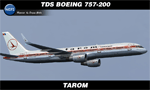
FS9/FSX TDS Boeing 757-200 in Tarom Classic livery. Repaint by Sergey Gleba aka serg09. Link to my products on SimMarket: http://secure.simmarket.com/paintsim.mhtml
| Filename: | Tarom_Classic_Boeing_757200__YRABL.zip |
| License: | Freeware |
| Added: | 29th September 2021, 16:34:34 |
| Downloads: | 82 |
| Author: | Sergey Gleba | PaintSim |
| Size: | 16.43 MB |
| Category: Flight Simulator 2004 - Aircraft Repaints, Textures and Modifications | |
| ITA Transportes Aéreos ITAPEMIRIM "PS-ITA" A320 IAE AirSimmer |
|
Images related to this file:
File Description:
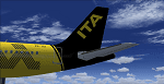
ITA Transportes Aéreos PS-ITA Livery for Airbus A320 IAE AirSimmer.Painted by Eduardo Custodio. See more repaints and updated visit fs2004addonsfacil.blogspot.com
| Filename: | ITA_Transportes_Areos_ITAPEMIRIM_PSITA_A320_IAE_Ai.zip |
| License: | Freeware |
| Added: | 30th September 2021, 18:54:19 |
| Downloads: | 231 |
| Author: | Eduardo Custodio |
| Size: | 10.81 MB |
© 2001-2026 AVSIM Online
All Rights Reserved
Privacy Policy |