
Where Flight Simulation Enthusiasts Gather from Around the World!
AVSIM Library - Search Results

| Category: Flight Simulator 2004 - Aircraft Repaints, Textures and Modifications | |
| Italian Air Force, North American F-86E/Canadair CL-13 MkIV |

|
File Description:
Textures only for an aircraft belonged to "Cavallino Rampante" Aerobatic Team (4th Aerobrigata, Grosseto, Italy 1956).
These textures require the FREEWARE original aircraft package by Kirk Olsson (sabrejet.zip). Installation instructions are included. Repaint by Manuele Villa.
| Filename: | Italian_Air_Force_North_American_F86ECanadair_CL13.zip |
| License: | Freeware |
| Added: | 8th May 2006, 18:24:09 |
| Downloads: | 227 |
| Author: | Manuele Villa |
| Size: | 2.89 MB |
| Category: Flight Simulator 2004 - Aircraft Repaints, Textures and Modifications | |
| Dutch Air Force North American B-25 N5-158 / VH-RDF |
|
Images related to this file:
File Description:
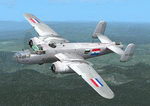
This folder contains a repaint for the MAAM-Sim B-25J 'briefing time', in the colors of an aircraft of the Dutch East Indies Air Force (ML-KNIL). N5-158 (41-30589) was a B-25D that flew with the Dutch forces between 1943 and 1950. It was used a transport aircraft, carrying the Australian call sign VH-RDF until an emergency landing on 3 may 1944. In 1950, it was transferred to the Indonesion Air Force. Repaint by Jan Kees Blom.
| Filename: | Dutch_Air_Force_North_American_B25_N5158__VHRDF.zip |
| License: | Freeware |
| Added: | 2nd May 2010, 05:38:41 |
| Downloads: | 247 |
| Author: | Jan Kees Blom |
| Size: | 11.16 MB |
| Category: Flight Simulator 2004 - Scenery | |
| Beaverton CBV2 and Beaverton North fields near Lake Simcoe, Ontario, Canada |
|
File Description:
The town of Beaverton is on the east shore of Lake Simcoe. Just a bit over three miles to the east of the town is Beaverton airfield CBV2, with a grass runway 12/30 that appears to be 2,100 feet long, rather than the listed 2,400 feet. The field is new enough to be omitted from FS9, and though there are plans to build hangars I don't know if anything has been built in the year since I last saw it, so the only buildings here are farm-related. The second field to the northwest is Beaverton North, which is privately owned. It has 2,000 feet or so of grass runway and a large hangar (or storage shed?) and that about sums up all I know about it. There are two airfield scenery folders, two landclass files to provide the grass airfield areas, and a third landclass folder that modifies the terrain around Beaverton CBV2.
| Filename: | Beaverton_CBV2_and_Beaverton_North_fields_near_Lak.zip |
| License: | Freeware |
| Added: | 3rd February 2010, 02:16:36 |
| Downloads: | 324 |
| Author: | Roger Wensley |
| Size: | 1.05 MB |
| Category: Flight Simulator 2004 - AI Aircraft | |
| "GEICO Skytypers" North American AT-6 Texan / Harvard - Multi Pack 5 |
|
Images related to this file:
File Description:

Another 7 textures in this AT6 package 5 "GEICO Skytypers", including model by JAI, and flight plans. Package also includes a white smoke effect which is optional. All credits and installation instruction are in the read me. Enjoy!
| Filename: | GEICO_Skytypers_North_American_AT6_Texan__Harvard_.zip |
| License: | Freeware |
| Added: | 14th September 2014, 18:18:12 |
| Downloads: | 591 |
| Author: | Ray Parker, JAI |
| Size: | 3.49 MB |
| Category: Flight Simulator 2004 - Scenery | |
| Canyonlands National Park, The Maze-North, Utah, Photo-Scenery (FSX too) |
|
Images related to this file:
File Description:
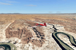
This is a re-upload of a package that was corrupted during the crash of the AVSIM library. The Maze is the wildest and least accessible district of Canyonlands National Park. It is a perplexing jumble of canyons that has been described as a '30 sq miles puzzle in sandstone'. The Maze covers the area west of the Green River and north of the Colorado River. Getting to most locations requires multiple hours of 4WD road driving. Hiking trails usually require multi day backpack trips.
Too strenous? Let's go flying! Checking out the area from an eagles perspective is certainly a stunning experience. The colors are awesome and the landforms are of breathtaking beauty. The scenery extends my Arches National Park scenery to the west and brings you another 3.500 sq km in 4.7m/pix quality. YourDonation@Work: Dedicated to Frans, Francois and James. Thanks!
| Filename: | Canyonlands_National_Park_The_MazeNorth_Utah_Photo.zip |
| License: | Freeware, limited distribution |
| Added: | 31st December 2009, 11:01:39 |
| Downloads: | 2,372 |
| Author: | Gottfried Razek - blueskyscenery.com |
| Size: | 92.88 MB |
| Category: Flight Simulator 2004 - Scenery | |
| Cape Dyer CWFD in Nunavut, Canada |
|
Images related to this file:
File Description:
Cape Dyer is on the southeast corner of Baffin Island, around 120 miles east of Pangnirtung at approximately N66 45 W61 30. There is a fine view north up the Davis Strait between Baffin Island and Greenland, and this is the whole reason for the airfield's existance as it was built to support the construction and operation of a DEW line radar station, which has now been updated to a North Warning System site. There are two camps; the upper camp is on the east side of the Cape and is where the radars are located, linked by a gravel road to the lower camp, which is on the west and more sheltered side of the Cape on the clifs above Sunneshine Fjord. The runway is 5,000' of 150' wide gravel, and it is lighted and at 1,320' feet ASL. Cape Dyer is now listed as abandoned in the Canada Flight Supplement. It is, however, still there and presumably is still used for access to the North Warning System equipment, which is automated and generally unmanned. The buildings were modeled for this scenery and include a hanagar large enough to accommodate a C-130. Ultimate Terrain is not required as it does not cover northern Canada.
| Filename: | Cape_Dyer_CWFD_in_Nunavut_Canada.zip |
| License: | Freeware, limited distribution |
| Added: | 21st June 2011, 19:30:07 |
| Downloads: | 488 |
| Author: | Roger Wensley |
| Size: | 1.9 MB |
| Category: Flight Simulator 2004 - Scenery | |
| CYDA - Dawson City - Yukon Territory, Canada |
|
Images related to this file:
File Description:
Dawson City is in the Yukon Territory, Canada, 140 miles south of Old Crow and about the same north of Whitehorse. The town has a population of just over 1,300 and is on the bank of the Yukon River; it is busy with nearby gold mining and tourism. There are regular flights by Air North, the Yukon airline, and I have included them in the AI along with ConAir and GA. Thanks go to Hernan for his Air North textures. The airport is beside the Klondike Highway that links Dawson City to Whitehorse, a few miles southwest of the town and the river. The runway approaches are steeper than most because of the surrounding hills and the Canada Flight Supplement notes that use is restricted to daylight hours, with some exceptions including emergencies. Runway 20 has right hand circuits. The runway is gravel and just over 5,000 feet long, aligned 02-20. There is a second apron for the activities of ConAir etc in the summer fire-fighting months. The "masts" are actually for fire hose drying; the ends of several 50 feet lengths are attached to a circular holder that is then pulled up to the top of the central pole.
| Filename: | CYDA__Dawson_City__Yukon_Territory_Canada.zip |
| License: | Freeware, limited distribution |
| Added: | 27th December 2014, 20:31:31 |
| Downloads: | 378 |
| Author: | Roger Wensley |
| Size: | 3.96 MB |
| Category: Flight Simulator 2004 - Scenery | |
| Northern Canada Mining CYOA & CHB3 in Canada |
|
Images related to this file:
File Description:
These are two airfields in northern Canada, serving two mining operations. The furthest north is Hope Bay CHB3 in Nunavut. It is in a sheltered inlet less than 3 miles from the northern mainland coast and around 65 miles southwest of Cambridge Bay. The owner is Hope Bay Mining Ltd, and their operation mines gold out of a tunnel rather than open cast. The airfield is incorporated into the road that leads north to the sea; traffic is halted by traffic lights when a flight is expected. The runway is 3,000 feet of gravel aligned 01-19 and with PAPI at both ends.
The second airfield serves the Ekati diamond mine and is some 265 miles southwest of Hope Bay, in the Northwest Territories. Ekati was the first Canadian diamond mine and is 195 miles northeast of Yellowknife and less than 20 miles north of a later mine, Diavik (by Sid and Pete). CYOA reflects the relative value of the two mining operations and is far better equipped than Hope Bay. It can be described as an airport while Hope Bay remains an airfield. The runway is 6,400 feet of gravel aligned 36-18 with PAPI and strobe approach lights at both ends. The scale of the mining operation can only be described as huge.
| Filename: | Northern_Canada_Mining_CYOA__CHB3_in_Canada.zip |
| License: | Freeware, limited distribution |
| Added: | 11th August 2018, 22:59:06 |
| Downloads: | 217 |
| Author: | Roger Wensley |
| Size: | 8.24 MB |
| Category: Flight Simulator 2004 - Scenery | |
| Shaktoolik 2C7 in Alaska |
|
Images related to this file:
File Description:
Shaktoolik is a coastal village 35 miles north of Unalakleet, with a fishing population of around 250. It was originally established inland on the Shaktoolik River but moved to the coast in 1933. Due to storms and erosion it was again moved in 1967, to its current location 2 miles further north. Confusingly, what is called "New Shaktoolik 38A" was in fact only "new" in 1967 and has since been replaced by "Shaktoolik 2C7" further north, built on wider land with a longer gravel runway of 4,000 feet. 38A is still visible but unusable, with the sheds being used for other purposes. There are flights from Unalakleet, included in the AI here as a further modification to the Bethel PABE AI. A note here about my scenery making. This is post number 500 and there will not be many more to follow this as I am almost at the end of the photos I either took or found for scenery purposes. There is a limit to what can be located online and I have already been making use of the little there is; eg Unalakleet. So, if you are near an airport (preferably Canadian or Alaskan) and have a camera..... Let me know.
| Filename: | Shaktoolik_2C7_in_Alaska.zip |
| License: | Freeware, limited distribution |
| Added: | 27th July 2019, 21:00:56 |
| Downloads: | 107 |
| Author: | Roger Wensley |
| Size: | 4 MB |
| Category: Flight Simulator 2004 - Scenery | |
| Arctic Runway Signs in the "Northern Domestic Airspace", Canada |
|
Images related to this file:
File Description:
These are scenery bgl's to replace those previously posted for Cape Dorset, Gjoa Haven, Igloolik, and Whale Cove. All of these airfields are within what is marked on the chart as "Northern Domestic Airspace" and their runway signage is not given as a magnetic bearing but as a true bearing. This is because at those latitudes, close to magnetic north, the magnetic field is more vertical than horizontal and magnetic readings become unreliable. Planes report their course as a true course, and fly at a height that reflects their true course instead of their magnetic course. The picture shows the runway sign for Qikiqtarjuaq CYVM (which used to be called Broughton Island) which I am working on right now, and I realised that my training was so far behind me that I had forgotten all of the above. The boundary line of the two air spaces is not a straight line; the furthest south it reaches is on the west coast of Hudson Bay just north of Churchill. To the east it passes through the southern end of Baffin Island, and to the west it is north of the coast at the Alaskan border, and there is an illustration included here.
| Filename: | Arctic_Runway_Signs_in_the_Northern_Domestic_Airsp.zip |
| License: | Freeware, limited distribution |
| Added: | 11th June 2011, 03:06:36 |
| Downloads: | 308 |
| Author: | Roger Wensley |
| Size: | 1.21 MB |


© 2001-2026 AVSIM Online
All Rights Reserved
Privacy Policy |