
Where Flight Simulation Enthusiasts Gather from Around the World!
AVSIM Library - Search Results

| Category: Flight Simulator 2004 - Scenery | |
| CYVC La Ronge Saskatchewan |

|
Images related to this file:
File Description:

La Ronge (Barber Field) is situated approximately six and a half kilometers north of the town of La Ronge, Saskatchewan, Canada. The present La Ronge airport was constructed beginning in 1976, notably as the central base of operations for the Province of Saskatchewan's water bomber fleet. The airport is home to maintenance facilities and a tanker base of operation for a fleet of CL-215, CL-215T, Convair 580 and deHavilland (Grumman) Tracker water bombers. The airport is also a major base of operation for Transwest airlines, West Wind Aviation, Osprey Airways and other bush operators.
CYVC was constructed using GMAX and represents the airport as it was in the Summer of 2009. It includes custom models of all the buildings at the airport, runway signs, taxiway and runway lighting, hangars, terminal building, custom vehicles and the seasonal tanker operations base. CYVC includes custom tarmac and textures to replicate the retardant and oil stained tanker ramp.
| Filename: | CYVC_La_Ronge_Saskatchewan.zip |
| License: | Freeware |
| Added: | 7th May 2010, 12:57:55 |
| Downloads: | 1,949 |
| Author: | Gregory Putz |
| Size: | 11.13 MB |
| Category: Flight Simulator 2004 - Scenery | |
| CYEG Edmonton International |
|
File Description:
Re-upload. Based on aerial and ground photos. The main terminal and cargo area buildings were all replaced. The aprons were modified to be more accurate and the smaller cargo area taxiway was added. All the usual goodies are included. V2 is a complete replacement for V1. Due to a nasty bug in EZ-Scenery (since eradicated), the entire V1 scenery was misaligned. That has been fixed. Incorrectly sized objects on the cargo ramps have been fixed. The commuter airline parking at the north side of the main terminal has been corrected to make it more like the real thing. V1.1, which contained just the ramp lighting, has been incorporated into V2.
One significant change is that there are now two versions of the scenery, V2 and V2a. V2, like V1, has static aircraft parked at the cargo ramps. In V2a the static aircraft have been removed so ai cargo planes can park at the cargo ramps. V2a of the AFCAD file has cargo parking spaces added.
| Filename: | CYEG_Edmonton_International.zip |
| License: | Freeware |
| Added: | 21st June 2010, 11:09:00 |
| Downloads: | 12,723 |
| Author: | Sidney Schwartz |
| Size: | 2.49 MB |
| Category: Flight Simulator 2004 - Scenery | |
| World Trade Center Twin Towers (Textures Only) |
|
Images related to this file:
File Description:
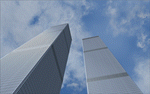
World Trade Center Twin Towers Textures - Only for Use With Tatu Kantomaa's New York City Objects.
These are Textures Only!
You must either have Tatu Kantomaa's New York City Objects scenery installed or you must download and install His scenery to use my textures (full details on file location in readme).
This is my way of rebuilding the Twin Towers and now they can Live again within the World of Flight Simulation.
Special Thanks To Tatu Kantomaa for granting me permission to upload these WTC texture modifications for use with His Great scenery "New York City Objects". His excellent scenery really improves NYC in FS9 with many other buildings created at a very high level of quality. Both North and South Tower Helipads are landable. You will find the Towers Glow with the color of the sunset so Dusk flights are very special when combined with My custom WTC night lighting. Please see Read Me file for more important information.
| Filename: | World_Trade_Center_Twin_Towers_Textures_Only.zip |
| License: | Freeware |
| Added: | 10th September 2011, 18:19:53 |
| Downloads: | 2,271 |
| Author: | Todd Manbeck,Tatu Kantomaa |
| Size: | 7.86 MB |
| Category: Flight Simulator 2004 - Scenery | |
| Quaqtaq CYHA in Hudson Strait, Quebec, Canada |
|
Images related to this file:
File Description:
Quaqtaq is a small village of 310 or so inhabitants at N 61 W 69 37 on the Hudson Strait at the northwest corner of Ungava Bay. It's name has some connection with "tapeworm" in Inuit; there is a story but I won't recount it here. The village does not feature in FS9 but is included in this scenery with approximately the right shape. No village buildings were specifically modeled; they are hand-made non-specific village houses typical of the north. The airfield runway is 3,520 feet of gravel 100 feet wide and is at 103 feet above the shoreline. I added the roads, a new airfield background, plus of course there is the scenery file and the AFCAD and AI, which is an Air Inuit Dash 8-300. This is the last of a series in northern Quebec that all have similar terminal buildings; I know of others which have the same type of building but I have no photos to discover the differences.
| Filename: | Quaqtaq_CYHA_in_Hudson_Strait_Quebec_Canada.zip |
| License: | Freeware, limited distribution |
| Added: | 8th November 2010, 04:29:39 |
| Downloads: | 414 |
| Author: | Roger Wensley |
| Size: | 2 MB |
| Category: Flight Simulator 2004 - Scenery | |
| Whati CEM3 in the Northwest Territories, Canada |
|
Images related to this file:
File Description:
Whati is a village at the southern end of Lac La Martre, a smaller lake (only by Canadian standards, at over 40 miles long) halfway between the Great Slave Lake and the Great Bear Lake and around 100 miles north of Yellowknife. The North West Company established a trading post there in 1793, and this was the centre for local trading in the area for 100 years until a post was opened by the Hudson Bay Company on the Great Slave Lake. The current population is in the region of 520. There is no graded road access and access is by boat or air. The main local economy revolves around hunting and fishing, with efforts being made to increase tourism amid the wilderness and the wildlife. The airfield is just over a mile east of the village, with a runway of around 3,400 feet of gravel aligned 09-27 as of 2010, with PAPI at both ends and lit. There are scheduled flights from Yellowknife by Air Tindi, included in the AI, and some GA. The terminal building is similar to that of Lutselk'e, but with a different colour scheme and with solar panels on the roof. It appears that they repaint the sign on the front of the building with a different wording every time; the one I have used is one of three that have existed in the last few years. The photos I had originally were taken in the winter, with snow. Seeing it in the summer I discovered that my version of the building is not at the right level above the ground by about a foot, or 30cm. I was too lazy to make it again, which was the only way to get it right and still have it throw a shadow on the ground. This scenery modifies the lake shore, corrects levels for land and lake, and adds the village and a connecting road in addition to the airport. A note here about my scenery making. There will not be many more to follow this as I am almost at the end of the photos I either took or found for scenery purposes, plus I expect to move on from FS9 at some point during next year.
| Filename: | Whati_CEM3_in_the_Northwest_Territories_Canada.zip |
| License: | Freeware, limited distribution |
| Added: | 15th December 2019, 19:18:29 |
| Downloads: | 150 |
| Author: | Roger Wensley |
| Size: | 4.25 MB |
| Category: Flight Simulator 2004 - AFCAD Files | |
| Newark Liberty Int'l Airport (KEWR) with active Crosswind Runway |
|
Images related to this file:
File Description:
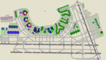
A high spec AFCAD2 for the FS2004 Newark Liberty Int'l Airport (KEWR) scenery by Steve Whalin. This afcad has been built using FAA Charts and information from the Airport Website. All taxiways are named and all aprons are reworked to be as real as possible according to photos. All gates are named as per real life and have airlines assigned to them. The Fedex and UPS aprons are represented and can accomodate many cargo aircraft. The final addition is random GA parking and the CO maintenance area to the north of the airport. Overflow parking is also available for rush hour periods (Ball Park). This airport features a tower view and also night and approach lighting. Finally, by using the crosswind runway technique, runways 04L/22R, 04R/22L and 11/29 can all be used simultaniously for take-off and landing. Runway 11/29 will be mainly used by CO Express flights. Enjoy!!
This afcad works with the Steve Whalin scenery only (Requires: kewr.zip).
| Filename: | Newark_Liberty_Intl_Airport_KEWR_with_active_Cross.zip |
| License: | Freeware |
| Added: | 2nd March 2010, 19:26:13 |
| Downloads: | 1,355 |
| Author: | Lee Brompton |
| Size: | 259.8 KB |
| Category: Flight Simulator 2004 - Aircraft Repaints, Textures and Modifications | |
| Syrian Air Airbus A320-232 (YK-AKE) |
|
Images related to this file:
File Description:

Syrian Arab Airlines, operating as SyrianAir, is the flag carrier airline of Syria. It operates scheduled international services to several destinations in Asia, Europe and North Africa, the number of flights operated has seriously declined due to the turmoil in Syria. SyrianAir used to serve over 50 destinations worldwide in recent years. Its main base is Damascus International Airport and Aleppo International Airport. SyrianAir is a member of the Arab Air Carriers Organization and Arabesk Airline Alliance.
Syrian Air's livery is painted on Project Airbus's Airbus A320-232 aircraft (included). The textures are saved in 32bit format for quality graphics. Textures are also characterized by HD (High Definition). Its features are idle-reverser animation, animated pack vents and pressurisation outflow valve, detailed textures, accurate paint, dynamic shine & effects, dynamic flexing wings that respond to turbulence, fully independent suspension, trim animation, gear steering, accurate flight dynamics, spoiler animation, reflective cockpit windows, improved wingflex code with input from several new parameters including ground spoilers, fuel load, and angle of attack, transparent navigation light lenses and many more. Thanks for downloading & Happy flying.
| Filename: | Syrian_Air_Airbus_A320232_YKAKE.zip |
| License: | Freeware |
| Added: | 7th July 2013, 19:18:03 |
| Downloads: | 802 |
| Author: | Giacomo Tomasini |
| Size: | 16.47 MB |
| Category: Flight Simulator 2004 - AFCAD Files | |
| Metro Oakland Int'l (KOAK) with Active Crosswind Runways |
|
File Description:
A high spec AFCAD2 for the default FS2004 Metro Oakland Int'l Airport (KOAK). This afcad has been built from scratch using FAA Charts, various aerial photographs and information from the Airport Website. All runways feature real life lengths/widths and include overrun areas. All taxiways are named and all aprons are reworked to be as real as possible according to photos. All gates are named and have airlines assigned to them. As per real life, only Southwest Airlines will use Terminal 2, all other airlines being allocated to Terminal 1. The Fedex and UPS aprons are represented and can accomodate up to 20 cargo aircraft. The final parking area is random GA parking to the north of the airport. Overflow parking is also available for rush hour periods. This airport now features a tower view and also upgraded night and approach lighting. Finally, by using the crosswind runway technique, runways 9L/27R, 9R/27L and 11/29 can all be used simultaniously for take-off and landing. Runway 15/33 is closed as it is not used in real life. Enjoy!!
| Filename: | Metro_Oakland_Intl_KOAK_with_Active_Crosswind_Runw.zip |
| License: | Freeware, limited distribution |
| Added: | 30th July 2005, 06:15:21 |
| Downloads: | 2,529 |
| Author: | Lee Brompton |
| Size: | 80.4 KB |
| Category: Flight Simulator 2004 - Scenery | |
| Herb's Field C417 near Ottawa in Ontario, Canada |
|
Images related to this file:
File Description:
Herb's is on the 417 between Ottawa and Montreal at the junction with highway 34, which is south of Hawkesbury. Herb's is a truckstop and a repair garage and a restaurant and a gas station, and is still (but only just!) an airfield. Which is to say there is still a runway, some 1,200 feet long and 30 feet wide. Do not go in your Cessna 172 as only the northern half is usable, and that after inspection from the air for any obstacles, parked cars, dogs, and similar obstacles. The southern half is the way in for trucks and cars, so make sure you can stop well before the ex-hangar which is now for truck repairs only. The planes all belonged to Herb's father, and even a casual inspection will reveal that they haven't moved for some time. If there is anything using the service road immediately to the north of the runway go around again, you won't be able to clear a vehicle and then land on the threshold.
| Filename: | Herbs_Field_C417_near_Ottawa_in_Ontario_Canada.zip |
| License: | Freeware, limited distribution |
| Added: | 14th February 2010, 14:39:56 |
| Downloads: | 386 |
| Author: | Roger Wensley |
| Size: | 2.02 MB |
| Category: Flight Simulator 2004 - Scenery | |
| Kremmling, Mc Elroy (20V), Colorado, Photo-Scenery |
|
Images related to this file:
File Description:

Kremmling, Mc Elroy (20V), Colorado, Photo-Scenery (FS9 & FSX)
Ever wanted to know how the scenery looks like around Kremmling VOR? Now you got the chance! This region covers the area around Kremmling and the northern part of the Gore Range. At Kremmling the Colorado River meets both the Blue River and the Muddy Creek. West of Kremmling you can see Gore Canyon. This rugged and steep canyon is almost 1000ft deep and was carved by the Colorado River on its way thru the Gore Range.
To explore the scenery depart from Mc Elroy Airfield (20V) in Kremmling and head north. High resolution versions of this scenery for FS9 and FSX (much sharper, but larger and multiple downloads) are available at www.blueskyscenery.com/GNB_West.html . The screenies are taken from the high-res versions, so expect this version to be slightly more blurry. Thanks to Joop Mak for providing custom AFCADs that correct airport layouts so that they align with the photo-textures! They are available at www.blueskyscenery.com/AFCADs.html . YourDonation@Work: Dedicated to Michael.
| Filename: | Kremmling_Mc_Elroy_20V_Colorado_PhotoScenery.zip |
| License: | Freeware, limited distribution |
| Added: | 21st April 2010, 17:39:09 |
| Downloads: | 1,138 |
| Author: | Gottfried Razek, blueskyscenery.com |
| Size: | 91.2 MB |


© 2001-2026 AVSIM Online
All Rights Reserved
Privacy Policy |