
Where Flight Simulation Enthusiasts Gather from Around the World!
AVSIM Library - Search Results

| Category: Flight Simulator 2004 - Aircraft Repaints, Textures and Modifications | |
| Air Berlin Boeing 737-800 |

|
Images related to this file:
File Description:
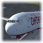
Empezamos septiembre e hice un nuevo repaint, esta vez del Boeing 737-800 de Air Berlin, esta es la segunda mayor linea aerea de Alemania, despues de Lufthansa, y la sexta mayor europea, Tiene su sede en la ciudad de Berlin, y opera vuelos cuasi-bajo costo entre 23 ciudades alemanas y ciudades europeas, destinos turisticos del Mediterraneo, las islas Canarias, Baleares y vuelos de largo recorrido a Las Americas, Asia y Africa. Modelo hecho por Project Open Sky, visiten mi blog en http://aerosimulaciones.blogspot.com/
Starting september and made a new repaint, the Air Berlin Boeing 737-800, Air Berlin is Germany's second largest airline, after Lufthansa, and Europe's sixth largest airline in terms of passengers. The airline operates an extensive network including holiday destinations in the Mediterranean region, the Canary Islands and North Africa and intercontinental destinations in Southeast Asia, the Caribbean and the Americas. Model by Project Open Sky, visit my blog in http://aerosimulaciones.blogspot.com/
| Filename: | Air_Berlin_Boeing_737800.zip |
| License: | Freeware |
| Added: | 7th September 2011, 22:15:10 |
| Downloads: | 862 |
| Author: | Juan Rodriguez / AeroSimulaciones |
| Size: | 7.87 MB |
| Category: Flight Simulator 2004 - Scenery | |
| Canouan TVSC in the Grenadines |
|
Images related to this file:
File Description:
Canouan Island is the one of the middle islands in the chain known as St Vincent and the Grenadines, between Mustique and Union Island. Canouan is around 5 miles long and shaped like a hook, with a resident population of 1,200. There has been major touristic development on the island since the early 1990's and the island now has paved roads, electricity, and desalinated water along with a golf course.
The airport is at the southern end of the island and the runway has been extended to 5,875 feet on reclaimed land, making Canouan the jet airport for the Grenadines with flights from North and South America. There are connecting flights to the other islands by SVG and LIAT. The airport apron has been extended to accomodate larger planes and I have shown the airport with this apron work still in progress and during the expansion of the terminal building. The AI has two international flights, on Wednesday and Saturday, and both by American.
| Filename: | Canouan_TVSC_in_the_Grenadines.zip |
| License: | Freeware, limited distribution |
| Added: | 11th June 2013, 22:59:04 |
| Downloads: | 656 |
| Author: | Roger Wensley |
| Size: | 3.6 MB |
| Category: Flight Simulator 2004 - Scenery | |
| Como Idroscalo - Italy |
|
Images related to this file:
File Description:
Italian scenery with water runway and some existing objects and other buildings sintax generated; Information: Como is a beautiful town on the Como lake, north Italy, closed to the Swiss border. In the hills outside the town you can find Baradello old fortification (S) and Brunate small village (E). The lake, also called Lario, has a wonderful landscapes, reachable with battles of Navigazione Lago di Como. Description and content: Water runway placed approx on the real coordinates. Scenery includes: water runway with ILS; the Aero Club Como hangar, lighted with static float aircraft inside; some docks and a water NDB; two helicopter floating bases with an Huges 500D and dinghy; several sailboats and speedboats; football stadium, fantasy obelisco and statue; one Navigazione Lago di Como wharf and ticket office; buildings, hotels, hospital, cathedral, kiosk, restaurant etc.; Baradello old fortification and tower with Como flag; Brunate small village, with church and houses; several trees around the scenery and lights on lakefront and pier, on roads, hospital and jetty
| Filename: | Como_Idroscalo__Italy.zip |
| License: | Freeware |
| Added: | 9th February 2011, 20:43:31 |
| Downloads: | 1,422 |
| Author: | Aldo Della Vedova |
| Size: | 11.17 MB |
| Category: Flight Simulator 2004 - Scenery | |
| LFQX Laon-Couvron AB 1955-62 |
|
Images related to this file:
File Description:
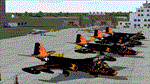
From 1950 to 1967 the USAF set up and maintained bases in France, with the agreement of the French government, as part of its commitment to the North Atlantic Treaty Organisation. Laon AB was one of the ten main air bases which supported both attack and air defence capabilities. Many people do not appreciate the sheer extent of the USAF bases in France at this time and the reasons leading to the USAF departure in 1967. There is a link to a fine article on all this included.
This is the second in a series of USAFE bases in France, the first being LFJA Chaumont AB. This scenery and traffic represent Laon Air Base during the years 1955 to 1962. Custom Tower and Hangars by Dan French with Custom aircraft paints by Ken Lawson and DeltaDart. Traffic files and the aircraft and paints needed are provided for 1955 (including the Black Knights B-57 Demonstration Team), 1957, 1959 and 1962.
| Filename: | LFQX_LaonCouvron_AB_195562.zip |
| License: | Freeware |
| Added: | 22nd November 2023, 16:08:03 |
| Downloads: | 88 |
| Author: | Al Von Pingel, Ken Lawson, Dan French |
| Size: | 35.77 MB |
| Category: Flight Simulator 2004 - AI Aircraft | |
| Executive Airbus A320 Package - Flightplans Included Version 2 |
|
File Description:
***This is an update to my original upload (evolveai_executive_a320s.zip). It was brought to my attention that the aircraft.cfg entry for the IAE model was incorrect. This upload contains the correct entry so if you installed the original you'll want to replace your IAE entry with the on in this packge. If you've not downloaded the original package this one will function as a stand-alone version. Installation insructions are provided in the readme. Thanks to Andrew Langille for pointing this out.***
This package contains repaints and flight plans for the two known Airbus A320 aircraft in executive service. The flight plans are based on photo locations as well as a great deal of internet research. These aircraft visit 16 airports in Europe and the Middle East as well as North America and Asia. This package contains textures only so you’ll need both the Evolve AI A320 CFM and IAE base packages installed on your system.
| Filename: | Executive_Airbus_A320_Package__Flightplans_Included_Version_2.zip |
| License: | Freeware, limited distribution |
| Added: | 1st July 2006, 13:44:03 |
| Downloads: | 1,429 |
| Author: | Kelly Freeman / Evolve AI |
| Size: | 502.98 KB |
| Category: Flight Simulator 2004 - Scenery | |
| Vadodara International Airport (VABO) |
|
Images related to this file:
File Description:
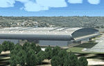
Vadodara International Airport (VABO) for FSX and FS2004.
Virtual aviation community stands basically on the grounds of what happens in the real world aviation and simulates the real thing, virtually. So that means they always have to be a step ahead and we follow. But my friend, we have a chance to make them follow us. Thats right! The proposed (final) integrated terminal at Vadodara shall have its construction commenced in mid of 2013 (the time can be altered, as real dudes define the situation). The design is finalized and here it is ..... the airport is basically " A basin kind".
Vadodara Airport or Civil Airport Harni (IATA: BDQ, ICAO: VABO) is a civilian airport located in the north-east of Vadodara, Gujarat, India in the suburb of Harni. A domestic airport until now, Vadodara Airport will become an international airport once the proposed new terminal is operational.
| Filename: | Vadodara_International_Airport_VABO.zip |
| License: | Freeware, limited distribution |
| Added: | 7th September 2010, 11:32:31 |
| Downloads: | 1,879 |
| Author: | Ashish Singh |
| Size: | 25.19 MB |
| Category: Flight Simulator 2004 - Scenery | |
| Kangirsuk CYAS in Quebec Canada |
|
Images related to this file:
File Description:
Kangirsuk is an Inuit village in northern Quebec, on the coast of Ungava Bay. The airport is the only means of access on this coast for the population of around 550, apart from a period in late summer. It is between Quaqtaq and Aupaluk, and around 140 miles north of Kuujjuaq, a major centre in this area for supplies, medical care, education, and anything to do with local government. This version of the airport and village is from around 2010, with the original terminal building that has now been replaced. The runway is just under 3,500 feet of lit gravel aligned 04-22 and the AI includes the daily Air Inuit flight that connects Kangirsuk with Kuujjuaq and other local airfields en route. This is almost certainly the last of the northern Quebec coastal airfields that I will be able to model with the correct buildings; only two missing so not too bad.
| Filename: | Kangirsuk_CYAS_in_Quebec_Canada.zip |
| License: | Freeware, limited distribution |
| Added: | 27th August 2020, 17:41:07 |
| Downloads: | 84 |
| Author: | Roger Wensley |
| Size: | 5.67 MB |
| Category: Flight Simulator 2004 - Scenery | |
| CYEK - Arviat - Nunavut, Canada v 1.1 |
|
Images related to this file:
File Description:
This version of Arviat corrects the VASI position on the runway, and also updates the taxiway edge lights to a newer and smaller version which is more realistically sized. This is a complete version and does not require you to have installed the old version. You can just replace the existing .bgl's and the existing textures in the scenery and texture folders if you already have this scenery. Arviat is a small town on the west coast of Hudson Bay in Nunavut, around 90 miles south of Whale Cove, 130 miles south of Rankin Inlet, and 160 miles north of Churchill. The airfield is just south of the town, and the 4,000 feet of gravel runway is aligned 149T/329T, as these are true bearings and not magnetic, as Arviat is just inside the Northern Domestic Airspace zone. There is 100LL fuel available in drums, with 2 hours prior notice. The visiting AI airline is Calm Air, plus a cargo delivery by Buffalo Air.
| Filename: | CYEK__Arviat__Nunavut_Canada_v_11.zip |
| License: | Freeware, limited distribution |
| Added: | 23rd August 2014, 11:20:05 |
| Downloads: | 226 |
| Author: | Roger Wensley |
| Size: | 2.33 MB |
| Category: Flight Simulator 2004 - Scenery | |
| Ontario Small Fields in Canada: #04 Stoney Point (Le Cunff) CRML V1 |
|
Images related to this file:
File Description:
This is the fourth in a series of small airfields in southern Ontario, Canada. It is Stoney Point (Le Cunff) CRML, a field near a small town (Stoney Point) close to Lake St Clair. The airfield has a grass runway of 2,250 feet, aligned 18/36; with trees around the house gardens between road and runway the south threshold is displaced by 250 feet. The markers approximately show the touchdown point north of the runway end. Le Cunff is the family name of the owners, included to differentiate between this and another Stoney Point field, CRJ2. I found the default FS9 airfield at the correct elevation of 625 feet, but sitting on a plateau, despite my Genesis Mesh. This looked so unreal that I have revised this to an incorrect lower elevation of 580. So if you find the airfield sitting in a hole in your installation you now know the reason. Let me know, with a screenshot please.
| Filename: | Ontario_Small_Fields_in_Canada_04_Stoney_Point_Le_.zip |
| License: | Freeware, limited distribution |
| Added: | 29th July 2015, 16:08:32 |
| Downloads: | 146 |
| Author: | Roger Wensley |
| Size: | 1.6 MB |
| Category: Flight Simulator 2004 - Scenery | |
| Northbrook East CF47 and Northbrook West CF48, Ontario, Canada |
|
File Description:
Thirty five miles north of the 401 on Highway 41 is a small town called Northbrook, and in the town itself is a dirt strip with a runway 11/29 1,830 feet long, which for the sake of telling them apart I have called Northbrook East. I have no idea of the history, or even of the reason why. Less than a mile west of the town is a second dirt strip with a runway 04/22 2,200 feet long. This one (Northbrook West) was built to support construction of the electrical power line installation and there is a dirt clearing between the strip and the power lines. There is absolutely nothing at either of these fields, no fuel, no oil, no hangar, and a very rough surface. Although I have made these as grass strips in fact they are dirt; the reason I didn't make them dirt is that dirt in FS9 stands out for miles and looks awful.
| Filename: | Northbrook_East_CF47_and_Northbrook_West_CF48_Onta.zip |
| License: | Freeware |
| Added: | 6th February 2010, 02:36:22 |
| Downloads: | 271 |
| Author: | Roger Wensley |
| Size: | 192.25 KB |


© 2001-2026 AVSIM Online
All Rights Reserved
Privacy Policy |