
Where Flight Simulation Enthusiasts Gather from Around the World!
AVSIM Library - Search Results

| Category: Flight Simulator 2004 - Scenery | |
| VFR of Lario, Area D2 - Como lake, Italy |

|
Images related to this file:
File Description:
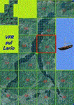
This is the seventh scenery of the "VFR of Lario" project, made with photorealistic terrain and some 3D GMax realistic objects. This scenery covers approximately an area of 7.5x6 kmt, from
north of Bellano (NW) to Casargo (NE), and from Fiumelatte (SW) to Cortenova (SE) and includes the NLC piers of Varenna and Bellano; it includes several dedicated buildings as Vezio castle (Perledo), villa Monastero, S.Giorgio church, marina, piers, hotel Olivedo, and some villas (Varenna), Tommaso Grossi square with pier and light fountain, S.Nazaro-Celso and S.Rocco-Sebastiano churches, Cantoni old cotton mill, group of houses by the lake (Bellano). There are also included four viaducts between the tunnels of the freeway 36, with moted traffic. Hydrofoil G. Marconi at Bellano pier together with other minor boats and docks alongside the lake coast; a moted traffic of motorboats is placed between Varenna's piers.
| Filename: | VFR_of_Lario_Area_D2__Como_lake_Italy.zip |
| License: | Freeware |
| Added: | 23rd July 2012, 15:45:14 |
| Downloads: | 1,260 |
| Author: | Aldo Della Vedova, Daniele Lanfranchi, Gian Mario Verga |
| Size: | 17.95 MB |
| Category: Flight Simulator 2004 - Scenery | |
| Chateau Airfield NZ22, & Chateau Hotel Village, Mount Ruapehu, New Zealand. |
|
File Description:
Welcome to the Chateau Airfield, the home of Mountain Air. The airfield is located on the foothills
of Togariro National Park's, Mount Ruapehu in the central North Island of New Zealand.
This scenery includes not only the airfield, but the Chateau Hotel and Village halfway up the mountain.
The scenery also features some custom buildings and signs (textures included).
For those that like to arrive for their ski-ing holday in style, there is a helipad (NZ20, ficticious), right
beside the Chateau Hotel, or alternatively, you can follow the road opposite the airfield, which leads directly
up to the Chateau Hotel and Village. Requires some EZ Scenery Object sets (see INSTALL instructions for details). Special thanks to Mike Andrews (creator2003) for giving his kind permission to use his custom Chateau Hotel building in this scenery.
*Requires some EZ Scenery Object sets.*
| Filename: | Chateau_Airfield_NZ22__Chateau_Hotel_Village_Mount.zip |
| License: | Freeware, limited distribution |
| Added: | 5th December 2008, 15:29:38 |
| Downloads: | 1,456 |
| Author: | Lawrie Roache |
| Size: | 2.98 MB |
| Category: Flight Simulator 2004 - Scenery | |
| FoxPine AirPark, New Zealand. NZFP. |
|
File Description:
Welcome to FoxPine Airpark ,NZFP.
FoxPine AirPark is situated by the small provincial town of Foxton on the South West coast of New Zealand’s North Island.
This Private Airfield set in park-like grounds is sited on a broad coastal plain of mixed farming and forestry bounded by sweeping beaches,
a meandering river, and off to the East, rugged bush-clad ranges, all great places to fly.
FoxPine is also where the "Jabiru" light aircraft is assembled, sold and serviced.
This scenery contains a bonus custom AI package, comprising of seven Jabiru-2's, a Cessna 172, and a Maule M6, and a traffic file for the aircraft. (AI Aircraft are complete with all files).
The AI aircraft, and the traffic file are fully compatible with GNZLAP traffic. Scenery requires some EZ Scenery Object Sets (see INSTALL instructions for details).
| Filename: | FoxPine_AirPark_New_Zealand__NZFP.zip |
| License: | Freeware, limited distribution |
| Added: | 14th August 2008, 21:27:16 |
| Downloads: | 929 |
| Author: | Lawrie Roache |
| Size: | 5.98 MB |
| Category: Flight Simulator 2004 - Scenery | |
| PAMR - Merrill Field - Anchorage, Alaska |
|
Images related to this file:
File Description:
Merrill Field is in Anchorage Alaska, between Anchorage International to the southwest and and Elmendorf Air Force Base to the north. It caters for general aviation and is the land equivalent of the Lake Hood float plane base (see my post) with fuel and numerous maintenance facilities, and several hundred parking spots for small planes. There are three runways, and the longest is 4,000 feet of 100 feet wide asphalt, the second 2,635 feet of asphalt 75 feet wide, and the third 2,000 feet of 60 feet wide gravel. It is a controlled airfield with a modern control tower. There are almost 50 buildings on the field and three quarters of them have been modeled specifically for this scenery. The download includes a LITE version for older computers as there are a lot of static parked aircraft.
| Filename: | PAMR__Merrill_Field__Anchorage_Alaska.zip |
| License: | Freeware, limited distribution |
| Added: | 3rd January 2011, 23:11:31 |
| Downloads: | 1,123 |
| Author: | Roger Wensley |
| Size: | 6.94 MB |
| Category: Flight Simulator 2004 - Scenery | |
| Killaloe CYXI near the Ottawa River in Ontario Canada |
|
File Description:
Killaloe is an old military airfield built for jet fighters in the 1950's,and now officially abandoned. It is 12 miles north of Madawaska Valley Airpark and just to the west of Round Lake, and there is no trouble spotting it as even from 20,000 feet (see the pic) it is very visible. This is mainly because it has a single 6,600 feet runway 29/11, which is likely to be useful if it all goes quiet and you need to land! So it is worth knowing about, even though the asphalt is not in a very good condition. It also continues to be used by the odd passing pilot who cannot resist adding another destination to his log book, though I have no personal knowledge of that. I understand local residents also use it for occasional drag racing, presumably unofficially.
| Filename: | Killaloe_CYXI_near_the_Ottawa_River_in_Ontario_Can.zip |
| License: | Freeware |
| Added: | 27th May 2008, 19:37:07 |
| Downloads: | 423 |
| Author: | Roger Wensley & Jim Turner |
| Size: | 593.04 KB |
| Category: Flight Simulator 2004 - Scenery | |
| Matheson Point CWMP in Nunavut, Canada |
|
Images related to this file:
File Description:
This was a DEW line I Station on the southeast shore of King William Island; the island is around 70 miles square and Gjoa Haven is also on the southeast corner, 20 miles to the south. The station was closed in 1963 and has now been totally dismantled and removed except for a fallen 300 feet communications tower. The runway is still there (mostly) and is around 3,360 feet of gravel 120' wide, aligned 146T/326T. There are no lights, signage, or windsock, or any building remaining. All of these DEW line stations are not particularly impressive or even interesting. However, you can bet that any pilot flying regularly in the north along the coast knows where all these runways are, in case one of them suddenly becomes his favourite in the whole world just after the sudden silence.
| Filename: | Matheson_Point_CWMP_in_Nunavut_Canada.zip |
| License: | Freeware, limited distribution |
| Added: | 22nd November 2012, 16:28:19 |
| Downloads: | 179 |
| Author: | Roger Wensley |
| Size: | 785.57 KB |
| Category: Flight Simulator 2004 - Scenery | |
| Reworked Altenstadt Army airfield, ETHA (Bavaria, South-Germany) including AI-Package |
|
File Description:
This airfield, located near Schongau in the Allgaeu (Bavaria, South-Germany),
is the main training center for parachuters of the German Army and used for cargo-drop missions of various users. The airport has been reworked to improve
the overall appearance. Version 2 replaces V1 completely.
The included AI-Package contains: Bell UH-1D SAR, Nord-Aviation Noratlas ND2501,
North-American T-6D and an aircraft.cfg for an AI-Transall C160.
Two Transall and a single T-6D from Landsberg and two Noratlas from Kaufbeuren
are comming over for touch and goes at Altenstadt as scheduled per attached
flightplan. A Dornier Do-28 does local touch and goes and a Bell UH-1D SAR-helicopter hurries to Landsberg. Welcome to a little Xmas party.
Lago's FSE is required in order to see most of the major buildings / objects.
| Filename: | Reworked_Altenstadt_Army_airfield_ETHA_Bavaria_Sou.zip |
| License: | Freeware, limited distribution |
| Added: | 24th December 2005, 17:48:42 |
| Downloads: | 2,424 |
| Author: | Klaus Jone |
| Size: | 3.97 MB |
| Category: Flight Simulator 2004 - Scenery | |
| 71AK - Bluff Park Farm, plus others |
|
Images related to this file:
File Description:
Bluff Park Farm 71AK is on the northern side of Knik Arm, opposite Birchwood on the southern side. Wasilla Creek Airpark 05AK is just under 5 miles northeast of Wolf Lake. Memory Lake 5AK8 is 3 miles north of the town of Wasilla. The others, which are all in with the Wasilla Creek Airpark scenery, are scattered around and are mostly included in this list because of FS9 to UT altitude anomalies. Where there is a hangar or another building this as been added, but where there are no buildings I have just made the elevation adjustments so that there is no ridiculous "runway-in-a-hole" situation visible near one of the other airfields that I have made in the area. This post includes, in total, 71AK, 05AK, 5AK8, 3AK2, 05AK, 5AK5, 16AK, 34AK, 59AK, and AK65.
| Filename: | 71AK__Bluff_Park_Farm_plus_others.zip |
| License: | Freeware, limited distribution |
| Added: | 26th October 2014, 02:05:06 |
| Downloads: | 216 |
| Author: | Roger Wensley |
| Size: | 4.74 MB |
| Category: Flight Simulator 2004 - Scenery | |
| Colorado Lakes Project IV |
|
File Description:
This project features the lakes of North Central Colorado, replaces all of the prominent reservoirs and lakes of the region (Dillon, Green Mountain, Granby, Williams Fork, and more), and adds over 500 highly detailed lakes to Colorado. They fit seamlessly with my "Colorado Lakes Project III" (colorado_lakes_project_3.zip), "Colorado Lakes Project II" (colorado_lakes_project_2.zip) and "Colorado Lakes Project I" (colorado_lakes_project_1.zip) lakes.
These lakes are specifically designed to show off their photo realistic detail when used in combination with "FSGenesis-The Rockies 38.2m Terrain Mesh-Colorado" available as "fsg_dem38m_usrk_co.zip" at avsim.com, or comparable mesh. The free FSGenesis US National Landclass Project Beta 6 also adds beautifully to the landscape. These lakes work equally as well with the default mesh.
All lake information was projected from satellite imagery and compiled with a beta version of Jim Keir's "Slartibartfast" utility.
| Filename: | Colorado_Lakes_Project_IV.zip |
| License: | Freeware |
| Added: | 10th June 2004, 04:27:10 |
| Downloads: | 4,832 |
| Author: | Carlyle Sharpe |
| Size: | 743.4 KB |
| Category: Flight Simulator 2004 - Scenery | |
| The First Heathrow. The London Airport 1946-1955. |
|
Images related to this file:
File Description:
The site upon which the airport now known as London Heathrow was built was acquired by the British government by compulsory purchase from Fairey Aviation in 1944. Thereafter development continued apace and in April 1955 terminal buildings and a control tower in the central area came into operation. Prior to that the terminal (which continued in use as the North Terminal for some years) had been on the northern boundary of the airport immediately adjacent to the Bath Road. This scenery represents The London Airport, as it was then called, in this first phase of its existence, that is between 1946 and 1955. Users will need to have already installed the FS2004 Custom Scenery Library Version 4 which is available from Tom Gibson's California Classics site here - http://www.calclassic.com/scenery.htm And the EZ Scenery Library - link available in the Read Me.
| Filename: | The_First_Heathrow_The_London_Airport_19461955.zip |
| License: | Freeware |
| Added: | 18th January 2016, 12:59:53 |
| Downloads: | 723 |
| Author: | Ken Lawson |
| Size: | 32.66 MB |


© 2001-2026 AVSIM Online
All Rights Reserved
Privacy Policy |