
Where Flight Simulation Enthusiasts Gather from Around the World!
AVSIM Library - Search Results

| Category: Flight Simulator 2004 - Scenery | |
| FS9 Fort St John CYXJ in BC Canada |

|
File Description:
Fort St John is close to the border between British Columbia and Alberta, around 40 miles north-northwest of Dawson Creek. The airport was originally a Royal Canadian Air Force base, associated with the wartime construction of the Alaska Highway. The airfield was part of this construction effort and the wartime ferrying of planes to Russia. It is currently named "North Peace Regional Airport", or "North Peace Airport"; apparently there has been no final decision?
The date for this scenery is around 2006. I was given an old video tape cassette which was filmed on an uncertain date, but which had to be before the terminal building was renovated in 2007 and totally changed in appearance. The only way to view the video was to play it in the camera and watch it on a small screen. After I had completed everything except the buildings I started to view the video to establish the building appearances and within an hour or so the camera died. It was so old there was no way to repair it, so I then made some new buildings from memory of the video and what was available online. I also used some that I had already made for other scenery but which were similar. I may replace the terminal building that is in this version with a build of the new one, as I know this one is not a very accurate reproduction. The replacement, if I do it, will be towards the end of this year.
The AI included here is for GA, Air Canada Jazz, and two helicopter companies that were (and still are?) based there. One is at the western end of the apron and the other is at the eastern end but separated from the apron. To gain access to the taxiways and runways (so that all airport users follow the same procedures, for safety reasons) the eastern end helicopters just taxi across the grass. The helicopters are used for maintenance trips to the oil and gas fields in the surrounding area. My screenshots show Westjet at the terminal; this is because I have later Canadian AI installed, while the AI included here is only for the time around 2000 to 2010, when Westjet were not flying to Fort St John.
The airport is square in plan, with the apron running along the northern side and two runways forming diagonals. The two runways are 11-29 (6,882 feet long and 200 feet wide, with ILS at the 29 end and PAPI at the other) and 02-20 (6,684 feet long and 200 feet wide, and with PAPI at each end). The eastern side taxiway that runs north-south is not used. The western side taxiway is in use but only as a race track for cars.
Please email me if you find faults, such as a plane without textures.
| Filename: | FS9_Fort_St_John_CYXJ_in_BC_Canada.zip |
| License: | Freeware, limited distribution |
| Added: | 10th October 2022, 14:03:38 |
| Downloads: | 213 |
| Author: | Roger Wensley |
| Size: | 37.49 MB |
| Category: Flight Simulator 2004 - Scenery | |
| Sachs Harbour CYSY in Northwest Territories, Canada |
|
Images related to this file:
File Description:
Sachs Harbour is on the southwest coast of Banks Island on the north side of Amundsen Gulf, around 240 miles northeast of Tuktoyaktuk and 180 miles northwest of Ulukhaktok. The village is the only permanent settlement on the island, and is located where it is to benefit from the harbour shelter provided by offshore land. The population is only 130 or so folks, who live on hunting and fishing with some tourism. One claim to fame is that the island is home to threequarters of the world's population of muskoxen and the second is the largest goose colony in North America. The airfield is on the plateau just above the village at 282 feet ASL. The gravel runway 084T/264T (true bearings in Northern Domestic Airspace) is 4,000' long and 100' wide and lit. The apron is on the south side at the centre of the runway and there is a new terminal building; there is JetA fuel available and perhaps 100LL in drums. To the west of the airfield are the deserted buildings of what was once a Department Of Transport weather station. Aklak Airlines flights (operated by Kenn Borek) fly to Sachs Harbour from Inuvik three times a week in summer and twice a week at other times; the AI will be included in the post of a revised Aklavik, and Inuvik revised and Tuktoyaktuk should be fully installed BEFORE Sachs Harbour.
| Filename: | Sachs_Harbour_CYSY_in_Northwest_Territories_Canada.zip |
| License: | Freeware, limited distribution |
| Added: | 14th May 2012, 17:20:09 |
| Downloads: | 394 |
| Author: | Roger Wensley |
| Size: | 6.16 MB |
| Category: Flight Simulator 2004 - Scenery | |
| Mesa Verde National Park, Cortez (KCEZ), Colorado, Photo-Scenery (FS9 & FSX) |
|
Images related to this file:
File Description:
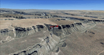
Mesa Verde National Park is famed for its numerous ruins of cliff dwellings built in the 12th century by ancient Pueblo people called Anasazi. Cliff dwellings are highly defensible stone villages situated under alcoves (rock overhangs) along the canyon walls. The largest cliff dwelling in the park is Cliff Palace, which is the largest cliff dwelling in North America. Cliff Palace contained 150 rooms and housed approximately 100 people. Unfortunately you won't see the cliff dwellings from the air, because they are under the cliffs but you will see everything else like all roads, trails and facilities. Very little is known about the Anasazis and the reason for their sudden departure at the end of the 13th century remains a mystery. Theories range from crop failures due to droughts to an intrusion of foreign tribes from the North. The name "Mesa Verde" stems from Spanish explorers seeking for a route from Sante Fe to California. They named the region Mesa Verde (spanish for green table) because of its high, tree-covered plateaus. High resolution versions of this scenery for FS9 and FSX (much sharper, but larger and multiple downloads)
are available at www.blueskyscenery.com/GNB_West2.html . The screenies are taken from the high-res versions, so expect this version to be slightly more blurry. Thanks to Joop Mak for providing custom AFCADs that correct airport layouts so that they align with the photo-textures! They are available at www.blueskyscenery.com/AFCADs.html . YourDonation@Work: Dedicated to David.
| Filename: | Mesa_Verde_National_Park_Cortez_KCEZ_Colorado_Phot.zip |
| License: | Freeware, limited distribution |
| Added: | 1st May 2010, 03:55:31 |
| Downloads: | 1,467 |
| Author: | Gottfried Razek - blueskyscenery.com |
| Size: | 92.87 MB |
| Category: Flight Simulator 2004 - Scenery | |
| St. George (KSGU) / Mesquite (67L), Utah/Nevada, Photo-Scenery (FS9 & FSX) |
|
Images related to this file:
File Description:
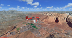
Covers the area between St. George, Utah and Mesquite, Nevada. To the north of St. George
the Pine Valley Mountains with their foothills of scenic red sandstone loom over the city.
St. George Municipal Airport (KSGU) is mostly used for general aviation but is also served by SkyWest Airlines
on behalf of Delta Connection. Because of it's location on a mesa this airport can't be expanded and so a new
airport is currently being built southeast of the city at the site of an abandoned airfield. The opening
is expected in 2011. To the south of the city make sure, you don't miss the Virgin River Gorge where the
Virgin River winds thru a long winding canyon in the transition zone between the red rocks of southern Utahs
Colorado Plateau and Nevadas Mojave Desert. Shortly afterwards you reach Mesquite which is situated just
west of the Arizona stateline. Like nearly all Nevada cities near the stateline Mesquite is home to several
Casinos. Mesquite Airport (67L) lies just north of the city.
High resolution versions of this scenery for FS9 and FSX (much sharper, but larger and multiple downloads)
are available at www.blueskyscenery.com/CNY_South3West6.html . The screenies are taken from the high-res versions,
so expect this version to be slightly more blurry. Thanks to Joop Mak for providing custom AFCADs that
correct airport layouts so that they align with the photo-textures! They are available at www.blueskyscenery.com/AFCADs.html .
YourDonation@Work: Dedicated to Werner, Ralf-Peter and Nels.
| Filename: | St_George_KSGU__Mesquite_67L_UtahNevada_PhotoScene.zip |
| License: | Freeware, limited distribution |
| Added: | 24th March 2010, 19:41:43 |
| Downloads: | 1,653 |
| Author: | Gottfried Razek - blueskyscenery.com |
| Size: | 95.58 MB |
| Category: Flight Simulator 2004 - Scenery | |
| Campbell River floats CAE3 in BC Canada |
|
Images related to this file:
File Description:
Campbell River is a medium sized town on Vancouver Island, some 50 miles north of Vancouver. The base is just north and west of the town on Spit Road. And Ultimate Terrain is required for the cost to be in the right place. The docks are on the south side of the spit, on the (relatively) sheltered river side, though take offs and landings are requested to take place outside the harbour if conditions permit. The base is noted as used and run by Corilair, though in fact there is also another company based there, Vancouver Island Air, who like Coril Air also have two docks, one for boarding passengers and one for maintenance and refuelling tie-ups. At the river mouth there is a small marina, run by the same folks who run the trailer park, and next to that a dock for visiting float planes. There is a seventh dock at the end furthest from the river mouth; I don't know what that is used for but it is next to Vancouver Island Air and might be theirs. At low tide there are numerous sandbanks (and more permanent islands with bushes and trees) in the mouth of the Campbell River and I decided to ignore installing these with all the problems they would cause me. The main buildings and most of the others are modeled specifically for this scenery; minor items like parked cars are RWY12.
| Filename: | Campbell_River_floats_CAE3_in_BC_Canada.zip |
| License: | Freeware, limited distribution |
| Added: | 12th February 2010, 18:45:00 |
| Downloads: | 881 |
| Author: | Roger Wensley |
| Size: | 5.3 MB |
| Category: Flight Simulator 2004 - Scenery | |
| Sisimiut (BGSS) on the west coast of Greenland |
|
Images related to this file:
File Description:
Sisimiut is on the west coast of Greenland. It is around 125 miles south of Aasiaat, and 80 miles west of Kangerlussuaq airport, which is currently the largest commercial airfield in Greenland. Sisimiut has a population of 5,500 and the main occupations are fishing, tourism, education, and a growing industrial base. It has the northernmost year-round ice-free port in Greenland, though icebergs floating down from the north are commonplace. The airport is across a bridge and along a two mile road on the north side of an inlet, northwest of the town. The runway is 2,600+ feet of asphalt almost 100 feet wide and lit, aligned 20/02 and at 33 feet ASL, with the apron and terminal building at the eastern end. The building is identical to the one at Aasiaat. Air Greenland run regular flights with a Dash-8, Dash-7, or Twin Otters; within FS9 it is impossible to land an Ai Dash-7 on a runway less than 3,000 feet long, so I used a Dash-8. There was no way to replicate both the parking facing away from the terminal AND the "through" taxiing to complete the circle back to the runway; after parking correctly the AI Air Greenland plane will reverse before heading out to take off. The surrounding area is rock with some scruffy grass and low bushes, and there is no grass around the runway; the airfield has compacted gravel instead.
| Filename: | Sisimiut_BGSS_on_the_west_coast_of_Greenland.zip |
| License: | Freeware, limited distribution |
| Added: | 28th April 2012, 22:03:35 |
| Downloads: | 852 |
| Author: | Roger Wensley |
| Size: | 3.71 MB |
| Category: Flight Simulator 2004 - Scenery | |
| Ulukhaktok (Holman) CYHI in the Northwest Territories, Canada |
|
Images related to this file:
File Description:
Ulukhaktok (Holman) is an airfield on the west side of Victoria Island, off the northern coast of Canada. It is 320 miles west of Cambridge Bay (and you should download and install the recent post of CYCB by Sid and Pete, as I use it for the AI included in this post) and around 400 miles east of Inuvik (my post of a few months ago). It has been officially called Ulukhaktok since 2006, and before that it's name was Holman.
The village of Ulukhaktok has been placed around the bay and is approximately the right shape; it houses some 460 people who used to rely solely on hunting and fishing. The village is close to 71 degrees north, and there are only four months of the year when the average high is above zero centigrade. The photograph with snow (and of course a frozen sea) is typical; for the frozen sea download my Frozen Rivers & Lakes post which will provide this. The buildings on the field have been modelled specifically for this scenery, and as in real life there is only JetA available. The AI visiting aircraft are an Aklak Air DC3 (based in Inuvik and operated by Kenn Borek Air) and a Canadian North Dash 8-100. Note that the runways are signed as "true" headings instead of magnetic; in the Canadian Northern Domestic Airspace all headings are given as true. Unfortunately FS9 doesn't accommodate this in ATC.
| Filename: | Ulukhaktok_Holman_CYHI_in_the_Northwest_Territorie.zip |
| License: | Freeware, limited distribution |
| Added: | 24th May 2011, 20:05:47 |
| Downloads: | 453 |
| Author: | Roger Wensley |
| Size: | 2.3 MB |
| Category: Flight Simulator 2004 - Scenery | |
| Kugaaruk CYBB and DEW Pelly Bay CWPB in Nunavut, Canada |
|
Images related to this file:
File Description:
Kugaaruk is on the coast of northern mainland Canada on the Boothia Peninsula, 60 miles into a deep north-south fjord-like inlet called Pelly Bay. The name was changed from Pelly Bay in 1999, and the population is around 800. Gjoa Haven is 150 miles to the west, and Hall Beach just over 200 miles to the east. Six miles south of the village, and connected by a gravel road, there is a NWS station and what remains of a DEW Auxiliary Site; the DEW site was closed in 1992, a year after the NWS station became operational. There is also a 3,350 feet long gravel runway beside Barrow Lake 2 miles east of the site, Pelly Bay CWPB. Kugaaruk airfield is adjacent to the village and the 5,000 feet of 100 feet wide gravel runway is aligned 049T/229T where T stands for "true" as opposed to magnetic. There are flights by First Air and Canadian North and the AI includes a daily flight of each from Yellowknife via Gjoa Haven (as per real life) plus a cargo visit by Buffalo. Although the runway is long enough to accomodate a 737 it is not licensed for regular scheduled jet flights; the reason for this is that the approach lighting is "inadequate". Included here is a new .bgl for Gjoa Haven which will remove the small hold short line from the gravel; my mistake.
| Filename: | Kugaaruk_CYBB_and_DEW_Pelly_Bay_CWPB_in_Nunavut_Ca.zip |
| License: | Freeware, limited distribution |
| Added: | 25th November 2012, 00:43:07 |
| Downloads: | 428 |
| Author: | Roger Wensley |
| Size: | 6.1 MB |
| Category: Flight Simulator 2004 - Scenery | |
| KSNA, John Wayne-Orange County Airport |
|
Images related to this file:
File Description:

John Wayne Airport (IATA: SNA, ICAO: KSNA, FAA LID: SNA) is an airport in an unincorporated area in Orange County, California, with its mailing address in the city of Santa Ana, which is also the county seat, hence the International Air Transport Association (IATA) airport code. The main entrance to the airport is off of MacArthur Blvd in Irvine, the city that abuts the airport from the north and east. Newport Beach and Costa Mesa form the southern and western boundaries, respectively, together with a small unincorporated area along the Corona del Mar (73) Freeway. Santa Ana lies just north, not actually touching the airport directly. Originally named Orange County Airport, the county Board of Supervisors renamed it in 1979 to honor the actor John Wayne, who resided in neighboring Newport Beach and died that year. It also became the first airport to be named after an entertainer.
The main runway, at 5,701 feet (1,738 m), is one of the shortest of any major airport in the United States, resulting in most passenger aircraft operating from the airport to be no larger than the Boeing 757. However, some larger cargo aircraft, such as the FedEx A310/300, fly from SNA. Some gates are built to handle planes up to the size of a Boeing 767, which can operate with payload/fuel load restrictions. No wide-body passenger aircraft are currently in scheduled service at the airport.
| Filename: | KSNA_John_WayneOrange_County_Airport.zip |
| License: | Freeware, limited distribution |
| Added: | 11th October 2011, 04:03:32 |
| Downloads: | 4,876 |
| Author: | Mateusz Stabryla MK-Studios |
| Size: | 59.73 MB |
| Category: Flight Simulator 2004 - Scenery | |
| Byron Bay, Cape Dyer, Cape Hooper, Dewar Lakes, and Durban Island adapted for the FSGenesis 76m North Canada Terrain Mesh |
|
Images related to this file:
File Description:
These are replacement bgl's to convert five northern Canada fields for use with the FSGenesis 76m terrain mesh for northern Canada. The five are Byron Bay CWBB, Cape Dyer CWFD, Cape Hooper CWFH, Dewar Lakes CWFL, and Durban Island CWFB. These are not stand-alone, and the presumption is that you have already downloaded and installed the previously posted sceneries. The installation consists solely of replacing the existing scenery bgl's with the new. There will be further posts of northern airfields in groups of five, alphabetically, and observations regarding the amendments and any further corrections that are required would be welcomed.
| Filename: | Byron_Bay_Cape_Dyer_Cape_Hooper_Dewar_Lakes_and_Du.zip |
| License: | Freeware, limited distribution |
| Added: | 3rd September 2017, 20:01:55 |
| Downloads: | 73 |
| Author: | Roger Wensley |
| Size: | 3.49 MB |


© 2001-2026 AVSIM Online
All Rights Reserved
Privacy Policy |