
Where Flight Simulation Enthusiasts Gather from Around the World!
AVSIM Library - Search Results

| Category: Flight Simulator 2004 - Scenery | |
| Sydney, Australia |

|
File Description:
This scenery is meant as an enhancement
to the already detailed photo-realistic Sydney
scenery provided by Microsoft in this version
of their Simulator.
THIS SCENERY FEATURES North Sydney Buildings
Chatswood buildings, TV Antena's, Fort Denision
Harbour traffic, including ferry boats and
other water traffic, Stadium Australia (Now Telstra Stadium)
Sydney Football Stadium (Now Aussie Stadium.)
Gladesville Bridge, Iron Cove Bridge.
In addition two heliports have been added, one
at the Opera House one at Telstra Stadium.
For use with or without SATPAC mesh scenery.
Textures required are Airport 2.6, VOD, Nova and Nova Gold.
& ASD.
| Filename: | Sydney_Australia.zip |
| License: | Freeware |
| Added: | 12th November 2003, 16:05:51 |
| Downloads: | 11,000 |
| Author: | Clive Marriott |
| Size: | 1.37 MB |
| Category: Flight Simulator 2004 - Aircraft Repaints, Textures and Modifications | |
| Corsairfly Boeing 747-422 "F-HKIS" |
|
Images related to this file:
File Description:

Corsairfly.com repaint for the PMDG Simulations 747-400: Queen of the Skies.
Corsairfly is currently the 2nd largest French airline after Air France and operates international scheduled and charter services to 62 European destinations, the French overseas territories, Africa and North America. Paris Orly Airport is the main base for its fleet of 2 Airbus A330s and 6 Boeing 747 Jumbo jets.
Ex-United Airlines B747-422 N184UA, built in 1992 (c/n 28609) joined the Corsairfly fleet in April 2006 as F-HKIS with a 582 seats configuration.
Note: Textures only, PMDG Simulations B747-400 add-on required.
| Filename: | Corsairfly_Boeing_747422_FHKIS.zip |
| License: | Freeware, limited distribution |
| Added: | 6th September 2010, 01:27:25 |
| Downloads: | 1,800 |
| Author: | Sylvain Coolsaet - PMDG |
| Size: | 9.56 MB |
| Category: Flight Simulator 2004 - Scenery | |
| Squamish CYSE replacement with AFCAD file |
|
File Description:
This is a replacement for my previous post, this time with the missing AFCAD file, and thanks to Richard for pointing this out. Squamish is around 40 miles north of Vancouver, at the top end of a BC fjord, past Bowen, Gambier, and Anvil Islands. There are 2,400 feet of asphalt runway 14/32, and watch out for the noise abatement procedures that either take you around the town on a much enlarged circuit and back to 14, or keep you away from the town with a slant final to 32, turning left 20 degrees when on short finals. There is no fuel.
| Filename: | Squamish_CYSE_replacement_with_AFCAD_file.zip |
| License: | Freeware |
| Added: | 12th January 2009, 12:11:08 |
| Downloads: | 652 |
| Author: | Roger Wensley |
| Size: | 3.62 MB |
| Category: Flight Simulator 2004 - Scenery | |
| Real Landclass Manchester Airport and surrounding area |
|
File Description:
Real Landclass Manchester Airport Area for FS2004
In FS2004 the surrounding area of Manchester Airport (EGCC) is not realistic. The Aiport is surrounded by a huge
City. Rivers, Railways and Rivers that are around the airport do not exist.In realiy Manchester Airport is surrounded by a huge area
of fields, Highways and Rivers.
With this file you get the realistic landscape that is surrounding Manchester Airport, including Highways and Railways to and from the
Terminals and even the small river that flows from the north of the airport to the south of the airport passing RWY24L underground.
| Filename: | Real_Landclass_Manchester_Airport_and_surrounding_.zip |
| License: | Freeware |
| Added: | 30th June 2008, 23:43:59 |
| Downloads: | 4,955 |
| Author: | Dave Sheffield |
| Size: | 12.29 KB |
| Category: Flight Simulator 2004 - Scenery | |
| AI for Inuvik CYXT in the Northwest Territories, Canada |
|
Images related to this file:
File Description:
This traffic file for Inuvik CYEV has several planes making flights to and from Inuvik. The DC3 C-GGKG goes north to Tuktoyaktuk on the coast and then back. C-GKBO goes to Norman Wells and back. C-GMAG visits early direct from Yellowknife, then C-GBFA and C-GECN, and in the late afternoon C-FAVO does the same and stays for around 3 hours. The screen shots show the different AI aircraft at different times of day. You will need to have installed my Inuvik scenery and to know how to download and install planes and textures for those planes.
| Filename: | AI_for_Inuvik_CYXT_in_the_Northwest_Territories_Ca.zip |
| License: | Freeware |
| Added: | 8th October 2010, 14:02:21 |
| Downloads: | 816 |
| Author: | Roger Wensley |
| Size: | 959.88 KB |
| Category: Flight Simulator 2004 - Scenery | |
| Argentina and the Andes |
|
Images related to this file:
File Description:
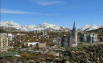
Scenery Argentina and the Andes scenery. Includes 17 airports near the Andes and in the metropolitan area of Buenos Aires. Also includes some cities such as Ushuaia, San Carlos de Bariloche etc. plus important mountains and valleys.
When I built the scenario of Chile I realized several virtual voyages toward Argentina crossing the Andes for different points when arrived to the Argentina sector found the classic airports made fs2004 and it was defrauded. This prompted me to build the present scenario. Also suggested are Chile north (chile_north.zip) and Chile South (chile_south.zip) - Its a perfect complement.
| Filename: | Argentina_and_the_Andes.zip |
| License: | Freeware |
| Added: | 11th December 2009, 12:11:55 |
| Downloads: | 1,947 |
| Author: | Toni Agramont |
| Size: | 61.29 MB |
| Category: Flight Simulator 2004 - Scenery | |
| Cyprus: Airfields plus landmarks and land class for all of Cyprus and AI |
|
Images related to this file:
File Description:
Cyprus, an island in the eastern Mediterranean. Without the benefit of Ultimate Terrain, which does not exist for Cyprus, the land class provided by FS9 stands out as hopelessly inadequate. I have added the extensive farmland and the larger towns and villages, plus the major roads. Four completely new airfields are included here, three in the north and one in the south. Ercan LCEN is in the north and functions as the airport for all of the north. It was recently closed for two years while a new terminal was built and the runway updated and an apron extended etc, and during that time Gecitkale LCGK functioned (barely) as the airport for the north. Gecitkale is now hardly used at all. The third northern airfield is Ilker Karter LCIK and this functions as the HQ base of the Turkish Army Corp in northern Cyprus. The last of the new airfields is Kingsfield LCRE, which is in the Sovereign Base area to the east of Larnaca and is now used for recreational purposes. Ercan is now undergoing further expansion with a new runway and a new terminal building and apron, so this scenery is for the period between 2010 to 2015. My set up of Cyprus already included a payware Larnaca by Aerosoft (now only 12 euros) plus a freeware Paphos, Nicosia, and Akrotiri; that was my starting point. Larnaca has been the major airport for Cyprus since the mid 1970's, with a huge tourist trade that peaks in the summer but which is year long (almost a million Brits visit every year, let alone the other nationalities). I have adapted this (gate sizes etc) to allow parking by a multitude of B737's and others. Nicosia is freeware (posted in 2010) and I have included modifications to reflect its now total disuse. Paphos is at the far western end of the island and freeware, and I have modified this to allow larger and military ai aircraft to function properly; the poster improved his first version to better cater for ai but I was unaware of this and I have stayed with my modifications. Akrotiri is freeware and includes a lot of library object input from MAIW. I have modified the parking somewhat and added further residential areas and munitions storage. The AI is based upon recorded take offs and landings in April, with some further additions in later months. At Ercan the visible gate numbers on the apron are as per real life, but the numbers within FS9 reflect the fact that planes are directed to gates at the centre of the terminal building and not at the far ends. Follow the pink line and obey ATC when it says taxi to gate number 2 even if it is visibly numbered 4.
| Filename: | Cyprus_Airfields_plus_landmarks_and_land_class_for.zip |
| License: | Freeware, limited distribution |
| Added: | 13th August 2017, 21:21:46 |
| Downloads: | 942 |
| Author: | Roger Wensley |
| Size: | 29.61 MB |
| Category: Flight Simulator 2004 - Aircraft Repaints, Textures and Modifications | |
| North American F-86E "Sabre" (Canadair CL-13) Aeronautica Militare Italiana (Italian Air Force) Acrobatic Team "Lanceri Neri". |
|
File Description:
Textures Only for an aircraft of the Acrobatic Team "Lanceri Neri" (2nd Aerobrigata, Treviso, Italy 1958).
These textures require the FREEWARE original aircraft by Kazunori Ito. Installation instructions are included.
Repaint by Manuele Villa.
File name: F86E_LAN.ZIP
| Filename: | North_American_F86E_Sabre_Canadair_CL13_Aeronautic.zip |
| License: | Freeware |
| Added: | 23rd January 2006, 17:28:09 |
| Downloads: | 260 |
| Author: | Manuele Villa |
| Size: | 853.55 KB |
| Category: Flight Simulator 2004 - Scenery | |
| PASN St Paul Island in Alaska |
|
Images related to this file:
File Description:
This is St Paul Island airport, plus the town and the harbour which has featured alongside Dutch Harbor in the tv series Deadliest Catch.
St Paul is in the Pribilof group of five islands around 250 miles north of Dutch Harbour. The town has a population of less than 600, so a lot smaller than Dutch Harbour and with only one processing plant, Trident.
The Ai includes a PenAir flight, a Coast Guard C-130, and Coast Guard helicopters; sea AI includes a fishing boat and a Coast Guard cutter. The Coast Guard C-130 and helicopter flights are to Dutch Harbor, so both sceneries are required to make it work as it should. The airport has 6,500 feet of 150 feet wide asphalt with 1,000 feet of over-run at each end, aligned 36/18, lit, and with two aprons at the southern end. There is no hangerage except for Coast Guard helicopters. Runway 36 has at its northern end a hill.
In real life the runway slopes up to the north by over 60 feet, but in FS9 it doesn't; hence the change in airport elevation to 80 feet ASL to get the northern end at least partly out of a box canyon. There is fuel available and it is dispensed from a truck, there are no pumps.
| Filename: | PASN_St_Paul_Island_in_Alaska.zip |
| License: | Freeware, limited distribution |
| Added: | 12th August 2012, 17:39:02 |
| Downloads: | 1,100 |
| Author: | Roger Wensley, Sidney Schwartz |
| Size: | 4.06 MB |
| Category: Flight Simulator 2004 - Scenery | |
| Peace River CYPE in northwest Alberta, Canada UPDATED |
|
Images related to this file:
File Description:
This is an updated version of the original post (from 2014) made in November 2018. It provides missing textures, and deals properly with an ai problem that I thought I had already fixed. It also adds extra objects to the apron area and adds a third gate. It is complete in itself and can be installed as-is if you do not have the original post. The Peace River flows east from the Rockies, joining up with the Slave River to empty into Great Slave Lake. The town is on both banks close to a bend where the Peace turns to the north, 245 miles northwest of Edmonton. The population is 7,000 and the surrounding area is either farmland or forest. The airport is just over 3 miles west of the town. The runway is 5,000 feet of wide asphalt (150 feet) aligned 04/22, lit, and with PAPI. There is a second runway to the south of the main runway, 1,900 feet of grass and aligned 08/26. The apron is to the north of the runway at the eastern end and is large; there is a purpose-built terminal building, plus other hangar buildings along taxiway C that extends westward from the apron. The airport is experiencing an increase in scheduled and GA flights in the last few years.
| Filename: | Peace_River_CYPE_in_northwest_Alberta_Canada_UPDAT.zip |
| License: | Freeware, limited distribution |
| Added: | 10th December 2018, 17:33:25 |
| Downloads: | 128 |
| Author: | Roger Wensley |
| Size: | 24.27 MB |


© 2001-2026 AVSIM Online
All Rights Reserved
Privacy Policy |