
Where Flight Simulation Enthusiasts Gather from Around the World!
AVSIM Library - Search Results

| Category: Flight Simulator 2004 - Scenery | |
| Teslin CYZW in the Yukon, Canada |

|
Images related to this file:
File Description:
Teslin is a village on the Alaska Highway around 85 miles east of Whitehorse, on the banks of the very long Teslin Lake and where there is a sizeable bridge across an offshoot of the lake. The Hudson Bay trading company established a post there in 1903. The current population is a rather meagre 120 or so and the only reason I am making this scenery is that I know one of the 120. This scenery, in addition to the terrain, village, bridge, and airport items also modifies the Alaska Highway. The AI includes a school excursion trip on a chartered Air North Hawker Siddeley 748 on Saturday. There are no scheduled flights to the field. The runway is now around 5,600 feet of gravel aligned 08-26 and with VASI at both ends. It is lit with runway lighting on the tops of traffic cones, and you will need to download the lighting library from my earlier postings of either Allakaket Lights or Anaktuvuk Lights earlier this week. A note here about my scenery making. There will not be many more to follow this as I am almost at the end of the photos I either took or found for scenery purposes, plus I expect to move on from FS9 at some point during next year.
| Filename: | Teslin_CYZW_in_the_Yukon_Canada.zip |
| License: | Freeware, limited distribution |
| Added: | 5th December 2019, 18:37:13 |
| Downloads: | 128 |
| Author: | Roger Wensley |
| Size: | 6.87 MB |
| Category: Flight Simulator 2004 - Scenery | |
| Kaltag KAL in Alaska |
|
Images related to this file:
File Description:
Kaltag is a small village on the west bank of the Yukon River, around 65 miles east of the coast at Unalakleet and about 40 miles south of where the river turns from north-south to east-west, east being upstream towards the distant Fairbanks. The population is just under 200 and living from fishing and the land. The airfield is close by and has a gravel runway aligned 21-3 and just under 5,000 feet long. Apart from the airfield itself, and it's buildings, this scenery modifies the local land class, adds village buildings while reducing the village size to reality, and creates a new airfield background. Kaltag is located on the edge of three different airlines coverage areas, and is served by Bering Air from the northwest, ERA from the southwest, and also by Wright Air from Fairbanks in the east. These are included in the AI.
A note here about my scenery making. This is post number 507 and there will not be many more to follow this as I am almost at the end of the photos I either took or found for scenery purposes. There is a limit to what can be located online and I have already been making use of the little there is; eg Unalakleet. So, if you are near an airport (preferably Canadian or Alaskan) and have a camera..... Let me know.
| Filename: | Kaltag_KAL_in_Alaska.zip |
| License: | Freeware, limited distribution |
| Added: | 20th August 2019, 19:04:35 |
| Downloads: | 102 |
| Author: | Roger Wensley |
| Size: | 3.57 MB |
| Category: Flight Simulator 2004 - Scenery | |
| Hazyview Airfield, Hazyview, South Africa |
|
Images related to this file:
File Description:
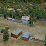
Hazyview is one of the gateway towns to the Kruger National Park and is located just to the West of Phabeni Gate, one of the main gates to use if you are travelling to Skukuza. The airfield in Hazyview is also called Numbi Airfield due to the location of the Numbi Hotel right next to the airfield.
Hazyview airfield is not included in the default scenery of FS2004. With this package, it has been faithfully produced in Gmax with photoreal textures on all the buildings and a photoreal ground as well. Even the Lowveld mall to the North of the airfield and right on the approach to Rwy 19 as well as the Building supplies store to the south and on approach to Rwy 01 is inlcuded with custom models and textures. Likewise, the buildings to the West of the runway (right at the edge of the runway) and the brickyard at the Northern end is modeled with custom models and textures. The two large cellphone antennas are also present in the airport scenery and custom made.
In real life, the runway is quite sloped and this was also recreated in the scenery under the limitations FS2004 presents with regards to non-flat airports.
The grass runway is aligned 01/19 and only 820m long. Take-off is on Rwy 01, with landings on Rwy 19.
| Filename: | Hazyview_Airfield_Hazyview_South_Africa.zip |
| License: | Freeware, limited distribution |
| Added: | 4th February 2022, 14:57:40 |
| Downloads: | 139 |
| Author: | Kobus van Wyk |
| Size: | 17.07 MB |
| Category: Flight Simulator 2004 - Aircraft Repaints, Textures and Modifications | |
| Alitalia "Carlo Goldoni" Airbus A320-216 (EI-EIE) |
|
Images related to this file:
File Description:

Alitalia Compagnia Aerea Italiana S.p.A. operating as Alitalia, is the flag carrier and national airline of Italy, which took over the name, the landing rights, many planes and some other assets from the liquidation process of the old Alitalia Linee Aeree Italiane and the entire Air One. The company has its head office in Fiumicino, Italy. Its main hub is Leonardo da Vinci-Fiumicino Airport, Rome. Alitalia is Italy's biggest airline, and the world's 19th. The name "Alitalia" is an Italian portmanteau of the words ali (wings), and Italia (Italy).
Alitalia livery is painted on Project Airbus's Airbus A320-214 model (included). The textures are saved in 32bit format for quality graphics. Textures are also characterized by HD (High Definition). Its features are idle-reverser animation, animated pack vents and pressurisation outflow valve, detailed textures, accurate paint, dynamic shine & effects, dynamic flexing wings that respond to turbulence, fully independent suspension, trim animation, gear steering, accurate flight dynamics, spoiler animation, reflective cockpit windows, improved wingflex code with input from several new parameters including ground spoilers, fuel load, and angle of attack, transparent navigation light lenses and many more.
Visit my facebook page "Aviation Art Paintings by Giacomo Tomasini" for news, updates and previews on my future repaint projects: https://www.facebook.com/AviationArtPaintings . Thanks for downloading & Happy flying.
| Filename: | Alitalia_Carlo_Goldoni_Airbus_A320216_EIEIE.zip |
| License: | Freeware |
| Added: | 13th October 2013, 17:31:59 |
| Downloads: | 2,414 |
| Author: | Giacomo Tomasini | Aviation Art Paintings |
| Size: | 19.05 MB |
| Category: Flight Simulator 2004 - Scenery | |
| Bethel PABE in southwest Alaska |
|
Images related to this file:
File Description:
There are four main northwestern Alaska towns which have good airports and are serviced by Alaska Airlines. From these airports local flights connect to nearby villages, "nearby" in Alaska meaning up to 200 miles away. The northernmost is Barrow. Southwest of Barrow is Kotzebue, then Nome, and the furthest south is this one, Bethel. The town of Bethel has a population of just over 6,000 and is 50 miles from the sea on the Kuskowim River, that splits and forks into many tributaries. Bethel Airport is close to the town and provides the only contact with the rest of Alaska, as there is no connecting highway system. There are scheduled flights by Alaska Airlines, ERA (now called Ravn) and Grant Aviation, plus others such as Ryan Air. There are cargo flights by Everts, Northern, and Lynden, and redistribution onwards to nearby villages by the smaller locally-based planes; all of these are included in the AI. There are two main runways, one just under 6,400 feet and another just under 3,900 feet, both of them aligned 19-1. The third runway is around 1,800 feet and mainly gravel, aligned 11-29. Parking at PABE is on three aprons, the northern for smaller commercial planes of Grant, ERA, Ryan etc, the central for larger planes of Alaska, Northern, Everts, and Lynden, and the southern for a large collection of GA; each apron has further hangars for maintenance companies and smaller operators. There is also another separate apron for the local military and Coastguard. There is not much photographic information available for PABE, and I have never been there; as a result it was impossible to make detailed photographic textures for some of the buildings. However, for most hangars I have made textures of at least the right colour etc based on the information I assembled and if it is green with white trim and side windows then that is how it now appears here. The exceptions are the Alaska Airlines terminal building which has complicated curved elements, and the two military hangars and workshops where I had to settle for an Alaska terminal building from another airport and the same for the military. There are numerous small villages in the vicinity of Bethel, all of them being beside either a river tributary or the coast. There are two Google Earth screenshots to show the villages that are served by the flights from Bethel and that are (mostly) included in the AI. Some of these airfields were not included in FS9 but AI will still operate in and out of Bethel. The smaller area screenshot shows the villages that are close to Bethel, and of these eight I have so far made six and they are included in this post: Napaskiak PKA, Napakiak WNA, Kwethluk KWT, Atmautluak 4A2, Nunapitchuk 16A, and Kasigluk Z09. I will work my way through the rest of the area.
| Filename: | Bethel_PABE_in_southwest_Alaska.zip |
| License: | Freeware, limited distribution |
| Added: | 8th March 2019, 00:37:58 |
| Downloads: | 306 |
| Author: | Roger Wensley |
| Size: | 32.02 MB |
| Category: Flight Simulator 2004 - Miscellaneous Files | |
| Nick's AI Jet Exhaust With Control Gauge |
|
File Description:
Hanging around the airport watching the A-I traffic and chasing A-I jet aircraft just got a little more interesting. Enjoy watching your entire A-I jet fleet as they display engine heat shimmer effects -after- push-back from the terminal and during taxi to the active runway. All the A-I traffic take off displaying a lite, expanding, frame-rate friendly and nicely scaled high throttle heat/exhaust trail FX which remain with the A-I aircraft during its entire flight. To top off the show, the A-I aircraft that are throttled down and landing display no exhaust from the engines! This package also comes with a gauge that allows pilot throttle control of the taxi heat shimmer/full-throttle exhaust FX for the jet aircraft being flown in the sim by the user. This package does NOT interfere with the logo, taxi or wing lights of any aircraft and comes with 5 all new exhaust effects files which can be applied to just about any size private, commercial or military jet. It requires editing/adding lines in the aircraft.cfg and panel.cfg files. The README files include very complete and comprehensive instructions including a quick and easy copy/paste file for all the Microsoft jet aircraft and tutorial on making custom gauges from the one provided. This package completely replaces my original *Nick's Jet Smoke* package and any/all updates for it.
By Nick Needham
| Filename: | Nicks_AI_Jet_Exhaust_With_Control_Gauge.zip |
| License: | Freeware, limited distribution |
| Added: | 22nd December 2003, 21:16:01 |
| Downloads: | 29,957 |
| Author: | Nick Needham |
| Size: | 894.61 KB |
| Category: Flight Simulator 2004 - Miscellaneous Files | |
| Nick's LightFix |
|
File Description:
The concept and the base textures for this package are from Mark Poole and his original light replacement releases. Mark's original Nav Light package has a really good concept and uses light textures which create sharp lens flairs or bursts. I found the lens flair in his packages to be a bit too large and out of scale for my display and taste. Also, I wanted to have an easy way to replace all the FS9 lights in one shot with little or no configuration file editing. With that in mind, this package was created. This release will automatically replace ALL the Flight Simulator aircraft and airport lights with more realistic ones along with better distance visuals of slower flashing radio tower/smoke stack and ground beacons. It also includes replacement lights in scale for the PMDG 737, 747 and for all Project Opensky aircraft offered on their site. It works automatically with Ultimate Traffic and other AI add-ons which use the default Microsoft aircraft lights. I added a diffused halo effect to Mark's original airport_lighting_v2 texture which gives a more realistic look in cloudy or weather conditions and enhances the dynamic directional brightness of the lights. In addition to the navigation lights, I have also created aircraft beacons and strobes which will also install automatically . A restore package is included allowing to you to revert back to default FS9 texture and FX files.
ENJOY!
From Nick Needham
[email protected]
| Filename: | Nicks_LightFix.zip |
| License: | Freeware, limited distribution |
| Added: | 4th April 2006, 21:47:56 |
| Downloads: | 19,322 |
| Author: | Nick Needham |
| Size: | 1.55 MB |
| Category: Flight Simulator 2004 - Aircraft Repaints, Textures and Modifications | |
| Macedonian Aviation Douglas DC-3 |
|
File Description:
Macedonian Aviation was formed as a charter operator in the summer of 1972 with a Dove and one DC-3 G-AMPO based at Luton and later, Southend Airports. By February 1973 the Dove had been sold and operations continued with the DC-3. Operations steadily grew and by December 1973 charter flights started to be flown in the oil rig support business from Aberdeen. With this work increasing Macedonian looked for further DC-3s to expand its operations, and in March 1974 it purchased British Island Airways' remaining three DC-3's. The first of these, G-AMHJ and G-AMRA were in service at Aberdeen Airport by May 1974 and G-AMPO was moved back to Southend to continue charter flights from there. The oil companies were beginning to insist on turbo-prop aircraft for the transportation of their personnel. Macedonian started negotiations to replace the DC-3's with Viscount or Heralds, but these negotians were unsuccessful so operations continued with the DC-3's. The third ex BIA DC-3 G-AMSV eventually arrived at Southend in September 1974 but this aircraft never entered service with Macedonian. In November 1974 all aircraft were flown back to Southend and Macedonian ceased all flying having been unable to raise any finance to support turbo-prop operations, and the DC-3's were sold. This repaint is of G-AMPO. Requires default Douglas DC-3.
| Filename: | Macedonian_Aviation_Douglas_DC3.zip |
| License: | Freeware |
| Added: | 14th April 2007, 18:28:39 |
| Downloads: | 240 |
| Author: | John Payne |
| Size: | 1.63 MB |
| Category: Flight Simulator 2004 - Utilities | |
| ILS and GPS Approach Creator v1.1 for FS9 and FSX (for non-US/UK users) |
|
File Description:
The original version of this program did not work on computers in countries which use a comma as the decimal separator (apologies for that). Version 1.1 fixes this problem and should work in all countries (including the US and UK) regardless of the format of their decimal numbers. This is the full package, so you do not need to download version 1.0 as well. If the original version is working on your computer, then there is no need for you to download this version instead, as the two versions are functionally identical. This easy-to-use program allows the user to add an ILS and/or a GPS approach to any airport in FS9 or FSX. The user will be able to select the approach in the GPS unit, and request the approach from ATC. The ATC will then vector you to make an ILS or GPS approach. The AI will also be able to use the ILS approach, and you will hear them say so over the radio. The program was designed with the non-expert user in mind, and no familiarity with XML coding is assumed. The program supports up to four FS installations. The program needs to be run in conjunction with AFCAD (or a similar utility for FSX). You will also need the .NET Framework 2.0 and MSXML 4.0 installed on your computer. Tested with XP Home and Pro. Full instructions included.
| Filename: | ILS_and_GPS_Approach_Creator_v11_for_FS9_and_FSX_f.zip |
| License: | Freeware, limited distribution |
| Added: | 23rd December 2007, 15:18:15 |
| Downloads: | 4,046 |
| Author: | Martin Gleeson |
| Size: | 361.81 KB |
| Category: Flight Simulator 2004 - AFCAD Files | |
| AFCAD SMOOTH for Major Airports! Düsseldorf International( EDDL / DUS ) |
|
File Description:
AFCAD SMOOTH is a normal AFCAD File for Major Airports such as Frankfurt, London LHR
or Paris CDG but all the taxiways have been totally reworked in order to get the most smoothest AI Traffic on ground you will ever have. To achive this all the new created taxiways have nothing in common with the original one for an airport. The new taxiways have been created in a way to allow the smoothest traffic on ground, without traffic jam, conflict alerts and also without planes staying almost 5 minutes at one point due to heavy traffic and finnaly disappear. All this has been resolved.In addition to this the parking positions have been created in a very very orderly way with as much positions as possible. The gates are almost the same as in reality only with minor changes.
I also added missing ILS to airports like LIMC (RWY 17R) This File is only recommended for virtual pilots who can call a huge amount of AI Traffic their own and who prefer smooth traffic instead an accurate taxiway system compared to the real airports one. In addition I recommend you AI Seperation (available at avsim), one of the best freeware AI Traffic
Management Tools for traffic on ground and in the air as well.
Comming soon, AFCAD Smooth for: Milan Malpensa, Stockholm Arlanda, Paris CDG, London Stansted, London Heathrow,
Vienna Schwechat, Zurich Kloten, Rom Fiumicino, Lissbon, Copenhagen, Oslo, Dublin and Palma De Mallorca.
| Filename: | AFCAD_SMOOTH_for_Major_Airports_Dsseldorf_Internat.zip |
| License: | Freeware |
| Added: | 17th May 2008, 13:04:24 |
| Downloads: | 1,368 |
| Author: | Dave Sheffield |
| Size: | 7.48 KB |


© 2001-2026 AVSIM Online
All Rights Reserved
Privacy Policy |