
Where Flight Simulation Enthusiasts Gather from Around the World!
AVSIM Library - Search Results

| Category: Flight Simulator 2004 - Scenery | |
| WLP-HQ |

|
File Description:
WLP HQ is a basic simple scenery. It's a fictous bush-airport and camp in northern Tanzania, just west of the famous Lake Natron.
WLP stands for "Wild Life Protection". WLP is a fictous project and is refering to J.T. Chance's latest adventure novel. Max Stein, a bushpilot and adventurer, is hunting down smuggling and illegal hunting gangs. This project stands for a complete new approach by making the reader a part of the story ... kind like interactiv action if you will say so. The book invites you to fly it's hero adventures in your flightsim, therefore you got maps, flightplans and so on with the book. (No need for a specific flightsim version.)
WLP HQ is the main base of these operations. You'll take over from there and you follow the storyline on your own yoke. There is no need to download any further files to do so. This scenery is freeware of course, the adventure may be purchased (inexpensive paper-back or even cheaper PDF download) on lulu.com
| Filename: | WLPHQ.zip |
| License: | Freeware |
| Added: | 19th January 2007, 01:32:36 |
| Downloads: | 456 |
| Author: | J.T. Chance |
| Size: | 3.37 MB |
| Category: Flight Simulator 2004 - Utilities | |
| Find ICAO in BGL-files |
|
File Description:
Data about airports and navaids (among others) are contained in binary files - generally in ...\scenery\*.bgl files in FS9 as well as in FSX. Apart from simple modifications of such data, which are possible using the AFCAD 2 AddOn tool, changes of parameters at a specified location have to be made within one of the bgl files mentioned by disassembling, re-writing and re-compiling them. As there exist hundreds of these files in the simulation program, it is not easy to find the correct one for a modification of the corresponding data.
| Filename: | Find_ICAO_in_BGLfiles.zip |
| License: | Freeware |
| Added: | 22nd February 2007, 20:10:06 |
| Downloads: | 1,825 |
| Author: | Gerhard Berendt |
| Size: | 64.7 KB |
| Category: Flight Simulator 2004 - Aircraft Repaints, Textures and Modifications | |
| LAN Airlines Airbus A320-233 (CC-COC) with Lighting Effects and Updated FDE |
|
File Description:
LAN Airlines, S.A. was formerly known as LAN Chile and is based Santiago, Chile with its main hub at Arturo Merino Benítez International Airport (SCEL) in Santiago. It also operates hubs in Lima, Peru Buenos Aires, Argentina Miami, Florida USA and Quito and Guayaquil Ecuador. LAN Airlines comprises LAN Chile, LAN Argentina, LAN Peru, LAN Ecuador and LAN Express.
I delayed the release of this aircraft after seeing the recent release by Dave Wilkins of high-quality LAN Airlines AI Aircraft using the EvolveAI models. After downloading and installing them myself, I thought it would be a nice complement if the colors of this A320 matched the colors of David's LAN Airlines AI A320's, A319's and A318. I think the result is quite nice and hope you agree.
This full installation package includes the Project Airbus A320 IAE V2 model and air files, a modified FDE (with permission from Peter Binamira of Project Airbus), A320 lighting enhancements and 32-bit textures. Uses default 737-400 panel and sounds. Please see Install.txt for installation details.
| Filename: | LAN_Airlines_Airbus_A320233_CCCOC_with_Lighting_Ef.zip |
| License: | Freeware, limited distribution |
| Added: | 25th August 2007, 12:46:08 |
| Downloads: | 2,922 |
| Author: | Project Airbus, Jeffrey S. Bryner, Grayson Ottaway |
| Size: | 6.26 MB |
| Category: Flight Simulator 2004 - Miscellaneous Files | |
| AES configuration file for the SSTSIM Concorde |
|
File Description:
AES configuration file for the payware SSTSIM Concorde. Docking gates or mobile air stairs will connect with the left forward door. This is the only door that I activated for this file. Tested only with the production models - not tested with pre-production or prototype models. Requires Airport Enhancement Services from Aerosoft. Please note the following: - 1) Due to a limitation with AES, catering service vehicles will not align properly with the right forward door. In AES, its position is deduced from the position of the LEFT door, which with this product, as with the real aircraft, is a few feet further toward the rear. Therefore the gate/stairs willl align properly, but the catering truck driver will miss the mark. 2) I chose not to include baggage vehicles as the forward cargo doors are in an awkward position under the fuselage, and the rear door is too high to be reached properly by the AES baggage vehicles. 3) None of the cargo doors operate on this model anyway.
| Filename: | AES_configuration_file_for_the_SSTSIM_Concorde.zip |
| License: | Freeware |
| Added: | 3rd August 2008, 17:03:25 |
| Downloads: | 1,397 |
| Author: | Philip Dawson |
| Size: | 1.25 KB |
| Category: Flight Simulator 2004 - Scenery | |
| Baton Rouge,La. ( KBTR v2 ) |
|
File Description:
FS2004 KBTR Baton Rouge,La. v2.0
This is an updated version from my old EZ Mega KBTR version 1.0
This Scenery is optimized for use with Ultimate Terrain USA,but should work OK with default land scenery.
This package features a lot of objects around the city of Baton Rouge, such as an accurate rendition of the 473foot tall State capital Building, Cortana mall,Seigen Village Mall,strip malls,banks,restaurants,gas stations,Chemical plants,River Barge Traffic,USS Kidd Destroyer,the two casino boats,the Marriott Hotel off College drive,Louisiana State Police headquarters with its own AFCAD and Helo pads and lots of other stuff.This version does not feature my custom built terminal and hangers,that will come in version 3.
The Airport AFCAD has been once again reworked as well to reflect the newly lengthened Rwy 22R-4L and other stuff.
This has been my test bed for the upcoming version 3 release which will be released by Christmas hopefully.
In the meantime,enjoy this new version equipped with familiar landmarks.
As Always...Enjoy!!!
| Filename: | Baton_RougeLa__KBTR_v2_.zip |
| License: | Freeware |
| Added: | 11th October 2008, 02:15:38 |
| Downloads: | 2,868 |
| Author: | Joe DeGregorio |
| Size: | 13.04 MB |
| Category: Flight Simulator 2004 - AI Aircraft | |
| Isles of Scilly Skybus de Havilland Canada DHC-6 Twin Otter |
|
File Description:
This is a repaint of the excellent de Havilland DHC-6 Twin Otter AI Model V.2 by Henry Tomkiewicz. Isles of Scilly Skybus is a British airline which operates seasonal and year round domestic scheduled services to the Isles of Scilly from various airports in south west England. The airline's main operating base is Land's End Airport (LEQ), whilst their head office is located in nearby Penzance, both in the county of Cornwall. The airline was established in March 1984 and started operations in August 1984. Isles of Scilly Skybus originated as an air charter operator at Land's End aerodrome which operated high frequency services to the Isles of Scilly. Following the withdrawal of Brymon Airways routes to and from the islands the operator stepped in, initially operating services to Plymouth. This route was later dropped but with the addition of Twin Otter aircraft the route network expanded to its current make-up. It is wholly owned by Isles of Scilly Steamship Company who also run the passenger ferry, Scillonian III, and freight services from Penzance to the Islands.
| Filename: | Isles_of_Scilly_Skybus_de_Havilland_Canada_DHC6_Tw.zip |
| License: | Freeware |
| Added: | 13th October 2008, 14:52:24 |
| Downloads: | 584 |
| Author: | John O'Leary |
| Size: | 676.07 KB |
| Category: Flight Simulator 2004 - Scenery | |
| Terrace CYXT in British Columbia, Canada - REVISED |
|
Images related to this file:
File Description:
This version includes the correct Piper Cub texture, unreported by all but one downloader (why?).
Terrace is fifteen miles east and inland from Prince Rupert, which is 500 miles north of Vancouver up the BC coast. It is at the point in the mountains where two fjords meet, one coming from Prince Rupert and the other from Kitimat. The airport is a couple of miles south of the town and on the south side of the Skeene River. There are two runways, and the main one is a recently-extended 7,500 feet long and lighted 33/15. The second is 5,373 feet of unlit 03/21. The apron has been enlarged to be able to accommodate a Boeing 737 so I have parked an Air Canada jet there, but the pics show the planes that do fly to Terrace, and these are Air Canada and Hawk Air Dash 8-300's. The original aircraft and the textures are down-loadable and and can be used for AI.
| Filename: | Terrace_CYXT_in_British_Columbia_Canada__REVISED.zip |
| License: | Freeware, limited distribution |
| Added: | 21st February 2010, 16:25:38 |
| Downloads: | 1,112 |
| Author: | Roger Wensley |
| Size: | 3.39 MB |
| Category: Flight Simulator 2004 - Scenery | |
| Nursery Corner Farm Field CF13 near Ottawa in Ontario, Canada |
|
Images related to this file:
File Description:
Nursery Corner is a tree nursery around 12 miles southwest of Rideau Valley Airpark CPL3 (which did not appear in FS9, probably because it was then mainly used by gliders, but is a post of mine and downloadable) and 6 miles south of Hicks Farm, a recent post. CPL3 is 15 miles south of Ottawa Airport, tucked into a right angle bend of the Rideau River. Ultimate Terrain puts the river into place and I am not sure how CPL3 works without UT as the river is close by. Fly west from CPL3 along the river and Hicks Farm will be on the south side; fly south parallel to the roads, cross a small river, and in an area which has place names like Hutchins Corners and Pattersons Corners will be the farm field with two grass runways at right angles among the nursery rows of trees. The runways are 36/18 1,700 feet and 27/09 2,000 feet. The single T hangar houses what looked like a Citabria.
| Filename: | Nursery_Corner_Farm_Field_CF13_near_Ottawa_in_Onta.zip |
| License: | Freeware, limited distribution |
| Added: | 11th February 2010, 00:53:28 |
| Downloads: | 247 |
| Author: | Roger Wensley |
| Size: | 14.1 MB |
| Category: Flight Simulator 2004 - Scenery | |
| Zion National Park South, Hurricane (1L8), Colorado City (KAZC), Utah/Arizona, Photo-Scenery (FS9 & FSX) |
|
Images related to this file:
File Description:
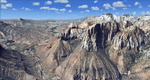
Covers the southern part of Zion National Park extends south along the cities of Hurricane and Colorado City. Zion National Park is another place where erosion of the Colorado Plateau formed the most beautiful colorful stone formations of unique and wonderful shapes. There are nine different layers of stone visible in the park. Most of them consist of sandstone. But there is also limestone, gypsum, siltstone, shale, clay and mudstone. The Virgin River cut a spectacular and famous canyon thru Zion Park that is as narrow as 20ft and up to 2000ft tall.
High resolution versions of this scenery for FS9 and FSX (much sharper, but larger and multiple downloads)
are available at www.blueskyscenery.com/CNY_South3West5.html . The screenies are taken from the high-res versions,
so expect this version to be slightly more blurry. Thanks to Joop Mak for providing custom AFCADs that
correct airport layouts so that they align with the photo-textures! They are available at www.blueskyscenery.com/AFCADs.html . YourDonation@Work: Dedicated to Jerry, Ralph J. and Lance.
| Filename: | Zion_National_Park_South_Hurricane_1L8_Colorado_Ci.zip |
| License: | Freeware, limited distribution |
| Added: | 20th March 2010, 23:26:42 |
| Downloads: | 1,784 |
| Author: | Gottfried Razek - blueskyscenery.com |
| Size: | 95.39 MB |
| Category: Flight Simulator 2004 - Scenery | |
| Kremmling, Mc Elroy (20V), Colorado, Photo-Scenery |
|
Images related to this file:
File Description:

Kremmling, Mc Elroy (20V), Colorado, Photo-Scenery (FS9 & FSX)
Ever wanted to know how the scenery looks like around Kremmling VOR? Now you got the chance! This region covers the area around Kremmling and the northern part of the Gore Range. At Kremmling the Colorado River meets both the Blue River and the Muddy Creek. West of Kremmling you can see Gore Canyon. This rugged and steep canyon is almost 1000ft deep and was carved by the Colorado River on its way thru the Gore Range.
To explore the scenery depart from Mc Elroy Airfield (20V) in Kremmling and head north. High resolution versions of this scenery for FS9 and FSX (much sharper, but larger and multiple downloads) are available at www.blueskyscenery.com/GNB_West.html . The screenies are taken from the high-res versions, so expect this version to be slightly more blurry. Thanks to Joop Mak for providing custom AFCADs that correct airport layouts so that they align with the photo-textures! They are available at www.blueskyscenery.com/AFCADs.html . YourDonation@Work: Dedicated to Michael.
| Filename: | Kremmling_Mc_Elroy_20V_Colorado_PhotoScenery.zip |
| License: | Freeware, limited distribution |
| Added: | 21st April 2010, 17:39:09 |
| Downloads: | 1,138 |
| Author: | Gottfried Razek, blueskyscenery.com |
| Size: | 91.2 MB |


© 2001-2026 AVSIM Online
All Rights Reserved
Privacy Policy |