
Where Flight Simulation Enthusiasts Gather from Around the World!
AVSIM Library - Search Results

| Category: Flight Simulator 2004 - AI Flight Plans | |
| Afriqiyah Airways Winter 2005/2006 |

|
File Description:
100% Accurate scheduled flightplans for the winter 2005-2006 period, which have been compiled according to the company website, and cross-checked with the Amadeus database. Following the US embargo towards Libya, Afriqiyah (in Arabic "for Africa") Airways is still wet-leasing three Airbus A320's from Nouvelair Tunisie, and operates them to link several European destinations to Africa, via Tripoli International airport. They also operate a single Airbus A300B4-600 for VIP and governmental transportation, thus not included in this file. Their current winter season network links Tripoli-International with: Abidjan, Accra, Bamako, Brussels, Cotonou, Geneva, Kano, Khartoum, Lagos, Lomé, London-Gatwick, N'Djamena, Niamey, Ouagadougou, and Paris-CDG. Later this winter, they also intend to open the following new destinations: Amsterdam, Bangui, and Douala. Schedule files fully compatible with Traffic Tools by Lee Swordy (available here). Enjoy.
| Filename: | Afriqiyah_Airways_Winter_20052006.zip |
| License: | Freeware |
| Added: | 10th November 2005, 22:00:44 |
| Downloads: | 989 |
| Author: | Jean-Philippe 'Jeepee' DELWICHE |
| Size: | 6.57 KB |
| Category: Flight Simulator 2004 - Scenery | |
| Reworked Altenstadt Army airfield, ETHA (Bavaria, South-Germany) including AI-Package |
|
File Description:
This airfield, located near Schongau in the Allgaeu (Bavaria, South-Germany),
is the main training center for parachuters of the German Army and used for cargo-drop missions of various users. The airport has been reworked to improve
the overall appearance. Version 2 replaces V1 completely.
The included AI-Package contains: Bell UH-1D SAR, Nord-Aviation Noratlas ND2501,
North-American T-6D and an aircraft.cfg for an AI-Transall C160.
Two Transall and a single T-6D from Landsberg and two Noratlas from Kaufbeuren
are comming over for touch and goes at Altenstadt as scheduled per attached
flightplan. A Dornier Do-28 does local touch and goes and a Bell UH-1D SAR-helicopter hurries to Landsberg. Welcome to a little Xmas party.
Lago's FSE is required in order to see most of the major buildings / objects.
| Filename: | Reworked_Altenstadt_Army_airfield_ETHA_Bavaria_Sou.zip |
| License: | Freeware, limited distribution |
| Added: | 24th December 2005, 17:48:42 |
| Downloads: | 2,427 |
| Author: | Klaus Jone |
| Size: | 3.97 MB |
| Category: Flight Simulator 2004 - Scenery | |
| Georgetown Q61 California Scenery |
|
File Description:
This is a scenery upgrade for Georgetown Airport, California (Q61). This is part Six of a series of small airstrip and minor airfield scenery enhancements which are based on real world data from Google Earth.
Changes to the default include surrounding landclass changed to mixed forest to match better the realworld, new airfield polygon to match shape and earth colours. The hangers I added had a mix of open door and closed door models, but for some odd reason they are all showing as closed, maybe it's just my system or some glitch, let me know if you get open doors!
I also added the usual extras which are of course artistic license!
Note that there are two exclude files, that is because I forgot to save data with one and new excludes needed another file making, sorry for the clutter!
| Filename: | Georgetown_Q61_California_Scenery.zip |
| License: | Freeware |
| Added: | 26th March 2006, 17:40:05 |
| Downloads: | 576 |
| Author: | Kim Gowney |
| Size: | 349.98 KB |
| Category: Flight Simulator 2004 - Miscellaneous Files | |
| Quebec, Canada - Airports with ILS |
|
File Description:
First, a .PDF file ( requires the free software Adobe Acrobat Reader ) presenting 2 tables ( one in FRENCH and one in ENGLISH ) which list the airports in the province of Quebec, Canada that have at least one runway that offers the assistance of the Instrument Landing System ( ILS ) to pilots trying to land.
Informations such as runway(s) number, lenght and altitude, heading, NAV 1 radio frequency are provided.
Also a column that specifies which of the 3 ILS components are available : LOC, GP, DME.
Only airports with at least the LOC ( localiser ) AND GP ( glide path ) appear in this list. Unfortunatly the DME component ( distance measuring equipment) is rarely available at the runway level that is.
A second .PDF file (Acrobat) lists the airport scenery addons corresponding, when available, to the airports listed in the first file.
| Filename: | Quebec_Canada__Airports_with_ILS.zip |
| License: | Freeware |
| Added: | 21st June 2008, 22:21:28 |
| Downloads: | 337 |
| Author: | Marc Renaud |
| Size: | 145.9 KB |
| Category: Flight Simulator 2004 - Aircraft Repaints, Textures and Modifications | |
| VistaLiners Boeing 737-300F |
|
File Description:
For all you Cargo and Freight haulers out there The Freight Shifters 2008 are proud to present the Channel Express repaint for the Vista Liners 737-300 Reg G-CELW for FS2004. Textures only in 32 Bit no MIPS for better frame rates. Vistaliners wonderful Model required here at avsim File VL_737-300. Boeing 737-300 Channel Express G-CELW C/N 23659 Line No 1292 - First Flight 11.09.86 Delivered new to Ansett Airlines as VH-CZF 23.11.86. Converted to a Freighter in Tel-Aviv Israel 23.06.02 Delivered to Channel Express 02.10.03. This aircraft mainly runs mail and cargo flights from Exeter Airport UK (EGTE) and is an active aircraft as of 07.07.08. Channel Express is part of Jet2.COM though this aircraft does not wear their colors.Requires Vistaliners Boeing 737-300 File Name VL_737-300
| Filename: | VistaLiners_Boeing_737300F.zip |
| License: | Freeware |
| Added: | 8th July 2008, 01:21:01 |
| Downloads: | 540 |
| Author: | Kevin McCarthy |
| Size: | 1.8 MB |
| Category: Flight Simulator 2004 - AI Flight Plans | |
| Private Wings Flugcharter - for 52-weeks |
|
File Description:
Fictional flightplans for Private Wings Flugcharter's present fleet of 4 Dornier 328TP, 2 Dornier 328Jets and 1 Beechcraft 1900D (the King Air 350 D-COLA was sold to S Africa). The flightplans are in 52 BGLs, one per week of the year. You can either select one week's plan and use it long-term, choose a different plan manually from time-to-time, or use an automatic swapper routine (available on Project AI) to change plans on a weekly basis. It really depends how much variety you want. The aircraft and repaints are all available here (JBAI Do328TP, AIG Do328Jet and HTAI B1900D). The fleet will be a lot busier than in real life. Also, the regular Audi service from Ingolstadt to Gyor-Per in Hungary is not simulated because the airport at Gyor does not exist in FS9.
| Filename: | Private_Wings_Flugcharter__for_52weeks.zip |
| License: | Freeware |
| Added: | 9th January 2009, 10:28:34 |
| Downloads: | 627 |
| Author: | Morello Ciliegia |
| Size: | 1.76 MB |
| Category: Flight Simulator 2004 - Scenery | |
| Malta archipelago |
|
Images related to this file:
File Description:
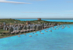
While I carried out a virtual flight from Africa toward Sicily I observes two totally naked islands. The biggest are Malta with its great airport LMML in the center. In Google earth I see that was the archipelago of Malta. Some islands that possess but churches that you hoist. I have just understood like in a piece of esth of 28x12 kilometers the biggest and 7x5 kilometers the island Gozo have been able to build so beautiful monuments. I have build some how many as some well strengths because Malta already takes many centuries defending of invasions of other towns and pirates. This archipelagos that I finish that it lacked to build in the Mediterranean. Now the "piccolissimas"
rot to alternate among my scenerys together with Baleares, Corcega, Cerdenia, Sicily, Cyprus, Crete and the group of islands of the Hreek territory.
| Filename: | Malta_archipelago.zip |
| License: | Freeware |
| Added: | 7th November 2009, 20:59:41 |
| Downloads: | 2,328 |
| Author: | Toni Agramont |
| Size: | 34.79 MB |
| Category: Flight Simulator 2004 - Scenery | |
| Fortal v5 Addon (SBFZ/SNFF) |
|
Images related to this file:
File Description:
Adds trucks, cars and other FS9 default objetcs to Fortaleza International Airport (SBFZ) and Feijo Airfield (SNFF), Ceara, Brazil. This sceney "fortalv5-addon.zip" is a complement to the "fortalv5.zip" scenery of Fortaleza/SBFZ made by the scenery designer Alvaro Volponi. You need to have "fortalv5.zip" installed beforehand in order to "fortalv5-addon.zip" work properly. You find it here: http://fsbrasil.wordpress.com/2010/01/19/fortalv5-addon/
****************************
Adiciona caminhoes, carros e outros objetos default do FS9 no Aeroporto Internacional de Fortaleza/SBFZ e no Aerodromo do Feijo (SNFF), Ceara, Brasil. Este cenario "fortalv5-addon.zip" eh um complemento ao cenario de Fortaleza/SBFZ "fortalv5.zip", de autoria de Alvaro Volponi. Voce necessita ter o "fortalv5.zip" instalado previamente para que o "fortalv5-addon.zip" possa funcionar normamente. Voce o encontra aqui: http://fsbrasil.wordpress.com/2010/01/19/fortalv5-addon/
| Filename: | Fortal_v5_Addon_SBFZSNFF.zip |
| License: | Freeware |
| Added: | 21st January 2010, 02:22:20 |
| Downloads: | 4,555 |
| Author: | Rui Mesquita |
| Size: | 781.46 KB |
| Category: Flight Simulator 2004 - Scenery | |
| Comb Ridge, Rock Point (49AZ), Utah/Arizona, Photo-Scenery |
|
Images related to this file:
File Description:
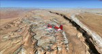
Comb Ridge, Rock Point (49AZ), Utah/Arizona, Photo-Scenery (FS9 & FSX)
This scenery extends my Monument Valley scenery to the east. It covers the area between the San Juan River in the north down to Rock Point, AZ (49AZ). Most of the scenery lies on the Navajo Nation Reservation. It completes the southeastern corner of Utah and paves our way into Colorado.
High resolution versions of this scenery for FS9 and FSX (much sharper, but larger and multiple downloads) are available at www.blueskyscenery.com/CNY_South3West6.html . The screenies are taken from the high-res versions, so expect this version to be slightly more blurry. Thanks to Joop Mak for providing custom AFCADs that correct airport layouts so that they align with the photo-textures! They are available at www.blueskyscenery.com/AFCADs.html . YourDonation@Work: Dedicated to Olivier, Kevin and Ruben.
| Filename: | Comb_Ridge_Rock_Point_49AZ_UtahArizona_PhotoScener.zip |
| License: | Freeware, limited distribution |
| Added: | 9th April 2010, 21:57:41 |
| Downloads: | 1,360 |
| Author: | Gottfried Razek, blueskyscenery.com |
| Size: | 90.99 MB |
| Category: Flight Simulator 2004 - Scenery | |
| Fairbanks International PFAF Float Base in Alaska |
|
Images related to this file:
File Description:
This is the floatplane base which is part of Fairbanks International Airport, PFAF. It has a separate PAFX identifier here due to the limitations of AI in FS9. Though it doesn't come close to the activity level of Lake Hood in Anchorage Alaska it is still a fairly busy place. In Fairbanks there is this floatbase, Chena Marina to the southwest, Chena River to the northwest, and Metro Field to the east between Fairbanks and the river. You will need Ultimate Terrain Alaska Canada, and you must first install the version of Fairbanks International PFAF by William Morgan, as this scenery was the starting point for the floatplane base scenery, and without it the result would be disappointing. There are scenery and land class files, files that modify PFAF, AFCAD for AI, and a traffic file.
| Filename: | Fairbanks_International_PFAF_Float_Base_in_Alaska.zip |
| License: | Freeware, limited distribution |
| Added: | 19th August 2010, 22:55:46 |
| Downloads: | 798 |
| Author: | Roger Wensley |
| Size: | 1.03 MB |


© 2001-2026 AVSIM Online
All Rights Reserved
Privacy Policy |