
Where Flight Simulation Enthusiasts Gather from Around the World!
AVSIM Library - Search Results

| Category: Flight Simulator 2004 - Scenery | |
| VEPT Patna, India |

|
Images related to this file:
File Description:
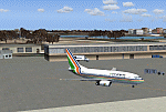
Googly scenery for VEPT Patna, India. In Flight Simulator 2004, the airport is
depicted at a pretty waterside location but only a small ramp for general aviation
aircraft is provided. In the real world it is served around six times a day by
Boeing jets on domestic flights by Alliance Air, Indian Airlines, Jet Airways, and
Sahara Airlines. These scenery files add aprons, taxiways, buildings and other
airport features to Flight Simulator's bland representation and allow "AI" traffic,
to land, taxi, park and take off in a realistic manner.
The scenery does not purport to be ultra-accurate. Based on high-detail satellite
imagery from Google Earth, the layout is proportionally correct but the added
airport features, such as buildings, are built from default Microsoft objects
and add-on libraries so will not look like the real thing.
You are not obliged to download and install any additional scenery libraries,
but to enjoy this scenery in its entirety, you may wish to. It will work fine,
with or without.
[File re-uploaded at request of AVSIM]
| Filename: | VEPT_Patna_India.zip |
| License: | Freeware |
| Added: | 7th May 2010, 11:02:44 |
| Downloads: | 1,704 |
| Author: | John Hinson |
| Size: | 65.91 KB |
| Category: Flight Simulator 2004 - Scenery | |
| WAML Palu/Mutiara, Indonesia |
|
Images related to this file:
File Description:
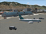
Googly scenery for WAML Palu/Mutiara, Indonesia. In Flight Simulator 2004 little
is provided other than a runway at this small domestic airport, although in the
real world it sees regular jet flights from airlines such as Batavia Air, Bouraq
Indonesia Airlines, Garuda Citylink, Lion Airlines and Merpati Nusentara and
smaller aircraft from operators like Airfast Service and Indonesia Air Transport.
These scenery files add aprons, taxiways, buildings and other airport features
to Flight Simulator's limited representation and allow "AI" traffic to land,
taxi, park and take off in a realistic manner.
The scenery does not purport to be ultra-accurate. Based on high-detail satellite
imagery from Google Earth, the layout is proportionally correct but the added
airport features, such as buildings, are built from default Microsoft objects
and add-on libraries so will not look exactly like the real thing.
You are not obliged to download and install any additional scenery libraries,
but to enjoy this scenery in its entirety, you may wish to. It will work fine,
with or without.
| Filename: | WAML_PaluMutiara_Indonesia.zip |
| License: | Freeware |
| Added: | 15th May 2010, 01:11:30 |
| Downloads: | 1,770 |
| Author: | John Hinson |
| Size: | 140.88 KB |
| Category: Flight Simulator 2004 - AFCAD Files | |
| Winnipeg Intl with Crosswind Runways |
|
File Description:
A high quality AFCAD2 file for Winnipeg Int'l airport, Manitoba, Canada. This file has been built from scratch using information from the internet. This AFCAD2 will extend the runways as follows - 07/25 is now 9000ft, 13/31 is now 9100ft and 18/36 is now 12000ft long. In addition, improvements have been made to runway lighting, VASI and approach lighting. Assigned parking is provided for all commercial airlines that serve YWG and also for the following companies - FedEx, UPS, Perimiter Aviation, Esso, Shell, Skyward Aviation and the Canadian Armed Forces. This airport also features extensive GA parking, Helicopter pads, Air Canada maintenance area, new taxiways and improved apron and taxiway night lighting. Using the crosswind runway technique, all 3 runways can also now be used simultaneously. There are 2 versions included here - (1) Concrete taxiways and runways, (2) Asphalt Taxiways and runways. This file is only for use with the addon scenery by Adam Bentley and David Madge (cywg_v101.zip) and has not been tested with the default airport.
| Filename: | Winnipeg_Intl_with_Crosswind_Runways.zip |
| License: | Freeware |
| Added: | 28th February 2005, 15:45:06 |
| Downloads: | 1,777 |
| Author: | Lee Brompton |
| Size: | 57 KB |
| Category: Flight Simulator 2004 - Miscellaneous Files | |
| Active ILS - KIAH v2.0 |
|
File Description:
UPDATED KIAH see the readme file -- By design KIAH is now another Airport that features advanced ATC control. As most know initiating the ILS at certain airports for AI Traffic is not a function at this time when using AFCAD2. If you add a new ILS runway to an airport such as KIAH (8L/26R) only the user aircraft can use this runway when visibility falls below 3 miles. ATC will no longer use this runway for AI Traffic because FS9 sees it as a visual runway. This will cause ATC to vector your AI Traffic back to 8/26 (old numbers) 8R/26L (new numbers) which is also a Terminal Departure Runway. All 5 runways for KIAH are now simultaneously active for departure and arrival. There are many additional options added to version 2.0 so follow the instructions in the README and just sit back (or fly) and plane spot either VMC or IMC for a very active airport. *** SimFlyers Scenery AFCAD2 and special ILS bgl also included ***
| Filename: | Active_ILS__KIAH_v20.zip |
| License: | Freeware, limited distribution |
| Added: | 26th August 2004, 02:23:19 |
| Downloads: | 2,720 |
| Author: | Jim Vile |
| Size: | 81.21 KB |
| Category: Flight Simulator 2004 - Utilities | |
| TreePlanter V4.1 |
|
File Description:
FS 2004 autogen will not be displayed in close proximity to an airport due to the associated airport exclude. GianP ( http://home.tele2.it/gianp ) has produced a library of ‘autogen-like’ trees which use either the default or Gerrish Gray's textures which can be placed near to an airport. The trees must be placed using XML code which is compiled into a scenery bgl by the BGLComp compiler from the FS 2004 BGL Comp SDK. TreePlanter automates this task by interfacing directly with FS 2004 to obtain the required position of each tree and generating the scenery bgl automatically. This updated TreePlanter includes a further 20 tree types by GianP using Gerrish Gray's textures. It also allows the 'p' key on the keyboard to be used to plant trees rather than needing to click on a button with the mouse. It also requires a new library from GianP's site and Gerrish Gray's textures.
An error in one of the Gerrish Gray tree selector has been corrected and the restriction on the use of spaces in filenames has been removed.
| Filename: | TreePlanter_V41.zip |
| License: | Freeware |
| Added: | 22nd February 2005, 22:33:33 |
| Downloads: | 4,909 |
| Author: | George Davison |
| Size: | 892.58 KB |
| Category: Flight Simulator 2004 - Scenery | |
| Colombian Airports - Update |
|
File Description:
This is an update to my previous Colombian Airports upload colapts1.zip.
The update contains mainly some navaid corrections to SKFL, SKIB, and SKVP, and adds the airport SKSJ Jorge E. Gonzales of San Jose del Guaviare; this is now at the correct location and altitude and has buildings, objects, and landclass added. It is for FS9 default scenery and the Colombia freeware mesh by Raimondo Taburet. However, the scenery should also work with the default or any other mesh but I have not tested it.
However, please NOTE:
that in the default scenery without mesh the airport SKSJ will be below the rest of the surface whereas with the mesh, the airport will be at the same altitude as the rest of the scenery with the exception of the river which now runs at a higher (the default) altitude (see screenshots). For me flying without the mesh does not make any sense, so I live with that restriction. If you don't like it, you can always delete or deactivate the files starting with "SKSJ".
| Filename: | Colombian_Airports__Update.zip |
| License: | Freeware |
| Added: | 10th September 2014, 14:50:05 |
| Downloads: | 1,437 |
| Author: | Detlev J. Rohmer |
| Size: | 5.4 MB |
| Category: Flight Simulator 2004 - Scenery | |
| Union Island TVSU in the Grenadines |
|
Images related to this file:
File Description:
Union Island is in the southern tail of the chain of islands known as St Vincent and the Grenadines, between Canouan and Carriacou. Union is another small island, 3.5 miles long and at its widest 1.5 miles wide; the resident population is around 3,000, mostly in the two towns Clifton and Ashton.
The airport is at the eastern end of the island, and has been extended into the sea on landfill. The runway is now around 2,480 feet long, aligned 08 (and with the southeast trade winds it is unlikely that you will find yourself using 26) and with a displaced threshold of 530 feet due to the hill to the west. The terminal is adjacent to a rather small apron; there is parking on the grass north of the taxiway. There are connecting flights by SVG to Barbados and the other islands and these are reflected in the AI. The airport has no lighting, and flights are obliged to land and depart in daylight hours only, outside of which the airport is closed.
| Filename: | Union_Island_TVSU_in_the_Grenadines.zip |
| License: | Freeware, limited distribution |
| Added: | 11th June 2013, 23:26:50 |
| Downloads: | 435 |
| Author: | Roger Wensley |
| Size: | 2.02 MB |
| Category: Flight Simulator 2004 - AI Aircraft | |
| AI Spanair FAIB AirbusA320-232 New Livery Fleet Pack |
|
Images related to this file:
File Description:

This textures were a Spanish airline "Spanair" the Airbus A320-232 IAE with his New Livery, only 3 aircrafts were painted with the next registrations: EC-IPI, EC-JJD, & EC-JNC.
Spanair S.A. was a Spanish airline, with its head office in the Spanair Building in L'Hospitalet de Llobregat, near Barcelona. Until 2009, it was a subsidiary of the SAS Group; the same parent company in control of Scandinavian Airlines and held slightly under 20% of the company. Spanair provided a scheduled passenger network within Spain and Europe, with an extension to West Africa. Worldwide charters were also flown for tour companies. Its main hub was Josep Tarradellas Barcelona–El Prat Airport, with focus cities at Adolfo Suárez Madrid–Barajas Airport and Palma de Mallorca Airport. The airline had 3,161 employees and was a Star Alliance member from 2003 until its demise on 27 January 2012.
This is my website: https://el-mundo-de-los-aviones-ai-traffic.jimdosite.com The model is FSX AI Bureau (FAIB) Airbus A320 IAE Basepack. I hope you enjoy it!.
| Filename: | AI_Spanair_FAIB_AirbusA320232_New_Livery_Fleet_Pac.zip |
| License: | Freeware |
| Added: | 8th July 2023, 16:46:53 |
| Downloads: | 61 |
| Author: | Jesús Gibran Soriano Solleiro |
| Size: | 21.98 MB |
| Category: Flight Simulator 2004 - Scenery | |
| CYXD - Edmonton City Centre - Alberta, Canada V1 |
|
Images related to this file:
File Description:
Edmonton is in central Alberta, Canada. The City Centre airport has had other names (Edmonton Municipal, Blatchford Field) and was the first licensed airfield in Canada, in 1929. The history of aviation in northern Canada would not be complete if Edmonton was not included as a chapter in its own right. Unfortunately progress takes little notice of past glory and CYXD has now been closed and will be "redeveloped", in sharp contrast to the thriving City Centre airport in Toronto. This version for FS9 includes in the AI a 737 of Western Pacific, an airline that became Canadian Airlines in a merger in 1987. So this CYXD is maybe in the middle eighties, or perhaps the middle nineties with a vintage 737 being used for short haul to Calgary for sentimental reasons. Scheduled flights were in fact stopped in 1995, with the field being used for GA, charter flights, and medical evacuations etc since then. I have included many of the surrounding buildings, as the "City Centre Airport" really is surrounded by and part of the neighbourhood.
| Filename: | CYXD__Edmonton_City_Centre__Alberta_Canada_V1.zip |
| License: | Freeware, limited distribution |
| Added: | 14th September 2014, 21:13:01 |
| Downloads: | 1,634 |
| Author: | Roger Wensley |
| Size: | 54.85 MB |
| Category: Flight Simulator 2004 - Scenery | |
| PAUT - Akun Island - Alaska, USA |
|
Images related to this file:
File Description:
Akun Island is close to Akutan, only 7 miles away from the village and the Trident fish processing plant that is just west of the village. Unfortunately those 7 miles are over the sea, as the airport has been built on a different island where there are fewer hills. The link is by hovercraft, which is included as AI in this post along with a "seaport" that boasts only an apron down by the beach. PAUT has a single runway aligned 09-27 which is 4,500 feet long and has a surrounding gravel base. There are daily flights from Dutch Harbor by Grant Aviation, more than one if more are required. The Ai contains these flights, plus a late afternoon Coastguard helicopter flight is added to the revised St Paul Island AI included here. Adjacent to the airport there is a camp for housing labour who were employed on the airport construction, and this is now available for wildlife survey teams or whoever else needs to find accommodation while working on Akun Island.
| Filename: | PAUT__Akun_Island__Alaska_USA.zip |
| License: | Freeware, limited distribution |
| Added: | 27th January 2015, 23:11:43 |
| Downloads: | 474 |
| Author: | Roger Wensley |
| Size: | 4.13 MB |


© 2001-2026 AVSIM Online
All Rights Reserved
Privacy Policy |