
Where Flight Simulation Enthusiasts Gather from Around the World!
AVSIM Library - Search Results

| Category: Flight Simulator 2004 - Scenery | |
| OPDB Dalbandin, Pakistan |

|
Images related to this file:
File Description:
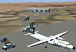
Googly scenery for OPDB Dalbandin, Pakistan - a quiet domestic airport for
which no operational facilities are provided in Flight Simulator 2004. These
scenery files add/correct the runways, apron, taxiways, buildings and other
airport features so that you and your "AI" traffic can land, taxi, park
and take off in a realistic manner.
The airport appears to be served all of once per week by ATRs of Pakistan
International Airways so will hardly buzz with activity, but you will be
assured of a friendly welcome when you arrive.
The scenery does not purport to be ultra-accurate. Based on high-detail satellite
imagery from Google Earth, the layout is proportionally correct but the added
airport features, such as buildings, are built from default Microsoft objects
and add-on libraries so will not look like the real thing.
You are not obliged to download and install any additional scenery libraries,
but to enjoy this scenery in its entirety, you may wish to. It will work fine,
with or without.
[File re-uploaded at the request of AVSIM]
| Filename: | OPDB_Dalbandin_Pakistan.zip |
| License: | Freeware |
| Added: | 5th May 2010, 22:32:37 |
| Downloads: | 1,017 |
| Author: | John Hinson |
| Size: | 65.99 KB |
| Category: Flight Simulator 2004 - Scenery | |
| VEPT Patna, India |
|
Images related to this file:
File Description:
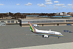
Googly scenery for VEPT Patna, India. In Flight Simulator 2004, the airport is
depicted at a pretty waterside location but only a small ramp for general aviation
aircraft is provided. In the real world it is served around six times a day by
Boeing jets on domestic flights by Alliance Air, Indian Airlines, Jet Airways, and
Sahara Airlines. These scenery files add aprons, taxiways, buildings and other
airport features to Flight Simulator's bland representation and allow "AI" traffic,
to land, taxi, park and take off in a realistic manner.
The scenery does not purport to be ultra-accurate. Based on high-detail satellite
imagery from Google Earth, the layout is proportionally correct but the added
airport features, such as buildings, are built from default Microsoft objects
and add-on libraries so will not look like the real thing.
You are not obliged to download and install any additional scenery libraries,
but to enjoy this scenery in its entirety, you may wish to. It will work fine,
with or without.
[File re-uploaded at request of AVSIM]
| Filename: | VEPT_Patna_India.zip |
| License: | Freeware |
| Added: | 7th May 2010, 11:02:44 |
| Downloads: | 1,705 |
| Author: | John Hinson |
| Size: | 65.91 KB |
| Category: Flight Simulator 2004 - Scenery | |
| WIOO Pontianak/Supadio, Kalimantan, Indonesia |
|
Images related to this file:
File Description:
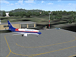
Googly scenery for WIOO Pontianak/Supadio, Kalimantan, Indonesia. In Flight Simulator
2004 only a general aviation parking is provided at this important Indonesian domestic
airport, but in the real world it is served over fifteen times
a day by jets and smaller aircraft of Adam Air, Airfast Service, Batavia Air, Deraya
Air Taxi, Indonesia Air Transport, Sriwijaya Air and Tri-MG Intra Asia Airlines. These
scenery files add aprons, taxiways, buildings and other airport features to Flight
Simulator's limited representation and allow "AI" traffic to land, taxi, park and
take off in a realistic manner.
The scenery does not purport to be ultra-accurate. Based on high-detail satellite
imagery from Google Earth, the layout is proportionally correct but the added
airport features, such as buildings, are built from default Microsoft objects
and add-on libraries so will not look like the real thing.
You are not obliged to download and install any additional scenery libraries,
but to enjoy this scenery in its entirety, you may wish to. It will work fine,
with or without.
[File re-uploaded at request of AVSIM]
| Filename: | WIOO_PontianakSupadio_Kalimantan_Indonesia.zip |
| License: | Freeware |
| Added: | 15th May 2010, 01:10:01 |
| Downloads: | 1,963 |
| Author: | John Hinson |
| Size: | 64.96 KB |
| Category: Flight Simulator 2004 - Scenery | |
| WAML Palu/Mutiara, Indonesia |
|
Images related to this file:
File Description:
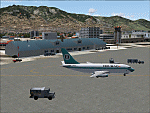
Googly scenery for WAML Palu/Mutiara, Indonesia. In Flight Simulator 2004 little
is provided other than a runway at this small domestic airport, although in the
real world it sees regular jet flights from airlines such as Batavia Air, Bouraq
Indonesia Airlines, Garuda Citylink, Lion Airlines and Merpati Nusentara and
smaller aircraft from operators like Airfast Service and Indonesia Air Transport.
These scenery files add aprons, taxiways, buildings and other airport features
to Flight Simulator's limited representation and allow "AI" traffic to land,
taxi, park and take off in a realistic manner.
The scenery does not purport to be ultra-accurate. Based on high-detail satellite
imagery from Google Earth, the layout is proportionally correct but the added
airport features, such as buildings, are built from default Microsoft objects
and add-on libraries so will not look exactly like the real thing.
You are not obliged to download and install any additional scenery libraries,
but to enjoy this scenery in its entirety, you may wish to. It will work fine,
with or without.
| Filename: | WAML_PaluMutiara_Indonesia.zip |
| License: | Freeware |
| Added: | 15th May 2010, 01:11:30 |
| Downloads: | 1,771 |
| Author: | John Hinson |
| Size: | 140.88 KB |
| Category: Flight Simulator 2004 - Scenery | |
| SPHZ Anta/Comandante German Arias Grazz, Peru |
|
Images related to this file:
File Description:
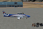
Googly scenery for SPHZ Anta/Comandante German Arias Grazz, Peru - a small
domestic airport for which nothing more than a runway is provided in Flight
Simulator 2004. These scenery files add the apron, taxiways, buildings and
other airport features so that you and your "AI" traffic can land, taxi, park
and take off in a realistic manner.
The airport is served daily by domestic operator L C Busre and perhaps also
others using small aircraft, but little information has been found on activity
in this area.
The scenery does not purport to be ultra-accurate. Based on high-detail satellite
imagery from Google Earth, the layout is proportionally correct but the added
airport features, such as buildings, are built from default Microsoft objects
and add-on libraries so will not look like the real thing.
You are not obliged to download and install any additional scenery libraries,
but to enjoy this scenery in its entirety, you may wish to. It will work fine,
with or without.
[File re-uploaded at request of AVSIM]
| Filename: | SPHZ_AntaComandante_German_Arias_Grazz_Peru.zip |
| License: | Freeware |
| Added: | 23rd May 2010, 01:24:24 |
| Downloads: | 1,224 |
| Author: | John Hinson |
| Size: | 65.15 KB |
| Category: Flight Simulator 2004 - AFCAD Files | |
| WIKK/WIKP/WIDK Depati Amir, Pangkal Pinang, Indonesia |
|
Images related to this file:
File Description:
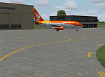
Googlyafcad A&F Data file for Depati Amir, based on Google Earth satellite data. It is a domestic airport located on the east coast of the island on Bangka serving the serving the largest town on the island, Pangkal Pinang, which is also the capital of the province
Bangka-Belitung.
The facilities in Flight Simulator 2004 only allow for general aviation traffic, but the
airport is regularly served by Boeing jets of Adam Air, Batavia Air and Sriwijaya Air as
well as smaller prop-driven craft of airlines like Merpati Nusentara. These files will
allow you and your "AI" traffic to land, taxi, park and take off in a realistic manner.
Like many airports in Indonesia, the ICAO code has changed in recent years. Microsoft
Flight Simulator 2004 uses the old code (WIKK) but this changed first to WIPK (in error)
and now WIDK. These files allow you to continue using the old code or change to the new
one. [File re-uploaded at request of AVSIM]
| Filename: | WIKKWIKPWIDK_Depati_Amir_Pangkal_Pinang_Indonesia.zip |
| License: | Freeware |
| Added: | 29th May 2010, 09:30:30 |
| Downloads: | 755 |
| Author: | John Hinson |
| Size: | 69.96 KB |
| Category: Flight Simulator 2004 - AI Flight Plans | |
| Aegean Airlines Summer 2010 |
|
Images related to this file:
File Description:

Aegean Airlines is the leading airline in Greece. They have been cooperating very closely with Olympic Air lately and a merger might take place in the near future. If this happens, the Aegean brand will disappear in favor of the Olympic one. Agean Airlines recently joined the Star Alliance hence the first logojet.They operate an extensive network of domestic flights as well as a good range of European services. Besides their scheduled flights, Aegean Airlines operate quite a few charter flights on behalf of various tour operators, main summer charter destinations being France and Italy, but also Romania and Russia. This is the las flightplan with the ATRs as they will be returned to lessor at the end of the season.The RJ-100s are also being phased out progressively. Two have already left the fleet. Aegean will soon be an all-A32X operator. Data was taken from various airport sites, OAG, Amadeus and cross-checked with info from Libhomeradar in order to get the right aircraft operate the right schedule.Flightplans are 99.9% realistic for the concerned period. Scheduled, charter and positioning flights included.
| Filename: | Aegean_Airlines_Summer_2010.zip |
| License: | Freeware |
| Added: | 1st September 2010, 21:46:34 |
| Downloads: | 800 |
| Author: | Dimitri Tousmanof |
| Size: | 126.99 KB |
| Category: Flight Simulator 2004 - Scenery | |
| Dutch Harbour PADU and St Paul PASN - UPDATES |
|
Images related to this file:
File Description:
This has revised runway circulation for both Dutch Harbour (dutchplus.zip) and St Paul (st_paul.zip) to better reflect reality in helicopter and aircraft operation. It is not realistic for a helicopter to land, continue in a straight line along 6,000' of runway, turn at the far end, then taxi back along the same 6,000' to the aprons. Similarly, a Cessna does not need the same runway length as a 747.
This fix incorporates intermediate turnaround points to allow helicopters and small aircraft to turn around soon after slowing to taxi speed and to taxi back to the aprons at the end of the runway, instead of trudging along the whole length of the runway twice. There are some things that cannot be improved; a plane or helicopter will always taxi all the way from the aprons to the far end of the runway before turning and taking off, and a helicopter or light plane will not "land long" to minimise the taxi length.
The pictures show different turning points. There are also revised AI bgl's to provide better time separation between flights.
| Filename: | Dutch_Harbour_PADU_and_St_Paul_PASN__UPDATES.zip |
| License: | Freeware, limited distribution |
| Added: | 16th August 2012, 19:37:32 |
| Downloads: | 944 |
| Author: | Roger Wensley |
| Size: | 2.53 MB |
| Category: Flight Simulator 2004 - AI Flight Plans | |
| Republic of Korea Air Force 11th FW Complete AI Package |
|
Images related to this file:
File Description:

The members of Military AI Works are proud to bring you the this freeware AI package, produced by Mark Campbell in conjunction with Military AI Works This package features all 60 of the Republic of Korea Air Force Boeing F-15K Slam Eagles and the 20 stored F4D of the 11th Fighter Wing, based at Daegu AB RKTN.
These brand new AI models here are produced by the very talented AI modellers Kevin Reed, Mike Pearson and Nick Black with realistic FDE produced by Mick MacIntyre. Also included in this package is custom scenery of Daegu AB, produced by Tony Dalton. We also feature a first for MAIW with some very cool animated earth excavator equipment modelled by Mark Griggs.
Credits: Models by Kevin Reed, Mike Pearson and Nick Black, FDE/Effect by Mike MacIntyre, Steve Holland, Nick Needham and Henry Tomkiewicz, Repaints by Graham King, Mike Pearson and Mark Heimer, Flightplans by Mark Campbell, VCPs by Stewart Pearson, Custom Scenery etc., by John Stinstrom, Mark Griggs and Tony Dalton
| Filename: | Republic_of_Korea_Air_Force_11th_FW_Complete_AI_Pa.zip |
| License: | Freeware |
| Added: | 9th December 2012, 19:34:54 |
| Downloads: | 533 |
| Author: | Mark Campbell; Military AI Works (MAIW) |
| Size: | 76.11 MB |
| Category: Flight Simulator 2004 - Original Aircraft | |
| A.V.I.A. L.3 (Part 1) |
|
Images related to this file:
File Description:
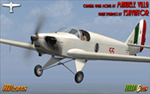
The L.3 was a partially failed attempt to create a very simple and cheap monoplane trainer, better suited to the entire basic training syllabus of Regia Aronautica pilots from 1940 onwards. This open cockpit version was also adopted for 'lead in' training, by the Croatian Air Force, and eventually the Luftwaffe, and by the A.N.R. for assault glider pilot training. Some also served as 'unit hacks' during WW2. Full details are in the supplied contextual history.
This release (Part 1) provides two open cockpit MDLs, with different landing gear, many relevant liveries, a combined contextual history of both the open and closed cabin versions, and an illustrated Student Training Manual to allow realistic simulation of the wartime Axis 'lead in' training syllabus. The Part 2 of this release will later feature the enclosed cabin version.
VC only. It also works subject to some limitations within in FSX. GMax Models and Skins by Manuele Villa, Flight dynamics by FSAviator. By Manuele Villa/MVG3D, January 2015.
| Filename: | AVIA_L3_Part_1.zip |
| License: | Freeware |
| Added: | 29th January 2015, 21:21:19 |
| Downloads: | 665 |
| Author: | Manuele Villa |
| Size: | 40.4 MB |


© 2001-2026 AVSIM Online
All Rights Reserved
Privacy Policy |