
Where Flight Simulation Enthusiasts Gather from Around the World!
AVSIM Library - Search Results

| Category: Flight Simulator 2004 - Scenery | |
| Tucson, Arizona, High-Resolution Scenery - Part 1: Tucson Intl. Airport (KTUS) |

|
File Description:
This is the first part of high resolution ground scenery for Tucson AZ, containing Tucson Intl. airport (KTUS) and 90 sq km around it. The resolution of the airport area itself is 0.3m/pix! The area around is in 1m/pix resolution. Realistic real-world runway textures are provided as well. This scenery is best, when combined with my standard resolution Tucson scenery (TUS2008_LR.zip), which covers a much larger area and matches perfectly in color and everything. YourDonation@Work: Dedicated to Robert, George and Jeff. Thanks!
| Filename: | Tucson_Arizona_HighResolution_Scenery__Part_1_Tucs.zip |
| License: | Freeware, limited distribution |
| Added: | 10th September 2008, 23:58:16 |
| Downloads: | 4,264 |
| Author: | Gottfried Razek - www.blueskyscenery.com |
| Size: | 97.19 MB |
| Category: Flight Simulator 2004 - Miscellaneous Files | |
| ' Ultimate Wing Views ' for the Boeing 747-200 ! |
|
File Description:
' Ultimate Wing Views ' for the Project Open Sky Posky Boeing 747-200 Series Aircraft! There are actually SIX (6) Wing Views, ranging from Behind the wing, center wing, and in front of the wing on both sides of the aircraft. All of these wing views have been extensively fine-tuned to provide the most realistic experience! I also have many other wing - views available in the AVSIM Library, just search for ' Ultimate Wing Views ' for the aircraft you need them for. Thanks and Enjoy!
| Filename: | _Ultimate_Wing_Views__for_the__Boeing_747200_.zip |
| License: | Freeware |
| Added: | 21st August 2004, 19:49:39 |
| Downloads: | 3,225 |
| Author: | Brian Kolbuch |
| Size: | 152.35 KB |
| Category: Flight Simulator 2004 - Scenery | |
| Alternate Ultimate Terrain Roads |
|
File Description:
ALTERNATE ULTIMATE TERRAIN ROADS
by Adnan 'Reload006' Arif (BEV team)
Being an autogen designer in the Birds Eye View team inspired me to manipulate whatever I can to make FS9 look as realistic as possible. This is an alternate set of concrete and asphalt highways and local roads, color matched exactly to photographs of roads and highways, and with more realistic local roads. THESE WILL ONLY WORK WITH ULTIMATE TERRAIN, and you need to have purchased Ultimate Terrain USA/Canada to make these work.
INSTALLATION :
They are simply installed into FS9/texture. The default 'bright' UT roads are also included in case you`d like to revert back to them.
The screenshots I have included are all with BEV summer textures. (www.flightsim-bev.com). I strongly advise getting Ultimate Terrain if you dont have it already, as it will greatly enhance your road/river/water bodies network . Also, if you change a setting in Ultimate Terrain, you will probably have to reinstall these roads. They should work with UT settings of 'residential roads on' or with 'main highways and roads only' .
Enjoy!
Adnan Arif/ aka Reload006.
[email protected]
| Filename: | Alternate_Ultimate_Terrain_Roads.zip |
| License: | Freeware |
| Added: | 13th March 2006, 02:28:26 |
| Downloads: | 7,298 |
| Author: | Adnan Arif |
| Size: | 6.55 MB |
| Category: Flight Simulator 2004 - Aircraft Repaints, Textures and Modifications | |
| Air North 'Yukon Livery' Boeing 737-201 (C-GNAU) |
|
File Description:
I am proud to present this realistic, detailed repaint of Air North's Boeing 737-201, registration C-GNAU, in the newer "Yukon livery". This aircraft has a distinct orange tail with the name of the territory which gives this airline its name; Yukon. Air North is a Canadian Airline based in Whitehorse, Yukon, and is 100% owned by Yukoners. This project has been fun for a significant reason; the people of Air North. I contacted them with a request for their logos to use in this repaint, and they were gracious and professional in granting my request. So I dedicate this repaint to Air North their kind personnel; especially Josh Clark. For this as with all of the aircraft I paint, I paid attention to detail and realism as much as possible and generated this repaint with realistic but not overstated details. The textures in this repaint are 32-bit. All Air North logos used in this repaint are copyrighted property of Air North and are used on this repaint with permission from Air North. This is a textures only package; you must have the Tinmouse 737-200adv v2 base package available here at AVSIM.
| Filename: | Air_North_Yukon_Livery_Boeing_737201_CGNAU.zip |
| License: | Freeware, limited distribution |
| Added: | 22nd August 2008, 02:12:46 |
| Downloads: | 955 |
| Author: | Jeffrey S. Bryner | Tinmouse II Project |
| Size: | 8.85 MB |
| Category: Flight Simulator 2004 - Scenery | |
| VABP Bhopal/Bairagarh, India |
|
Images related to this file:
File Description:
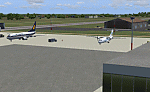
Googly scenery for VABP Bhopal/Bairagarh, India - an enhancement to the
airport provided in Flight Simulator 2004 which is incorrect in many respects.
These scenery files enlarge the apron to a realistic size to accept scheduled
traffic, remove spurious taxiways (they were actually perimeter tracks!), and
add buildings and other airport features so that you and your "AI" traffic
can land, taxi, park and take off in a realistic manner.
This small domestic airport is served by Boeing and Airbus jets of Indian
Airlines and Jet Airways together with local flights operated by ATRs of Air
Deccan.
The scenery does not purport to be ultra-accurate. Based on high-detail satellite
imagery from Google Earth, the layout is proportionally correct but the added
airport features, such as buildings, are built from default Microsoft objects
and add-on libraries so will not look like the real thing.
You are not obliged to download and install any additional scenery libraries,
but to enjoy this scenery in its entirety, you may wish to. It will work fine,
with or without.
[File re-uploaded at request of AVSIM]
| Filename: | VABP_BhopalBairagarh_India.zip |
| License: | Freeware |
| Added: | 7th May 2010, 22:34:06 |
| Downloads: | 1,625 |
| Author: | John Hinson |
| Size: | 64.37 KB |
| Category: Flight Simulator 2004 - AFCAD Files | |
| PAKT Ketchikan International, Alaska, USA |
|
Images related to this file:
File Description:
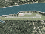
Googlyafcad A&F Data file for Ketchikan International based on Google Earth satellite
data - a small but relatively busy airport located in one of the wettest parts of
Alaska, USA. Ketchikan is Alaska's fifth largest city, with its economy based on
salmon fishing.
For some curious reason the facilities provided in Flight Simulator 2004 omit a crucial
taxiway at the west end of the airport, causing all traffic to taxi from the opposite
end. These files redress this issue, and also provide realistic levels of parking for
commercial and general aviation traffic, allowing you and your "AI" traffic to land,
taxi, park and take off in a realistic manner. The layout has been cunningly designed
to fit both with the Flight Simulator default scenery and version 2 of Alan Wright's
enhanced scenery (paktv2.zip on AVSIM) and is compatible with both in every respect.
Apart from conventional and water-based general aviation aircraft Ketchikan International
is regularly served by commercial flights of Alaska Airlines and by smaller operators
such as Alaska Central Express, Everts Air Alaska and LAB Flying Service. [File re-uploaded at request of AVSIM]
| Filename: | PAKT_Ketchikan_International_Alaska_USA.zip |
| License: | Freeware |
| Added: | 29th May 2010, 09:28:41 |
| Downloads: | 1,267 |
| Author: | John Hinson |
| Size: | 206.01 KB |
| Category: Flight Simulator 2004 - Scenery | |
| VFR of Lario, Area E2 - Como Lake, Italy (Update) |
|
Images related to this file:
File Description:
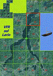
This 8th scenery covers approximately an area of 7.5x6 km, from S.Gregorio/Dongo (NW) to Colico (NE), and S.Siro (SW) to Tremenico/Aveno (SE) and includes six NLC piers: Dervio, Piona, Colico, Dongo, Musso, Pianello del Lario, in addition to the disused Cremia's one; a lot of dedicated buildings are included, as S.Tommaso of Canterbury church and fortification (Corenno), Cistercian abbey (Piona), pier and dock (Colico), S.Stefano church, factory buildings and airpollution control machinery (Dongo), Rezzonico's castle (S.Siro).
This VFR on Lario scenery includes several Dervio's details, and fully revises the previous Dervio scenery; Are included: Boldona's park office and stand, railway station, NLC shiphard, Pontile piers with Concordia steamer, dock bay with small floating pier and compass of the lake, S. Peter and Paul church and houses front of lake, hydro power station, Municipality and some other buildings, Castello's tower, windsurf school, windsurfers and kitesurfers on the lake, cross and Madonna on top of Legnoncino mountain. There are also included two viaducts between the tunnels of the freeway 36, with moted traffic. Catamarans Citta di Como and Tivano at Colico/Dongo piers together with other minor boats and docks alongside the lake coast; a moted regata with catamarans is placed in the lake between Pianello and Dervio.
This scenery SUPERSEDES AND CANCELS the previous "dervio_v2a" one, removed from the library. This is the eighth scenery of the "VFR of Lario" project, made with photorealistic terrain (multiseason & night) and with some 3D GMax realistic objects.
| Filename: | VFR_of_Lario_Area_E2__Como_Lake_Italy_Update.zip |
| License: | Freeware |
| Added: | 25th November 2012, 20:54:39 |
| Downloads: | 1,665 |
| Author: | Aldo Della Vedova, Daniele Lanfranchi, Gian Mario Verga |
| Size: | 39.39 MB |
| Category: Flight Simulator 2004 - Scenery | |
| KIAH - Houston Intercontinental Airport v3.0 |
|
File Description:
Flightlevel390 is proud to present to you KIAH-Houston's George Bush Intercontinental Airport version 3.0.This scenery was created using EZ-Scenery object placer & Flightones' Instant Scenery.This scenery WILL NOT work in FS X.This will work with Default FS9 terrain,although it is optimized for use with ultimate terrain...This will be the final project under the FL390 brandname,all projects hereafter will be with BSMP...
Includes the Main terminals,Continental Maintenence Base,FedEx cargo ramp,UPS cargo ramp,City cargo ramp,fuel farm by 15R,CFR building further down 15R,CFR Building along Rwy 9-27 taxiway,FBOs on both sides of the 33s,including the big Landmark Aviation FBO,static ground equipment & some custom made signs.Also includes full ramp night lighting,aircraft gate outline markings at each gate.
This version adds some more stuff and fixing some stuff that was noted in previous versions.This also fixes the blurries that some people had reported.
Features a very good and super accurate AFCAD file and decent rendition of the real airport layout.***
Most of the objects in this scenery are all default with some of our own custom made stuff and some objects from some 3rd party EZ Object Libraries and RWY12 Object Libraries.
***You will need to download the EZ-Scenery & RWY12 Object Libraries which can be had at avsim,flightsim.com and our own website available as single downloads instead of multiple seperate downloads.I also recomend that you install our recently released EZ-Object Library Installer which is available at flightsim.com and our own website in the downloads section.File name on flightsim.com is ( EZOLIv33.zip )....
Downloading the installer will ensure that you will have all of the fixed default textures from Sid Schwartz's default libraries....As always...Enjoy!!
| Filename: | KIAH__Houston_Intercontinental_Airport_v30.zip |
| License: | Freeware |
| Added: | 15th June 2008, 17:39:45 |
| Downloads: | 8,412 |
| Author: | Joe DeGregorio |
| Size: | 3.08 MB |
| Category: Flight Simulator 2004 - Scenery | |
| Samedan 2004 |
|
File Description:
Very detailed and accurate regional airport in the south east of Switzerland on 1787m or 5600ft. It's the highest
airfield in Europe! All main buildings of the airport and some surrounding farm, office and living buildings are included.
All textures are with full night lightning. Static cars, trucks are included. A new AFCAD - file with
smaller taxiways and runway lightning and more parking gates and a VFR area chart and a visual approach chart is
also available. It works fine with ATC and AI.
It's my third version of this airport. Previous version had over 3000 downloads.
| Filename: | Samedan_2004.zip |
| License: | Freeware, limited distribution |
| Added: | 29th February 2004, 00:11:43 |
| Downloads: | 17,719 |
| Author: | Andreas Hegi |
| Size: | 4.45 MB |
| Category: Flight Simulator 2004 - Flight Plans | |
| Hopping Round The World Adventure - Pack 21 |
|
File Description:
Taking off from Martha's Vineyard you head to Boston. Once you prepare to leave Boston for Manchester, NH you see the downtown silhouette in the night sky. Soon you discover its lights out while preparing to land. Can you land in zero visibility? We run into another winter storm bringing heavy snow and rain. You can expect to see another winner of a sunset and sunrise. We are making good progress but your IFR skills will be put to good use for sure. The Learjet versatility for short and long runways keeps it as a favorite up to this point.
| Filename: | Hopping_Round_The_World_Adventure__Pack_21.zip |
| License: | Freeware |
| Added: | 21st December 2003, 03:09:02 |
| Downloads: | 2,983 |
| Author: | David Dossiere |
| Size: | 2.06 MB |


© 2001-2026 AVSIM Online
All Rights Reserved
Privacy Policy |