
Where Flight Simulation Enthusiasts Gather from Around the World!
AVSIM Library - Search Results

| Category: Flight Simulator 2004 - Scenery | |
| Modified SRTM relief 76 m for Slovakia |

|
File Description:
This Slovak terrain mesh 76 m (LOD9) is made from the 3arc-sec SRTM. The voids in the source data were filled by the interpolation. Both the primary processing of the 3arc-sec data and the rendering of the terrain in the FS cause flattening and simplifying of the real shape of the terrain. This phenomenon was partially compensated by the sharpening of the source data.
Made by the programs Surfer (Golden Software) and MS Terrain SDK 2000 and 2002. The relief covers the area N49.9219 E016.1719 to N47.4609 E022.9687 in the boundaries of the LOD9 quadrants. This scenery contains only the elevation data. The other elements of the basic terrain as the landclass, locally used airborne photos, vector roads, rivers and lakes are available in different sceneries by other authors and they are continuously developed.
| Filename: | Modified_SRTM_relief_76_m_for_Slovakia.zip |
| License: | Freeware, limited distribution |
| Added: | 28th May 2010, 19:40:13 |
| Downloads: | 4,606 |
| Author: | Vladimir Stoje |
| Size: | 19.36 MB |
| Category: Flight Simulator 2004 - Scenery | |
| KCRW - Charleston-Yeager 2014 |
|
Images related to this file:
File Description:
Yeager Airport KCRW in Charleston, West Virginia, is a mid-size airport surrounded by beautiful terrain (see the section on Optional Mesh). The terminal can easily accommodate 737 class airliners as well as commuter turboprops, and there are GA and West Virginia National Guard ramps. This scenery reflects the current single runway configuration, the former second runway having been converted into taxiway C. It is a complete rebuild with all custom buildings and some photo ground textures. I have also redone the instrument approaches to match the current real ones, and they will automatically be listed and displayed on your GPS. Instrument Approach Plates are included.
This work is entirely my own, but I would like to thank Brandon DePalo for his very well done earlier version of KCRW. Without that, I would not have known about this airport.
| Filename: | KCRW__CharlestonYeager_2014.zip |
| License: | Freeware |
| Added: | 26th April 2014, 07:05:30 |
| Downloads: | 646 |
| Author: | Sidney Schwartz |
| Size: | 7.29 MB |
| Category: Flight Simulator 2004 - Scenery | |
| Modified SRTM Relief 76 m for Czech Republic |
|
File Description:
This Czech Republic terrain mesh 76 m (LOD9) is made from the 3arc-sec SRTM. Small voids in the source data were filled by the interpolation. Both the primary processing of the 3arc-sec data and the rendering of the terrain in the FS cause flattening and simplifying of the real shape of the terrain. This phenomenon was partially compensated by the sharpening of the source data. Made by the programs Surfer (Golden Software) and MS Terrain SDK 2000 and 2002. The relief covers the area N51.1523 E011.9531 to N48.5156 E018.9844 in the boundaries of the LOD9 quadrants. This scenery contains only the elevation data. The other elements of the basic terrain as the landclass, locally used airborne photos, vector roads, rivers and lakes are available in different sceneries by other authors and they are continuously developed.
| Filename: | Modified_SRTM_Relief_76_m_for_Czech_Republic.zip |
| License: | Freeware |
| Added: | 22nd December 2003, 21:25:07 |
| Downloads: | 6,722 |
| Author: | Vladimir Stoje |
| Size: | 20.81 MB |
| Category: Flight Simulator 2004 - Scenery | |
| High Canyon Camp |
|
File Description:
This little camp in the Ketchikan, Alaska area is part of a group of fictional sceneries covering Southeast AK. Should work fine with or without Eddy Denny's terrain mesh. I hope you enjoy them as much as I have.
Menu entries on the Add-on Scenery menu will get you to the starting points. Requires trees_v3 from Garrish Gray. Includes a short dirt strip, STOL planes only need apply. It makes for a nice hop from Ketchikan, AK, and due its proximity to Moudi Farm (Najis Bush Scenery), is a good weekend camping spot for farm residents and visitors. The old cabin is boarded up and has fallen into disuse, but the landing strip is in pretty good shape, and you will usually (okay always) find campers there. Fly on in, I'm sure you'll be welcome.
| Filename: | High_Canyon_Camp.zip |
| License: | Freeware |
| Added: | 16th January 2004, 21:11:31 |
| Downloads: | 1,629 |
| Author: | Todd Hudgel |
| Size: | 980.46 KB |
| Category: Flight Simulator 2004 - Scenery | |
| Tokyo Bay 2005 |
|
Images related to this file:
File Description:
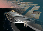
FS2004 Scenery Tokyo Bay Scenery 2005 Ver. 5.0
This add-on scenery improves specific scenerys (Tokyo Bay, Japan) of FS2004.
There are a lot of reclaimed land in Tokyo Bay.
They form an artificial peculiar coastline. This scenery reproduces these coastlines precisely.
And, this scenery reproduces the Keihin industrial area and the Keiyo industrial area in Tokyo Bay located west and east. In this scenery design, the coastline was reproduced as exactly as possible, following the specification of FS2004.
Moreover, 90m mesh geographical data is reproduced by using SRTM 3arc/sec.
The range of detailed coastline and 90m digital elevation data is as follows:
** [detailed coastline] N33:45 E138:45 to N36:55 E141:05 (included Izu Islands)
** [90m digital elevation data] N33:00 E138:00 to N37:00 E141:00 --
The Tokyo Wan AquaLine is arranged in the exact location. By Kazuo Kawamura
| Filename: | Tokyo_Bay_2005.zip |
| License: | Freeware, limited distribution |
| Added: | 3rd December 2011, 23:51:31 |
| Downloads: | 11,790 |
| Author: | Kazuo Kawamura |
| Size: | 9.74 MB |
| Category: Flight Simulator 2004 - Scenery | |
| Argyle International Airport, Saint Vincent |
|
Images related to this file:
File Description:
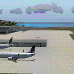
This is a scenery created by me of the soon to be completed Argyle International Airport on the island nation of Saint Vincent and the Grenadines. This scenery was created as a pet project of mine out of personal love for the project. The airport was created using only default scenery objects and the only thing that was changed was the type and direction of the turning point at the RWY04 end. I'm sharing this so FS2004 simmers can see what the airport will be like on completion. The scenery is 100% customizable to suit your preference. All I ask is that you don't change the actual airport design. I hope that this will bring you hours and hours of flying fun.
Important: This scenery requires the full RWY12 Scenery Library including the Gate Markings SS files. Also the Lesser Antilles Mesh is required.
| Filename: | Argyle_International_Airport_Saint_Vincent.zip |
| License: | Freeware |
| Added: | 22nd December 2013, 21:57:40 |
| Downloads: | 529 |
| Author: | Cilbert Campbell |
| Size: | 6.8 KB |
| Category: Flight Simulator 2004 - Scenery Design | |
| ResampleTools V.095Beta |
|
File Description:
ResampleTools is a great little utility that helps you automate the import of Mesh or Photo Real scenery into
Flight Simulator 200x. The interface is a simple 4 or 6 step wizard depending
on what you are importing and the information you have about your source files.
FS Resample Tools can help you determine the extents of your bitmap source if
you don't already know them (all four corners in degrees) and will also
determine the CellX and CellY sample or pixel width from those corner extents among others.
This is a beta version and there will be no more updates as work on this tool stoped a while ago but the author has been kind enough to allow distribution to all who might enjoy using it,(note: this may have been replaced by Elronds "imagetool" also available soon in this library).
Works with FS2000/FS2002 and FS2004.
| Filename: | ResampleTools_V095Beta.zip |
| License: | Freeware, limited distribution |
| Added: | 21st September 2003, 18:50:03 |
| Downloads: | 1,621 |
| Author: | Elrond Elvish |
| Size: | 728.39 KB |
| Category: Flight Simulator 2004 - Scenery | |
| Revised East Vancouver Islands - compatible with vicenh05 |
|
File Description:
These files are a revision of the default Vancouver Island shorelines and landclass textures from Chemainus to Campbell River, British Columbia. Included are the islands from the Southern Gulf Islands to Texada Island and inland to Cowichan Lake. Most of the smaller lakes within 20 km of the shoreline have been redrawn as well. In this version shorelines have been revised to match Jon Patch & Holger Sandman's vicenh05.zip. As well major corrections for the shorelines in LOD5 area 117-114, Comox, have been made so that the shorelines now conform to the 38.2m mesh and to Vern Opperman's CFB - Comox version 042. Shoreline types are changed to look more like the Pacific Northwest courtesy of Holger Sandman's who made his shoreline textures for vicenh05 available. Also in this version no roads are included since complete British Columbia roads in bcroadsys.zip are now available.
| Filename: | Revised_East_Vancouver_Islands__compatible_with_vi.zip |
| License: | Freeware, limited distribution |
| Added: | 8th October 2005, 20:17:46 |
| Downloads: | 3,927 |
| Author: | Harvey Janszen |
| Size: | 346.85 KB |
| Category: Flight Simulator 2004 - Scenery | |
| Airstrips of Southern Germany |
|
Images related to this file:
File Description:
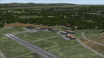
The next my Western Europe airstrips project, herewith about 170 small airfields, mostly in Baden-Wurttemberg and Bavaria, each enhanced with buildings, taxiways, parking spaces and aprons as appropriate, to further facilitate the generation of lightweight AI traffic in the area, without overloading the more major airfields.
Again, there's no photo-realism here, just a selection of basic 'generic' buildings, more or less accurately sized and placed to reflect the airfield layout as seen on on-line satellite imagery and aerial photography. These buildings have minimal effect on frame-rates, so are ideal for this kind of job. The airfields are aligned as well as possible with the roads etc. in UT Europe and the Genesis Europe mesh, but should mostly be fine in a default installation or other configuration.
Please read the rest of this "blurb" in the included text file. There may be some details of note or interest.
| Filename: | Airstrips_of_Southern_Germany.zip |
| License: | Freeware |
| Added: | 25th December 2024, 20:54:30 |
| Downloads: | 126 |
| Author: | Chris Eve |
| Size: | 2.84 MB |
| Category: Flight Simulator 2004 - Scenery | |
| The Victoria Falls of the Zambezi River, Zambia/Zimbabwe |
|
File Description:
One of the main landmarks of Africa, the spectacular Victoria Falls of the Zambezi River are missing in out-of-the-box FS. With a local SRTM LOD9 mesh as a base (included) and the help of satellite imagery, maps, Ground2K4, and GMax, we did our best to model a realistic representation of the falls, the river, and the gorge, complete with custom waterfall and spray effects. The portion of the Zambezi covered in this project extends from E25 to E26.5 (more than 100km), with the falls at its center. Also included is a replacement landclass file for an area of about 20km on either side of the Zambezi River and an optional AI boat (by Lynn and Bill Lyons) cruising on the Zambezi above the falls. Tested with FS2004 only but most scenery enhancements (not the AI boat) should work just as well in FS2002.
| Filename: | The_Victoria_Falls_of_the_Zambezi_River_ZambiaZimb.zip |
| License: | Freeware, limited distribution |
| Added: | 8th May 2004, 02:45:30 |
| Downloads: | 19,146 |
| Author: | Holger Sandmann and Johan van Wyk, Aeroworx |
| Size: | 3.5 MB |


© 2001-2026 AVSIM Online
All Rights Reserved
Privacy Policy |