
Where Flight Simulation Enthusiasts Gather from Around the World!
AVSIM Library - Search Results

| Category: Flight Simulator 2004 - Scenery | |
| Exploring Our World - Part 3 - The Wine Country of Chile. |

|
Images related to this file:
File Description:

Exploring Our World - Part 3 - The Wine Country of Chile. Here is your opportunity to explore the Wine Country of Northern Chile with stopovers at four delightful GA airfields (SCAD-SCMI-SCOV-SCVN) enhanced by Cesar Carrasco. Along the way you will enjoy some very beautiful scenery. This package includes revised Afcads for the airports and a small Traffic file using default aircraft plus a challenge to find an observatory which I have added. Please read the documentation for further details. Designed to work with the default FS2004 scenery, no additional mesh is required. Please unzip (using folders option) to a temporary folder and follow the simple installation instructions which are in .doc and .pdf formats. Compiled for your flying enjoyment by David "Opa" Marshall.
| Filename: | Exploring_Our_World__Part_3__The_Wine_Country_of_C.zip |
| License: | Freeware |
| Added: | 3rd February 2010, 02:08:43 |
| Downloads: | 1,467 |
| Author: | David "Opa" Marshall |
| Size: | 1.19 MB |
| Category: Flight Simulator 2004 - Scenery | |
| Ko Samui, Thailand (VTSM) v4.0 |
|
File Description:
Samui is a small, but busy airport on the island of Ko Samui. It is located in Southern Thailand, and is an exotic resort destination. In 1989 Bangkok Airways opened their own airport on the island, which decreased the travel time from Bangkok considerably. The airport is currently served by Bangkok Airways, although an occasional private aircraft will land here. This scenery is a detailed and accurate representation of this airport as it looks today. I consulted with several visitors to the airport, as well as the AIP for Thailand. Landsat imagery was used to modify the shoreline, and a custom landclass is included. Taxiway and parking areas were modified by using AFCAD2. This scenery is compatible with 3rd-party mesh scenery for Thailand.
| Filename: | Ko_Samui_Thailand_VTSM_v40.zip |
| License: | Freeware, limited distribution |
| Added: | 25th April 2004, 21:10:31 |
| Downloads: | 11,739 |
| Author: | Martin Strong |
| Size: | 5.34 MB |
| Category: Flight Simulator 2004 - Scenery | |
| San Francisco Int. (SFO) High Res Ground Scenery |
|
File Description:
This scenery contains high resolution ground scenery for the airport of San Francisco Intl. (SFO). It makes me kind of nostalgic, because that's the area where I first successfully tried my hi-res mesh technique for FS2004. The scenery has a resolution of 1.2m/pix (4.7m/pix is FS2004-standard). Coverage is the area around SFO containing the San Bruno Mountain Park and the San Adreas Res. So it's quiet a sight! And don't forget to bring some flowers :-) The scenery gives best results when combined with with my "San Francisco" standard resolution ground scenery, which covers a much larger area at 4.7m/pix and matches perfectly in color and everything...
Won't work in FSX. For FSX please wait for the upcoming FSX-version of this scenery.
| Filename: | San__Francisco_Int_SFO_High_Res_Ground_Scenery.zip |
| License: | Freeware, limited distribution |
| Added: | 27th November 2006, 10:58:19 |
| Downloads: | 16,817 |
| Author: | Gottfried Razek |
| Size: | 41.8 MB |
| Category: Flight Simulator 2004 - Miscellaneous Files | |
| Some Curved or Angled Approaches, Beirut, Washington Reagan, Lugano and Swiss valleys |
|
File Description:
This little project started from my Air Glaciers package when I noticed how indifferent the AI pilots were to terrain. Intrigued by the work of Jim Vile on his "active approach" series I have experimented with interesting approaches that FS9 has not implemented. Using XML files I created curved approaches for Beirut Runway 21 ILS (inbound flights arc across the city), the visual turn to final for Washington Reagan's Runway 19, the circling approach for runway 19 at Lugano in Switzerland (just an arc in this case) and valley approaches for airports in Switzerland at Sion, Samedan and Locarno. Due to AI limitations in FS9 these have all needed to be created as ILS approaches, even at airports without an ILS. Note that your AFCAD layouts do not need to have ILS added to airports that don't have it. In some cases the approach will be called an ILS by the controller, if you can live with that, you might like these. Note that I've included the source XML for each of the approaches so that you can improve upon them if you wish. Note also that they have been tested with the default Microsoft mesh and an addon mesh might alter the proximity of terrain to aircraft. AI aircraft FDEs will, in some cases, be stretched to (and beyond?) their limits. In the case of Beirut I have included two approaches (BOB NDB and "Wide Arc"), the latter less demanding than the former, in case your AI can't fly the BOD NDB approach.
Note that although the approaches are designed for AI, I have built full procedures for Lugano and Sion for the user to fly.
| Filename: | Some_Curved_or_Angled_Approaches_Beirut_Washington.zip |
| License: | Freeware, limited distribution |
| Added: | 8th April 2005, 03:19:33 |
| Downloads: | 2,760 |
| Author: | Matthew Ministry |
| Size: | 478.08 KB |
| Category: Flight Simulator 2004 - Scenery | |
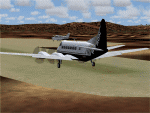
| Beaver Creek CYXQ in Yukon Territory, Canada |
|
Images related to this file:
File Description:
Beaver Creek is located at mile 1202 of the Alaska Highway, just east of the Alaska/Yukon border. The populaton is around 100 and the main employment is with the Border Agency, the White River First Nation, or with local tourist lodges. The airfield is a mile north of the town and close to the Canadian border post, which is included in the scenery. It was built by Jack Stalberg in the 1960's, and I have no further information beyond the fact that he loved to fly. The airport serves as an "airport of entry", though it is restricted in hours of opening and in the size of aircraft that it can handle; up to a maximum of only 15 seats. The single runway is 3,745 feet long and 100 feet wide, gravel, aligned 13-31 in FS9, lit, and with vasi at both ends. Righthand circuits for runway 13. There is a 340 feet threshold displacement to runway 31, which is of course unmarked on a gravel runway. The terminal building was recently reclad; I don't like it, but they didn't consult me. The ai reflects the sort of traffic the airfield gets; ie brief paperwork stopovers for GA or small charter flights into Canada from Alaska, usually in the mornings.I have adjusted the local scenery terrain levels to remove adjacent hills that I believe do not exist in real life but are part of the Northern Canada terrain mesh that I have installed. If you do not have this mesh you may find that the scenery works fine for you without the API flatten that is included here. The airfield is at 2,129 feet ASL.
| Filename: | Beaver_Creek_CYXQ_in_Yukon_Territory_Canada.zip |
| License: | Freeware, limited distribution |
| Added: | 28th January 2019, 06:19:20 |
| Downloads: | 174 |
| Author: | Roger Wensley |
| Size: | 4.68 MB |
| Category: Flight Simulator 2004 - AFCAD Files | |
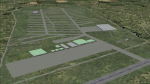
| YALG Adels Grove, Queensland, Australia |
|
Images related to this file:
File Description:
Googlyafcad A&F Data file for Adels Grove, based on Google Earth satellite data.
Unfortunately, Microsoft have omitted this location from Flight Simulator 2004 and this file will allow you and your "AI" traffic to land, taxi, park and take off in a realistic manner.
Adels Grove is a small airstrip serving Lawn Hill National Park, a port of call on the Heron Airlines Northern Affordable Air Tour. The very last commercially operated de Havilland Heron flight called here in 2003 but the service still operates and is now worked by Metroliner aircraft.
These files have been tested with Flight Simulator 2004 default scenery, Visual Australia (VOZ) enhanced scenery and add-on mesh by Andy Weir and is compatible with all. [File re-uploaded at request of AVSIM]
| Filename: | YALG_Adels_Grove_Queensland_Australia.zip |
| License: | Freeware |
| Added: | 20th June 2010, 10:48:26 |
| Downloads: | 412 |
| Author: | John Hinson |
| Size: | 60.12 KB |
| Category: Flight Simulator 2004 - Scenery | |
| Huahine Airport, French Polynesia, NTTH, Fare |
|
File Description:
This is an all new airport on the Island of Huahine in French Polynesia, just a short hop from Bora Bora. It is located in the Society Islands of French Polynesia which contain 98% of the areas population, with Tahiti being the main area of commerce, and urban center. This scenery includes the terminal, and a few rustic hangars and storage facilities. This Island like most in the area is supported by the tourist industry, and they are known for being the most beautiful and romantic Islands in the world. As with all of the airports in this area, this one will be greatly enhanced with the terrain mesh from Rolf Keibel and Johnathan Applegate, under the name FPSIMESH.zip. Afcad by Ray Smith is also included in this file.
| Filename: | Huahine_Airport_French_Polynesia_NTTH_Fare.zip |
| License: | Freeware |
| Added: | 7th May 2004, 12:44:33 |
| Downloads: | 11,738 |
| Author: | Bill Melichar |
| Size: | 2.72 MB |
| Category: Flight Simulator 2004 - Scenery | |
| Airstrips of the Iberian Peninsular |
|
Images related to this file:
File Description:
Third in my ongoing "Airstrips of Western Europe" project for FS2004, herewith about fifty sceneries of small, mostly default airfields in Spain and Portugal, each enhanced with taxiways, parking spaces and aprons as appropriate, to further facilitate the generation of lightweight AI traffic in the area without overloading the more major airfields.
Again, there's no photo-realism here, just a selection of basic 'generic' buildings, more or less accurately sized and placed to reflect the airfield layout as seen on on-line satellite imagery and aerial photography. These buildings have minimal effect on frame-rates, so are ideal for this kind of job. The airfields are aligned as well as possible with the roads etc. in UT Europe and the Genesis Europe mesh, but should mostly be fine in a default installation or other configuration.
| Filename: | Airstrips_of_the_Iberian_Peninsular.zip |
| License: | Freeware |
| Added: | 8th August 2024, 12:56:49 |
| Downloads: | 88 |
| Author: | Chris Eve |
| Size: | 1.3 MB |
| Category: Flight Simulator 2004 - Scenery | |
| Airstrips of Italy |
|
File Description:
Herewith about 40 small airfields from around Italy, some of which were not included in FS2004, each enhanced with taxiways, aprons, parking and buildings etc., both to enable the implementation of lightweight GA AI traffic in the area and to add a little generic detail.Again, there's no photo-realism here, just a selection of basic 'generic' buildings, more or less accurately sized and placed to reflect the airfield layout as seen on on-line satellite imagery and aerial photography. These buildings have minimal effect on frame-rates, so are ideal for this kind of job. The airfields are aligned as well as possible with the roads etc. in UT Europe and the Genesis Europe mesh, but should mostly be fine in a default installation or other configuration.
| Filename: | Airstrips_of_Italy.zip |
| License: | Freeware |
| Added: | 21st July 2025, 11:51:49 |
| Downloads: | 110 |
| Author: | Chris Eve |
| Size: | 299.94 KB |
| Category: Flight Simulator 2004 - AFCAD Files | |
| Fiji Airstrips |
|
File Description:
Afcads and exclude files for 11 airstrips in Fiji that Microsoft omitted from FS9. Made primarily with Ultimate Traffic users in mind, to give full traffic in the Fiji Islands (aircraft assigments permitting!).
The Afcads add runways, aprons and parking spots; the exclude files get rid of the autogen trees. Airstrips built using current data from Australian Defense Force En Route Supplements, so runway locations, dimensions, alignments and elevations are fairly accurate. But aprons and parking spots are entirely fictional! And no airport buildings included!
Tested only with default scenery plus fijifix.zip by Jim Keir (available at avsim) to correct elevation errors in default mesh at Moala.
Includes NFNB Levuka/Bureta, NFCI Cicia, NFKD Kandavu/Namalata, NFNO Koro Is, NFNK Lakeba, NFNH Laucala, NFFO Malololailai, NFMA Mana Is, NFMO Moala, NFNS Savusavu and NFVB Vanuabalavu.
| Filename: | Fiji_Airstrips.zip |
| License: | Freeware |
| Added: | 4th December 2004, 05:17:19 |
| Downloads: | 1,613 |
| Author: | Adrian Wright |
| Size: | 14.82 KB |
© 2001-2026 AVSIM Online
All Rights Reserved
Privacy Policy |