
Where Flight Simulation Enthusiasts Gather from Around the World!
AVSIM Library - Search Results

| Category: Flight Simulator 2004 - Scenery | |
| Maurice Bishop TGPY on Grenada in the Caribbean |

|
Images related to this file:
File Description:
Grenada island is 17 miles south of the southernmost island of the Grenadines, Carriacou; there are some smaller islands between the two. Grenada is 18 miles long and around 8 miles wide, has an estimated population of 110,000, and produces a very large part of the world's annual nutmeg harvest. The capital, St Georges, is by far the largest town and is at the southern end of the island, with the airport close by.
The airport is now called Maurice Bishop, but for some years was called Point Salines. The runway is just over 9,000 feet long and oriented 10/28. Point Salines replaced Pearl Airport, which is on the east coast 12 miles northeast of St Georges and was difficult to expand as the runway had mountains at one end and the sea at the other. Pearl is now closed; it is included here but only as a visual landmark with "closed" markings. There are regular international flights from North America and Europe, some of which are seasonal only (Air Canada for instance) and local connecting flights by LIAT and SVG. I retained the default control tower as it is some distance away. In real life it is also some distance away and on a hill northwest of the terminal. Which is why I did not take photos from which I would have made the real one. The hill does not feature in FS9.
| Filename: | Maurice_Bishop_TGPY_on_Grenada_in_the_Caribbean.zip |
| License: | Freeware, limited distribution |
| Added: | 11th June 2013, 23:28:17 |
| Downloads: | 825 |
| Author: | Roger Wensley |
| Size: | 7.38 MB |
| Category: Flight Simulator 2004 - AFCAD Files | |
| RFS New improved and realistic Afcads for TNCM,TFFJ, and SABA/TNCS |
|
File Description:
Make the three FlyTampas airports even more realistic. These Files are for Flight simulator enthusiasts, who prefer realism. These Afcads are optimized for AI Traffic. FlyTampas FlyMarten is very realistic yet, but these files even optimize this very good scenery addon.
These files are improved afcads for the three FlyTampa FlyMarten airports St. Marten (TNCM), St. Barthélemy (TFFJ) and Saba (SABA/TNCS). They are on the basis of the three original afcads from Flytampa, but there are a few differences between the old and the new version: 1. AI Traffic does not make the u-turns in the grass, but they make the u-turns on the provided u-turn areas at the ends of the runways 9 in TNCM, 10 in TFFJ and 12 und 30 SABA. 2. Landing and Takeoff on runway 27 in TNCM and Takeoff on runway 28 in TFFJ is forbidden; it is not possible to prohibit landing, but allow takeoff. So I compound, that all flight movements in TNCM will be performed on RWY 9. 3. At all of the three airports tower frequencies replace AFT, e. g. "Saba Traffic". 4. In SABA and TFFJ I removed few gates, because the pushbacking aircrafts taxied into each other when using the old file. Important: These Files are functional only if FlyTampa-Marten is installed on your computer. There are also the original files in the backup folder.
RFS Real Flight Simulation
| Filename: | RFS_New_improved_and_realistic_Afcads_for_TNCMTFFJ.zip |
| License: | Freeware |
| Added: | 13th August 2008, 19:39:19 |
| Downloads: | 1,802 |
| Author: | Ernst Kamuschke |
| Size: | 1.8 MB |
| Category: Flight Simulator 2004 - Scenery | |
| Squamish CYSE in British Columbia Canada |
|
Images related to this file:
File Description:
Squamish is a town with a population of just under 20,000, located at the northern end of Howe Sound where the Squamish River reaches the sea. Howe Sound is 25 miles deep and around 10 miles northwest of downtown Vancouver. It was for years based on the surrounding timber and a pulp mill, but with the closure of the saw and pulp mills now is more tourist oriented and the escape for Vancouver residents looking for (relative) peace and quiet. The runway is 2,400 feet of asphalt aligned 14-32. The buildings are built on differing levels of terrain, and the taxiways are sloped access ramps between the levels. This, of course, cannot be replicated in FS9, but it explains what at first sight appears to be a strange layout. The buildings are fairly well replicated. This is not an airport, it is an airfield meant for summer use as there is no lighting of any sort for runway or taxiways. The AI includes both GA and the helicopter flights by the two companies with bases at Squamish, Black Tusk and Blackcomb, the latter having several bases in this area with a HQ in Whistler. If you have the Vancouver scenery by FSAddon then you will need to move some of their bgl's aside; there are screenshots so that you can see which ones I have relocated. The UT settings are optional; I have been asked for my personal preferences. If you find a defect, email me.
| Filename: | Squamish_CYSE_in_British_Columbia_Canada.zip |
| License: | Freeware, limited distribution |
| Added: | 16th November 2020, 19:15:12 |
| Downloads: | 125 |
| Author: | Roger Wensley |
| Size: | 15.9 MB |
| Category: Flight Simulator 2004 - Miscellaneous Files | |
| Doherty' Difficult & Dangerous Approaches - Volume 54 |
|
File Description:
FS 2004 Doherty's Difficult and Dangerous
Approaches - Volume 54. I am constantly
amazed by the high number of simers that
restrict their flying activities to small
localized areas, never venturing much
further than their own backyards. I can't
help thinking that they miss out
on some truly great flying experiences by
confining themselves to such limited
parameters. If nothing else, Doherty's
Difficult and Dangerous Approaches will
get you out more! Whether you are simply a
local pilot flying within your own well-worn
neighbourhood, or a demanding adventurous
international aviator, there's something for
everyone in these volumes. For the new simer
I have included some very easy approaches,
and for the army of case-hardened veterans who
think they have seen and done it all - let me
tell you now - you haven't! I'll introduce you
to approaches that will leave you absolutely
flabbergasted - and may I add, begging for
more! Each volume contains (10) difficult and
dangerous approaches which are set up for
you – all you have to do is fly them! I have
also included a special ~ (STAR) ~ approach
in each volume - which is a gem of an approach
that will thrill and amaze you. If you've
always wanted to know where all the difficult
and dangerous approaches could be found in
MSFS 2004, but never new where to look, I've
discovered them all - and now I'm sharing
them with you. Check out Doherty's Difficult
and Dangerous Approaches - by Michael
Doherty - you won't be disappointed.
| Filename: | Doherty_Difficult__Dangerous_Approaches__Volume_54.zip |
| License: | Freeware |
| Added: | 22nd September 2004, 21:02:13 |
| Downloads: | 3,963 |
| Author: | Michael doherty |
| Size: | 747.01 KB |
| Category: Flight Simulator 2004 - AI Aircraft | |
| AI Lineas Aereas Azteca Htai Bombardier Learjet 31 XA-OLE |
|
Images related to this file:
File Description:
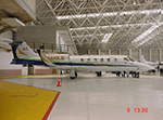
This is the aircraft of the extinct mexican airline "Lineas Aereas Azteca", the Bombardier Learjet 31 with the registration: XA-OLE. LÃneas Aéreas Azteca was an airline based in Mexico City, Mexico. It operated domestic scheduled services and international services to the USA. Its main base was Mexico City International Airport, with a hub at General Abelardo L. RodrÃguez International Airport, Tijuana. The airline was established on 9 May 2000 and started operations on 1 June 2000, operating domestic services with Boeing 737 aircraft. It started up after TAESA closed down and some of the staff and assets were taken over. The airline's operations were suspended by the government in March 2007 due to safety problems, and in October 2007 the Mexican government permanently revoked its air operator's certificate because the company hadn't solved those problems. On 10 October 2007, the General Civil Aeronautics Directorship (DGAC) of Mexico's Communications and Transport Secretariat permanently revoked LÃneas Aéreas Azteca's air operator's certificate, because the airline did not have a sound financial statement after the previous suspension. The fleet consisted in 6 Boeing 737-300 (XA-AAU, XA-AAV, XA-CAS, XA-TWG, XA-UCL, XA-UCP), 3 Boeing 737-700 (XA-AEP, XA-AEQ, XA-TWF), and 1 Bombardier Learjet 31 (XA-OLE). The models of this traffic are HENRY TOMKIEWICZ AI (HTAI) Bombardier Learjet 31. This is my website: https://el-mundo-de-los-aviones-ai-traffic.jimdosite.com I hope you enjoy it!
| Filename: | AI_Lineas_Aereas_Azteca_Htai_Bombardier_Learjet_31.zip |
| License: | Freeware |
| Added: | 29th May 2023, 21:00:20 |
| Downloads: | 51 |
| Author: | Jesus Gibran Soriano Solleiro |
| Size: | 23.97 MB |
| Category: Flight Simulator 2004 - AFCAD Files | |
| Norfolk International Airport (KORF) |
|
File Description:
Again, another instance of an airport I don't really fly into much but I decided to and yet again the default MS afcad is for lack of a better word, "nasty". This is an accuarate an AFCAD for Norfolk as it's gonna get folks. I've managed to include all terminal gates with accurate numbering and airline assignments as per the Norfolk airport website. Cargo areas and general aviation parking are also provided. This should definetely improve your experience in and out of the Norfolk Int'l Airport. As a note to users so that you do not think it was an error on my part, MS in their infinite grace decided to put the terminal almost on top of each other leaving a tiny space in between with which to park, let alone taxi. You may notice that when AI pushback they may pushback onto the aircraft behind them at times, there is, unfortunately nothing I can do about this short of removing all those gates and then you'd lose 50% of the actual gates in the airport...If someone at a future date makes some good ORF scenery, I'll update the AFCAD accordingly. Having said that, this is 10 times better then what the default MS afcad provides. Note: Independance Air is now using gate B18. The current AFCAD does not have a designator for that airline. Any of you flying
Independance or using them with AI they park at that gate.
| Filename: | Norfolk_International_Airport_KORF.zip |
| License: | Freeware |
| Added: | 28th June 2004, 03:03:11 |
| Downloads: | 1,337 |
| Author: | Jason Diaz |
| Size: | 115.67 KB |
| Category: Flight Simulator 2004 - Scenery | |
| CYQS - St Thomas - Ontario, Canada *V1* |
|
Images related to this file:
File Description:
St Thomas is a town in Ontario around 12 miles south of London and less than 10 miles from the north shore of Lake Erie, with a population of just under 40,000. The airport (actually more of an airfield, as there are no scheduled flights) has three runways typical of an ex-military field, with one remaining hangar from RCAF flight training times in the 1940's, and the east-west runway now extended to just over 5,000 feet. The main presence at CYQS is a company in the crop seeding and spraying business over a wide area of Ontario; as a result there are several AT-802 planes based there which are included here as AI planes and also as parked scenery objects. To the west of the original apron area there are added taxiways to cater for a herd of new individual hangars wearing orange and white uniforms. There is fuel, runway lighting on 09-27, taxiway lights, visitor parking on the edge of the apron, and maintenance companies in the large hangars, plus a flight training group. A small terminal building sits quietly between hangars, waiting. Ditches along the road and around much of the airfield provide separation, which is why the fences are not continuous. I presume that the warning balls on the electricity cables were found to be necessary to persuade pilots not to land there; probably ski planes in winter, they tend to land anywhere so long as it has snow on it. This V1 version includes previous updates.
| Filename: | CYQS__St_Thomas__Ontario_Canada_V1.zip |
| License: | Freeware, limited distribution |
| Added: | 30th August 2015, 02:35:28 |
| Downloads: | 265 |
| Author: | Roger Wensley |
| Size: | 11.13 MB |
| Category: Flight Simulator 2004 - Scenery | |
| KLBB - Lubbock Preston Smith Intl - Texas V3.0.1 |
|
Images related to this file:
File Description:

Lubbock is another one of those little known, neglected airports that populate the
FS world. Avery simple airport, LBB somewhat feels like a little DFW. There is a very DFW-ish main terminal with fewer than
10 gates and plenty of space to grow. The only mainline service is courtesy Southwest, but several RJ's freqent Lubbock
several times per day along with the big freighters. This airport was built from the ground up with excellent detail,
and because of the sparse traffic, frame rates are excellent as well.
V2.0 Update:
Recently, Lubbock has moved their east-west runway 8/26 roughly 1000 feet to the East so as to eliminate runway incursions
by separation from the north-south runway 17R-35L. Version 2.0 reflects this modificaton. Several taxiways have been removed
or modified, and airport fencing has been altered to reflect the change.
V3.0 Update:
This update fixes some major errors mainly on the West side of the airport. The cargo ramp and some of the GA parking had been
found to be located in the wrong positions. They have been relocated and rebuilt to match GoogleEarth images. Also, the afcad
has been updated to line up with these changes along with airline parking updates at the main terminal. All the jetways have
been replaced with more accurate representations, and they have also been adjusted to match their current real world positioning.
v3.0.1 update:
There was a missing scenery library that has been added to the download, so now the jetways will appear if they had not before.
| Filename: | KLBB__Lubbock_Preston_Smith_Intl__Texas__V301.zip |
| License: | Freeware |
| Added: | 18th May 2013, 07:39:35 |
| Downloads: | 1,551 |
| Author: | FRFStudio.net / William Morgan |
| Size: | 8.17 MB |
| Category: Flight Simulator 2004 - Scenery | |
| OSM World: South America |
|
Images related to this file:
File Description:
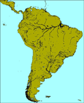
OSM World is a community project! If you wish to help, check the documentation and contact the author!
Welcome to OSM Wold: South America! This is a vector data scenery package covering the South American area. Coastlines, Rivers, lakes, roads, railways, and power lines with detail never before seen! All in an autogen-compatible density! You can see roundabouts, train terminals, harbor areas in a resolution of a point every 10 meters. At this same resolution a vectorial city class places residential (in small and big building variations, depending on surface area) and industrial areas exactly where they are supposed to be. This gives the city areas a resolution far superior to the capacity of FS-2004 default landclass bitmaps, limited to approximately 1 Km x 1 Km squares. OSM World: South America will even give you small roads leading to small towns (even a few houses across)! From big highway intersections, including ramps, to the tiniest rural pathways covering the entire South american area! Wherever in South America you fly, there is something to see!
You can enjoy this scenery near coastlines too! harbor areas and extremely detailed coastal topology (try the southern Chile). This scenery makes sure that the ocean is always flat, you can forget about the climbing water often found around photo-sceneries! This scenery is best paired with a good set of terrain meshes (like the freeware global SRTM mesh by Stephen Rothlisberger , available here: http://simviation.com/1/fs2004terrainmesh).
| Filename: | OSM_World_South_America.zip |
| License: | Freeware |
| Added: | 5th August 2015, 02:31:08 |
| Downloads: | 3,099 |
| Author: | Mario Noriega, Luis Miguel Hernandez |
| Size: | 64.37 MB |
| Category: Flight Simulator 2004 - Scenery | |
| Butuan Bancasi Airport, Butuan, Philippines |
|
File Description:
This is a totally new Butuan Scenery Addon for Flight Simulator 2004. This features Multi-Level of Detail (MLOD) which makes a scenery framerate-friendly. At a distance, the objects are on its LOW POLYGON STATE. And while you get closer and closer, the objects become more and more complex, making you landing sequence unaffected by heavy framerate hit due to the High number of Polygons of the Library Objects.
Butuan Bancasi Airport Scenery (RPME) features photorealistic textures. This includes the Main Terminal Building, the Philippine Airlines Cargo warehouse, the Old Butuan Airport Cargo Warehouse, the Air Transportation Office Building, the Old Private Hangar, and the Control Tower. This scenery has full night lighting textures and has night lighting beams that illuminate the ramp from the main terminal building. Other library objects included are: Cebu Pacific baggage carts, Cebu Pacific and Philippine Airlines stairs, Airport and Ramp personnel, cars, trucks, buses, jeeps, cows and horses. But these objects do not interfere with the framerate so much because this is defined in the MLOD feature.This scenery has not been tested with FS2002 but is more likely to work without problem in that version.
Currently, Philippine Airlines serves this destination daily from Manila arriving at 12:15 p.m. and departing for Manila at 01:15 p.m. Cebu Pacific also serves this destination daily from Manila arriving at 10:25 a.m. and departing for Manila at 11:15 a.m. and thrice weekly (Mon-Wed-Sat) from Mactan, Cebu arriving at 11:50 a.m. and departing for Mactan at 12:30 p.m.
| Filename: | Butuan_Bancasi_Airport_Butuan_Philippines.zip |
| License: | Freeware |
| Added: | 24th June 2004, 05:40:52 |
| Downloads: | 6,873 |
| Author: | Ver Walter Gulfan, Philippine Flightsimmers Group |
| Size: | 8.85 MB |


© 2001-2026 AVSIM Online
All Rights Reserved
Privacy Policy |