
Where Flight Simulation Enthusiasts Gather from Around the World!
AVSIM Library - Search Results

| Category: Flight Simulator 2004 - Scenery | |
| Lake Powell East / Natural Bridges National Monument, Utah, Photo-Scenery |

|
Images related to this file:
File Description:
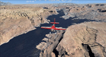
Lake Powell East / Natural Bridges National Monument, Utah, Photo-Scenery (FS9 & FSX)
This scenery covers the eastern part of Lake Powell from just south of Hite (UT03) and goes down south along White Canyon, Natural Bridges National Monument and the Grand Gulch Primitive Area all the way to the San Juan River. It extends my Canyonlands sceneries to the south and brings you another 3.500 sq km of wonderful southern Utah in 4.7m/pix quality. To explore the scenery depart from Cal Black Memorial Apt. (U96) and head east. High resolution versions of this scenery for FS9 and FSX (much sharper, but larger and multiple downloads) are available at www.blueskyscenery.com/CNY_South2West.html. The screenies are taken from the high-res versions, so expect this version to be slightly more blurry. YourDonation@Work: Dedicated to Guy, Ruben and EDB.
| Filename: | Lake_Powell_East__Natural_Bridges_National_Monumen.zip |
| License: | Freeware, limited distribution |
| Added: | 4th January 2010, 19:19:43 |
| Downloads: | 1,873 |
| Author: | Gottfried Razek, blueskyscenery.com |
| Size: | 95.26 MB |
| Category: Flight Simulator 2004 - Scenery | |
| Torrey, Box-Death Hollow Wilderness, Aquarius Plateau, Utah, Photo-Scenery (FS9 & FSX) |
|
Images related to this file:
File Description:
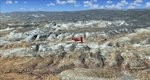
The southern part of this region covers the Box-Death Hollow Wilderness, with its vertical gray-orange walls of Navajo sandstone. Then comes the Aquarius Plateau which is the highest timbered plateau in North America with Boulder Mountain. In the north you'll find the little town of Torrey, which is just eight miles west of Capitol Reef National Park. Extends my Grand Staircase Escalante scenery to the north.
High resolution versions of this scenery for FS9 and FSX (much sharper, but larger and multiple downloads) are available at www.blueskyscenery.com/CNY_SouthWest3.html . The screenies are taken from the high-res versions, so expect this version to be slightly more blurry.
Thanks to Joop Mak for providing a custom AFCADs that correct airport layouts so that they align with the photo-textures! They are available here: www.blueskyscenery.com/AFCADs.html . YourDonation@Work: Dedicated to Ralf-Peter, Jon and Laurent.
| Filename: | Torrey_BoxDeath_Hollow_Wilderness_Aquarius_Plateau.zip |
| License: | Freeware, limited distribution |
| Added: | 3rd April 2010, 00:52:09 |
| Downloads: | 1,206 |
| Author: | Gottfried Razek - blueskyscenery.com |
| Size: | 93.79 MB |
| Category: Flight Simulator 2004 - AFCAD Files | |
| FlyTampa San Francisco (KSFO) v2 |
|
Images related to this file:
File Description:
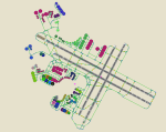
This AFCAD2 is for use with FlyTampa KSFO only. It must not be used with any other scenery, or the default KSFO. This file has been built from scratch and features accurate Taxiway naming, accurate parking and a Tower View. All gates and cargo ramps are assigned to the correct airlines, the United Airlines maintenance areas are included and feature "In Hangar" parking. United Express ramps are also included. An extensive GA area is now featured, capable of holding aircraft ranging from a C172 upto a B767. Finally, the US Coast Guard station has 3 parking positions. All runways are active and are all available for use at the same time, thanks to the crosswind runway activation technique.
This file replaces the AFCAD that was released in 2005, and provides up to date gate assignments as of April 2010. Previous Version had 3336 downloads. Enjoy!
| Filename: | FlyTampa_San_Francisco_KSFO_v2.zip |
| License: | Freeware |
| Added: | 17th April 2010, 13:52:48 |
| Downloads: | 2,144 |
| Author: | Lee Brompton |
| Size: | 57.46 KB |
| Category: Flight Simulator 2004 - AFCAD Files | |
| Denver with Active Crosswind Runways v2 |
|
Images related to this file:
File Description:
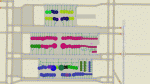
This is an AFCAD2 file for the freeware Denver Int'l Airport (KDEN) scenery by Harald Krause (dia2k4v1.zip). It is built from scratch using the latest FAA charts and information from the Denver airport website. All taxiways and gates are named and numbered as per real life and feature assigned airline parking. Parking areas for United Express, Great Lakes and Frontier Jet Express can also be found in their correct locations. A Tower view is now provided for the airport also. Using the crosswind runway technique, all runways can now be used simultaneously for takeoffs and landings at this airport. This file will not work properly if used with any other addon scenery, or the default airport. This file is an update to the AFCAD that was released in 2005, and provides up to date gate assignments as of April 2010. Previous Version had 2779 downloads. Enjoy!
| Filename: | Denver_with_Active_Crosswind_Runways_v2.zip |
| License: | Freeware |
| Added: | 17th April 2010, 13:53:12 |
| Downloads: | 800 |
| Author: | Lee Brompton |
| Size: | 218.98 KB |
| Category: Flight Simulator 2004 - Aircraft Repaints, Textures and Modifications | |
| China Southern, Embraer ERJ-145 (B-3060), v2 |
|
Images related to this file:
File Description:

I originally released this aircraft here on January 26th 2007. I recently received some valuable input from He Lingyuan, a fellow simmer from the great land of China. This input lead to a correction on the Chinese lettering on the right side of the fuselage. Thank you He Lingyuan. So, I took this opportunity to correct another problem with this aircraft repaint; the Rolls Royce engine logos. They were missing from the original repaint. They are now present. So, with these changes consider this re-release as a version 2.
Repainted textures are 32-bit with no mipmaps. As before, this is a full install; Dreamwings Design ERJ-145 model and air files included. Uses default panel and sounds, but see README file for panel and sound suggestions.
NOTE: This is a re-upload due to the AVSIM site compromise.
| Filename: | China_Southern_Embraer_ERJ145_B3060_v2.zip |
| License: | Freeware, limited distribution |
| Added: | 29th May 2010, 09:15:16 |
| Downloads: | 560 |
| Author: | Dreamwings Design, Jeffrey S. Bryner |
| Size: | 3.13 MB |
| Category: Flight Simulator 2004 - Flight Plans | |
| OB-27 Ashland Maine and Fort Drum New York |
|
Images related to this file:
File Description:
FS2004 Flight Plan for OB-27 Ashland ME and Fort Drum NY IFR high speed low altitude military training route. This is the tenth in a series of FS2004 flight plans I am uploading. This route goes through both flat and rolling and mountainous terrain in Maine, New Hampshire, Vermont and New York. These are great routes for B-52, F-111, B-1B, B-2 A6, A4, Vulcan and any fighter or bomber enthusiasts. Of course you can fly the route with any aircraft of your choice. Included in this package is a gauge by Karol Chlebowski for TFR flying at very low altitude. This gauge will greatly enhance your ability to fly these challenging routes and is a great companion of the flight plans. Another option to download Version 2.0 of my FS2004 mini panel which has all this functionality and more.
| Filename: | OB27_Ashland_Maine_and_Fort_Drum_New_York.zip |
| License: | Freeware |
| Added: | 27th July 2011, 23:07:39 |
| Downloads: | 100 |
| Author: | Bill McClellan |
| Size: | 522.79 KB |
| Category: Flight Simulator 2004 - Flight Plans | |
| OB-53 Minneapolis Minnesota |
|
Images related to this file:
File Description:
FS2004 Flight Plan for OB-53 Minneapolis Minnesota IFR high speed low altitude military training route. This is the fourteenth in a series of FS2004 flight plans I have uploaded. This route goes through mostly flat and rolling terrain in Minnesota, North Dakota and South Dakota. This route has three different sets of targets. These are great routes for B-52, F-111, B-1B, B-2 A6, A4, Vulcan and any fighter or bomber enthusiasts. Of course you can fly the route with any aircraft of your choice. Included in this package is a gauge by Karol Chlebowski for TFR flying at very low altitude. This gauge will greatly enhance your ability to fly these challenging routes and is a great companion of the flight plans. Another option to download Version 2.0 of my FS2004 mini panel which has all this functionality and more.
| Filename: | OB53_Minneapolis_Minnesota.zip |
| License: | Freeware |
| Added: | 27th July 2011, 23:10:27 |
| Downloads: | 77 |
| Author: | Bill McClellan |
| Size: | 366.29 KB |
| Category: Flight Simulator 2004 - Flight Plans | |
| OB-96 Fort Worth Texas |
|
Images related to this file:
File Description:
FS2004 Flight Plan for OB-96 Fort Worth Texas IFR high speed low altitude military training route. This is the fifteenth in a series of FS2004 flight plans I have uploaded. This route goes through mostly flat and rolling terrain in Texas, Oklahoma and Louisiana. This route has two different sets of targets. These are great routes for B-52, F-111, B-1B, B-2 A6, A4, Vulcan and any fighter or bomber enthusiasts. Of course you can fly the route with any aircraft of your choice. Included in this package is a gauge by Karol Chlebowski for TFR flying at very low altitude. This gauge will greatly enhance your ability to fly these challenging routes and is a great companion of the flight plans. Another option to download Version 2.0 of my FS2004 mini panel which has all this functionality and more.
| Filename: | OB96_Fort_Worth_Texas.zip |
| License: | Freeware |
| Added: | 27th July 2011, 23:11:17 |
| Downloads: | 94 |
| Author: | Bill McClellan |
| Size: | 466.75 KB |
| Category: Flight Simulator 2004 - Flight Plans | |
| OB-97 Fayetteville Arkansas |
|
Images related to this file:
File Description:
FS2004 Flight Plan for OB-97 Fayetteville Arkansas IFR high speed low altitude military training route. This is the sixteenth in a series of FS2004 flight plans I have uploaded. This route goes through mostly flat and rolling terrain in Arkansas, Texas, Oklahoma and Kansas. This route has two different sets of targets. These are great routes for B-52, F-111, B-1B, B-2 A6, A4, Vulcan and any fighter or bomber enthusiasts. Of course you can fly the route with any aircraft of your choice. Included in this package is a gauge by Karol Chlebowski for TFR flying at very low altitude. This gauge will greatly enhance your ability to fly these challenging routes and is a great companion of the flight plans. Another option to download Version 2.0 of my FS2004 mini panel which has all this functionality and more.
| Filename: | OB97_Fayetteville_Arkansas.zip |
| License: | Freeware |
| Added: | 28th July 2011, 09:22:42 |
| Downloads: | 64 |
| Author: | Bill McClellan |
| Size: | 489.81 KB |
| Category: Flight Simulator 2004 - Flight Plans | |
| OB-98 Rapid City South Dakota |
|
Images related to this file:
File Description:
FS2004 Flight Plan for OB-98 Rapid City South Dakota IFR high speed low altitude military training route. This is the seventeenth in a series of FS2004 flight plans I have uploaded. This route goes through both mountainous and flat and rolling terrain in South Dakota, Nebraska, Wyoming and Montana. This route has two different sets of targets. These are great routes for B-52, F-111, B-1B, B-2 A6, A4, Vulcan and any fighter or bomber enthusiasts. Of course you can fly the route with any aircraft of your choice. Included in this package is a gauge by Karol Chlebowski for TFR flying at very low altitude. This gauge will greatly enhance your ability to fly these challenging routes and is a great companion of the flight plans. Another option to download Version 2.0 of my FS2004 mini panel which has all this functionality and more.
| Filename: | OB98_Rapid_City_South_Dakota.zip |
| License: | Freeware |
| Added: | 28th July 2011, 09:23:26 |
| Downloads: | 76 |
| Author: | Bill McClellan |
| Size: | 360.49 KB |


© 2001-2026 AVSIM Online
All Rights Reserved
Privacy Policy |