
Where Flight Simulation Enthusiasts Gather from Around the World!
AVSIM Library - Search Results

| Category: Flight Simulator 2004 - Scenery | |
| 1960 Nice Côte d'Azur Airport (LFMN) |

|
Images related to this file:
File Description:
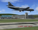
We have produced this scenery to provide taxiways and details as they were around 1960 at Nice airport. We have also included new parking to allow the AI aircraft to taxi correctly at the new (old!) airport. We had just a few photographs of the "old" Nice airport, so we tried to come as close as possible. Our goal was to reflect something of the atmosphere and feel of that period, prior to the all jet era of today.
| Filename: | 1960_Nice_Cte_dAzur_Airport_LFMN.zip |
| License: | Freeware, limited distribution |
| Added: | 20th December 2012, 21:16:20 |
| Downloads: | 4,013 |
| Author: | Harry Biard, Johan Dees, Jaap de Baare, Wolfgang Gersch, Nikko Yaginuma and Tom Gibson |
| Size: | 6.41 MB |
| Category: Flight Simulator 2004 - Aircraft Repaints, Textures and Modifications | |
| Icelandair Boeing 738-MAX V3 (TF-ICE) |
|
Images related to this file:
File Description:
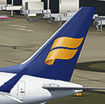
2004/FSX TDS Boeing 738-MAX V3 Icelandair (TF-ICE). Icelandair is the flag carrier of Iceland, headquartered at KeflavÃk International Airport in Iceland. It is part of the Icelandair Group and as of April 2018, operated scheduled services to 48 cities in 16 countries on both sides of the Atlantic Ocean out of its hub at KeflavÃk International Airport. Model design by Hiroshi Igami. Flight dynamics design by Nick Wilkinson and David Biggar. Master textures by Kyle Schurb.
| Filename: | Icelandair_Boeing_738MAX_V3_TFICE.zip |
| License: | Freeware, limited distribution |
| Added: | 23rd February 2021, 20:02:33 |
| Downloads: | 337 |
| Author: | Danny Cummings |
| Size: | 18.34 MB |
| Category: Flight Simulator 2004 - Scenery Design | |
| EZ-RWYand TAXI LIGHTS |
|
File Description:
These lights you place by yourself for those private airstirps at home or un-monitored airfields at night. This download contains two libraries. Both are indentical except one is controlled by nav2; the other one is controlled by ADF. Nav2 2 will light up day or night. ADF will light up at night only, no dusk\dawn. ADF just appears at night. Nav2 is animated... pops up out of the ground. Turn them off and they disappear into the ground, leaving only the day version (lamps out). No texutre files are needed except for the display I included. For that all is included here. This display shows all lights together and shows how they work. Please read the mustreadme file completely as well as the readme file in one of the included folders. Thanks to David (Opa) Marshall for his inspiration in this and his beta testing and John B. Loney's help as well, who, btw is working on a couple of nice sceneries in CA. One will have a 18 hole golf course with it. Have fun and enjoy. Bob
| Filename: | EZRWYand_TAXI_LIGHTS.zip |
| License: | Freeware |
| Added: | 11th August 2007, 22:47:38 |
| Downloads: | 2,021 |
| Author: | Robert Lacy |
| Size: | 300.19 KB |
| Category: Flight Simulator 2004 - Scenery | |
| Nicholson Peninsula CWNP & Liverpool Bay CWLB DEW sites in Northwest Territories, Canada |
|
Images related to this file:
File Description:
These are DEW line sites in northern mainland Canada, to the east of Tuktoyaktuk.
Nicholson Peninsula is 100 miles east of Tuktoyaktuk and was not included in FS9. The peninsula is sometimes more like an island than a peninsula as it is barely connected to the mainland and at times is not connected at all (see the current Gogle Earth!). At the northern end there is another long and narrow gravel bar that is formed by the tide and currents and the gravel runway is on the top of this. It is now officially closed, but is still usable. The annual refuelling and maintenance to the NSW station up on the hills is carried out from a barge that lands tanker trucks onto the shore for the drive up the existing gravel roads that have been there since the early DEW station was established.
Liverpool Bay is 50 miles east of Tuktoyaktuk, up on higher land at around 300 feet ASL. The NWS (there was no previous DEW station at this site) is serviced by helicopter from Tuktoyaktuk or from a barge a mile away on the beach. There is a gravel landing pad on the north side of the station. To answer your question, the three little houses on stilts are actually fuel tanks for the generators, shaped to shed snow.
| Filename: | Nicholson_Peninsula_CWNP__Liverpool_Bay_CWLB_DEW_s.zip |
| License: | Freeware, limited distribution |
| Added: | 17th July 2012, 18:55:24 |
| Downloads: | 238 |
| Author: | Roger Wensley |
| Size: | 1.84 MB |
| Category: Flight Simulator 2004 - Scenery | |
| Mackenzie CYZY in British Columbia, Canada |
|
Images related to this file:
File Description:
Mackenzie is around 120 miles west of Peace River and the BC/Alberta border, at the southern end of Williston Lake. The lake is 135 miles long and the population of the town is about 3,500; those figures illustrate typical Canada, a huge area enjoyed by the few. The main occupations relate to timber and mining in some form, plus tourism (in particular winter sports tourism). The airport is 2 miles southwest of the town, with no regular scheduled flights but it is not unusual to find Central Mountain Air there delivering either charter passengers or freight. The single runway is aligned 16-34 and 100 feet wide lit asphalt that is just over 5,000 feet long, with (in 2010 or so) an additional 1,500 feet of gravel. There is PAPI at both ends of the asphalt. The largest operation based at the airfield is a helicopter company, at the northern end of the apron. There is a "mandatory frequency" of 123.5 which is a Canadian invention; you MUST have a radio. There is no control tower at the actual airfield, and if or when there is no response from further afield then you announce your intentions etc. In FS9 there is no way to "switch off or on" the monitoring of a MF radio frequency so you will find that this one is always silent.
| Filename: | Mackenzie_CYZY_in_British_Columbia_Canada.zip |
| License: | Freeware, limited distribution |
| Added: | 27th December 2018, 20:19:05 |
| Downloads: | 135 |
| Author: | Roger Wensley |
| Size: | 19.81 MB |
| Category: Flight Simulator 2004 - Aircraft Repaints, Textures and Modifications | |
| VT ANG Air Museum Collection - Part 2 |
|
File Description:
The Vermont Air National Guard was organized on 1 July 1946 at Burlington Municipal Airport and was federally recognized as the 134th Fighter Squadron on 14 August 1946 making it the fifth US ANG unit so formed and recognized. Since that time the VT ANG has flown eight different aircraft types in its primary mission and several more in support of it. The primary mission aircraft flown include the P-47D-40, P-51D-25, F-94B, F-89J, F-102A, EB-57B, F-4D, F-16A and the current F-16C. The mission support aircraft flown include the L-5, AT-6C, AT-11, C-47B, T-33A, C-45H (?), C-54G, C-131D, C-12F and C-26A. The VT ANG has a small air museum near the main gate to their base at Burlington
International Airport which currently includes a T-33A, F-94B, F-89J, F-102A, F-4D, C-47B, C-45H and C-131D. My virtual VT ANG Air Museum Collection for FS9 is an attempt by an old 134th FS veteran to duplicate and expand upon the actual VT ANG Air Museum. This second download package, vamc2.zip, includes my VT ANG repaints of the AT-6G Texan by Cliff Presley, the P-51D Mustang by Andrew Wai and the P-47D Thunderbolt by Krzysztof Malinowski/Greg Pierson/Tom Kohler.
| Filename: | VT_ANG_Air_Museum_Collection__Part_2.zip |
| License: | Freeware, limited distribution |
| Added: | 9th March 2004, 00:28:31 |
| Downloads: | 865 |
| Author: | Mike MacIntyre |
| Size: | 7.17 MB |
| Category: Flight Simulator 2004 - Scenery | |
| Lake Athabasca Airfields in Alberta & Saskatchewan Canada |
|
Images related to this file:
File Description:
These are four airfields around or near Lake Athabasca, in Alberta and Saskatchewan. Fort Chipewyan CYPY is at the southwestern end of the lake and the direct recipient of pollution that flows north from the Tar Sands to the south. The population of around 850 lives in one of the earliest European settlements in Alberta, founded as a trading post by Peter Pond of the Northwest Company in 1788 and named for the Chipewyan people who lived in the area. The airfield has one runway aligned 03-21 and 5,000 feet of asphalt, with PAPI at both ends. The landclass has been modified along with the grassed area of the airfield to create the village on the lakeshore. There are scheduled flights and GA flights in the AI for all four airfields. Charlot River CJP9 is on the northern shore at the western end of the lake, in Saskatchewan. It serves a nearby hydroelectric project and is used to transport technical staff in and out. There is no terminal building, only waiting pickup trucks and a generator building. There is one lit gravel runway aligned 04-22 and just over 3,200 feet long. Fond-du-Lac CZFD is on the northern shore in Saskatchewan, at the narrower eastern end. The population is around 900 and is a remotely situated "fly-in" village that has existed for over 150 years where "living off the land" is an accepted and normal way of life. The village has been created along with the airfield. The single runway is 3,800 feet of lit gravel aligned 10-28 with PAPI at the western end. Stony Rapids CYSF is east of the end of Lake Athabasca, on the Fond du Lac River. It has a population of around 250 and is only semi-connected to the rest of Canada by a rough gravel road. The runway is over 5,000 feet of gravel, aligned 06-24 with PAPI at both ends. The NorthSKlake is a flatten for an Ultimate Terrain lake that was at an incorrect elevation.
| Filename: | Lake_Athabasca_Airfields_in_Alberta__Saskatchewan_.zip |
| License: | Freeware, limited distribution |
| Added: | 7th August 2018, 12:39:52 |
| Downloads: | 181 |
| Author: | Roger Wensley |
| Size: | 20.36 MB |
| Category: Flight Simulator 2004 - Miscellaneous Files | |
| Harley Davidson |
|
File Description:
This GMAX model features a fully animated rider
and suspension with additions including a filling sequence ,
kickstand deploy plus brake lights and a headlight .
From the VJPL Flight Lab at WestCoastATC.com
| Filename: | Harley_Davidson.zip |
| License: | Freeware, limited distribution |
| Added: | 25th March 2006, 19:09:32 |
| Downloads: | 1,200 |
| Author: | Chuck Jodry VJPL WestcoastATC.com |
| Size: | 3.38 MB |
| Category: Flight Simulator 2004 - AI Flight Plans | |
| Italiweb Summer 2006 |
|
File Description:
FS2004 Italiweb AI Flight Plans for the first week of August 2006 with the codeshare flights operated for Alpi Eagles. Requires MRAI Installer can be found at http://aita2004.pvdveen.net/download.htm.
| Filename: | Italiweb_Summer_2006.zip |
| License: | Freeware, limited distribution |
| Added: | 13th April 2006, 18:19:27 |
| Downloads: | 750 |
| Author: | Massimiliano Leveratto |
| Size: | 6.6 KB |
| Category: Flight Simulator 2004 - Scenery | |
| Fort Myers - Page Field, Florida (KFMY) |
|
File Description:
KFMY Page Airport at Ft.Myers FL.. this is a companion airport to KRSW Southwest Florida Intl. This airport has been made using EZ-Scenery... RWY12 and EZ scenery libraries are required...
| Filename: | Fort_Myers__Page_Field_Florida_KFMY.zip |
| License: | Freeware |
| Added: | 1st June 2006, 04:26:30 |
| Downloads: | 1,590 |
| Author: | Ray Lunning, Tom Pamin |
| Size: | 392.29 KB |


© 2001-2026 AVSIM Online
All Rights Reserved
Privacy Policy |