
Where Flight Simulation Enthusiasts Gather from Around the World!
AVSIM Library - Search Results

| Category: Flight Simulator 2004 - Scenery | |
| Deline CYWJ - Northwest Territories, Canada |

|
Images related to this file:
File Description:
This is the third in a series of airfields that follow in a southward direction that early access route to the Canadian northern shore, the Mackenzie River. Deline is south of Tuktuk, Inuvik, Fort McPherson, and Fort Good Hope, all already posted. Deline is at 704 feet asl and around 50 miles east of the the Mackenzie, where the Great Bear River flows out of the western end of Great Bear Lake on its way to the Mackenzie. This lake is huge. The town of Deline has a population of around 500, and the first trading post (of the North West Company) was established there as early as 1799. The Hudson Bay Company opened an outpost in 1825 to support the Franklin Arctic Exploration expedition, and it was then called Fort Franklin. The name was changed to Deline in 1993. The airport is just over a mile north of the town, and has almost 4,000 feet of gravel runway. There is no fuel available. The original airfield is still visible just to the north of the town, from before it was rebuilt on higher ground (better drainage) and away from the houses. AI will follow with later posts.
| Filename: | Deline_CYWJ__Northwest_Territories_Canada.zip |
| License: | Freeware, limited distribution |
| Added: | 5th July 2014, 14:47:36 |
| Downloads: | 242 |
| Author: | Roger Wensley |
| Size: | 2.54 MB |
| Category: Flight Simulator 2004 - Aircraft Repaints, Textures and Modifications | |
| Air North 'Yukon Livery' Boeing 737-201 (C-GNAU) |
|
File Description:
I am proud to present this realistic, detailed repaint of Air North's Boeing 737-201, registration C-GNAU, in the newer "Yukon livery". This aircraft has a distinct orange tail with the name of the territory which gives this airline its name; Yukon. Air North is a Canadian Airline based in Whitehorse, Yukon, and is 100% owned by Yukoners. This project has been fun for a significant reason; the people of Air North. I contacted them with a request for their logos to use in this repaint, and they were gracious and professional in granting my request. So I dedicate this repaint to Air North their kind personnel; especially Josh Clark. For this as with all of the aircraft I paint, I paid attention to detail and realism as much as possible and generated this repaint with realistic but not overstated details. The textures in this repaint are 32-bit. All Air North logos used in this repaint are copyrighted property of Air North and are used on this repaint with permission from Air North. This is a textures only package; you must have the Tinmouse 737-200adv v2 base package available here at AVSIM.
| Filename: | Air_North_Yukon_Livery_Boeing_737201_CGNAU.zip |
| License: | Freeware, limited distribution |
| Added: | 22nd August 2008, 02:12:46 |
| Downloads: | 957 |
| Author: | Jeffrey S. Bryner | Tinmouse II Project |
| Size: | 8.85 MB |
| Category: Flight Simulator 2004 - Aircraft Repaints, Textures and Modifications | |
| US Air Metal Fuse BAC 1-11 204AF (N1127J) |
|
Images related to this file:
File Description:
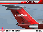
I am very proud to present this very detailed and realistic repaint of the BAC 1-11 204AF model by David Maltby in the classic US Air livery from the early 80's. This was one of the original jets flown by US Air. It flew side by side in their fleet with the B727, DC9 and 737-200. This repaint is the result of a major overhaul of the paintkit for this aircraft, and is very detailed and realistic. The many new details and hand repainted items include; custom metal fuselage, custom windows, custom tail textures, hand painted wheels, and also much needed night lighting and night textures. The US Air logo is also hand painted. All repainted textures in this package are 32-bit with no mipmaps. This repaint is dedicated to Lorne Jordan, a Canadian simmer who inspired this project and who helped Q/A this repaint so we didn't miss a detail. Thanks to the permission granted by of the gracious and talented David Maltby (creator of this aircraft model), this is a full installation package, complete with 2D panel, virtual cockpit and BAC 1-11 sounds. Please see README.TXT for installation instructions.
| Filename: | US_Air_Metal_Fuse_BAC_111_204AF_N1127J.zip |
| License: | Freeware, limited distribution |
| Added: | 5th May 2012, 07:36:27 |
| Downloads: | 851 |
| Author: | Jeffrey S. Bryner, Lorne Jordan, David Maltby |
| Size: | 21.41 MB |
| Category: Flight Simulator 2004 - Scenery | |
| Mackar Inlet CWMI in Nunavut, Canada |
|
Images related to this file:
File Description:
Mackar Inlet was a DEW line Auxiliary Station on the west shore of the Melville Peninsula, which is part of the northern Canadian mainland. The station was closed only in 1992, so it is relatively intact. Hall Beach is 120 miles to the east, on the eastern shore of the peninsula, and Kugaaruk is just over 100 miles to the west. The runway is still in good condition and is around 3,800 feet of gravel 110' wide, aligned 164T/344T and at 100 feet ASL. The station buildings are up on the hill at 1,350 feet ASL and 5 miles to the south. None of these DEW line stations are particularly impressive or even interesting. However, you can bet that any pilot flying regularly in the north along the coast knows where all these runways are, in case one of them suddenly becomes his favourite in the whole world just after the sudden silence. I should have mentioned a long time ago that to see the apron lights working (on my fields that HAVE apron lights) requires you to have the "lights_ss_v2" by Sidney Schwartz installed.
| Filename: | Mackar_Inlet_CWMI_in_Nunavut_Canada.zip |
| License: | Freeware, limited distribution |
| Added: | 2nd December 2012, 17:58:34 |
| Downloads: | 218 |
| Author: | Roger Wensley |
| Size: | 1.16 MB |
| Category: Flight Simulator 2004 - Scenery | |
| Colville Lake CEB3 in Northwest Territories Canada |
|
Images related to this file:
File Description:
Colville Lake is a small village of around 150 Dene, located to the northwest of the Great Bear Lake and east of the Mackenzie River, 120 miles north of Norman Wells. The village and the airfield are next to each other and to the lake shore. I recently discovered which of the standard terminal buildings had been used there and this, along with information I already had, enabled me to now make the scenery, which is based on an approximate 2010 date. The gravel runway is lit and around 2,800 feet long, aligned 10-28. North Wright Air serves the village from it's headquarters at Norman Wells with daily flights by de Havilland Twin Otters, or "twotters" as they were quickly named among the northern Canadian airline personnel when they were first produced. The approximate time of this scenery is 2010. While testing this scenery I discovered that Tulita (previously called Fort Norman) which is another Mackenzie River airfield to the south of Norman Wells, needs to be reposted due to a terrain fault. If you find an error here then email me please, and note that my email address has been changed to rogwens at Gmail dot com.
| Filename: | Colville_Lake_CEB3_in_Northwest_Territories_Canada.zip |
| License: | Freeware, limited distribution |
| Added: | 31st July 2021, 18:23:48 |
| Downloads: | 70 |
| Author: | Roger Wensley |
| Size: | 4.51 MB |
| Category: Flight Simulator 2004 - Scenery | |
| Bella Coola CYBD in British Columbia, Canada |
|
Images related to this file:
File Description:
Bella Coola is in one of the deep east-west fjords amid the Coastal Range on the coast of BC, approximately mid way between Vancouver and the Alaskan border and some 70 miles inland from the open ocean. The town of Bella Coola has a small population of around 150, while the population of the whole Bella Coola Valley is around 2,000. The valley is warmer in both summer and winter than the surrounding area, and tourism flourishes along with forestry, fishing, and local government administration. Although there is road access, the ferry service is the main connection to larger coastal towns or cities such as Vancouver. The airport, 7 miles east of the town, is connected by daily Pacific Coastal flights to Vancouver and Anahim Lake (to the east). The asphalt runway is 4,200 feet long and aligned 04-22 in FS9 (by 2010 this had changed to 05-23 in reality) and is without lighting of any sort, so it is restricted to daylight hours only. At the eastern end is the terminal building and in the middle the West Coast Helicopter hangar, which has a large fenced paddock-like enclosure in front of it. The helicopters hop over the three feet high fence as they "taxi" to the apron in front of the hanger (but not in FS9!). Between the two there are four other company hangars spread out along the roadway beside the fence. I have never seen the airfield in Summer, and I have not attempted to replicate the apron as it now shows in Google Earth. The screenshots show the main and overwhelming feature of Bella Coola, the large valley amid the steep mountains. This terrain has an inevitable effect on the ai, in that you will never see a plane land as it hits solid rock before it makes it to the runway. You will, however, see them take off. Pacific Coastal currently flies Beechcraft 1900's to Bella Coola; I have used the Saab 340 which I have seen there some years ago and which I prefer.
| Filename: | Bella_Coola_CYBD_in_British_Columbia_Canada.zip |
| License: | Freeware, limited distribution |
| Added: | 25th October 2018, 17:57:06 |
| Downloads: | 286 |
| Author: | Roger Wensley |
| Size: | 14.57 MB |
| Category: Flight Simulator 2004 - Scenery | |
| Victoria, Canada area scenery |
|
File Description:
This is a complete upgrade of vicenh05, Victoria, Canada area scenery for FS9. New in this version: automated installer and configurator from Ken Peters; several detailed models including the Empress Hotel, the Legislature, the Regent Hotel and the Johnson St. Bridge; greatly enhanced Inner Harbour; many generic buildings representing buildings throughout the area; 7 new small airfields with sloping runways; seven new floatplane bases (owners of Vancouver+ get extensive floatplane traffic in local liveries); 7 new heliports (Vancouver+ users get additional heli AI traffic) and a myriad of minor fixes and improvements. Included from previous versions are revised shorelines, landclass and 19m mesh and buffer meshes for South-Eastern Vancouver Island; boat docks with static boats, seaplane docks and terminal buildings for Harbour Air, Kenmore Air and West Coast Air; piers, buildings, breakwater and other components of the Ogden Point Terminal; dock, service building and pilot boats of the Pacific Pilotage Authority; Odgen Point Cafe and Dive Shop; marine navigational lights for Victoria Harbour and area, including Esquimalt harbour and Oak Bay; antennae location corrections for the area; AFCADs included: Land based (CML2), Floatplane (CAB3, CAP5, CAP8, CAV8, CAW7, CAX6, CMAP, CYWH), Heli (CAL7, CBF5, CBF7, CBK8, CBW7, CBW9, CBZ7, CMBH); AI craft models and repaints (Cruise ships are repaints of Asuka model by Mitsuya Hamaguchi: MS Amsterdam of the Holland America Line travelling from Victoria to Vancouver, MS Summit of the Celebrity Cruise Line travelling from Seattle to Victoria); S-61 Sea-King helicopter in Helijet colours; Pacific Pilot custom vessel working from the Pilot dock; 22, 30 and 40 foot vessels plying the harbour and nearby Straight of Juan de Fuca. Effects included for lights, water, smoke effects. Many flights are offered, including two flights for owners of the Aerosoft Beaver (not required). Ultimate Terrain compatible (not required). Users of Misty Fjords will also get additional cruise ship traffic: the Island Princess and the Volendam alternating with the Amsterdam and Summit. Fully compatible with Don Grovestine's excellent CYYJ 2007. Replaces viflat.zip, ve4_tr1.zip, vicenh02.zip, vicenh03.zip, vicenh04.zip and vicenh05.zip. Detailed documentation included. By Jon Patch and Holger Sandmann.
| Filename: | Victoria_Canada_area_scenery.zip |
| License: | Check within download |
| Added: | 29th January 2010, 21:22:09 |
| Downloads: | 5,320 |
| Author: | Jon Patch and Holger Sandmann |
| Size: | 24.28 MB |
| Category: Flight Simulator 2004 - Sounds | |
| AIG Alpha India Group Tower Package Release 6 |
|
Images related to this file:
File Description: UPDATE FOUND HERE:

This is the sixth release package of 37 EditVoicepack files for FS2004/FSX by the Alpha India Tower Group. This package includes all previously released files since Package Release 5. Our goal is to provide accurate ATC calls in order to provide Microsoft Flight Simulator traffic with quality ATC. These sounds are the best that we have been able to compile and are accurate as of release date and to the extent that our data and the limitations of the EditVoicepack allow. Included in this package release are ARCTIC EAGLE, BARBIE, BEAUTY, BLIZZARD, BRIKO, CALIMA, CATATUMBO, CITATION, COMOROS AIRLINE, DANACO, EIFEL, FASTLINK, GLOBAL AUSTRIA, JETSUN, JOY AIR, JUMP RUN, KUNMING AIR, LUCKY AIR, LUFO, MAC, MINT AIRWAYS, NASAIRWAYS, NAWRAS, PACIFIC PEARL, PERLA, RELIABLE, REPATRIATE, RUBY, RYUKYU, SCORPIO UNIVERS, SUN GROUP, TASMAN, TECHWIN, TEEWAY, UTAIR-EXPRESS, UT-UKRAINE, and W-BUSINESS. Visit us at www.alpha-india.net for more information.
| Filename: | AIG_Alpha_India_Group_Tower_Package_Release_6.zip |
| License: | Freeware, limited distribution |
| Added: | 6th August 2011, 03:07:27 |
| Downloads: | 3,589 |
| Author: | Alpha India Group |
| Size: | 31.84 KB |
| Category: Flight Simulator 2004 - Aircraft Repaints, Textures and Modifications | |
| LAPA Namc YS-11 Combi (Launch Livery) |
|
File Description:
IJ in LAPA Launch livery.When in September 1979 Austral ceased operations with the Namcs, LAPA (Lineas Aereas Privadas Argentinas) an emergent commuter airline, bought the three planes and obtained the governmental license to exploit the forsaken routes left by Austral. With a new livery, and an agressive advertising campaign, the Namcs based at SABE, begun flights to Gral. Pico, Gral. Roca, La Plata, Mar del Plata, Necochea and Pehuajo. Despite a promising beginning, such routes were not profitable at the end, and the planes flew with a coefficient of occupation of only 21%, too low to keep the Namcs on the air. LAPA then, decided to halt the YS-11 and to replace them with the smaller Shorts 330. By the end of 1981, the Namcs were made available to the market, and bought by Mid-Pacific Air, concluding fourteen years of presence of the Namcs in Argentina. Included in this file there's a version of the YS-11 Combi fitted with the external Apu kit, done by Esa Kaihlanen. Textures only for the AFG's Namc YS-11 V2.7 Combi Configuration (ys-11combi.zip).
| Filename: | LAPA_Namc_YS11_Combi_Launch_Livery.zip |
| License: | Freeware |
| Added: | 6th April 2007, 10:01:24 |
| Downloads: | 464 |
| Author: | AFG / Damian Radice |
| Size: | 9.19 MB |
| Category: Flight Simulator 2004 - Original Aircraft | |
| North American B-45 and RB-45 Tornado FS2004 |
|
Images related to this file:
File Description:
The North American B-45 Tornado was one of the most important American aircraft of the early Cold War period, and one of the least remembered today. It was the first bomber-sized jet bomber in service anywhere in the world, first jet to drop a live atomic bomb, first jet to cross the North Pacific non-stop (Alaska to Japan,) first jet to fly the North Atlantic (with stops), NATO forces’ first and for some time only nuclear deterrent, first reconnaissance plane to fly deep penetration missions over North Korea, the People’s Republic of China, and the Soviet Union, and first aircraft to routinely use in-flight refueling on combat missions. The package includes twenty models and three dozen authentic skins depicting every major variant and numerous minor and sub-variants as they appeared throughout the type’s service life. A detailed manual explains some of the type’s unique operational procedures. Mostly by David Wooster with some help and skins painted by Mick.
| Filename: | North_American_B45_and_RB45_Tornado_FS2004.zip |
| License: | Freeware, limited distribution |
| Added: | 16th February 2023, 01:15:07 |
| Downloads: | 194 |
| Author: | David Wooster |
| Size: | 340.85 MB |


© 2001-2026 AVSIM Online
All Rights Reserved
Privacy Policy |