
Where Flight Simulation Enthusiasts Gather from Around the World!
AVSIM Library - Search Results

| Category: Flight Simulator 2004 - AI Flight Plans | |
| SVG AIR AI FlightPlans 2016 |

|
Images related to this file:
File Description:

SVG AIR AI FlightPlans 2016. I made these flightplans to use with my repaints of the SVG Air fleet, found right here on Avsim.com. Just search for Finbar Lesmond to find them. They work really well though they are not a true reflection of the company's schedules. SVG AIR is a charter outfit, thus there is no available data on their random movements. So take those plans with a pinch (TON) of salt. I made them for FS2004 but I use them in FSX/Steam. Enjoy.
| Filename: | SVG_AIR_AI_FlightPlans_2016.zip |
| License: | Freeware |
| Added: | 25th August 2016, 12:06:32 |
| Downloads: | 344 |
| Author: | Finbar Lesmond |
| Size: | 153.97 KB |
| Category: Flight Simulator 2004 - Aircraft Repaints, Textures and Modifications | |
| Rockwell (Boeing) B-1B (85-0060), Kansas Air National Guard "Reach Out & Touch Someone" |
|
Images related to this file:
File Description:
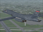
This aircraft is as it appeared in the late '90s while operating with the 184th Bomb Wing, Kansas Air National Guard (127th Bomb Squadron "Flying Jayhawks") at McConnell AFB in Wichita, Kansas. The 184th BW was the first Air National Guard unit in the history of the U.S. Air Force to fly a heavy bomber. ANG B-1B's operated out of McConnell from July 1994 to August 2002. These textures are intended for use with the Alpha Simulations "B-1B Lancer" payware aircraft package.
| Filename: | Rockwell_Boeing_B1B_850060_Kansas_Air_National_Gua.zip |
| License: | Freeware, limited distribution |
| Added: | 19th May 2010, 05:13:01 |
| Downloads: | 611 |
| Author: | Alphasim, Frank Safranek |
| Size: | 680.54 KB |
| Category: Flight Simulator 2004 - Flight Plans | |
| RTW-K4-05 |
|
File Description:
An FS2K4 GPS flight and plan by the Ancient Brit and the RTW-K4 Team for the FS2K4 default aircraft (B737-400) and scenery. Depart Kvernberget (ENKB) runway 07, Kristiansund, Norway and arrive 48 minutes later at Leirin (ENFB) runway 15, Fagerness, Norway. The plan is fully flight briefed with Word and text briefings and kneeboard in-flight briefing. A start-up flight that loads the plan, weather and kneeboard flight briefing is included; also a short Finals practise flight is included. The flight starts with a low level (1,500 ft) trip along a winding steep sided Fjord then climbs into the mountains (5,700 ft) skimming some peaks dodging others before concluding with a non-ILS finals.
| Filename: | RTWK405.zip |
| License: | Freeware |
| Added: | 4th October 2003, 00:17:41 |
| Downloads: | 788 |
| Author: | Denis Egan |
| Size: | 77.88 KB |
| Category: Flight Simulator 2004 - Flight Plans | |
| RTW-K4-01 |
|
File Description:
An FS2K4 GPS flight and plan by the Ancient Brit and the RTW-K4 Team for the FS2K4 default aircraft (B737-400) and scenery. Depart Gatwick (EGKK) runway 08R, London, UK and arrive 1 hour 3 minutes later at Isle of Man (EGNS) runway 08, Isle of Man, UK. The flight is fully flight briefed with Word and text briefings and with kneeboard in-flight briefing. The Briefings contain climb, cruise, and top of descent and fuel loading details, waypoint timings and destination details. A start-up flight that loads the plan, weather and kneeboard flight briefing is included also a Finals practice flight. Low level views of London and a non-ILS finals are features of this flight.
| Filename: | RTWK401.zip |
| License: | Freeware |
| Added: | 13th September 2003, 00:01:12 |
| Downloads: | 1,161 |
| Author: | Denis Egan |
| Size: | 61.39 KB |
| Category: Flight Simulator 2004 - Miscellaneous Files | |
| Real World Flight Plans for B767 |
|
File Description:
The two files contain real world B767- 200/300/400 flight plans taken over two 3 day periods, one in August 2003, and the other during March 2004, which originated in, terminated in or passed through UK Airspace. Duplicate routes have been removed from the list, though there may be duplicate city pairs where different routes were flown.
The format of the file is suitable for use by FSBuild and may be included as a Category of flight plans. Alternatively, the route portion may be copied and pasted into the FSBuild route field.
The flight plans from 2003 will need validation as there have been significant changes to airways since they were created.
NOT FOR REAL WORLD NAVIGATION
| Filename: | Real_World_Flight_Plans_for_B767.zip |
| License: | Freeware |
| Added: | 24th March 2005, 14:01:50 |
| Downloads: | 701 |
| Author: | Andrew Piper |
| Size: | 50.83 KB |
| Category: Flight Simulator 2004 - Aircraft Repaints, Textures and Modifications | |
| Bahamas Airways BAC 1-11 432FD |
|
File Description:
BAC 1-11 432FD VP-BCY as operated by Bahamas Airways between November 1968 and the Spring of 1969. The carrier leased this One-Eleven till the One-Eleven 517FEs the company ordered were delivered. Bahamas Airways was liquidated in 1970 when an attempted take-over by the the Bahamian government was stymied by owners BOAC, so the carrier's flirtations with the One-Eleven range were short-lived. Textures only - you'll need the original 111-400 model by David Maltby's DM Flight Sim (http://www.dmflightsim.co.uk/). All daytime textures for the fuselage, vertical stabiliser, tailplane and engines are of the 32-bit variety, but everything else is a DXT3. No added sugar OR mip-maps either.
| Filename: | Bahamas_Airways_BAC_111_432FD.zip |
| License: | Freeware |
| Added: | 20th August 2005, 18:18:55 |
| Downloads: | 487 |
| Author: | Bob Hall |
| Size: | 1.57 MB |
| Category: Flight Simulator 2004 - Scenery | |
| Craig Municipal Airport v1.5 |
|
File Description:
FS2004 Scenery-Craig Municipal Airport v1.5 (IATA: CRG, ICAO: KCRG) is a mid-sized facility for personal aircraft and small commuter planes located 8 mi (12.9 km) east of Jacksonville, Florida, United States. The airport has a control tower and handles 400-500 aircraft operations daily. Craig Municipal Airport serves Jacksonville and Duval County and is owned by Jacksonville Port Auth. The airport has more than one runway. The longest is a paved runway extending 4007 feet. The facility is at an elevation of 42 feet. THIS DOWNLOAD CORRECTS ALL REPORTED ERRORS FROM VERSION 1. Created with EZ Scenery whose libraries are required. The readme file is REQUIRED READING. By John B. Loney, Jr.
| Filename: | Craig_Municipal_Airport_v15.zip |
| License: | Freeware, limited distribution |
| Added: | 29th April 2007, 21:42:44 |
| Downloads: | 1,081 |
| Author: | John B. Loney, Jr. |
| Size: | 1.21 MB |
| Category: Flight Simulator 2004 - Aircraft Repaints, Textures and Modifications | |
| Austral BAC 1-11 420EL |
|
File Description:
State-owned Austral airlines made the jump to the jet age on 10 December, 1967 when BAC One-Eleven 420EL construction number H122, registered LV-IZR was handed over to the Argentine carrier. LV-IZR served with the airline straight through September, 1982, when it was leased out to Quebecair in Canada and re-registered C-GQBP. These textures are for the BAC One-Eleven 400 model by David Maltby's DM Flight Sim (available at http://www.dmflightsim.co.uk). The fuselage, engines and tail unit have been rendered in 32-bit textures, with DXT3s used everywhere else. To ensure it doesn't go all blurry with some video cards, all mip-maps have been scientifically, but brutally, exorcised.
| Filename: | Austral_BAC_111_420EL.zip |
| License: | Freeware |
| Added: | 17th August 2005, 00:18:04 |
| Downloads: | 358 |
| Author: | Bob Hall |
| Size: | 1.34 MB |
| Category: Flight Simulator 2004 - AI Aircraft | |
| Ultimate Gulfstream 4 Part 4 |
|
File Description:
Ultimate GA is delighted to bring you the most comprehensive and detailed AI package to date.
These packages contain (in total) 358 repaints covering all 558 known Gulfstream 4, Gulfstream 300 and Gulfstream 400 in service. The flightplans were created with highly accurate flight plan data gleamed from flight tracking resources flying over 6500 weekly sectors.. Major fractional fleet operators, such as Netjets are covered, all corporate owners and every military and government operated example. Very easy installation for FS2004 users, flight plan textfiles are included for FS2002 users.
Part Four of Four. Please ensure that you download all four files prior to installation. (Re-upload of missing file)
| Filename: | Ultimate_Gulfstream_4_Part_4.zip |
| License: | Freeware, limited distribution |
| Added: | 24th August 2013, 10:48:17 |
| Downloads: | 11,269 |
| Author: | Ultimate GA, Henry Tomkiewicz |
| Size: | 13.43 MB |
| Category: Flight Simulator 2004 - Scenery | |
| Bella Coola CYBD in British Columbia, Canada |
|
Images related to this file:
File Description:
Bella Coola is in one of the deep east-west fjords amid the Coastal Range on the coast of BC, approximately mid way between Vancouver and the Alaskan border and some 70 miles inland from the open ocean. The town of Bella Coola has a small population of around 150, while the population of the whole Bella Coola Valley is around 2,000. The valley is warmer in both summer and winter than the surrounding area, and tourism flourishes along with forestry, fishing, and local government administration. Although there is road access, the ferry service is the main connection to larger coastal towns or cities such as Vancouver. The airport, 7 miles east of the town, is connected by daily Pacific Coastal flights to Vancouver and Anahim Lake (to the east). The asphalt runway is 4,200 feet long and aligned 04-22 in FS9 (by 2010 this had changed to 05-23 in reality) and is without lighting of any sort, so it is restricted to daylight hours only. At the eastern end is the terminal building and in the middle the West Coast Helicopter hangar, which has a large fenced paddock-like enclosure in front of it. The helicopters hop over the three feet high fence as they "taxi" to the apron in front of the hanger (but not in FS9!). Between the two there are four other company hangars spread out along the roadway beside the fence. I have never seen the airfield in Summer, and I have not attempted to replicate the apron as it now shows in Google Earth. The screenshots show the main and overwhelming feature of Bella Coola, the large valley amid the steep mountains. This terrain has an inevitable effect on the ai, in that you will never see a plane land as it hits solid rock before it makes it to the runway. You will, however, see them take off. Pacific Coastal currently flies Beechcraft 1900's to Bella Coola; I have used the Saab 340 which I have seen there some years ago and which I prefer.
| Filename: | Bella_Coola_CYBD_in_British_Columbia_Canada.zip |
| License: | Freeware, limited distribution |
| Added: | 25th October 2018, 17:57:06 |
| Downloads: | 286 |
| Author: | Roger Wensley |
| Size: | 14.57 MB |


© 2001-2026 AVSIM Online
All Rights Reserved
Privacy Policy |