
Where Flight Simulation Enthusiasts Gather from Around the World!
AVSIM Library - Search Results

| Category: Flight Simulator 2004 - Aircraft Repaints, Textures and Modifications | |
| The Austrian Eagle L-29 Delfin (ZU-DNW) |

|
Images related to this file:
File Description:

L29 in the colors of private operators in South Africa under registration ZU-DNW. The package contains only the textures. Model download:http://www.flightsim.cz/fsitem.php?act=exe&id=386&lan=&menu=4
| Filename: | The_Austrian_Eagle_L29_Delfin_ZUDNW.zip |
| License: | Freeware |
| Added: | 19th January 2014, 20:20:50 |
| Downloads: | 142 |
| Author: | Kendy Schwarz |
| Size: | 2.78 MB |
| Category: Flight Simulator 2004 - Aircraft Repaints, Textures and Modifications | |
| "Rotterdam The Hague Airport" Boeing 737-800 - Fictional |
|
Images related to this file:
File Description:
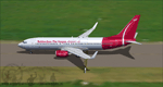
This is an Boeing B737-8RT in the promo fictional Rotterdam The Hague Airport.nl colors of an scale model at the information desk at Rotterdam The Hague Airport The Netherlands Registration: PH-RTM, Repaint By: Mathieu Vos (APSS), Model By: TDS. Also compatible with FSX.
| Filename: | Rotterdam_The_Hague_Airport_Boeing_737800__Fiction.zip |
| License: | Freeware |
| Added: | 20th December 2015, 16:31:18 |
| Downloads: | 343 |
| Author: | Mathieu Vos (APSS) |
| Size: | 12.69 MB |
| Category: Flight Simulator 2004 - Aircraft Repaints, Textures and Modifications | |
| Aerosur "The Wave" Boeing 727-200 (CP-2424) |
|
Images related to this file:
File Description:
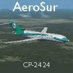
Aerosur Boeing 727-200, Registration CP-2424. Circa 2010. Textures only for the TDS 727-200 model. Download the base package from Flightsim.com: tds_b727-200.zip or tdsx_b727-200.zip. Repainted by Hernan Anibarro.
| Filename: | Aerosur_The_Wave_Boeing_727200_CP2424.zip |
| License: | Freeware |
| Added: | 27th July 2016, 21:00:45 |
| Downloads: | 240 |
| Author: | Hernan Anibarro / TDS |
| Size: | 6.56 MB |
| Category: Flight Simulator 2004 - Scenery | |
| Kotzebue PAOT on the northwestern coast of Alaska |
|
Images related to this file:
File Description:
There are four main northwestern Alaska towns which have good airports and are serviced by Alaska Airlines. From these airports local flights connect to nearby villages, "nearby" in Alaska meaning up to 150 miles away. The northernmost is Barrow. Southwest of Barrow is Kotzebue, then Nome, and the furthest south is Bethel. The town of Kotzbue is north of the Bering Strait on the northwestern coast, 320 miles southwest of Barrow. The population is just over 3,000 people. The location was for a long time a base for trading in furs, with three rivers emptying into the sea and providing routes into the interior land and villages; a meeting place between hunters and traders from Russia and elsewhere. The Kotzebue airport is called the Ralph Wien Memorial and has two runways. The modern one is aligned 08-26 and is 5,880 feet of 150 feet wide asphalt built across a shallow lagoon, with an ILS on 08 and PAPI on both ends. The second and older runway is originally military and gravel, aligned 17-35 and 3,786 feet long and used (wind allowing) by the GA planes that park alongside the runway. The prevalent wind is from the west; when the wind is from the east it is generally relatively feeble and with a much lower cloud base, possibly to the ground, hence the need for an ILS. All AI aircraft in FS9 much prefer to use a runway that has an ILS and so will continue to use 08-26 even if the wind is from the south until it reaches 30+ knots, even if they are a Cessna 150 flying VFR. So for AI realism in FS9 a northern or southern wind needs to be a strong one so that the runway is actually used. However, as Alaska Airlines, Northern Air Cargo, and Everts Air also fly to Kotzebue and can only use the east-west runway (as less than 4,000 feet of asphalt would be seriously inconvenient for a Boing 737 or DC6) it is necessary to have the northern or southern wind UNDER 30 knots at the times when they are landing or taking off. Your choice. I suppose a permanent strong wind from the west would be the most realistic on a daily basis, deterring all planes from ever using 17-35. The AI will develop along with further scenery additions in the neighbourhood.
| Filename: | Kotzebue_PAOT_on_the_northwestern_coast_of_Alaska.zip |
| License: | Freeware, limited distribution |
| Added: | 2nd August 2016, 16:47:52 |
| Downloads: | 463 |
| Author: | Roger Wensley |
| Size: | 19.32 MB |
| Category: Flight Simulator 2004 - Scenery | |
| Nome PAOM on the northwestern coast of Alaska |
|
Images related to this file:
File Description:
There are four main northwestern Alaska towns which have good airports and are serviced by Alaska Airlines. From these airports local flights connect to nearby villages, "nearby" in Alaska meaning up to 200 miles away. The northernmost is Barrow. Southwest of Barrow is Kotzebue, then Nome, and the furthest south is Bethel. The town of Nome is south of the Bering Strait on the southern coast of the Seward Peninsula, around 185 miles south of Kotzebue, with a population of about 3,800. It is the town that led to the creation of the most famous dogsledge race in the world, the Iditarod, which is based on the delivery to Nome of diphtheria serum during the blizzard conditions of the winter of 1925. The Nome airport (it currently has no other name) was originally built as the last of the refuelling airfields for planes being ferried to Russia during WW2. It has two runways, aligned 09-27 and 02-20 in FS9 (the wandering magnetic north has recently renamed the magnetic headings) and both of them around 6,000 feet with an ILS on 27. There is a modern airport layout diagram included showing taxiway names etc. Alaska Airlines, ERA, and Bering Air (which is headquartered in Nome), along with the shared cargo terminal for Northern Air Cargo and Everts Air, are all on the southern apron. The northern apron is mainly for GA, along with maintenance facilities, a garage building that also houses a weather bureau, and at the far northern end of runway 02-20 an apron and hanger for the Alaska Air National Guard. All AI aircraft in FS9 much prefer to use a runway that has an ILS and so will continue to use 09-27 even if the wind is from the north or south, right up until it reaches 30+ knots, so for AI realism in FS9 a permanent wind from the west would be the most realistic on a daily basis. There is also a small gravel strip just north of the town and this is included (94Z), as are some old line-of-sight radio communication reflectors on the hills above the town. There is a note about making adjustments to Ultimate Terrain Alaska-Canada regarding both realistic road lighting and also auto-generation.
| Filename: | Nome_PAOM_on_the_northwestern_coast_of_Alaska.zip |
| License: | Freeware, limited distribution |
| Added: | 18th October 2016, 02:38:42 |
| Downloads: | 489 |
| Author: | Roger Wensley |
| Size: | 22.65 MB |
| Category: Flight Simulator 2004 - Scenery | |
| Obre Lake CKV4 in the Northwest Territories Canada |
|
Images related to this file:
File Description:
This is a fifth airfield around or linked to Lake Athabasca, in Alberta and Saskatchewan. Obre Lake is some 120 miles northeast of Stony Rapids and is in the Northwest Territories, and the airfield is owned and run by North Of 60 Fishing Camps, which explains it all. It is one of several fishing vacation spots that are serviced by flights from Stony Rapids, and it is these flights to the north that explain the number of regular scheduled flights into Stony Rapids from the south. The Obre Lake camp has docks for boats and also for clients that want to arrive in their own float planes.
| Filename: | Obre_Lake_CKV4_in_the_Northwest_Territories_Canada.zip |
| License: | Freeware, limited distribution |
| Added: | 9th August 2018, 11:36:15 |
| Downloads: | 98 |
| Author: | Roger Wensley |
| Size: | 2.18 MB |
| Category: Flight Simulator 2004 - Aircraft Repaints, Textures and Modifications | |
| Carenado's C210 in the Colors of 4X-CDG |
|
File Description:
This is a repaint of the Carenado's C210 model in Israeli colors of 4X-CDG. Include only texture files.
| Filename: | Carenados_C210_in_the_Colors_of_4XCDG.zip |
| License: | Freeware |
| Added: | 9th April 2004, 12:37:36 |
| Downloads: | 291 |
| Author: | Sagi Yanay |
| Size: | 2.47 MB |
| Category: Flight Simulator 2004 - Aircraft Repaints, Textures and Modifications | |
| Cessna 195 - Saint John Berchman's - The Flying Nun |
|
File Description:
These are textures only and require filename: shakey_jake.zip which can be found here in the AVSIM library. This paintjob is a take-off from the "Sister Heather" saga in the Bush Flying Unlimited PIREP's. See more about her adventures in the PIREP Hall of Fame at http://www.avsim.com/bfu/index_PIREPHoF.html
The external textures are saved in a hi-resolution 32-bit format with no mip-maps to preserve image clarity.
| Filename: | Cessna_195__Saint_John_Berchmans__The_Flying_Nun.zip |
| License: | Freeware, limited distribution |
| Added: | 5th May 2004, 15:40:33 |
| Downloads: | 532 |
| Author: | Heather Sherman (Repaint) |
| Size: | 3.83 MB |
| Category: Flight Simulator 2004 - Aircraft Repaints, Textures and Modifications | |
| North American 'The Millie G' P-51D Mustang |
|
File Description:
"The Millie G" repaint of the Reno Racer Mustang.(RD_P-51D.ZIP). This is a texture only, RD_P-51D.ZIP is required for installation. Further recommended: Tuned-down flight model (P51D.ZIP) and lights & switches (P-51D_SL+SS.ZIP).
| Filename: | North_American_The_Millie_G_P51D_Mustang.zip |
| License: | Freeware |
| Added: | 14th May 2004, 23:05:56 |
| Downloads: | 529 |
| Author: | Michael Gurezka |
| Size: | 1.11 MB |
| Category: Flight Simulator 2004 - Miscellaneous Files | |
| ActiveSky Weather Adventures Vol. 2 - Fly the AT! |
|
File Description:
ActiveSky Weather Adventures Vol. 2 - Fly the AT! (Includes updated Vol. 1 - Winter's End) ***In addition to archives for AS2k4 users, saved flights with AS2k4 processed weather are included so people who don't own ActiveSky can fully enjoy these adventures and get a taste of what ActiveSky 2k4 has to offer! * Includes TWO Volumes of Weather Adventures * Volume 2 - Fly the AT! - Ten flights take you from Maine to Georgia along route of the Appalachian Trail - features three days of real-weather as a slow front approaches from the west - can YOU make it to Georgia before the thunder rolls in? * Volume 1 includes 10 flights highlighting weather phenomena such as a tornado outbreak in Texas and Oklahoma, a New England "nor'easter", and a massive upper-level low occupying the plains states! ***The ASWxAd-Kneeboard!*** A modification to FS9's kneeboard which allows viewing of original material describing these flights, radar and satellite loops, and annotated sectionals depicting flight plans and the AT! * This is the Automatic Installer version. A manual install is also available - ASAS2MAN.zip * Previous version had nearly 2000 downloads!
| Filename: | ActiveSky_Weather_Adventures_Vol_2__Fly_the_AT.zip |
| License: | Freeware, limited distribution |
| Added: | 4th June 2004, 14:14:58 |
| Downloads: | 2,798 |
| Author: | Scott Gridley |
| Size: | 22.04 MB |


© 2001-2026 AVSIM Online
All Rights Reserved
Privacy Policy |