
Where Flight Simulation Enthusiasts Gather from Around the World!
AVSIM Library - Search Results

| Category: Flight Simulator X - Scenery | |
| Mesh South America / MeSA A01 |

|
File Description:
FSX Mesh South America Project:
This terrain mesh file is a part of a whole project covering all the Continent of South America and some islands, divided in tiles identified in a map by its column (letters) and rows (numbers).
Those files were multi-LOD compiled from 90m SRTM2 source data, reprocessed with 3DEM to remove voids and spikes, providing a 76.4m (LOD9) horizontal resolution topography intended for use only in FSX updated with SP1.
Although not well documented, to improve performance, the updated FSX loads DEM files in threads and only the closer terrain (about 5 NM from the point of view)is rendered in high detail, while at far distances FSX shows up its default low resolution mesh, when there is not a third part terrain mesh compiled in all others intermediate level of details (multi-LOD).
THIS FILE: FSX_MeSA_A01
(Column A x Row 01)
This file covers the area inside the boundaries:
N = 16º 52,5' N; S = 11º 15' N;
W = 90º 0' W; E = 82º 30' W;
AUTHORS:
Hely Heck Junior - Magrao ( [email protected] )
and Jose Lobo ( [email protected] )
TerraBrasilis: www.terra-brasilis.org
| Filename: | Mesh_South_America__MeSA_A01.zip |
| License: | Freeware |
| Added: | 11th June 2007, 00:03:00 |
| Downloads: | 1,958 |
| Author: | Hely Heck Jr. and José Lôbo |
| Size: | 49.55 MB |
| Category: Flight Simulator X - Scenery | |
| Mesh South America / MeSA A03 |
|
File Description:
FSX Mesh South America Project:
This terrain mesh file is a part of a whole project covering all the Continent of South America and some islands, divided in tiles identified in a map by its column (letters) and rows (numbers).
Those files were multi-LOD compiled from 90m SRTM2 source data, reprocessed with 3DEM to remove voids and spikes, providing a 76.4m (LOD9) horizontal resolution topography intended for use only in FSX updated with SP1.
Although not well documented, to improve performance, the updated FSX loads DEM files in threads and only the closer terrain (about 5 NM from the point of view) is rendered in high detail, while at far distances FSX shows up its default low resolution mesh, when there is not a third part terrain mesh compiled in all others intermediate level of details (multi-LOD).
THIS FILE:
FSX_MeSA_A03
Column A x Row 03
This file covers the area inside the boundaries:
N = 5º 37,5' N; S = 0º 0' S;
W = 90º 0' W; E = 82º 30' W;
AUTHORS:
Hely Heck Junior - Magrao ( [email protected] )
and José Lôbo ( [email protected] )
TerraBrasilis: www.terra-brasilis.org
| Filename: | Mesh_South_America__MeSA_A03.zip |
| License: | Freeware |
| Added: | 11th June 2007, 00:02:40 |
| Downloads: | 1,419 |
| Author: | Hely Heck Jr. and José Lôbo |
| Size: | 1.52 MB |
| Category: Flight Simulator X - Scenery | |
| Mesh South America / MeSA B06 |
|
File Description:
FSX Mesh South America Project:
This terrain mesh file is a part of a whole project covering all the Continent of South America and some islands, divided in tiles identified in a map by its column (letters) and rows (numbers).
Those files were multi-LOD compiled from 90m SRTM2 source data, reprocessed with 3DEM to remove voids and spikes, providing a 76.4m (LOD9) horizontal resolution topography intended for use only in FSX updated with SP1.
Although not well documented, to improve performance, the updated FSX loads DEM files in threads and only the closer terrain (about 5-10 NM from the point of view) is rendered in high detail, while at far distances FSX shows up its default low resolution mesh, when there is not a third part terrain mesh compiled in all others intermediate level of details (multi-LOD).
THIS FILE:
FSX_MeSA_B06 (Column B x Row 06)
This file covers the area inside the boundaries:
N = 11º 15' S; S = 16º 52,5' S;
W = 82º 30' W; E = 75º 0' W;
AUTHORS:
Hely Heck Junior - Magrao ( [email protected] )
and Jose Lobo ( [email protected] )
TerraBrasilis: www.terra-brasilis.org
| Filename: | Mesh_South_America__MeSA_B06.zip |
| License: | Freeware |
| Added: | 11th June 2007, 22:10:10 |
| Downloads: | 1,422 |
| Author: | Hely Heck Jr. and José Lôbo |
| Size: | 12.99 MB |
| Category: Flight Simulator X - Scenery | |
| Mesh South America / MeSA D09 |
|
File Description:
FSX Mesh South America Project:
This terrain mesh file is a part of a whole project covering all the Continent
of South America and some islands, divided in tiles identified in a map by its
column (letters) and rows (numbers).
Those files were multi-LOD compiled from 90m SRTM2 source data, reprocessed
with 3DEM to remove voids and spikes, providing a 76.4m (LOD9) horizontal
resolution topography intended for use only in FSX updated with SP1.
Although not well documented, to improve performance, the updated FSX loads DEM
files in threads and only the closer terrain (about 5-10 NM from the point of view)
is rendered in high detail, while at far distances FSX shows up its default low
resolution mesh, when there is not a third part terrain mesh compiled in all
others intermediate level of details (multi-LOD).
THIS FILE:
FSX_MeSA_D09 (Column D x Row 09)
covers the area inside the boundaries:
N = 33º 45' S; S = 39º 22.5' S;
W = 67º 30' W; E = 60º 0' W;
AUTHORS:
Hely Heck Junior - Magrao ( [email protected] )
and Jose Lobo ( [email protected] )
TerraBrasilis: www.terra-brasilis.org
| Filename: | Mesh_South_America__MeSA_D09.zip |
| License: | Freeware |
| Added: | 13th June 2007, 12:36:59 |
| Downloads: | 1,259 |
| Author: | Hely Heck Jr. and José Lôbo |
| Size: | 52.3 MB |
| Category: Flight Simulator X - Scenery | |
| Mesh South America / MeSA D13 |
|
File Description:
FSX Mesh South America Project:
This terrain mesh file is a part of a whole project covering all the Continent
of South America and some islands, divided in tiles identified in a map by its
column (letters) and rows (numbers).
Those files were multi-LOD compiled from 90m SRTM2 source data, reprocessed
with 3DEM to remove voids and spikes, providing a 76.4m (LOD9) horizontal
resolution topography intended for use only in FSX updated with SP1.
Although not well documented, to improve performance, the updated FSX loads DEM
files in threads and only the closer terrain (about 5-10 NM from the point of view)
is rendered in high detail, while at far distances FSX shows up its default low
resolution mesh, when there is not a third part terrain mesh compiled in all
others intermediate level of details (multi-LOD).
THIS FILE:
FSX_MeSA_D13 (Column D x Row 13)
covers the area inside the boundaries:
N = 50º 37.5' S; S = 56º 15' S;
W = 67º 30' W; E = 60º 0' W;
AUTHORS:
Hely Heck Junior - Magrao ( [email protected] )
and Jose Lobo ( [email protected] )
TerraBrasilis: www.terra-brasilis.org
| Filename: | Mesh_South_America__MeSA_D13.zip |
| License: | Freeware |
| Added: | 13th June 2007, 16:38:14 |
| Downloads: | 1,124 |
| Author: | Hely Heck Jr. and José Lôbo |
| Size: | 4.79 MB |
| Category: Flight Simulator X - Scenery | |
| Mesh South America / MeSA D12 |
|
File Description:
FSX Mesh South America Project:
This terrain mesh file is a part of a whole project covering all the Continent
of South America and some islands, divided in tiles identified in a map by its
column (letters) and rows (numbers).
Those files were multi-LOD compiled from 90m SRTM2 source data, reprocessed
with 3DEM to remove voids and spikes, providing a 76.4m (LOD9) horizontal
resolution topography intended for use only in FSX updated with SP1.
Although not well documented, to improve performance, the updated FSX loads DEM
files in threads and only the closer terrain (about 5-10 NM from the point of view)
is rendered in high detail, while at far distances FSX shows up its default low
resolution mesh, when there is not a third part terrain mesh compiled in all
others intermediate level of details (multi-LOD).
THIS FILE:
FSX_MeSA_D12 (Column D x Row 12)
covers the area inside the boundaries:
N = 45º 0' S; S = 50º 37.5' S;
W = 67º 30' W; E = 60º 0' W;
AUTHORS:
Hely Heck Junior - Magrao ( [email protected] )
and Jose Lobo ( [email protected] )
TerraBrasilis: www.terra-brasilis.org
| Filename: | Mesh_South_America__MeSA_D12.zip |
| License: | Freeware |
| Added: | 13th June 2007, 15:28:04 |
| Downloads: | 1,146 |
| Author: | Hely Heck Jr. and José Lôbo |
| Size: | 5.54 MB |
| Category: Flight Simulator X - Scenery | |
| Mesh South America / MeSA A02 |
|
File Description:
FSX Mesh South America Project:
This terrain mesh file is a part of a whole project covering all the Continent of South America and some islands, divided in tiles identified in a map by its column (letters) and rows (numbers).
Those files were multi-LOD compiled from 90m SRTM2 source data, reprocessed with 3DEM to remove voids and spikes, providing a 76.4m (LOD9) horizontal resolution topography intended for use only in FSX updated with SP1.
Although not well documented, to improve performance, the updated FSX loads DEM files in threads and only the closer terrain (about 5 NM from the point of view) is rendered in high detail, while at far distances FSX shows up its default low resolution mesh, when there is not a third part terrain mesh compiled in all others intermediate level of details (multi-LOD).
THIS FILE:
FSX_MeSA_A02
Column A x Row 02
This file covers the area inside the boundaries:
N = 11º 15' N; S = 5º 37,5' N;
W = 90º 0' W; E = 82º 30' W;
AUTHORS:
Hely Heck Junior - Magrao ( [email protected] )
and Jose Lobo ( [email protected] )
TerraBrasilis: www.terra-brasilis.org
| Filename: | Mesh_South_America__MeSA_A02.zip |
| License: | Freeware |
| Added: | 11th June 2007, 00:02:15 |
| Downloads: | 1,592 |
| Author: | Hely Heck Jr. and José Lôbo |
| Size: | 10.95 MB |
| Category: Flight Simulator 2004 - Scenery | |
| VABP Bhopal/Bairagarh, India |
|
Images related to this file:
File Description:
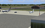
Googly scenery for VABP Bhopal/Bairagarh, India - an enhancement to the
airport provided in Flight Simulator 2004 which is incorrect in many respects.
These scenery files enlarge the apron to a realistic size to accept scheduled
traffic, remove spurious taxiways (they were actually perimeter tracks!), and
add buildings and other airport features so that you and your "AI" traffic
can land, taxi, park and take off in a realistic manner.
This small domestic airport is served by Boeing and Airbus jets of Indian
Airlines and Jet Airways together with local flights operated by ATRs of Air
Deccan.
The scenery does not purport to be ultra-accurate. Based on high-detail satellite
imagery from Google Earth, the layout is proportionally correct but the added
airport features, such as buildings, are built from default Microsoft objects
and add-on libraries so will not look like the real thing.
You are not obliged to download and install any additional scenery libraries,
but to enjoy this scenery in its entirety, you may wish to. It will work fine,
with or without.
[File re-uploaded at request of AVSIM]
| Filename: | VABP_BhopalBairagarh_India.zip |
| License: | Freeware |
| Added: | 7th May 2010, 22:34:06 |
| Downloads: | 1,625 |
| Author: | John Hinson |
| Size: | 64.37 KB |
| Category: Flight Simulator X - Miscellaneous Files | |
| ENBSeries for FSX |
|
File Description:
CORRECTED VERSION - Accidently included the wrong d3d9.dll in the previous upload, which messes up your textures. This one is the right one. My main goal in adjusting this ENBSeries file was to make sunny days look sunny and dark nights look dark, while maintaining a natural look to all things as much as possible (so no exaggerated bloom effects which you don't see at all in real life) I only changed the BLOOM and the COLOR CORRECTION options, nothing else. I have all the other options turned off anyway, since I don't have a very powerful computer. If you want to change options yourself you can read the 'readme_en.txt' for further information.
I included some screenshots to compare the default lightning to my custom made ENBSeries version (press the ZipDive! button to see them without downloading the whole package)
Install:
- Just copy the d3d9.dll and enbseries.ini to the FSX root folder.
- When in FSX you can press [SHIFT] + [F12] to turn the effect on or off. To remove, simply delete the 2 files from your FSX root folder.
| Filename: | ENBSeries_for_FSX.zip |
| License: | Freeware |
| Added: | 24th January 2016, 18:41:19 |
| Downloads: | 3,326 |
| Author: | Robin Heinis |
| Size: | 2.81 MB |
| Category: Flight Simulator 2004 - Aircraft Repaints, Textures and Modifications | |
| Martinair "Biafra" Douglas DC-6A |
|
Images related to this file:
File Description: On 13 December 1966 the Dutch charter company Martinair Holland (MAC), proud
owner of a fleet of four Douglas C-47, a Douglas C-54B, two Convair 640, and
four Douglas DC-7C aircraft, bought a Douglas DC-6A registered PH-MAM. The
DC-6A, which at one time belonged to KLM and could transport 11 tons payload or
97 passengers, was aquired in order to replace the smaller C-54B PH-MAE. It was
a very popular aircraft among crew and passengers alike. From the late October
1968 till the beginning of January 1970, PH-MAM flew on the Biafra airlift from
the island of Fernando Po to Uli airstrip to provide humanitarian aid, on behalf
of the Dutch Red Cross. Having returned from this mission, the aircraft was
overhauled and used by Martinair for one more year, before being sold to
Yugoslavia. The inspiration for this repaint was a coincidental meeting at
Schiphol I had many years ago with former Martinair Captain Dries van Ommen. He
was in command of PH-MAM during the Biafra airlift. We had a nice conversion,
accompanied by the impressive sight and sound of a DC-6 during take off. These
are textures only. You will need California Classic's FS2004/FSX Douglas DC-6B
CB-16 Base Pack, DC-6A CB-17 Base Pack and DC-6A CB-16 Base Pack (available at
http://www.calclassic.com/dc6b.htm). Repaint by Maarten Brouwer. For FS2004 and FSX.
| Filename: | Martinair_Biafra_Douglas_DC6A.zip |
| License: | Freeware, limited distribution |
| Added: | 19th November 2013, 14:28:39 |
| Downloads: | 192 |
| Author: | Maarten Brouwer |
| Size: | 3.86 MB |
© 2001-2026 AVSIM Online
All Rights Reserved
Privacy Policy |