
Where Flight Simulation Enthusiasts Gather from Around the World!
AVSIM Library - Search Results

| Category: Flight Simulator 2004 - Original Aircraft | |
| Grumman Albatross version 2.1 |

|
Images related to this file:
File Description:
Grumman HU-16 Albatross 2.1
Greg Pepper, Michael Verlin
May 18, 2012
I am privileged to be honored with the custodianship of this model.
Greg Pepper is no longer with us. I wish to honor his memory and I've made a few modifcations to enhance this aircraft.
WHAT'S NEW FOR 2.1
The flight model is the most significant change. The flight model has been enhanced by the use of Jerry Beckwith's AirWrench.
The performance of the Albatross is now much closer to the parameters published for it. I've also adjusted the contact points for the hull.
Please make sure you adjust the fuel and payload before flying. This is a very heavy aircraft, and will be very sluggish if you attempt flight with full tanks and a full payload.
I've also added a few liveries, and modified several others. The colors and lettering of the U.S. Navy versions have been revised. The font the Navy uses is USN Long Beach. The paint colors are accurate now as well. You will also find new spin prop textures.
I've also slightly revised the original U.S. Air Force HU-16B and two of the U.S. Coast Guard liveries.
New for this release: U.S. Navy VXE6 UF-1L triphibian that served in the Antarctic, Chalk's G-111 and two new private liveries.
Michael Verlin
May 18, 2012
[email protected]
| Filename: | Grumman_Albatross_version_21.zip |
| License: | Freeware, limited distribution |
| Added: | 19th May 2012, 05:08:32 |
| Downloads: | 3,462 |
| Author: | Greg Pepper Michael Verlin |
| Size: | 88.13 MB |
| Category: Flight Simulator 2004 - Scenery | |
| Chennai International Airport , India ( VOMM ) |
|
Images related to this file:
File Description:
Chennai scenery has been in demand for long time and here it is ,the file also includes " the ACTIVE RNAV�1 (GNSS or DME/DME/IRU) SIDs and STARs. It also has the extended runway and the extended taxiway M3. Definitely the screen shots will help you decide if its worth downloading.T his will also work in FSX. Inside you will find a zip file that reads-"Asia.zip" if you are FSX user you will have to add this addition folder to database (FSX) 2-3 buildings used are default FS2004 object which are not in FSX . This additional will enable that thing previously if you have downloaded Chatrapatti shivaji International Scenery that I uploaded for everyone made the FSX users unhappy , because they must have found few objects hanging in air or something's missing. This asia folder included in the scenery will solve the trouble. Airport Features include- NEW models of taxiway edge fixtures, Parkable Hanger for General aviation light aircrafts. Just roll in and out sticking to the ctr guide line. You can even begin simulation parked inside the hanger .Don't worry , you won't be disappointed .. check out the pics. Oh! you'll also find surfaces painted " paraphernalia " kind of stuff at all taxiway- runway intersection and surface painting for stands numbers at one of the apron. stands 1-7 .
| Filename: | Chennai_International_Airport__India__VOMM_.zip |
| License: | Freeware |
| Added: | 10th July 2010, 02:54:43 |
| Downloads: | 6,684 |
| Author: | Ashish Singh |
| Size: | 70.84 MB |
| Category: Flight Simulator 2004 - Aircraft Repaints, Textures and Modifications | |
| KLM 1956-1960, Lockheed L-749A Constellation |
|
Images related to this file:
File Description:
First of all for those who installed the repaint package 'Lockheed L-749A Constellation KLM 1950-1955': I overlooked a mistake in the folder texture.KLM-1955-PHLDP. In this package you will also find a replacement bitmap.
KLM was a major European operator of various models of the Lockheed Constellation and Super Constellation. Out of 48 Connies and Super Connies, 11 were L-749 (8 of them later converted to L-749A) and 9 were L-749A Constellations. The first L-749 entered service with KLM in August 1947, and for some 13 years this and the other L-749(A) Connies served on various medium- and long-haul routes. By the end of the 1950's the career of KLM's (Super) Constellation started to come to an end with the arrival of the Douglas DC-7C and, introducing the airlines' jet-age, the DC-8.
Featured are KLM's PH-LDS 'Soerabaja' (1957 livery), PH-LDE 'Utrecht (1958 livery), PH-LDT 'Tilburg' (1958 livery) and PH-LDK 'Amsterdam' (1959 livery), both without and with "Speedpak" cargo pod. These are textures only. You will require Team 749's (Manfred Jahn & Co) Lockheed L-749 Constellation package (lockheed749.zip). Also required Team 749's Lockheed L-749 Constellation models update (749_models_update.zip). Repaints (based on Manfred Jahn's textures) by Maarten Brouwer.
| Filename: | KLM_19561960_Lockheed_L749A_Constellation.zip |
| License: | Freeware, limited distribution |
| Added: | 9th April 2010, 21:51:03 |
| Downloads: | 623 |
| Author: | Maarten Brouwer |
| Size: | 19.15 MB |
| Category: Flight Simulator 2004 - Scenery | |
| Terrace CYXT Updated |
|
Images related to this file:
File Description:
This revises the previous versions by adding two missing buildings, corrects the apron markings and parking and adds a third gate, creates more GA parking, updates the AI to include, for instance, a Westjet flight, and most importantly of all adds the ILS to runway 33. It is complete in itself and can be installed as-is without first installing previous versions. Terrace is fifteen miles east and inland from Prince Rupert, which is 500 miles north of Vancouver up the BC coast. It is at the point in the mountains where two fjords meet, one coming from Prince Rupert and the other from Kitimat. The population of the town is around 12,500. The airport is called Terrace-Kitimat and is a couple of miles south of the town of Terrace, on the south side of the Skeena River. There are two runways, and the main one is a recently-extended 7,500 feet long and lit 33-15 with approach lighting to both ends and an ILS on 33. The second is 5,373 feet of unlit 03-21. The apron has been enlarged to be able to accommodate a Boeing 737, though there is at the moment no airline using a 737 for flights to Terrace. The pics and the video show the surrounding hilly terrain and the nearby river between the airport and the town.
| Filename: | Terrace_CYXT_Updated.zip |
| License: | Freeware, limited distribution |
| Added: | 13th January 2019, 18:38:12 |
| Downloads: | 177 |
| Author: | Roger Wensley |
| Size: | 15.64 MB |
| Category: Flight Simulator 2004 - Scenery | |
| Z19O - Hamat Airbase - Batroun, Lebanon |
|
Images related to this file:
File Description:
Hamat is a village near the coast of Lebanon, around 25 miles north of Beirut. The airport runway was built during the civil war to the west of Hamat in the late 1970's, between Hamat and another village called Wuajh Al Hajar. The intention was have an alternative to Beirut airport, which could be (and often was) closed by shell fire from any or all of the sides involved in the civil war, or by bombing by those who were not directly part of the civil war but occasionally joined in. It has been used for drag racing, occasional freefall parachuting (this may continue) and is now an army base with mostly helicopter use. The runway is around 5,600 feet of asphalt, 90 feet wide and aligned 02/20. There is no lighting. The apron is set well back from the runway and has hangars at each end; one set is four hangars long, and at the other end of the apron there are three hangars. There are also the remains of some radar to the west of the apron, bombed (in 1982?). The runway has been repositioned and the surrounding landclass modified to reduce one village to it's approximate actual size and to create a second village which was missing entirely. An intrusive road has been deleted, and the airfield grass area also modified.
| Filename: | Z19O__Hamat_Airbase__Batroun_Lebanon.zip |
| License: | Freeware, limited distribution |
| Added: | 23rd May 2015, 10:03:10 |
| Downloads: | 224 |
| Author: | Roger Wensley |
| Size: | 8.53 MB |
| Category: Flight Simulator 2004 - Scenery | |
| CYOC - Old Crow - Yukon Territory, Canada |
|
Images related to this file:
File Description:
Old Crow is in the far north of the Yukon Territory, Canada, 115 miles south of the nearest coastline and 30 miles east of the border with Alaska. The town has a population of less than 300 and the population are reliant on the caribou migration for an annual food supply replenishment. The fact that it is the only Yukon town that cannot be reached by car makes the airport important, and there are regular flights by Air North, the Yukon airline. They are included in the AI along with GA aircraft. I had several tries at matching up the Hawker Siddeley 748 with the right set of textures and I have included both here so that you do not have to go through the same torture. Thanks go to Hernan for sorting all that out, and for his textures. The airport is beside the town that is built along a bank of the Porcupine River. I have replicated the current shore line of the river that has cut a new channel at one end of the town, and I flattened the river as it was somewhat mountainous. The runway is gravel and just over 5,000 feet long, aligned 03-21. The terminal building is specific to Old Crow as I had photos, but the hangars are approximations and the village houses are only representational.
| Filename: | CYOC__Old_Crow__Yukon_Territory_Canada.zip |
| License: | Freeware, limited distribution |
| Added: | 5th December 2014, 13:31:46 |
| Downloads: | 371 |
| Author: | Roger Wensley |
| Size: | 7.58 MB |
| Category: Flight Simulator 2004 - Scenery | |
| Dolbeau-St-Felicien CYDO in Quebec Canada |
|
Images related to this file:
File Description:
This is the fourth of five sceneries around Lac Saint-Jean in Quebec, Canada. Saint-Felicien is a village on a small river at the western end of Lac Saint-Jean, and the airfield is just under 10 miles to the northeast. At the same distance further to the northeast of the airfield and on a slightly larger river is the village called Dolbeau. The village of Sainte-Methode is closer than either of the other villages but presumably lacked influence. The airfield effectively has one runway aligned 11-29 and just under 5,000 feet long, with approach lights on 11. There is, or was, a second runway aligned north-south but this has badly deteriorated without maintenance and has loose stones that threaten propellor damage. The taxiway that runs east-west is in a similar condition and all planes operate as if there is no taxiway. There is a clubhouse and a maintenance facility along with a line of old hangars that remain in full use, plus planes parked in the open. The landclass has been modified along with the grassed area of the airfield, and in the AI (included with the post of CYRC) there are scheduled flights by Max Aviation, and GA flights etc. It is a really typical airfield in northern(ish) rural Canada with a lot more activity than one might expect.
| Filename: | DolbeauStFelicien_CYDO_in_Quebec_Canada.zip |
| License: | Freeware, limited distribution |
| Added: | 19th November 2017, 15:52:32 |
| Downloads: | 167 |
| Author: | Roger Wensley |
| Size: | 4.17 MB |
| Category: Flight Simulator 2004 - Scenery | |
| CYPE - Peace River - Northwest Alberta, Canada |
|
Images related to this file:
File Description:
The Peace River flows east from the Rockies, joining up with the Slave River to empty into Great Slave Lake. The town is on both banks close to a bend, 245 miles northwest of Edmonton. The population is 7,000 and the surrounding area is either farmland or forest and used for winter sports; Peace River hosted the 2004 Alberta Winter Games. The airport is just over 3 miles west of the town. The runway is 5,000 feet of wide asphalt (150 feet) aligned 04/22, lit, and with PAPI. There is a second runway to the south of the main runway, 1,900 feet of grass and aligned 08/26. The apron is to the north of the runway at the eastern end and is large; there is a purpose-built terminal building, plus other hangar buildings along taxiway C that extends westward from the apron. The airport gives the impression that it is under-used; there are no long lines of parked planes waiting for the weekend and few scheduled flights. These are mainly (totally?) by Sunwest Home Aviation, but unfortunately nobody has made the textures for Sunwest and my talents do not run in that direction so I have made believable substitutions. There is also a small but obstinate AI difficulty, described in the notes.
| Filename: | CYPE__Peace_River__Northwest_Alberta_Canada.zip |
| License: | Freeware, limited distribution |
| Added: | 10th November 2013, 23:56:22 |
| Downloads: | 333 |
| Author: | Roger Wensley |
| Size: | 10.83 MB |
| Category: Flight Simulator 2004 - Scenery | |
| Mountain View CPZ3 in Ontario, Canada |
|
Images related to this file:
File Description:
This is Mountain View, a small RCAF airfield at the eastern end of Lake Ontario on Prince Edward Island, some 40 miles west of Kingston. Mountain View is used for training during the summer months, and part of this training is for C-130 crews, who practice landing on rough or unprepared landing strips. The crews are based at Trenton, which is a large base 10 miles to the northwest on the mainland. There are (or were, I haven't seen it recently) numerous parked and ancient fighter planes such T-33's and Canadair Tutors; these could also have possibly been used for summer training or perhaps were just stored. Last summer there were only two hangars left standing; in 2002 there were five. In real life you would be on the lookout not only for C-130's but also (at certain times during the summer) for parachutists and also gliders. This airfield is one that you will fly over and not land on; I confess that I have cheated with the length of the 06L-24R gravel "practice" runway, so that it became possible for the FS version of a touch-n-go with a C-130 to be completed without using the grass. The aerial photograph shows the new "practice" gravel runway under construction.
| Filename: | Mountain_View_CPZ3_in_Ontario_Canada.zip |
| License: | Freeware, limited distribution |
| Added: | 9th March 2012, 15:05:57 |
| Downloads: | 350 |
| Author: | Roger Wensley |
| Size: | 7.26 MB |
| Category: Flight Simulator 2004 - Scenery | |
| VFR of Lario, Area C2A - Como lake, Italy |
|
Images related to this file:
File Description:
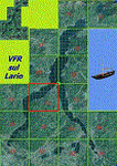
*** REPLACEMENT OF PREVIOUS ISSUE, due to a bug of an High Winter texture ***
This is the fifth scenery of the "VFR of Lario" project, made with photorealistic terrain (multiseason & night) and with some 3D GMax realistic objects.
Information: Como's lake is in the north of Italy, closed to the Helvetic border; this scenery covers approximately an area of 7.5x6 kmt, from la "Zoca de l'Oli" and mountains over Ossuccio (NW) to Tremezzo (NE), and from Colonno (SW) to Magreglio (SE) and includes the NLC piers of Sala Comacina, Comacina island, Campo, Lenno, Tremezzo, Bellagio (2), S. Giovanni, Lezzeno; it includes several dedicated buildings as Taverna Bleu hotel (Sala Comacina), S. Maria e S.Giacomo churches and villa Balbiano (Ossuccio), church and pier of S. Michele (Colonno), villa del Balbianello (Lenno), hotel Villa Marie, S. Lorenzo Church, villa La Quiete, Grand Hotel, villa Carlotta, hotel La Darsena, Pub motor ship Bisbino (Tremezzo), villa Melzi, villa Giulia, buildings Carillon e lungolago Manzoni, hotels Excelsior, Du Lac, Metropole (Bellagio). Two NLC ferry (moted on the way Bellagio-Cadenabbia) are placed together with other minor boats and docks placed alongside the coast, including platforms for seaplanes arrival.
Contents: GMax objects as above and other buildings, minor piers and boats together with autogen buildings and trees are fully spreaded on the scenery.
| Filename: | VFR_of_Lario_Area_C2A__Como_lake_Italy.zip |
| License: | Freeware |
| Added: | 22nd May 2012, 18:12:41 |
| Downloads: | 1,669 |
| Author: | Aldo Della Vedova, Daniele Lanfranchi, Gian Mario Verga, Diego Caligiuri |
| Size: | 28.49 MB |
© 2001-2026 AVSIM Online
All Rights Reserved
Privacy Policy |