
Where Flight Simulation Enthusiasts Gather from Around the World!
AVSIM Library - Search Results

| Category: Flight Simulator 2004 - Scenery | |
| Ft Collins-Loveland Muni 'KFNL' |

|
File Description:
FS2004 Scenery-Fort Collins-Loveland Municipal Airport, Colorado (KFNL) serves Fort Collins/Loveland and Larimer County and is owned by Fort Collins & Loveland. The airport has more than one runway. The longest is a paved runway extending 8500 feet. The facility is at an elevation of 5016 feet at a distance of about 9 miles from Fort Collins/Loveland. Fort Collins-Loveland Municipal Airport is mostly used for general aviation but is also served by one commercial airline, Allegiant Air. This scenery is not an attempt to be picture accurate. Requires the EZ scenery libraries. Read the readme file for list. Lago's FSE optional. By John B. Loney, Jr.
| Filename: | Ft_CollinsLoveland_Muni_KFNL.zip |
| License: | Freeware |
| Added: | 4th December 2006, 20:21:25 |
| Downloads: | 1,286 |
| Author: | John B. Loney, Jr. |
| Size: | 835.37 KB |
| Category: Flight Simulator X - AFCAD Files | |
| ZGSZ - Shenzhen Bao'an Intl Airport - Shenzhen, China |
|
Images related to this file:
File Description:
ZGSZ - Bao´an Intl Airport - Shenzhen, China
Shenzhen Bao'an International Airport (formerly named Shenzhen Huangtian Airport) is located near Huangtian and Fuyong villages in Bao'an District, Shenzhen, Guangdong, China. It is 32 km northwest of the city center. It is the hub for Shenzhen Airlines, Shenzhen Donghai Airlines, SF Airlines, Jade Cargo International and a focus city for China Southern Airlines and Hainan Airlines. The airport also serves as an Asian-Pacific cargo hub for UPS Airlines.
Using ADEx 1.55, SBuilderX, aeronautical maps and Google Earth (2014) all these changes have been built into the default FSX airport to better reflect today´s situation.
| Filename: | ZGSZ__Shenzhen_Baoan_Intl_Airport__Shenzhen_China.zip |
| License: | Freeware |
| Added: | 30th January 2015, 16:52:24 |
| Downloads: | 4,413 |
| Author: | Menno C. Robert |
| Size: | 2.95 MB |
| Category: Flight Simulator X - Scenery | |
| PicNic 1.0 - Add grass in Flight Simulator |
|
File Description:
After the success of TreeX, it was logical to improve the ground of Flight Simulator. This is why PicNic was carried out. But PicNic is much more than grass! It makes it possible to improve the ground in general, giving to basic textures an aspect more contrasted and also while bringing more relief. PicNic run olso on the photo-realistic sceneries bringing an additional dimension to them!
It also makes it possible to better appreciate its speed, making the flights at very low altitude more alive.
The pilots of helicopter will appreciate the precision which PicNic during the operations of landing and hoovering. PicNic is FS2004 compatible.
| Filename: | PicNic_10__Add_grass_in_Flight_Simulator.zip |
| License: | Freeware |
| Added: | 10th October 2007, 12:41:28 |
| Downloads: | 28,259 |
| Author: | Aimé Leclercq - Interface: Jacky Brouze |
| Size: | 11.28 MB |
| Category: Flight Simulator 2004 - Original Aircraft | |
| Waco Classic Biplane |
|
File Description:
Former payware package uploaded with permission of original authors. Built by the Waco Classic Aircraft Corporation this new/old biplane combines the beautiful and classic lines of the 1930s Waco and the new world of modern avonics. Of all the antique and/or classic biplanes of the pre-war era, the Waco is certainly the most beautiful of them all and Bill Lyons has packaged several repaints of the wheeled version and 2 repaints of a float version in this single download. Having an excellent dynamic 3D virtual cockpit (as all of Bill's aircraft have had since the days of FS98) and excellent sounds, this is truly an FS classic! Bear!
| Filename: | Waco_Classic_Biplane.zip |
| License: | Freeware, limited distribution |
| Added: | 19th August 2003, 01:53:11 |
| Downloads: | 30,146 |
| Author: | Lynn & Bill Lyons |
| Size: | 3.13 MB |
| Category: Flight Simulator X - Scenery | |
| SVMD - Merida, Venezuela |
|
Images related to this file:
File Description:
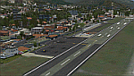
SVMD is an airport located 3 km southwest of downtown Merida, Venezuela, at an elevation of 1,526 m MSL. Its runway is 1,630 m long.
The runway has a gradient slope of +/- 4.05 %, for that reason, this airport is the most difficult and dangerous to land in Venezuela.
It is situated in a valley in the Andean mountains, surrounded by higher terrain in all
quadrants. Night operations are prohibited. Runway 07 is used for landings only and Rwy 25 is used only for take off.
Photo-terrain area improved with Autogen files.
Only compatible with versions to FSX or P3Dv1v2v3.x.
Also includes a friendly Auto-Install.
| Filename: | SVMD__Merida_Venezuela.zip |
| License: | Freeware |
| Added: | 9th December 2015, 09:13:34 |
| Downloads: | 1,072 |
| Author: | David Maldonado |
| Size: | 72.62 MB |
| Category: Flight Simulator 2004 - Scenery | |
| Tillamook, Oregon (S47) Airport - a comprehensive enhancement |
|
Images related to this file:
File Description:
Tillamook, Oregon (S47) Airport - a comprehensive enhancement - designed to work in the default FS2004 setup. Featured is the Hangar B Air Museum which houses a fine privately owned collection of restored Warbirds. Hangar B is considered to be the largest, all wooden structure in the world - built in the early 1940's to house and service Navy Blimps. Also featured is the Tillamook Air Tours charter service complete with an AI Bi-Wing Waco aircraft. There is even an option to have an AI Goodyear Blimp visit Tillamook and make sightseeing flights. Driving or slewing around the airport will reveal many other surprises! The airport, which was virtually ignored by MS, has been redone using RWY12, EZ and many custom objects. A listing of all required libraries is included and a list of those who have contributed their time and talents to this project will be found in the documentation. Please unzip to a temporary folder and follow the installation instructions very carefully. Compiled for your flying enjoyment by David "Opa" Marshall.
| Filename: | Tillamook_Oregon_S47_Airport__a_comprehensive_enha.zip |
| License: | Freeware |
| Added: | 11th December 2009, 09:54:01 |
| Downloads: | 2,681 |
| Author: | John McKeon, David "Opa" Marshall and friends |
| Size: | 12.41 MB |
| Category: Flight Simulator 2004 - Scenery | |
| AI Water "aircraft" for Lake Okanagan, BC. |
|
Images related to this file:
File Description:
AI Water "aircraft" for Lake Okanagan, BC. This package features an AI Sternwheeler ship, an AI Waco Bi-wing plane and AI Cabin Cruisers set on Lake Okanagan, near Penticton and Kelowna, BC, Canada. Offerred as an interesting scenery enhancement, it also demonstrates the use of the "forward departure" (no push-back) technique as applied to water based aircraft. A few EZ objects have also been used to decorate the dock areas where the AI "craft" will be seen. This enhancement has been tested with the default FS2004 scenery only and may not work with other enhancements (such as UT-Canada) which alter the shorelines of Lake Okanagan. Other downloads may be required or are recommended. Complete details about these will be found in the instructions. Please unzip to a temporary folder and follow the easy installation instructions. Compiled for your flying enjoyment by David "Opa" Marshall.
-
NOTE: This package replaces the one which is missing due to the May hack on Avsim. Nothing new has been added.
| Filename: | AI_Water_aircraft_for_Lake_Okanagan_BC.zip |
| License: | Freeware |
| Added: | 29th January 2010, 21:28:38 |
| Downloads: | 1,464 |
| Author: | David "Opa" Marshall |
| Size: | 1.8 MB |
| Category: Flight Simulator X - Scenery | |
| YBLT - Ballarat Aerodrome - Victoria, Australia |
|
Images related to this file:
File Description:
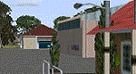
YBLT (Ballarat Aerodrome) is a regional 'airport' in the central west of the State of Victoria, Australia and utilises infrastructure from the days of RAAF operations which lasted till the early 1960's. Thus the buildings are now a bit outdated but this file does not reflect that as I have not done any custom texturing so everything in this package tends to look a bit new and crispy.
Note the name of this 'airport'. The locals are adamant it is an aerodrome, not an airport. I have not found any freeware or commercial offerings for an alternative to the default and so I have put one together.
This is a reasonable approximation of the airport /aerodrome but is not entirely accurate as the hangars/buildings I have modelled myself are generic ones I have done and do not look exactly like the ones at that facility. The connecting road is not in true alignment as I have created it so as it blends into the surrounding default scenery.
| Filename: | YBLT__Ballarat_Aerodrome__Victoria_Australia.zip |
| License: | Freeware |
| Added: | 21st October 2014, 01:51:16 |
| Downloads: | 841 |
| Author: | Robert Budd |
| Size: | 4.43 MB |
| Category: Prepar3D V1-4 - Scenery | |
| TNCA - Queen Beatrix International Airport - Aruba |
|
File Description:
The scenery was made using the Airport Design Editor, ModelConverterX, FSEarthTiles, SketchUp 2017 an others.
Queen Beatrix International Airport (Dutch: Internationale luchthaven Koningin Beatrix; Papiamento: Aeropuerto Internacional Reina Beatrix), colloquially known as Aruba Airport (IATA: AUA, ICAO: TNCA), is an international airport located in Oranjestad, Aruba. It has flight services to the United States, several countries in the Caribbean, the northern coastal countries of South America, Canada, as well as some parts of Europe, notably the Netherlands.
It is named after Beatrix of the Netherlands, who was Queen of the Netherlands from 1980 to 2013.
The airport offers United States border preclearance facilities. A terminal for private aircraft opened in 2007. The airport used to serve as the hub for bankrupt airline Air Aruba, which was for many years an international airline. Before Aruba's separation from the Netherlands Antilles in 1986 it was also one of three hubs for ALM Antillean Airlines as well as a home base for Tiara Air until 2016.
This scenario was only tested on P3Dv4.5.
History - fron Wikipedia.com
| Filename: | TNCA__Queen_Beatrix_International_Airport__Aruba.zip |
| License: | Freeware |
| Added: | 8th May 2021, 17:39:28 |
| Downloads: | 683 |
| Author: | Eduardo Puelker |
| Size: | 3.78 MB |
| Category: Flight Simulator 2004 - Scenery | |
| EPWA - Warsaw Chopin Airport - Warsaw, Poland ** UPDATED VERSION `` |
|
Images related to this file:
File Description:
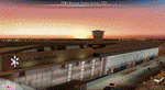
EPWA WARSAW CHOPIN AIRPORT 2015 DEMO features an extremely detailed scenery of EPWA Chopin airport in Warsaw, Poland, fully compatible with FS2004.
This product is a fully functional DEMO version of the commercial payware product. It features same airport layout as in the full version but with limited 3D objects and low resolution textures. Using this free demo ensures no problems with online (VATSIM, IVAO, multiplayer etc.) flying in case some users use the payware scenery and some don't.
Warsaw Chopin Airport (WAW / EPWA) is is an international airport located in Warsaw, Poland's capital, which handles just under 40% of the country's air passenger traffic. There are two crossing runways (2800m and 3690m), a number of hangars, a cargo terminal and a passenger terminal, completely rebuilt in 2008-2015.
The product is equipped with an automatic installer, which means that the scenery will be automatically added to the Flight Simulator Scenery Library. Please uninstall all previous versions of this airport you may have installed before. Please make also sure that no duplicated AFCAD files are installed.
Enjoy your virtual flying with Drzewiecki Design!
| Filename: | EPWA__Warsaw_Chopin_Airport__Warsaw_Poland___UPDAT.zip |
| License: | Freeware, limited distribution |
| Added: | 4th March 2016, 15:54:50 |
| Downloads: | 1,039 |
| Author: | Drzewiecki Design |
| Size: | 15.67 MB |


© 2001-2026 AVSIM Online
All Rights Reserved
Privacy Policy |