
Where Flight Simulation Enthusiasts Gather from Around the World!
AVSIM Library - Search Results

| Category: Flight Simulator 2004 - Aircraft Repaints, Textures and Modifications | |
| FS2004 Trans-Union CPAI DC-6B for AI, ca 1970 |

|
Images related to this file:
File Description:
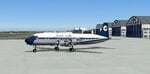
Repaint of Christian Pagé's Douglas DC-6B for AI traffic
| Filename: | FS2004_TransUnion_CPAI_DC6B_for_AI_ca_1970.zip |
| License: | Freeware, limited distribution |
| Added: | 1st May 2026, 20:53:42 |
| Downloads: | 36 |
| Author: | Christian Page |
| Size: | 321.49 KB |
| Category: Flight Simulator 2004 - Aircraft Repaints, Textures and Modifications | |
| FS2004 LTU DWAI Fokker F.28 for AI, ca 1970 |
|
Images related to this file:
File Description:
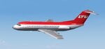
Repaint of Dee Waldron's Fokker F.28 mk 1000 for AI traffic
| Filename: | FS2004_LTU_DWAI_Fokker_F28_for_AI_ca_1970.zip |
| License: | Freeware, limited distribution |
| Added: | 1st May 2026, 20:53:58 |
| Downloads: | 42 |
| Author: | Christian Page |
| Size: | 158.86 KB |
| Category: Flight Simulator 2004 - Aircraft Repaints, Textures and Modifications | |
| FS2004 Transpommair 1970 CPAI Douglas DC-6B for AI traffic |
|
Images related to this file:
File Description:
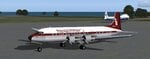
A repaint of Christian Page's DC-6B for AI traffic
| Filename: | FS2004_Transpommair_1970_CPAI_Douglas_DC6B_for_AI_.zip |
| License: | Freeware, limited distribution |
| Added: | 21st May 2026, 19:48:18 |
| Downloads: | 31 |
| Author: | Christian Page |
| Size: | 298.47 KB |
| Category: Flight Simulator 2004 - Aircraft Repaints, Textures and Modifications | |
| FS2004/FSX Boeing 737-200 Sky Aviation Corp. - VP-CBA |
|
Images related to this file:
File Description:
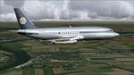
This is an Boeing 737-200 of Sky Aviation Corp. Registration: VP-CBA, Repaint by: Mathieu Vos (APSS), Model by: Kittyhawk. (also compatible with FS X read the readme for instructions!)
| Filename: | FS2004FSX_Boeing_737200_Sky_Aviation_Corp__VPCBA.zip |
| License: | Freeware |
| Added: | 13th October 2012, 17:22:40 |
| Downloads: | 418 |
| Author: | Mathieu Vos (APSS) |
| Size: | 59.96 MB |
| Category: Flight Simulator 2004 - Miscellaneous Files | |
| FS2004 Water-Torpedo Effects for the KBT P-3C Orion |
|
File Description:
FS2004 Water-Torpedo Effects for KBT P-3C Orion.
Water-Torpedo Effect for Team FS KBT's Orion.
Requires p-3c_.zip. Easy install. By D. Arwe.
| Filename: | FS2004_WaterTorpedo_Effects_for_the_KBT_P3C_Orion.zip |
| License: | Freeware |
| Added: | 29th August 2005, 16:39:54 |
| Downloads: | 2,073 |
| Author: | Detlev Arwe |
| Size: | 289.44 KB |
| Category: Flight Simulator 2004 - Aircraft Repaints, Textures and Modifications | |
| FS2004 MAAM-SIM C-47A Fuerza Aerea Argentina TA-05 |
|
File Description:
C-47A Fuerza Aerea Argentina TA-05 (called “El Montañés”, the Highlander). She was the first argentinean plane to reach the South Pole, the 3rd November 1965. Ta-05 took off from the Belgrano Antartical Base and after nine hours of flight, reached the 90° south latitude. This plane is still preserved in Buenos Aires.Textures only for the MAAM-SIM payware DC3 and the MAAM-SIM D-Day C-47 'Skytrain' and Dakota Mk III Expansion Pack The base textures for repainting are by Mark Beaumont,original textures are by Jan Visser.
| Filename: | FS2004_MAAMSIM_C47A_Fuerza_Aerea_Argentina_TA05.zip |
| License: | Freeware |
| Added: | 6th January 2006, 14:33:59 |
| Downloads: | 425 |
| Author: | Damian Radice |
| Size: | 4.81 MB |
| Category: Flight Simulator 2004 - Miscellaneous Files | |
| Tips and Tricks for FS2004 - Number 23 - Sept. 2006 Issue |
|
Images related to this file:
File Description:

Tips and Tricks Number 23 - Sept. 2006 Issue. After an all too brief Summer Vacation, Tips and Tricks is back with a wide assortment of helpful information and ideas. This issue includes an important warning for anyone who may try the FSX Demo from Microsoft. The "From the E-mail Bag Department" answers several interesting questions and you will find an extensive review of the Kai Tak (Hong Kong) airport circa 1998. Rounding out this issue are links to several fine websites, reviews of scenery, aircraft and utilities plus a surprise or two has been thrown in for good measure. Hopefully you will find something of value whether you are a newbie or long time simmer. An updated index by John Burford for the entire series is included. Please unzip (using folders option) to a temporary folder. Compiled in pdf format for your flying enjoyment.
| Filename: | Tips_and_Tricks_for_FS2004__Number_23__Sept_2006_I.zip |
| License: | Freeware |
| Added: | 1st September 2006, 20:05:21 |
| Downloads: | 6,276 |
| Author: | David "Opa" Marshall |
| Size: | 2.41 MB |
| Category: Flight Simulator 2004 - Scenery | |
| Little Port Walter Fish Hatchery for FSAddon's Tongass Fjords FS2004 |
|
File Description:
LITTLE PORT WALTER FISH HATCHERY Scenery for FS2004
Designed specifically for the Tongass Fjord scenery
add-on by FSAddon. Gmax designed all original models.
The scenery changes with time and season. AI Boat traffic
includes an Coast Guard cutter (scenery only) with landable
deck that launches a rigid hull inflatable that patrols the
waterways. Also includes AI traffic for Fishing boats included
in Tongass Fjords with permission.
| Filename: | Little_Port_Walter_Fish_Hatchery_for_FSAddons_Tong.zip |
| License: | Freeware |
| Added: | 30th July 2006, 04:43:17 |
| Downloads: | 1,428 |
| Author: | Brian Smith |
| Size: | 3.17 MB |
| Category: Flight Simulator 2004 - Aircraft Repaints, Textures and Modifications | |
| CFS2/FS2004 Republic P-47B Thunderbolt Razorback 41-6002/1 |
|
File Description:
CFS2/FS2004 Republic P-47B Thunderbolt Razorback 41-6002/1. This aircraft was flown by the CO of the 56th FG USAAF, Mitchell Field, New York, June 1942. Note the triple colored cowl. This repaint is for the ALPHASIM model. Repaint by Evan G. Butterbrodt (revev). NOTE- this aircraft will work with CFS2 AND FS9!
| Filename: | CFS2FS2004_Republic_P47B_Thunderbolt_Razorback_416.zip |
| License: | Freeware |
| Added: | 20th June 2008, 01:58:52 |
| Downloads: | 119 |
| Author: | Evan G. Butterbrodt |
| Size: | 1.53 MB |
| Category: Flight Simulator 2004 - Aircraft Repaints, Textures and Modifications | |
| Aurigny Air Service livery for default FS2004 Beech Baron 58 |
|
File Description:
Aurigny Air Service livery for the default FS2004 Beech Baron 58 model.
Textures in DXT3 format, no MipMaps. Repainted background for 2D panel included.
| Filename: | Aurigny_Air_Service_livery_for_default_FS2004_Beec.zip |
| License: | Freeware |
| Added: | 16th December 2008, 01:11:16 |
| Downloads: | 670 |
| Author: | Thierry PUJOL |
| Size: | 1.37 MB |


© 2001-2026 AVSIM Online
All Rights Reserved
Privacy Policy |