
Where Flight Simulation Enthusiasts Gather from Around the World!
AVSIM Library - Search Results

| Category: Flight Simulator X - Scenery | |
| South America Mesh Scenery, MeshX_D3 |

|
File Description:
Mesh terrain scenery for the whole continental South America, based on SRTM 90m
dem geotiff files resampled to 76 meter of horizontal resolution (LOD 9). The new files have
improved the vertical resolution from 16m to 10m, resulting in more details
and accuracy over previous versions. There are 50 files, compatible with FS 9
and FS X, identified in a map by column letter and line number, covering the
contiguous countries and states. Boundaries: N = 0º 0' S; S = 5º 37.5' S;
E = 48º 45' W; W = 56º 15' W.
| Filename: | South_America_Mesh_Scenery_MeshX_D3.zip |
| License: | Freeware |
| Added: | 28th October 2006, 19:50:25 |
| Downloads: | 1,478 |
| Author: | Oséas Dourado and José Lôbo |
| Size: | 38.77 MB |
| Category: Flight Simulator X - Scenery | |
| South America Mesh Scenery, MeshX_C5 |
|
File Description:
Mesh terrain scenery for the whole continental South America, based on SRTM 90m
dem geotiff files resampled to 76 meter of horizontal resolution (LOD 9). The new files have
improved the vertical resolution from 16m to 10m, resulting in more details
and accuracy over previous versions. There are 50 files, compatible with FS 9
and FS X, identified in a map by column letter and line number, covering the
contiguous countries and states. Boundaries: N = 11º 15' S; S = 16º 52.5' S;
E = 56º 15' W; W = 63º 45' W.
| Filename: | South_America_Mesh_Scenery_MeshX_C5.zip |
| License: | Freeware |
| Added: | 28th October 2006, 23:27:21 |
| Downloads: | 1,457 |
| Author: | Oséas Dourado and José Lôbo |
| Size: | 35.44 MB |
| Category: Flight Simulator X - Scenery | |
| South America Mesh Scenery, MeshX_C4 |
|
File Description:
Mesh terrain scenery for the whole continental South America, based on SRTM 90m
dem geotiff files resampled to 76 meter of horizontal resolution (LOD 9). The new files have
improved the vertical resolution from 16m to 10m, resulting in more details
and accuracy over previous versions. There are 50 files, compatible with FS 9
and FS X, identified in a map by column letter and line number, covering the
contiguous countries and states. Boundaries: N = 5º 37.5' S; S = 11º 15' S;
E = 56º 15' W; W = 63º 45' W.
| Filename: | South_America_Mesh_Scenery_MeshX_C4.zip |
| License: | Freeware |
| Added: | 28th October 2006, 23:27:57 |
| Downloads: | 1,442 |
| Author: | Oséas Dourado and José Lôbo |
| Size: | 39.66 MB |
| Category: Flight Simulator X - Scenery | |
| South America Mesh Scenery, MeshX_Z234 |
|
File Description:
Mesh terrain scenery for the whole continental South America, based on SRTM 90m
dem geotiff files resampled to 76 meter of horizontal resolution (LOD 9). The new files have
improved the vertical resolution from 16m to 10m, resulting in more details
and accuracy over previous versions. There are 50 files, compatible with FS 9
and FS X, identified in a map by column letter and line number, covering the
contiguous countries and states. Boundaries: N = 1º 24.375' N; S = 8º 26.25' S;
E = 78º 45' W; W = 82º 30' W.
| Filename: | South_America_Mesh_Scenery_MeshX_Z234.zip |
| License: | Freeware |
| Added: | 29th October 2006, 10:41:03 |
| Downloads: | 1,658 |
| Author: | Oséas Dourado and José Lôbo |
| Size: | 19.95 MB |
| Category: Flight Simulator X - Scenery | |
| South America Mesh Scenery MeshX_A9 |
|
File Description:
Mesh terrain scenery for the whole continental South America, based on SRTM 90m
dem geotiff files resampled to 76 meter of horizontal resolution (LOD 9). The new files have
improved the vertical resolution from 16m to 10m, resulting in more details
and accuracy over previous versions. There are 50 files, compatible with FS 9
and FS X, identified in a map by column letter and line number, covering the
contiguous countries and states. Boundaries: N = 33º 45' S; S = 39º 22.5' S;
E = 71º 15' W; W = 78º 45' W.
| Filename: | South_America_Mesh_Scenery_MeshX_A9.zip |
| License: | Freeware |
| Added: | 30th October 2006, 00:33:36 |
| Downloads: | 2,132 |
| Author: | Oséas Dourado and José Lôbo |
| Size: | 12.6 MB |
| Category: Flight Simulator X - Scenery | |
| South America Mesh Scenery MeshX_A10 |
|
File Description:
Mesh terrain scenery for the whole continental South America, based on SRTM 90m
dem geotiff files resampled to 76 meter of horizontal resolution (LOD 9). The new files have
improved the vertical resolution from 16m to 10m, resulting in more details
and accuracy over previous versions. There are 50 files, compatible with FS 9
and FS X, identified in a map by column letter and line number, covering the
contiguous countries and states. Boundaries: N = 39º 22.5' S; S = 45º 0' S;
E = 71º 15' W; W = 78º 45' W.
| Filename: | South_America_Mesh_Scenery_MeshX_A10.zip |
| License: | Freeware |
| Added: | 30th October 2006, 00:49:28 |
| Downloads: | 2,803 |
| Author: | Oséas Dourado and José Lôbo |
| Size: | 17.38 MB |
| Category: Flight Simulator X - Scenery | |
| South America Mesh, MeshX_B10 |
|
File Description:
Mesh terrain scenery for the whole continental South America, based on SRTM 90m
dem geotiff files,
resampled to 76 meter of horizontal resolution (LOD 9). The new files have
improved the vertical resolution from 16m to 10m, resulting in more details
and accuracy over previous versions. There are 50 files, compatible with FS 9
and FS X, identified in a map by column letter and line number, covering the
contiguous countries and states. Boundaries: N = 39º 22.5' S; S = 45º 0' S;
E = 63º 45' W; W = 71º 15' W.
| Filename: | South_America_Mesh_MeshX_B10.zip |
| License: | Freeware |
| Added: | 30th October 2006, 01:47:45 |
| Downloads: | 2,208 |
| Author: | Oséas Dourado, José Lôbo |
| Size: | 32.13 MB |
| Category: Flight Simulator 2004 - Scenery | |
| Alta circling approach |
|
File Description:
The old circling approach for runway 30 at Alta, Norway (ENAT) is a challenging approach. I don't think it is used anymore, but it was still in use during the 1980:s and perhaps even into the 1990:s when SAS flew DC-9 i northern Norway. During the approach you fly a circle, following lights in the terrain and keeping track of the altitude. Included in this zip-archive are the bgl-files for the lights and the old approach plates for Alta. Recommended additional installations are Norway airports and Norway Mesh.
Happy flying!
| Filename: | Alta_circling_approach.zip |
| License: | Freeware |
| Added: | 20th May 2010, 02:48:06 |
| Downloads: | 440 |
| Author: | Krister Renard |
| Size: | 328.64 KB |
| Category: Flight Simulator X - Scenery | |
| Avalon Catalina - California (CA), USA |
|
Images related to this file:
File Description:
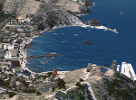
The city of Avalon on Catalina Island with many custom built objects including the Turret House, Wrigley Memorial, Pier, working Bell Tower (sounds), and several businesses and hotels. This scenery was designed around the freeware Catalina Island by Aerosoft and is required for this scenery to display correctly. FS2002 version of this scenery has over 5500 downloads. Tested on FSX Gold Edition (FSX Deluxe and Acceleration Expansion Pack), FSGenesis 9.6 terrain mesh, and Win7 operating system. Requires RWEOBJv5.zip & RWEOBJc5.zip (or later) Object Libraries. By Ron Ezra
| Filename: | Avalon_Catalina__California_CA_USA.zip |
| License: | Freeware |
| Added: | 14th January 2016, 19:29:50 |
| Downloads: | 903 |
| Author: | Ron Ezra |
| Size: | 1.53 MB |
| Category: Flight Simulator 2004 - Scenery | |
| Alps LOD10 Topo Mesh - Update 1 |
|
File Description:
Patch files to remove tall spike in terrain near Salzburg at N47 44´ E13 00´ and to add the missing/distorted peaks of La Grande Moucherolle at N45 00´ E5 34´ and Mont Aiguille at N44 50' E5 33'.
Requires the full version of our Alps LOD10 mesh files, alpse_fe.zip and alpsw_fe.zip. Source data by Jonathan de Ferranti, compiled for FS by Holger Sandmann. Fully compatible with FS2002. A big thank-you to those who reported the "Salzbug" and the missing peaks in the French Alps.
| Filename: | Alps_LOD10_Topo_Mesh__Update_1.zip |
| License: | Freeware, limited distribution |
| Added: | 9th February 2006, 15:02:59 |
| Downloads: | 32,364 |
| Author: | Holger Sandmann, Jonathan de Ferranti |
| Size: | 2.57 MB |


© 2001-2026 AVSIM Online
All Rights Reserved
Privacy Policy |