
Where Flight Simulation Enthusiasts Gather from Around the World!
AVSIM Library - Search Results

| Category: Flight Simulator 2004 - Scenery | |
| Baluchistan SRTM Mesh |

|
File Description:
This mesh includes both Pakistani and Iranian "Baluchistan" south of 28.5°N. The Baluchistan area would approximately fit in a square defined by Zahedan - Quetta - Karachi - Chah Bahar cities. The northernmost part of Baluchistan is already covered by my "Southern Afghanistan SRTM mesh" (afghanistan_south_srtm.zip).
Based on SRTM Data (3 arcsec, 90m) and sampled to LOD9 resolution (76m) using Matthew Styles's program "SRTM To BGL v1.04".
Big SRTM "holes" (void data) were patched with SRTM 30-arcsec dataset thanks to John Child's beautiful and powerful "Blackart" utility.
| Filename: | Baluchistan_SRTM_Mesh.zip |
| License: | Freeware, limited distribution |
| Added: | 15th August 2005, 03:13:38 |
| Downloads: | 2,589 |
| Author: | Yohann Baptiste |
| Size: | 28.81 MB |
| Category: Fly! II - Scenery | |
| LOGF Mesh fix |
|
File Description:
This file contains the SCENERY.Sxx file for my LOGF-Scenery which is necessary to use it with Helmut Mayers mesh OE-OST.
My original D011165.POD contains the elevation data and the SCENERY.Sxx-File. To use Helmuts mesh I have created LOGFMESH.POD, which only contains the SCENERY.SXX-File.
If you have my LOAN-Sscenery, remove also D011166.POD.
| Filename: | LOGF_Mesh_fix.zip |
| License: | Freeware |
| Added: | 1st August 2002, 11:45:27 |
| Downloads: | 151 |
| Author: | Harald Kraft |
| Size: | 2.94 KB |
| Category: Fly! II - Scenery | |
| Austria Mesh East |
|
File Description:
Elevation mesh based on 3° SRTM elevation-data from 46°N 14°E to 49°N 19°E. The Area around my Austrian Airports is manually corrected.
| Filename: | Austria_Mesh_East.zip |
| License: | Freeware |
| Added: | 12th January 2004, 14:30:33 |
| Downloads: | 622 |
| Author: | Harald Kraft |
| Size: | 3.97 MB |
| Category: Fly! II - Scenery | |
| Austria Mesh West |
|
File Description:
Elevation mesh based on 3° SRTM elevation-data from 46°N 09°E to 49°N 14°E. The Area around my Austrian Airports is manually corrected.
| Filename: | Austria_Mesh_West.zip |
| License: | Freeware |
| Added: | 14th January 2004, 20:21:21 |
| Downloads: | 461 |
| Author: | Harald Kraft |
| Size: | 6.49 MB |
| Category: Flight Simulator 2004 - Scenery | |
| Nashville Area Mesh |
|
File Description:
This is a mesh file that includes the immediate Nashville International Airport (KBNA) area. It is from N036W87 & N036W86 SRTM data information. This is produced using the 1 Arc per Sec method.
| Filename: | Nashville_Area_Mesh.zip |
| License: | Freeware |
| Added: | 24th November 2003, 20:59:20 |
| Downloads: | 2,196 |
| Author: | Larry Stewart |
| Size: | 6.72 MB |
| Category: Flight Simulator 2004 - Scenery | |
| France SRTM Mesh |
|
File Description:
Based on SRTM 3 arc.sec data.
Unfortunately SRTM DATA have many holes and data loss, so I made a resampling and an oversampling with other data with lower resolution, but with better coverege (like data from swiss topographic federal istitute or from italian IGM, and finally with DTED Level 0.) with geo cad software like Grass and GlobalMapper for projection convertion.
Compression and conversion to bgl with MS Flight simulator SDK at LOD 9
This scenery cover the part of France territories not included in my Italian and Spanish sceneries;thus these sceneries are required to cover entire France country. Parts of Belgium and Netherlands are included too (Till E005)
| Filename: | France_SRTM_Mesh.zip |
| License: | Freeware |
| Added: | 23rd November 2003, 11:48:22 |
| Downloads: | 25,759 |
| Author: | Pietro Mauri |
| Size: | 46.44 MB |
| Category: Flight Simulator X - Scenery | |
| Death Valley National Park - California, USA |
|
Images related to this file:
File Description:
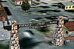
FSX Scenery--Death Valley. This scenery covers several areas of Death Valley National Park (CA). See the World's lowest golf coarse at Furnace Creek Ranch, the moving rocks at the RaceTrack, Scotty's Castle, Panamint Spring, and Stovepipe Wells. Custom designed buildings with photorealistic textures, night textures, and satellite image for the grounds. This scenery has been tested on FSX Gold Edition (FSX Deluxe and Acceleration Expansion Pack), FSGenesis 9.6 terrain mesh, and Win7 operating system. Requires RWEOBJv5.zip & RWEOBJc5.zip (or later) Object Libraries. By Ron Ezra.
| Filename: | Death_Valley_National_Park__California_USA.zip |
| License: | Freeware |
| Added: | 13th January 2016, 22:23:10 |
| Downloads: | 457 |
| Author: | Ron Ezra |
| Size: | 5.53 MB |
| Category: Flight Simulator 2004 - Scenery | |
| 9Dragons - Kai Tak Airport, Hong Kong - Version 2, Part 1 of 4 |
|
File Description:
Now with auto-installer! Break out your 'heavies' from the 70's-80's-90's and see if you can tame the Dragon by mastering the infamous IGS 'Checkerboard' Approach. Scenery also includes the areas of Kowloon, Hong Kong, Chek Lap Kok, custom autogen, terrain mesh, and approximately 800 miles of photoreal day and night textures. Version 2 improvements also include an uninstaller, bug fixes, full support for Aerosoft's AES and some minor scenery adjustments. Part 1 is the 9Dragons Pilot's Guide v2.
| Filename: | 9Dragons__Kai_Tak_Airport_Hong_Kong___Version_2_Pa.zip |
| License: | Freeware, limited distribution |
| Added: | 1st February 2008, 04:57:44 |
| Downloads: | 39,644 |
| Author: | Marcus Thompson, Frabrizio Pascucci, Eddie Chan |
| Size: | 21.67 MB |
| Category: Flight Simulator 2004 - Scenery | |
| Tok Junction 6K8 in Alaska, USA |
|
Images related to this file:
File Description:
Tok Junction is a village, or small town, on the Alaska Highway some 180 miles east of Fairbanks and 60 miles west of the Alaska-Canada border. The town is spread over a wide area on the flat terrain and barely registers among the trees, and as such is not shown in FS9 except as a grid of roads as there is no town terrain texture like it used in FS9. The airfield is at the eastern end of the town and adjacent to the Alaska Highway and I have included some surrounding houses, workshops, shops, lodges, etc. The single runway is 3,000 feet of 50 feet wide asphalt aligned 07-25 and lit. There is a small airline based on the airfield called 40-Mile Air. Their hangar is red and the name written large and 100LL fuel is available beside it at all times. Jet A-1 is available by a telephoned pre-arangement. They are, I believe, no longer flying scheduled flights but they do still function as an air taxi and they have a contract to deliver mail to surrounding villages that are not served by all-weather roads. The airfield now has a new icao "PFTO" but in FS9 it remains as the original FAA LID, 6K8. The FS9 roads are not accurately placed, and the grass airfield background is not really appropriate as the reality is more like gravel mixed with earth; it is however difficult to replicate this with the available textures and still prevent bushes or trees appearing. But, in the winter and with snow on the ground it looks as it should. A note here about my scenery making. There will not be many more to follow this as I am almost at the end of the photos I either took or found for scenery purposes, plus I expect to move on from FS9 at some point during next year.
| Filename: | Tok_Junction_6K8_in_Alaska_USA.zip |
| License: | Freeware, limited distribution |
| Added: | 14th January 2020, 17:49:21 |
| Downloads: | 176 |
| Author: | Roger Wensley |
| Size: | 25.47 MB |
| Category: Flight Simulator 2004 - AI Flight Plans | |
| Alaska Airlines Spring/Summer 2006 |
|
File Description:
FS2004 - Alaska Airlines Spring/Summer 2006 AI flightplans
| Filename: | Alaska_Airlines_SpringSummer_2006.zip |
| License: | Freeware |
| Added: | 31st March 2006, 00:29:41 |
| Downloads: | 1,489 |
| Author: | Jeffery Andrews |
| Size: | 100.95 KB |


© 2001-2026 AVSIM Online
All Rights Reserved
Privacy Policy |