
Where Flight Simulation Enthusiasts Gather from Around the World!
AVSIM Library - Search Results

| Category: Flight Simulator X - AFCAD Files | |
| Somerset Airport (KSMQ), NJ |

|
File Description:
Located 03 miles N of Somerville, New Jersey on 210 acres of land, Somerset is a public airport with one asphalt and two grass runways, the longest of which is 2733' in length. The turf runways have no hard surfaces and you will be landing on terrain so have your mesh set as high as possible - both runways are still selectable in the ATC window for landing/takeoff announcements. AI aircraft will not use them. The helipad is a start location in front of the main terminal if a parking location is not wanted to begin helicopter flights. Parking is divvied up into three categories - GA_SMALL spots will accommodate aircraft with wingspans no greater than 40 feet. GA_MEDIUM spots will accommodate aircraft with wingspans no greater than 60 feet. GA_LARGE spots are named to identify locations suitable for starting in a glider if you wish to do so. They can also accommodate aircraft with wingspans no greater than 60 feet. In addition to tie downs, there are 13 hangars open for parking in various locations - they can be identified by GA_DOCK. Only the N Parking hangar can accommodate aircraft with wingspans no greater than 60 feet - all other hangers are suitable only for aircraft with wingspans no greater than 40 feet. Several of the hangars have attendants - look beside the doors for the NAV2 frequency to set for opening them. AI aircraft will only spawn on the north tarmac/hangars (largely to prevent AI traffic crossing the runway on taxi). All objects and static aircraft in the immediate vicinity of parking and taxiways have collision disabled. If your aircraft has a wingspan greater than 40 feet it is NOT recommended that you taxi down the middle taxiway leading to the main tarmac from N Parking as you will not clear the hangars - go either via the NW taxiway past the grass tie downs (NW Parking) or around East to the next taxi way on the other side of the east hangars (E Parking) which has more wing clearance. Fuel is available on both tarmacs north and south of the runway by stopping on the asphalt in front of the tanks/pump.
Scenery constructed with use of satellite images/streetview/aerial photos - the author has not been there in person.
This scenery is meant to be used in conjunction with MegaScenery Earth New York 005. It is not required, but apron use is minimized to allow satellite scenery to show through as much as possible, and objects are placed based on the MSE textures - lack of it may make scenery look out of place.
| Filename: | Somerset_Airport_KSMQ_NJ.zip |
| License: | Freeware |
| Added: | 27th September 2011, 01:15:53 |
| Downloads: | 306 |
| Author: | Drew Sikora |
| Size: | 1.47 MB |
| Category: Flight Simulator X - Scenery | |
| St. Helena, Ascension, and Tristan da Cunha Islands |
|
Images related to this file:
File Description:
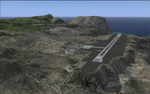
This project was begun to add the new airport (FHSH) to St. Helena Island and eventually was expanded to include a complete remake of Ascension Island (FHAW) and Tristan da Cunha (with an optional airport FHTC) and Gough Island with the actual weather station heliport (FHGH). Tested in both the default FSX/Acceleration and with FTX Global/Vector, accurate coastlines, lakes, road data, and SRTMGL1 (30m) mesh, as well as corrected landclass are provided based on the latest available satellite imagery. Flight plans are provided for the proposed commercial service to St. Helena, and some additional GA and military flights to the island are added as well.
The FSX St. Helena (FHSH) airport was created by aligning master plans for the airport with current satellite data and by studying many of the pictures that have been posted as the airport has taken shape. The official opening of the real airport on May 21, 2016, has been pushed back for more field tests due to challenging crosswinds. The Ascension Island (FHAW) airport was updated after I realized that Ascension could receive commercial service as a result of the new St. Helena airport. The entire airfield is redesigned to allow the volcanic terrain to display properly. The airbase, towns, BBC Atlantic relay station, and numerous satellite dishes, radomes, and wind turbines now appear in their real-world locations. Since I was already in the region, I added the Tristan da Cunha Islands (including Inaccessible, Nightingale and Gough Islands) and the Gough Island weather station maintained by the South African National Antarctic Programme. I also added an optional airport (and flight plans) to Tristan da Cunha (FHTC), which can be easily enabled/disabled. The FHTC airport is placed on the only part of the island that appears to be free of people or farmland, and the area is just long enough to accommodate a pared-down version of the St. Helena airport.
Updates were created or rebuilt in a manner which carefully aligns airport data with current satellite imagery. Scenery was created using Airport Design Editor X v1.67.5684, SBuilderX 3.13, and the FSX Object Placement Tool. Scenery objects were added and modified from stock FSX scenery to resemble as closely as possible the actual airports. The animated flag model is by Dietmar Loleit, the FSX apron lights included are from the set created by Jim Dhaenens, and the animated wind turbines and radomes are from the freeware package by Ray Porter.
| Filename: | St_Helena_Ascension_and_Tristan_da_Cunha_Islands.zip |
| License: | Freeware |
| Added: | 1st May 2016, 11:23:05 |
| Downloads: | 6,095 |
| Author: | Carlyle Sharpe |
| Size: | 10.52 MB |
| Category: Flight Simulator X - Scenery | |
| Thomas Hudner AFB |
|
File Description:
Thomas Hudner AFB is a fictitious Air Force Base located at Henderson Island, a member of the Pitcairn Islands in the Pacific. Located in a sheltered bay on the east side of the island, the airport features a 7500' x 120' paved runway, several hangars, barracks, and a fire dept. This airport also features a Delta V rocket and launch pad, a container ship being unloaded offshore by hovercrafts, and a small military ship. The default FSX scenery at this island has been completely replaced with custom scenery and terrain based on satellite photos.
This scenery requires the FSX Acceleration expansion pack for all of the objects to show up properly. Also, for some reason, Ground Environment X causes the sand textures to show up as rain forest. This is purely a visual quirk and the airport will still work, but it is up to you. This airport is not designed for FS2004, but you may try it at your own risk. Special thanks to Ashton Lawson for his invaluable help on this project.
| Filename: | Thomas_Hudner_AFB.zip |
| License: | Freeware, limited distribution |
| Added: | 31st January 2009, 01:29:20 |
| Downloads: | 543 |
| Author: | Daniel Otto |
| Size: | 1.57 MB |
| Category: Flight Simulator X - Scenery | |
| TTCPx Patch Ver. 1.2 ( Rev. 8 ) |
|
Images related to this file:
File Description:
Unofficial LatinVFR Tobago TTCP for FSX Expansion Pack. This freeware patch contents: New photoreal scenery with seasons to airport area ( day and night for winter/fall and summer/spring seasons ); New ADE with correction of the NDB TAB 323 and park positions, activation of the RWY's 11 and 29, and other minor fixes; Addition of fuel-repair trigger points to the airport ( JetA to Gates 1-4 area, JetA1 to Gates 5-6 area, and AV100 to Gate 7 area ); New land and water classiffication in the entire island of Tobago; Correction of the entire island terrain including a better flatten around the airport area; More buildings, objects, vegetation and life around on the island of Tobago ( FSX default fictitious objects ); More road traffic over the photoreal area; Full set of the TTCP airport charts ( Use for Virtual Flight Only ); Other fixes. It's not a cumulative patch, so remove any previous version to install. System Requirements: LatinVFR Tobago TTCP v1.1 for FSX and Microsoft Flight Simulator X SP2 or Acceleration.
| Filename: | TTCPx_Patch_Ver_12__Rev_8_.zip |
| License: | Freeware |
| Added: | 22nd August 2010, 08:59:46 |
| Downloads: | 2,429 |
| Author: | Gladson Moreira |
| Size: | 32.76 MB |
| Category: Flight Simulator X - Panels | |
| General Dynamics F-111 PIG HUD PROJECT |
|
Images related to this file:
File Description:
FSX F-111 PIG HUD PROJECT - Navigation/Situation awareness cockpit.
REVISION 6.UPGRADE. MUST already have fxpiggb5.zip installed.
New features:In cockpit Pave Tack Display with full control allows views
in all directions, pitch,zoom and altitude, Terrain shading added to 2 GPS
displays, Virtual Cockpit layout improved, Flt Pln leg toggle SW,Precision
airspeed capable,Revised 56 pge Flight Manual includes new TFR procedures.
Adds to what is already an extreme capability panel and package packed
with custom instruments and concepts not available in other aircraft.
All instruments and text are sized to be clearly and easily readable.
Includes enhanced HUD, multiple radars,GPS units,MFDs,and effects,TFR,
autopilot/autothrottle, is Carrier and Air to Air capable,ICAO entry and
day/night/IFR/VFR navigation with constant current position awareness.
HUD available in all views including the 10 Camera views. This package sets
the benchmark for the amount, type of data provided and its presentation.
Possibly the best pilot friendly military aircraft available.
By Karol Chlebowski.
| Filename: | General_Dynamics_F111_PIG_HUD_PROJECT.zip |
| License: | Check within download |
| Added: | 17th September 2010, 23:53:26 |
| Downloads: | 410 |
| Author: | Karol Chlebowski |
| Size: | 14.7 MB |
| Category: Flight Simulator X - AFCAD Files | |
| Fla-Net Airport (0NJ5), NJ |
|
File Description:
This another weird airport entry in the FSX database. The real 0NJ5 is the Meadowlands Sports Complex Heliport #2, and this just shows up as a random turf strip up near Netcong/Flanders in northern NJ. I could not find any specific information regarding the airport online, and while it does appear to once harbour the room and terrain for a grass strip, it's largely overgrown, even in the current MegaScenery Earth textures. So I've removed the strip entirely. There is still a start at the northwest end of where the strip used to be if you want to travel there, but that's it.
Scenery constructed with use of satellite images/streetview, the author has not been there in person.
This scenery is meant to be used in conjunction with MegaScenery Earth New York 005. It is not required, but apron use is minimized to allow satellite scenery to show through as much as possible, and objects are placed based on the MSE textures - lack of it may make scenery look out of place.
| Filename: | FlaNet_Airport_0NJ5_NJ.zip |
| License: | Freeware |
| Added: | 21st October 2010, 23:23:44 |
| Downloads: | 188 |
| Author: | Drew Sikora |
| Size: | 199.2 KB |
| Category: Flight Simulator 2004 - AI Aircraft | |
| Aeronautica Militare Fiat/Aeritalia G.91 |
|
Images related to this file:
File Description:

Aeronautica Militare Fiat/Aeritalia G.91. I present a comprehensive AI traffic model package for this backbone of close air support in Europe during the Cold War years. The G.91 was built to suit a requirement for a NATO-compatible aircraft for close air support and light strike roles, able to operate from terrain as primitive as a flat grassy meadow (I found photos during research that support this). Going into production in 1961, this aircraft was manufactured for 19 years and served three European air forces for 35 years. The G.91 saw extensive combat service in Africa while operated by the Portuguese Air Force.
An original 7-LOD model brings this historic aircraft to the flightsim world. This package represents the G.91 in the service of the Italian Air Force and Frecce Tricolori Demonstration Team; with a total of 22 models and 74 repaints. Aircraft models covered are the G.91PAN, G.91R1, G.91R1A, G.91R1B, G.91T1, and G.91Y. Aircraft, textures, and flight dynamics by Michael Pearson.
| Filename: | Aeronautica_Militare_FiatAeritalia_G91.zip |
| License: | Freeware |
| Added: | 7th October 2013, 22:34:21 |
| Downloads: | 771 |
| Author: | Michael Pearson |
| Size: | 21.81 MB |
| Category: X-Plane - Original Aircraft | |
| A1 Spec. SL-1 |
|
File Description:
The Sealiner 1 A1 Special is a small amphibian jet, capable of landing both on land and water as well as other tough terrain, This iarcraft boasts 6 compact low bypass jet engines, The plane also has a nice and simple cockpit design, so simple this is a perfect plane for any first time pilot. Not only is it fast and user friendly but it is safe with a huge chute on it, it can slow this plane down to landing speed in seconds. Unlike the VTOL aircraft I built before this plane is much smaller and this is reflected in the amount of payload it can carry, but there is a good reason for this. This airplane was designed to service small islands (mainly in the south pacific) where before a boat would have had to been taken if one decided to leave, so with the SL-1 them and 20 other people can fly commerical airline style almost anywhere! In the future look for another engine to be added.
| Filename: | A1_Spec_SL1.zip |
| License: | Freeware, limited distribution |
| Added: | 25th April 2004, 01:57:41 |
| Downloads: | 568 |
| Author: | Sam Hoy |
| Size: | 48.1 KB |
| Category: Flight Simulator 2004 - Scenery | |
| St. Kitts International Airport (Bradshaw), Caribbean |
|
File Description:
This scenery depicts the Robert L. Bradshaw International airport on the Island of St. Kitts in the Caribbean. It contains the modern new terminal, along with the distinctive green glass tower, and outer buildings. It is a small airport which is located in a valley between two mountain ranges near the southern end of the Island. The scenery has been updated to work in FS2004 by changing the location slightly, removing the hills which are no longer necessary, since FS has now done a great job with the new terrain. The tarmac area is now more representational of the airport, since the scenery tarmacs now override the default FS tarmacs, taxiways, and lines. The airport now has a cleaner layout, and the taxiway extending to the runway end now fits in perfectly. More trees have been added to prevent the stark look of the old scenery. This airport needs an afcad, since there are some A1 aircraft which park in the middle of the taxiway. This scenery will not work in FS2002.
| Filename: | St_Kitts_International_Airport_Bradshaw_Caribbean.zip |
| License: | Freeware |
| Added: | 23rd August 2003, 15:27:31 |
| Downloads: | 4,299 |
| Author: | Bill Melichar |
| Size: | 3.57 MB |
| Category: Flight Simulator 2004 - Scenery | |
| Baton Rouge,La. ( KBTR v2 ) |
|
File Description:
FS2004 KBTR Baton Rouge,La. v2.0
This is an updated version from my old EZ Mega KBTR version 1.0
This Scenery is optimized for use with Ultimate Terrain USA,but should work OK with default land scenery.
This package features a lot of objects around the city of Baton Rouge, such as an accurate rendition of the 473foot tall State capital Building, Cortana mall,Seigen Village Mall,strip malls,banks,restaurants,gas stations,Chemical plants,River Barge Traffic,USS Kidd Destroyer,the two casino boats,the Marriott Hotel off College drive,Louisiana State Police headquarters with its own AFCAD and Helo pads and lots of other stuff.This version does not feature my custom built terminal and hangers,that will come in version 3.
The Airport AFCAD has been once again reworked as well to reflect the newly lengthened Rwy 22R-4L and other stuff.
This has been my test bed for the upcoming version 3 release which will be released by Christmas hopefully.
In the meantime,enjoy this new version equipped with familiar landmarks.
As Always...Enjoy!!!
| Filename: | Baton_RougeLa__KBTR_v2_.zip |
| License: | Freeware |
| Added: | 11th October 2008, 02:15:38 |
| Downloads: | 2,876 |
| Author: | Joe DeGregorio |
| Size: | 13.04 MB |


© 2001-2026 AVSIM Online
All Rights Reserved
Privacy Policy |