
Where Flight Simulation Enthusiasts Gather from Around the World!
AVSIM Library - Search Results

| Category: Flight Simulator X - Aircraft Repaints, Textures and Modifications | |
| McDonnell Douglas DC-10 - air charter airlines 4-pack |

|
Images related to this file:
File Description:
FSX McDonnell Douglas DC-10-15 air charter 4-pack repaint textures for the
freeware Thomas Ruth/Eric Cantu McDonnell Douglas DC-10 series. I use the
updated for FSX with VC models multi-pack (tomdc10.zip), which includes the -10,
-15, -30, and -40 models. With plenty of life left before heading to the boneyard,
these DC-10's are pressed into service with four small time mom and pop charter
operators... Charterlink America, Holiday Alaska Charters, Honolulu Aero Charter,
and Tropicanada Island Tours. These repaints work with any of the four Ruth/Cantu
model variations, I just chose the -15 as my painting platform. Also includes
engine exhaust smoke coordinates for FSX which you can add to your various model's
"aircraft.cfg" files if you wish. Screenshots enclosed. Easy installation.
Repaints by Tom Tiedman.
| Filename: | McDonnell_Douglas_DC10__air_charter_airlines_4pack.zip |
| License: | Freeware |
| Added: | 24th August 2013, 10:57:35 |
| Downloads: | 272 |
| Author: | Thomas Ruth, Erick Cantu, Tom Tiedman |
| Size: | 56.34 MB |
| Category: Flight Simulator 2002 - Scenery | |
| Alaskan Commuter #9: North Alaskan Skies 2002 |
|
File Description:
Enhancements to 50 land-based airports in Northern Alaska. Includes static aircraft and additional airport structures as well as easy to install landclass files. These landclass files add small villages and stands of conifers that blanket the surrounding areas. The experience can be further enhanced with autogen tree replacements by either Ed Truthan or Gerrish Gray (download separately). This will greatly improve the look of autogen conifers, and multiply their numbers significantly. The results are realistic approaches over thickly forested areas into bush airports with small nearby communities, and it is fairly gentle on frame rates. If you download this scenery, and if you are not using these replacement trees, I recommend (no, I insist) that you download one of those utilities now. Look for "conifers.zip" by Ed Truthan or "MSTrees2.zip" by Gerrish Gray.
| Filename: | Alaskan_Commuter_9___North_Alaskan_Skies_2002.zip |
| License: | Freeware |
| Added: | 6th November 2002, 20:16:43 |
| Downloads: | 6,543 |
| Author: | Dave Erickson |
| Size: | 8.04 MB |
| Category: Flight Simulator 2004 - Flight Plans | |
| World Challenge Cross Country Race U.S.A East Coast |
|
File Description:
This is a special challenge for the racing fans. In this challenge you will race arcoss the U.S from the Maine to Alaska. There are many challenges ahead, Some are easy while some are very hard. You will start in Caribou,Maine and hug the east coast all the way down to Key West, Fl. You can use any turbo prop or prop aircrafts the faster the better. No Jets. You can visit downtown Boston or fly over New York City and take the grand tour. You pick the route, the east coast race ends in Key West, Fl and begins there also. I have added alot of information that you can use on your trip if you like. Also upgrade your Scenrey and AFCAD files to get a better feel of the race.
| Filename: | World_Challenge_Cross_Country_Race_USA__East_Coast.zip |
| License: | Freeware |
| Added: | 8th July 2007, 21:07:15 |
| Downloads: | 306 |
| Author: | Hosea Robertson |
| Size: | 403.82 KB |
| Category: Flight Simulator 2004 - Scenery | |
| The Alaskan Pipeline - Valdez Terminal and Pump Stations - Updated |
|
File Description:
The Alaskan Pipeline - Your opportunity to explore one of the largest and most difficult construction projects of our time and see some spectacular scenery while doing it. This is a representation of the Valdez, Alaska Terminal and several Pump Stations along the 800 mile Alaskan Pipeline which extends from Prudhoe Bay to Valdez. The project was originally designed for ZIA Cargo/Sunspot Charter VA pilots, but is now being made available to the flightsim community. This is a completely new installation package which replaces all previously uploaded files and which clarifies the installation procedure. Complete instructions in .doc and .pdf formats are included. Please unzip (using folders option) to a temporary folder and follow the instructions very carefully. Scenery and design by John J. Hogan - Afcads and project compilation by David "Opa" Marshall.
| Filename: | The_Alaskan_Pipeline__Valdez_Terminal_and_Pump_Sta.zip |
| License: | Freeware, limited distribution |
| Added: | 25th August 2005, 17:57:35 |
| Downloads: | 4,869 |
| Author: | John J. Hogan and David Marshall |
| Size: | 10.47 MB |
| Category: Flight Simulator 2004 - Scenery | |
| SeaTac Mall Visual Landmark Object for Seattle-Tacoma INTL. KSEA |
|
File Description:
Sea-Tac Mall has been the center of the community in Federal Way WA for over 25 years and for just as long has been a landmark for thousands of flights that use KSEA yearly. The phrase...........Alaska 69 is with you at 7.5 DME for the MALL VISUAL 34L or Right is heard on many a sunny days on those with airband scanners. My motivation for creating this scenery is not only because I live within walking distants but that Microsoft did not include the landmark for it in FS9COF however they did not forget about the HUSKY Visual that starts at UofWASH Husky stadium to the north. Im certian that if you have arrived from the south you have seen Sea-Tac Mall out your window seat.
| Filename: | SeaTac_Mall_Visual_Landmark_Object_for_SeattleTaco.zip |
| License: | Freeware |
| Added: | 11th August 2003, 01:41:16 |
| Downloads: | 3,220 |
| Author: | Randall Smith |
| Size: | 320.63 KB |
| Category: Prepar3D V1-4 - Scenery | |
| LTFE - Milas Bodrum Airport - Turkey |
|
Images related to this file:
File Description:
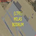
LTFE - Accurate positioning according to the latest charts, google map coordinates and the Navigraph runway coordinates data.
Upon planning a flight from Istanbul to Bodrum, I realized that the airport has been developed with the addition of the international terminal, and the conversion of the old taxiway A into a runway (10R - 28L), and thus decided to quickly make this update.
Milas–Bodrum Airport (IATA: BJV, ICAO: LTFE) is an international airport that serves the Turkish towns of Bodrum and Milas. The airport is situated 36 km northeast of the town of Bodrum, and 16 km south of Milas.
The airport is surrounded by beautiful scenery of hills, with a steep approach of 3.90 degrees due to the surrounding terrain.
Please read the included README file for the simple install instructions.
| Filename: | LTFE__Milas_Bodrum_Airport__Turkey.zip |
| License: | Freeware, limited distribution |
| Added: | 5th July 2017, 17:46:12 |
| Downloads: | 768 |
| Author: | Ahmed Abdessalam |
| Size: | 945.88 KB |
| Category: Flight Simulator 2004 - Flight Plans | |
| OB-1 Wilder Idaho |
|
File Description:
FS2004 Flight Plan for OB-1 Wilder Idaho IFR high speed low altitude military training route through mountainous terrain in Oregon, Nevada and Idaho. This is the first in a series of FS2004 flight plans I will upload. These are great routes for B-52, F-111, B-1B, B-2 A6, A4, Vulcan and any fighter or bomber enthusiasts. Of course you can fly the route with any aircraft of your choice. Included in this package is a gauge by Karol Chlebowski for TFR flying at very low altitude. This gauge will greatly enhance your ability to fly these challenging routes and is a great companion of the flight plans. Another option to download Version 2.0 of my FS2004 mini panel which has all this functionality and more.
| Filename: | OB1_Wilder_Idaho.zip |
| License: | Freeware |
| Added: | 27th July 2011, 22:58:55 |
| Downloads: | 102 |
| Author: | Bill McClellan |
| Size: | 307.34 KB |
| Category: Flight Simulator 2004 - Flight Plans | |
| OB-9 Bayshore Michigan |
|
Images related to this file:
File Description:
FS2004 Flight Plan for OB-9 Bayshore Michigan IFR high speed low altitude military training route. This is the second in a series of flight plans I have uploaded. This route goes through flat and rolling terrain and over water in Ontario and Michigan. These are great routes for B-52, F-111, B-1B, B-2 A6, A4, Vulcan and any fighter or bomber enthusiasts. Of course you can fly the route with any aircraft of your choice. Included in this package is a gauge by Karol Chlebowski for TFR flying at very low altitude. This gauge will greatly enhance your ability to fly these challenging routes and is a great companion of the flight plans. Another option to download Version 2.0 of my FS2004 mini panel which has all this functionality and more.
| Filename: | OB9_Bayshore_Michigan.zip |
| License: | Freeware |
| Added: | 27th July 2011, 22:59:45 |
| Downloads: | 78 |
| Author: | Bill McClellan |
| Size: | 458.56 KB |
| Category: Flight Simulator 2004 - Flight Plans | |
| OB-10 Hawthorne Nevada |
|
Images related to this file:
File Description:
FS2004 Flight Plan for OB-10 Hawthorne Nevada IFR high speed low altitude military training route. This is the third in a series of flight plans I have uploaded . This route goes through both mountainous and flat and rolling terrain in California, and Nevada. These are great routes for B-52, F-111, B-1B, B-2 A6, A4, Vulcan and any fighter or bomber enthusiasts. Of course you can fly the route with any aircraft of your choice. Included in this package is a gauges by Karol Chlebowski for TFR flying at very low altitude. This gauge will greatly enhance your ability to fly these challenging routes and is a great companion of the flight plans. Another option to download Version 2.0 of my FS2004 mini panel which has all this functionality and more.
| Filename: | OB10_Hawthorne_Nevada.zip |
| License: | Freeware |
| Added: | 27th July 2011, 23:00:38 |
| Downloads: | 86 |
| Author: | Bill McClellan |
| Size: | 458.56 KB |
| Category: Flight Simulator 2004 - Flight Plans | |
| OB-11 Richmond Kentucky |
|
Images related to this file:
File Description:
FS2004 Flight Plan for OB-11 Richmond Kentucky New IFR high speed low altitude military training route. This route goes through mountainous terrain in Tennessee, North Carolina, Virginia and Kentucky. This is the fourth in a series of flight plans I have uploaded. These are great routes for B-52, F-111, B-1B, B-2 A6, A4, Vulcan and any fighter or bomber enthusiasts. Of course you can fly the route with any aircraft of your choice. Included in this package is a gauge by Karol Chlebowski for TFR flying at very low altitude. This gauge will greatly enhance your ability to fly these challenging routes and is a great companion of the flight plans. Another option to download Version 2.0 of my FS2004 mini panel which has all this functionality and more.
| Filename: | OB11_Richmond_Kentucky.zip |
| License: | Freeware |
| Added: | 27th July 2011, 23:02:36 |
| Downloads: | 77 |
| Author: | Bill McClellan |
| Size: | 363.4 KB |


© 2001-2026 AVSIM Online
All Rights Reserved
Privacy Policy |