
Where Flight Simulation Enthusiasts Gather from Around the World!
AVSIM Library - Search Results

| Category: Flight Simulator 2002 - Scenery Design | |
| LWMDraw4 |

|
File Description:
LWMDraw4 -- FS2002 Scenery Design
LWMDraw4 is developed to be an easy to use and helpful
time saving tool for placing free design shapes or photoreal
default type water areas such as lakes "with effects" onto
the FS2002 terrain surface generating a "ready to assemble"
LWMSource.asm file. Features include the addition of default
type FS2002 roads/lines/shorelines, Polygons, and LandClass
with the generation of a separate VTPSource.asm file as well.
Includes many additional features, a new tabbed interface,
and more options explained within the detailed Help menu
along with Quick Start Guide menu for fast placement.
Freeware by Ken Nelson
| Filename: | LWMDraw4.zip |
| License: | Freeware, limited distribution |
| Added: | 16th May 2010, 23:27:23 |
| Downloads: | 974 |
| Author: | Ken Nelson |
| Size: | 1.77 MB |
| Category: Flight Simulator X - Scenery | |
| The Real VCBI X |
|
Images related to this file:
File Description:

This is the complete & high detailed scenery of Bandaranaike International Airport
for Microsoft Flight Simulator X. If you are a Sri Lankan flightsimmer or like to fly
around Sri Lanka in Flight Simulator X, then this is a must for you!.
Features -: High quality Satellite terrain.
G-Max�������® designed terminal and other buildings.
Accurate building and apron placement.
Extremely high detailed terminal and surroundings.
Re-Adjusted glide scope and localizer to match actual situation.
Road traffic animations and other effects.
High detailed Autogen data.
| Filename: | The_Real_VCBI__X.zip |
| License: | Freeware, limited distribution |
| Added: | 4th October 2011, 08:00:05 |
| Downloads: | 8,614 |
| Author: | Gayan Liyanaarachchi |
| Size: | 22.65 MB |
| Category: Flight Simulator X - Scenery | |
| Tobago TTCPx Patch Ver. 1.2 ( Rev. 7 ) |
|
Images related to this file:
File Description:
Unofficial LatinVFR Tobago TTCP for FSX Expansion Pack. This freeware patch contents: a new photoreal scenery with seasons to local airport area ( day and night for winter/fall and summer/spring seasons ); a new land and water classification in the entire island of Tobago; a correction of the entire island terrain including a better flatten around the airport area; more buildings, objects, vegetation and life around on the island of Tobago ( FSX default fictitious objects ); more road traffic over the photoreal area; and other minor fixes. System Requirements: LatinVFR Tobago TTCP v1.1 for FSX and Microsoft Flight Simulator X SP2 or Acceleration.
| Filename: | Tobago__TTCPx_Patch_Ver_12__Rev_7_.zip |
| License: | Freeware |
| Added: | 19th August 2010, 22:54:02 |
| Downloads: | 843 |
| Author: | Gladson Moreira |
| Size: | 30.76 MB |
| Category: Flight Simulator X - Scenery | |
| Shahjalal International Airport (Zia) v1.1 |
|
Images related to this file:
File Description:
Updates and Fixed Issues:
**The "VGZR_ADEX_FSX.bgl" is re-edited;
**Some other minor bugs where fixed.
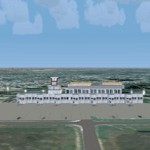
The biggest Shahjalal International Airport (Zia). Meticulously detailed and realistically depicted Flight Simulator X scenery for Shahjalal International Airport (Zia). Created with 3ds max from scratch, the scenery includes accurate buildings, hangars, parking bays, night texturing and illumination effects. The scenery contains variety of static aircraft and animations and photo real terrain texture. This a complete scenery for FSX. The ZIA_Shahjalal International Airport is the busiest airport in Bangladesh and provides access to 4,6 Mio. million passengers a year.
| Filename: | Shahjalal_International_Airport_Zia_v11.zip |
| License: | Freeware |
| Added: | 8th January 2012, 07:38:28 |
| Downloads: | 4,620 |
| Author: | Huseyin Buharali |
| Size: | 14.01 MB |
| Category: Flight Simulator 2004 - Scenery | |
| TropicalSim Cancun 2010 - Aftershave |
|
Images related to this file:
File Description:
A hand made shaving work over the TropicalSim-Cancun 2010 scenery for FS2004. This package contains these enhancements: New and improved terrain imagery with night textures, corrected runway headers for 12L/30R and 12R/30L, get rid of the default airport background image polygon, enchanced AFCAD which also includes the new ILS for runway 12L and the new VOR 'Nichupte', enchanced landclass and waterclass, added also windsocks, taxi signs, VOR and ILS antennas, a very realistic Cancun's peninsula, naval traffic* and additional enhancements for Lago FSE users*. Main requirement to install this patch: FS2004 (FS9.1) and TropicalSim MMUN 2010.
| Filename: | TropicalSim_Cancun_2010__Aftershave.zip |
| License: | Check within download |
| Added: | 3rd March 2010, 22:48:28 |
| Downloads: | 4,562 |
| Author: | Angel Salazar Estrada |
| Size: | 6.49 MB |
| Category: Flight Simulator 2004 - Scenery | |
| GREECE GAP Chios Island 2011 |
|
Images related to this file:
File Description:

This is the complete version of the scenery of Chios. It includes the photorealistic scenery, a part of HELLENIC ACTUAL SCENERY. Many of the objects were renewed, and the images and textures of the scenery were edited, as well as many airport objects.
New navigation lights were installed in the mountain tops of the island.
New 3D Taxi lights provide a better feeling of the airport area, combined with the updated night lighting.
The photorealistic terrain is improved compared to the summer 2010 release, with autogen in the most important areas around the airport area and many more...
| Filename: | GREECE_GAP_Chios_Island_2011.zip |
| License: | Freeware |
| Added: | 4th January 2011, 17:55:50 |
| Downloads: | 3,654 |
| Author: | Greek Airports Project & Hellenic Actual Scenery |
| Size: | 35.17 MB |
| Category: Flight Simulator 2004 - Scenery | |
| LPCA_Agueda Municipal airfield (Casarao) Version 1.0 |
|
Images related to this file:
File Description:
LPCA_Agueda Municipal airfield (Casarao) Version 1.0.
This Portugal _Agueda freeware scenery was created using digital pictures taken at the airfield thanks to the GIPS-GNR crew placed at this airfield, as well as real measures by Google Earth and official information at https://www.nav.pt/docs/AIS/pistas-ul/casar%C3%A3o.pdf?sfvrsn=6; there are Eucalyptus trees as visual reference... This scenery have dawn, dusk and night effects;
This scenery is to be used EXCLUSIVELLY with Portugal Terrain from PTSIM (http://www.ptsim.com)
Freeware. Agueda_VTTP.bgl was produced by Leonardo Santos. For Microsoft FS2004.NOT tested for FSX
By Joao Ferreira.
| Filename: | LPCA_Agueda_Municipal_airfield_Casarao_Version_10.zip |
| License: | Freeware |
| Added: | 18th May 2018, 01:19:17 |
| Downloads: | 193 |
| Author: | Joao A. Graca Ferreira |
| Size: | 24.31 MB |
| Category: Flight Simulator X - AFCAD Files | |
| Dave's Aerodrome Airport (7NJ9), NJ |
|
File Description:
Located 01 miles SW of Cedarville, New Jersey on 43 acres of land, Dave's Aerodrome Airport is a private turf field 2000' with a 600' displaced threshold on Runway 12. Each runway has a clear 20:1 approach slope, but in the case of Runway 12 be sure to aim for a landing past the hangar! There are power lines running along the road at the runway threshold that are not just there for decoration - come in too low and FSX will register a crash. In real life they have red balls on them - unfortunately I have no way of adding those in the sim at this time. So be on the lookout while on approach. Also take note that it is a right pattern for Runway 12 and a left pattern for Runway 30. The windsock is located next to the hangar and is not lit. There are no lights at this airport so daytime VFR operations only are suggested. No services are offered for transient aircraft. There is no hard-surfaced runway, you will be landing on bare terrain so set your mesh complexity slider as high as it will go for the best effect.
Scenery constructed with use of satellite images/streetview/aerial photos - the author has not been there in person.
This scenery is meant to be used in conjunction with MegaScenery Earth New Jersey/Delaware 005. It is not required, but apron use is minimized to allow satellite scenery to show through as much as possible, and objects are placed based on the MSE textures - lack of it may make scenery look out of place.
| Filename: | Daves_Aerodrome_Airport_7NJ9_NJ.zip |
| License: | Freeware |
| Added: | 16th February 2011, 15:36:42 |
| Downloads: | 211 |
| Author: | Drew Sikora |
| Size: | 1.02 MB |
| Category: Flight Simulator X - Scenery | |
| New airport AFCAD for 7AK ICAO: PAUT Akutan, Alaska, USA for FSX and Prepar3D |
|
File Description:
The airport was opened in 2012. Akutan was previously served by amphibious airplane service to Akutan Seaplane Base, located on Akutan Island, however, in 2012 operator PenAir announced that they would retire their Grumman Goose aircraft and as a result the traditional airport on Akun Island was built to serve Akutan. The new airport is connected to Akutan by a hovercraft.
Changes were made based on 2012 construction plans. Custom models have been added.
This is a reworked version originally from Wayne Roberts.
The Airport has been reoriented according the Satellite-Image.
| Filename: | New_airport_AFCAD_for_7AK_ICAO_PAUT_Akutan_Alaska_.zip |
| License: | Freeware |
| Added: | 1st December 2017, 17:22:18 |
| Downloads: | 522 |
| Author: | Wayne Roberts, Conrad F. Staeheli |
| Size: | 8.57 MB |
| Category: Flight Simulator X - Gauges | |
| PFD for Flight Instrument Panel |
|
Images related to this file:
File Description:
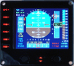
For Saitek Pro Flight Instrument Panel.
This Primary Flight Display (PFD) Glass type gauge provides following utilities:
1. Artificial horizon with sliding bug (yellow).
2. Moving tapes for: Air speed, Altitude, Heading.
3. Detail window for altitude.
4. Needle for vertical speed.
5. Glide slope and Localizer bars, they appear when in range of ILS only.
6. Digital values for: Total Air Temperature (TAT), QNH, Mach number, VOR 1 selected course, VOR 1 bearing, DME 1 range, Radio height altitude up to 2000 feet, above a bar go through the window, vertical speed, a minus sign appears when vertical speed is negative.
7. Autopilot bugs for: Selected altitude, Selected speed, Selected heading. Rmk: Bugs appear only when autopilot ALT, SPD or HDG functions are selected.
8. Display Autopilot functions with Text acronysm in yellow: AP, Autopilot Master On, THR, auto throttle mode engaged, SPD, air speed mode selected, HDG, heading mode selected, NAV, navigation mode selected (VOR 1), APR, approach mode selected, BC, back course mode selected.
9. Knobs functions: Right, allows to change QNH value. Left, allows to move VOR 1 course.
| Filename: | PFD_for_Flight_Instrument_Panel.zip |
| License: | Freeware |
| Added: | 23rd May 2011, 22:37:18 |
| Downloads: | 1,096 |
| Author: | Philippe Verhaege |
| Size: | 249.48 KB |


© 2001-2026 AVSIM Online
All Rights Reserved
Privacy Policy |